Webberville, Michigan

Last updated

Webberville, Michigan
Village of Webberville
Webberville, MI location.png
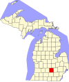
Location within Ingham County
USA Michigan location map.svg
Red pog.svg
Webberville
Location within the state of Michigan
Usa edcp location map.svg
Red pog.svg
Webberville
Location within the United States
Coordinates: 42°39′51″N84°10′47″W / 42.66417°N 84.17972°W / 42.66417; -84.17972 [1]
CountryUnited States
State Michigan
County Ingham
Township Leroy
Settled1837
Government
  Type Village council
  PresidentBrad Hitchcock Sr.
   Clerk Jaymee Hord
Area
[2]
  Total1.83 sq mi (4.74 km2)
  Land1.82 sq mi (4.71 km2)
  Water0.01 sq mi (0.03 km2)
Elevation
[1]
876 ft (267 m)
Population
 (2020)
  Total1,288
  Density707.69/sq mi (273.26/km2)
Time zone UTC-5 (Eastern (EST))
  Summer (DST) UTC-4 (EDT)
ZIP code(s)
48892
Area code 517
FIPS code 26-85080 [3]
GNIS feature ID2400119 [1]
Website Official website

Webberville is a village in Ingham County in the U.S. state of Michigan. It is located within Leroy Township. The population was 1,288 at the 2020 census.

Contents

The village is just southeast of the junction of M-43 and M-52 with I-96. It is about 5 miles (8.0 km) southeast of Williamston and about 20 miles (32 km) southeast of Lansing.

Geography

According to the United States Census Bureau, the village had a total area of 1.84 square miles (4.77 km2), of which 1.83 square miles (4.74 km2) is land and 0.01 square miles (0.03 km2) is water. [4]

History

Webberville was settled in 1837 by Ephraim Meech. It was originally named Phelpstown. In 1850 it was renamed Leroy after Daniel LeRoy the first Attorney General of the state of Michigan. It was renamed Webberville in 1867 when the post office was reestablished since there was another town in Michigan named Leroy. Webberville was for the postmaster Hubert Webber. [5]

The Michigan Brewing Company operated in Webberville from 1996–2012.

Demographics

Historical population
CensusPop.Note
1880 489
1890 404−17.4%
1900 346−14.4%
1910 3490.9%
1920 46533.2%
1930 4884.9%
1940 5084.1%
1950 60018.1%
1960 66410.7%
1970 1,25188.4%
1980 1,53522.7%
1990 1,69810.6%
2000 1,503−11.5%
2010 1,272−15.4%
2020 1,2881.3%
U.S. Decennial Census [6]

2010 census

As of the census [7] of 2010, there were 1,272 people, 508 households, and 352 families living in the village. The population density was 695.1 inhabitants per square mile (268.4/km2). There were 573 housing units at an average density of 313.1 per square mile (120.9/km2). The racial makeup of the village was 97.5% White, 0.6% African American, 0.2% Native American, 0.1% Asian, 0.8% from other races, and 0.9% from two or more races. Hispanic or Latino of any race were 2.7% of the population.

There were 508 households, of which 35.4% had children under the age of 18 living with them, 49.8% were married couples living together, 14.0% had a female householder with no husband present, 5.5% had a male householder with no wife present, and 30.7% were non-families. 26.8% of all households were made up of individuals, and 6.5% had someone living alone who was 65 years of age or older. The average household size was 2.50 and the average family size was 3.01.

The median age in the village was 35.6 years. 26.4% of residents were under the age of 18; 8.1% were between the ages of 18 and 24; 28.5% were from 25 to 44; 27.7% were from 45 to 64; and 9.2% were 65 years of age or older. The gender makeup of the village was 49.6% male and 50.4% female.

2000 census

As of the census [3] of 2000, there were 1,503 people, 561 households, and 403 families living in the village. The population density was 1,207.0 inhabitants per square mile (466.0/km2). There were 612 housing units at an average density of 491.5 per square mile (189.8/km2). The racial makeup of the village was 97.01% White, 0.60% African American, 0.27% Native American, 0.33% Asian, 0.40% from other races, and 1.40% from two or more races. Hispanic or Latino of any race were 1.06% of the population.

There were 561 households, out of which 41.0% had children under the age of 18 living with them, 51.2% were married couples living together, 15.9% had a female householder with no husband present, and 28.0% were non-families. 22.1% of all households were made up of individuals, and 6.4% had someone living alone who was 65 years of age or older. The average household size was 2.68 and the average family size was 3.12.

In the village, the population was spread out, with 30.7% under the age of 18, 9.7% from 18 to 24, 34.5% from 25 to 44, 17.8% from 45 to 64, and 7.3% who were 65 years of age or older. The median age was 31 years. For every 100 females, there were 93.4 males. For every 100 females age 18 and over, there were 86.4 males.

The median income for an average household in the village was $45,388, and the median income for a family was $47,625. Males had a median income of $38,375 versus $23,563 for females. The per capita income for the village was $17,663. About 4.7% of families and 5.5% of the population were below the poverty line, including 6.8% of those under age 18 and 6.1% of those age 65 or over.

Related Research Articles

<span class="mw-page-title-main">Athens, Michigan</span> Village in Michigan, United States

Athens is a village in Calhoun County in the U.S. state of Michigan. The population was 936 at the 2020 census. The village is located in southern Athens Township, and is part of the Battle Creek, Michigan Metropolitan Statistical Area. It was settled in 1831.

<span class="mw-page-title-main">Burlington, Michigan</span> Village in Michigan, United States

Burlington is a village in Calhoun County in the U.S. state of Michigan. The population was 261 at the 2010 census. It is part of the Battle Creek, Michigan Metropolitan Statistical Area. The village is located within Burlington Township on M-60.

<span class="mw-page-title-main">Elsie, Michigan</span> Village in Michigan, United States

Elsie is a village in Clinton County in the U.S. state of Michigan. The population was 966 at the 2010 census. The village consists of two noncontiguous portions within Duplain Township in the northeast portion of Clinton County—the smaller of which contains the village's Riverside Cemetery.

<span class="mw-page-title-main">Ashley, Michigan</span> Village in Michigan, United States

Ashley is a village in Gratiot County in the U.S. state of Michigan. The population was 508 at the 2020 census. The village is located in the northwest corner of Elba Township. No major state trunkline runs through the village, although M-57 passes within one mile to the south. Ashley was platted in 1884.

<span class="mw-page-title-main">Breckenridge, Michigan</span> Village in Michigan, United States

Breckenridge is a village in Gratiot County in the U.S. state of Michigan. The population was 1,328 at the 2010 census. The village is located in Wheeler Township.

<span class="mw-page-title-main">Elkton, Michigan</span> Village in Michigan, United States

Elkton is a village in Huron County in the U.S. state of Michigan. The population was 796 at the 2020 census. The village is within Oliver Township, along the Pinnebog River. It was incorporated in 1897.

<span class="mw-page-title-main">Sebewaing, Michigan</span> Village in Michigan, United States

Sebewaing is a village in Huron County in the U.S. state of Michigan. The population was 1,721 at the 2020 census. The village is within Sebewaing Township. This community is known as the Sugar Beet Capital, due to the Michigan Sugar slicing mill located within the village and the yearly Michigan Sugar Festival. The Sebewaing area, the Thumb, and the state of Michigan overall are major beet sugar producers, mostly for domestic consumption. Sebewaing is also the first gigabit village in the state of Michigan. In 2014–15, Sebewaing completed its fiber to the home network, offering up to gigabit/second speeds over their fiber optic network.

<span class="mw-page-title-main">Leroy Township, Ingham County, Michigan</span> Civil township in Michigan, United States

Leroy Township is a civil township of Ingham County in the U.S. state of Michigan. The population was 3,530 at the 2010 census.

<span class="mw-page-title-main">Stockbridge, Michigan</span> Village in Michigan, United States

Stockbridge is a village in Ingham County in the U.S. state of Michigan. It is located within Stockbridge Township about 36 miles (58 km) southeast from downtown Lansing. The population was 1,218 at the 2010 census.

<span class="mw-page-title-main">Lyons, Michigan</span> Village in Michigan, United States

Lyons is a village in Ionia County in the U.S. state of Michigan. The population was 789 at the 2010 census. Most of the village is within Lyons Township. A small portion extends west into Ionia Township.

<span class="mw-page-title-main">Muir, Michigan</span> Village in Michigan, United States

Muir is a village in Lyons Township, Ionia County in the U.S. state of Michigan. The population was 604 at the 2010 census.

<span class="mw-page-title-main">Clinton, Lenawee County, Michigan</span> Village in Michigan, United States

Clinton is a village in Lenawee County in the Irish Hills area of the U.S. state of Michigan. The population was 2,336 at the 2010 census. The village is located within Clinton Township.

<span class="mw-page-title-main">Lakewood Club, Michigan</span> Village in Michigan, United States

Lakewood Club is a village in Dalton Township of Muskegon County in the U.S. state of Michigan. The population was 1,291 at the 2010 census.

<span class="mw-page-title-main">Krakow Township, Michigan</span> Civil township in Michigan, United States

Krakow Township is a civil township of Presque Isle County in the U.S. state of Michigan. The population was 622 at the 2000 census. It was named after the Polish city of Kraków, a historical capital of Poland and seat of Polish monarchs.

<span class="mw-page-title-main">Applegate, Michigan</span> Village in Michigan, United States

Applegate is a village in Sanilac County of the U.S. state of Michigan. The population was 241 at the 2020 census. Applegate is in the southeast corner of Washington Township on the boundary with Sanilac Township.

<span class="mw-page-title-main">Morrice, Michigan</span> Village in Michigan, United States

Morrice is a village located in Shiawassee County in the U.S. state of Michigan. The population was 927 at the 2010 census. The village is located within Perry Township. The center of population of Michigan is located near Morrice.

<span class="mw-page-title-main">New Lothrop, Michigan</span> Village in Michigan, United States

New Lothrop is a village in Shiawassee County in the U.S. state of Michigan. The population was 565 at the 2020 census. The village is located within Hazelton Township.

<span class="mw-page-title-main">Breedsville, Michigan</span> Village in Michigan, United States

Breedsville is a village in Van Buren County of the U.S. state of Michigan. The population was 199 at the 2010 census. The village is within Columbia Township.

<span class="mw-page-title-main">Lawton, Michigan</span> Village in Michigan, United States

Lawton is a village in southeastern Van Buren County, Michigan, United States. The population was 1,900 at the 2010 census.

<span class="mw-page-title-main">Buckley, Michigan</span> Village in Michigan, United States

Buckley is a village in Wexford County in the U.S. state of Michigan. The population was 775 at the 2020 census. The village is located within Hanover Township.

References

  1. 1 2 3 U.S. Geological Survey Geographic Names Information System: Webberville, Michigan
  2. "2020 U.S. Gazetteer Files". United States Census Bureau. Retrieved May 21, 2022.
  3. 1 2 "U.S. Census website". United States Census Bureau . Retrieved January 31, 2008.
  4. "US Gazetteer files 2010". United States Census Bureau . Retrieved November 25, 2012.
  5. Michigan infor entry on Webberville
  6. "Census of Population and Housing". Census.gov. Retrieved June 4, 2015.
  7. "U.S. Census website". United States Census Bureau . Retrieved November 25, 2012.