
North Bethesda is an unincorporated, census-designated place in Montgomery County, Maryland, United States, located just north-west of the U.S. capital of Washington, D.C. It had a population of 50,094 as of the 2020 census. Among its neighborhoods, the centrally-located, urbanizing district of White Flint is the commercial and residential hub of North Bethesda. The Pike & Rose development and the Pike District is an initiative of Montgomery County to brand and market this region as "North Bethesda's Urban Core". The WMATA White Flint metro station and Grosvenor-Strathmore metro station serve the region.

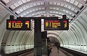
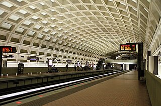
The Red Line is a rapid transit line of the Washington Metro system, consisting of 27 stations in Montgomery County, Maryland, and Washington, D.C., in the United States. It is a primary line through downtown Washington and the oldest, busiest, and currently the longest line in the system. It forms a long, narrow "U", capped by its terminal stations at Shady Grove and Glenmont.

Friendship Heights is a Washington Metro station straddling the border of Washington, D.C. and Montgomery County, Maryland, United States. The station was opened on August 25, 1984, and is operated by the Washington Metropolitan Area Transit Authority (WMATA).
Bethesda is a rapid transit station on the Red Line of the Washington Metro system in Bethesda, Maryland. It is one of the busiest suburban Metro stations, serving on average 9,142 passengers each weekday in 2017. The Purple Line, currently under construction, will terminate at Bethesda, providing rail service to other inner Maryland suburbs such as Silver Spring and College Park, each of which has additional north-south connections by Washington Metro, and New Carrollton, which has Amtrak and MARC connections to both Washington, D.C. and Baltimore.

Medical Center is an island-platformed Washington Metro station in Bethesda, Maryland, United States. The station was opened on August 25, 1984, and is operated by the Washington Metropolitan Area Transit Authority (WMATA). Providing service for the Red Line, the station serves the National Institutes of Health campus and the Walter Reed National Military Medical Center, and is located at Rockville Pike and South Drive. Since there is little retail in the area and no commuter parking lot, this station is used almost exclusively by employees and visitors to those two institutions.

Twinbrook is a rapid transit station on the Red Line of the Washington Metro attached to the Twinbrook neighborhood of Rockville, Maryland. One of a number of stations on the Rockville Pike corridor, it primarily acts as a commuter station.

Shady Grove is a Washington Metro station in Derwood in Montgomery County, Maryland, United States. The station was opened on December 15, 1984 as part of a four-stop extension of the line from Grosvenor–Strathmore station out to Shady Grove. The station is operated by the Washington Metropolitan Area Transit Authority (WMATA).

Rhode Island Avenue is a Washington Metro station in Washington, D.C. on the Red Line. The station is located in the Brentwood neighborhood of Northeast, on an elevated platform crossing Rhode Island Avenue NE

Silver Spring is a Washington Metro and MARC Train station in Montgomery County, Maryland on the Red Line and Brunswick Line. On the Metro, Silver Spring is the first station in Maryland of the eastern end of the Red Line, and is the second-busiest Metro station in Maryland after Shady Grove. North of this station, it goes underground as it heads towards the underground terminus of Glenmont.

Grosvenor–Strathmore is a rapid transit station on the Red Line of the Washington Metro in North Bethesda, Maryland. Grosvenor–Strathmore is the last above-ground station for Glenmont-bound Red Line trains until NoMa-Gallaudet U; south of the station, trains cross over the Capital Beltway before descending underground. It is one of a number of stations on the Rockville Pike corridor in Montgomery County.

Ballston–MU is a side-platformed Washington Metro station in Arlington County, Virginia, United States. The station opened on December 1, 1979, and is operated by the Washington Metropolitan Area Transit Authority (WMATA). The station serves the Orange and Silver Lines. The station serves the transit-oriented community of Ballston, Ballston Quarter, and Marymount University (MU). Ballston–MU is also a major Metrobus transfer station. The station entrance is located at North Fairfax Drive and North Stuart Street, near the intersection of Wilson Boulevard and North Glebe Road. West of this station, the tracks rise above ground inside the median of Interstate 66.
Farragut West is a side-platformed Washington Metro station in Downtown Washington, D.C., United States. The station was opened on July 1, 1977, and is operated by the Washington Metropolitan Area Transit Authority (WMATA). Providing service for the Blue, Silver, and Orange Lines, the station is located just west of Farragut Square with two entrances on I Street at 17th and 18th Streets, Northwest.

Wisconsin Avenue is a major thoroughfare in Washington, D.C., and its Maryland suburbs. The southern terminus begins in Georgetown just north of the Potomac River, at an intersection with K Street under the elevated Whitehurst Freeway. The section of Wisconsin Avenue in Georgetown was called High Street before the street names in Georgetown were changed in 1895 to conform to those of the L'Enfant Plan for the federal city.

Greensboro is a Washington Metro station in Tysons, in Fairfax County, Virginia, on the Silver Line. It opened on July 26, 2014 as part of phase 1 of the Silver Line. Greensboro is one of four Metro stations in the Tysons area and is to be part of the massive regeneration of the district.
Flash BRT is a bus rapid transit network in Montgomery County, Maryland with one operational line and two more under development. When complete, the network will run along U.S. 29 from Silver Spring to Burtonsville, Maryland Route 355 from Bethesda to Clarksburg, and Veirs Mill Road from Wheaton to Rockville.

The College Park–Bethesda Line, designated Route J4, is a rush hour-only MetroExtra bus route operated by the Washington Metropolitan Area Transit Authority between the College Park–University of Maryland station of the Green and Yellow Lines of the Washington Metro and Bethesda station of the Red Line of the Washington Metro. The J4 operates throughout the neighborhoods in Prince George's and Montgomery counties in Maryland. This line currently runs along construction of the upcoming Purple Line between College Park and Bethesda.
The College Park–White Flint Line, designated Route C8, is a bus route that operates Monday to Saturday that is operated by the Washington Metropolitan Area Transit Authority, United States, between College Park–University of Maryland station of the Green and Yellow Lines and White Flint station of the Red Line of the Washington Metro. The line operates every 30 minutes at all times. Trips are roughly 60 - 80 minutes long.
The I–270 Express Line, designated as Routes J7, J9, was an express bus route that was operated by the Washington Metropolitan Area Transit Authority between Bethesda station of the Red Line of the Washington Metro and Lakeforest Transit Center in Gaithersburg, Maryland. The line operated every 25–30 minutes during rush hours only with J7 trips taking roughly 25 minutes and J9 trips roughly taking 45 minutes. The route was discontinued due to low ridership and arrival of Ride On extRa on October 2, 2017.
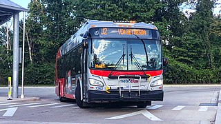
The Bethesda–Silver Spring Line, designated Route J1, J2, is a daily bus route operated by the Washington Metropolitan Area Transit Authority between Silver Spring station of the Red Line of the Washington Metro and Westfield Montgomery Transit Center. Route J1 operates in the weekday peak direction only while route J2 operates daily. J1 trips roughly takes 45 minutes while J2 trips take roughly 55 minutes.
The Twinbrook–Silver Spring Line, designated Route J5, was a bus route operated by the Washington Metropolitan Area Transit Authority between Silver Spring station and Twinbrook station of the Red Line of the Washington Metro. The line operated during the weekday peak-hours only providing express service along the Capital Beltway connecting both Silver Spring and Rockville without having to enter Washington D.C. The line was discontinued on June 25, 2017 due to a budget crisis.
