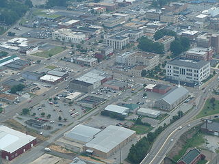
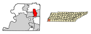
Jackson is a city in and the county seat of Madison County, Tennessee. Located 70 miles (110 km) east of Memphis, it is a regional center of trade for West Tennessee. Its total population was 65,211 at the 2010 census and 67,191 in the 2019 Census estimate. According to the 2017 census estimate, Jackson was the eighth-largest city in Tennessee.

Bartlett is a city in Shelby County, Tennessee, United States, located northeast of Memphis. The population was 54,613 at the 2010 U.S. Census.
Lakeland is a city in Shelby County, Tennessee, United States and a suburb of Memphis and it's metropolitan area. The population was 12,430 at the 2010 census.
West Tennessee is one of the three Grand Divisions of the U.S. state of Tennessee that roughly comprises the western quarter of the state. The region includes 21 counties between the Tennessee and Mississippi rivers, delineated by state law. Its geography consists primarily of flat lands with rich soil and vast floodplain areas of the Mississippi River. Of the three regions, West Tennessee is the most sharply defined geographically, and is the lowest-lying. It is both the least populous and smallest, in land area, of the three Grand Divisions. Its largest city is Memphis, the state's second most populous city.
The Southern Railway was a class 1 railroad based in the Southern United States between 1894 and 1982, when it merged with the Norfolk & Western to form Norfolk Southern. The railroad was the product of nearly 150 predecessor lines that were combined, reorganized and recombined beginning in the 1830s, formally becoming the Southern Railway in 1894.
Midtown Memphis, Tennessee is a collection of neighborhoods to the east of Downtown.

Whitehaven, informally known as "Blackhaven", is a predominantly African-American community in Memphis, Tennessee, first organized in the late 19th century as a neighborhood for upper-class families. Its current population is about 50,000.

High Point Terrace is a neighborhood located in the heart of the city of Memphis, Tennessee. The High Point Terrace Historic District is listed on the National Register of Historic Places.
Raleigh is a neighborhood in north-central Memphis, Tennessee named for a formerly incorporated town that used to be at its center. Raleigh is bordered on the west by the community of Frayser, on the east by the incorporated suburb of Bartlett, on the south by the Wolf River and Interstate 40, and on the north by the Memphis city limits. The former town of Raleigh was the first county seat of Shelby County, Tennessee.

Memphis Union Station was a passenger terminal in Memphis, Tennessee. It served as a hub between railroads of the Southwest, the Missouri Pacific Railroad and the St. Louis Southwestern Railway, and railroads of the Southeast, the Louisville and Nashville Railroad, the Nashville, Chattanooga and St. Louis Railway and the Southern Railway. The terminal, completed in 1912, was built in the Beaux-Arts style and was located on Calhoun Street, between south Second Street and Rayburn Boulevard. It was demolished in 1969. This location in south Memphis was approximately two blocks east of the other major Memphis railroad terminal, Memphis Grand Central Station.

The Memphis and Charleston Railroad, completed in 1857, was the first railroad in the United States to link the Atlantic Ocean with the Mississippi River. Chartered in 1846, the 311 miles (501 km) 5 ft gauge railroad ran from Memphis, Tennessee to Stevenson, Alabama through the towns of Corinth, Mississippi and Huntsville, Alabama. The portion between Memphis and LaGrange, Tennessee was originally to be part of the LaGrange and Memphis Railroad, chartered in 1838. From Stevenson, the road was connected to Chattanooga, Tennessee via the Nashville and Chattanooga Railroad. In Alabama, the railroad followed the route of the Tuscumbia, Courtland and Decatur Railroad between Tuscumbia and Decatur, the first railroad to be built west of the Appalachian Mountains.
East Memphis is a region of Memphis, Tennessee with several defined and informal subdivisions and neighborhoods such as Colonial Acres, White Station-Yates, Sherwood Forest, Normal Station, High Point Terrace, Belle Meade, Normandy Meadows, St. Nick, Pleasant Acres, Balmoral, and Ridgeway. The general boundaries are informal:

Berclair is a district of Memphis, Tennessee, that is known for a major street in the district.
Normal Station is a neighborhood in East Memphis, Tennessee, anchored by the University of Memphis, formerly Memphis State University, and originally called West Tennessee State Normal School. It is bordered by the University of Memphis to the north, Audubon Park to the east, Park Avenue and the Sherwood Forest neighborhood to the south, and Highland Street to the west.
The City of Memphis is located on the eastern bank of the Mississippi River in the southwest corner of the U.S. state of Tennessee. It is the regional hub for a tri-state area of Arkansas, Mississippi and Tennessee.
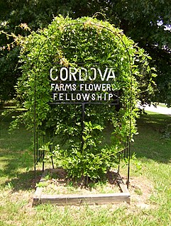
Cordova is a community in Shelby County, Tennessee, United States. Cordova lies east of Memphis, north of Germantown, south of Bartlett, and northwest of Collierville at an elevation of 361 feet.

Binghampton is a neighborhood on an edge of Midtown in Memphis, Tennessee. It is named after WH Bingham, an Irish immigrant, hotelier, planter, magistrate, politician and entrepreneur who founded a town to the east and slightly north expansion of the city limits in 1893.
Oakville was a community in Tennessee located just west of the current site of the Memphis International Airport. It was centered along the Route of US 78 just a little northeast of the intersection with Getwell Road.
Ellendale is an unincorporated community in Shelby County, Tennessee, United States, in the Memphis metropolitan area.
Kerrville is an unincorporated community located in northeastern Shelby County, Tennessee. Kerrville is located along about 3.5 miles to the north of Millington and just to the south of the Tipton County line, along with Atoka and Munford city limits. It is named for Andrew Hart Kerr, who moved from Middle Tennessee to Big Creek, that purchased 5,000 acres of land.


