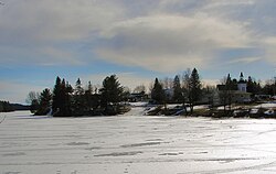
Whitestone, Ontario

Last updated

Whitestone
Municipality of Whitestone
Municipal Office.jpg
Whitestone municipal office in Dunchurch
Canada Southern Ontario location map 2.png
Red pog.svg
Whitestone
Coordinates: 45°41′N79°59′W / 45.683°N 79.983°W / 45.683; -79.983
CountryCanada
Province Ontario
District Parry Sound
Incorporated2000
Government
  TypeMunicipality
  MayorGeorge Comrie
  Federal riding Parry Sound-Muskoka
  Prov. riding Parry Sound—Muskoka
Area
[1]
  Land957.93 km2 (369.86 sq mi)
Population
 (2016) [1]
  Total916
  Density1.0/km2 (3/sq mi)
Time zone UTC-5 (EST)
  Summer (DST) UTC-4 (EDT)
Postal Code
P0A
Area codes 705, 249
Website www.whitestone.ca OOjs UI icon edit-ltr-progressive.svg
Dunchurch Dunchurch ON.JPG
Dunchurch

Whitestone is a municipality in the Canadian province of Ontario, as well as the name of a community within the municipality.

Contents

The municipality, located in the Parry Sound District, had a population of 916 in the Canada 2016 Census.

History

In 2000, the Municipality of Whitestone was formed out of Unorganized Centre Parry Sound District and incorporated by the Parry Sound District Restructuring Commission. The new municipality includes the geographic townships of East Burpee, Burton, McKenzie, Ferrie, Hagerman, and part of Croft, as well as the communities of Ardbeg, Dunchurch, Maple Island, and the village of Whitestone.

A popular attraction was once the Ardbeg fire tower, which was one of the last remaining staffed towers in Southern Ontario until the early 1970s when aerial forest fire detection took over. It stood on a small hill where the road meets the railway.

Communities

The municipality comprises the communities of Ardbeg, Boakview, Bolger, Burton, Dunchurch, Fairholme, Lorimer Lake, Maple Island, South Magnetawan, Sunny Slope, Wahwashkesh, and Whitestone.

Geography

The municipality's vegetation is dominated by white pine trees, and the area is dotted with many lakes, including Wahwashkesh Lake, Shawanaga Lake, Whitestone Lake, Wilson Lake () and Lorimer Lake. The three major rivers are Magnetawan River, Shawanaga River, and Naiscoot River, all flowing west into Georgian Bay.

Demographics

Whitestone population history
YearPop.±%
1996 802    
2001 853+6.4%
2006 1,030+20.8%
2011 918−10.9%
2016 916−0.2%
2021 1,075+17.4%
[2] [3] [1]

In the 2021 Census of Population conducted by Statistics Canada, Whitestone had a population of 1,075 living in 549 of its 1,427 total private dwellings, a change of

Mother tongue: [5]

See also

Related Research Articles

<span class="mw-page-title-main">Carling, Ontario</span> Township in Ontario, Canada

Carling is a township in Ontario, Canada, located in the District of Parry Sound on Georgian Bay. Killbear Provincial Park is located in the municipality.

<span class="mw-page-title-main">Parry Sound District</span> District in Ontario, Canada

Parry Sound District is a census division of the Canadian province of Ontario. Its boundaries are District of Muskoka to the south, the Sudbury District to the north-northwest, the French River and Lake Nipissing in the north, Nipissing District and North Bay in the north and east and parts of Algonquin Park in the northeast.

<span class="mw-page-title-main">The Archipelago</span> Township in Ontario, Canada

The Archipelago is a township in central Ontario, Canada, along the Georgian Bay in the Parry Sound District.

<span class="mw-page-title-main">Seguin, Ontario</span> Township in Ontario, Canada

Seguin is a township in central Ontario, Canada, in the District of Parry Sound.

<span class="mw-page-title-main">Unorganized Centre Parry Sound District</span> Unorganized area in Ontario, Canada

Unorganized Centre Parry Sound District is an unorganized area in central Ontario, Canada, between Georgian Bay and Lake Nipissing in the District of Parry Sound. It is made up of geographic townships which have no governing bodies and which are not incorporated as municipalities. The territory consists of two non-contiguous areas, with the main part located directly south of the French River and Lake Nipissing, and east of Georgian Bay. Shawanaga Township is a small exclave south of it along Highway 69.

<span class="mw-page-title-main">Burk's Falls</span> Village in Ontario, Canada

Burk's Falls is an incorporated village in the Almaguin Highlands region of Parry Sound District, Ontario, Canada, located 265 kilometres (165 mi) north of Toronto and 90 kilometres (56 mi) south of North Bay, Ontario. The village, and the waterfall on the site, were named by David Francis Burk of Oshawa, after he selected the land surrounding the waterfall in the Free Land Grant Act. Burk's Falls is part of the Magnetawan River waterway.

<span class="mw-page-title-main">Nipissing, Ontario</span> Township in Ontario, Canada

Nipissing is an incorporated (political) township in Parry Sound District in Central Ontario, Canada. It is on Lake Nipissing and is part of the Almaguin Highlands region. Nipissing was surveyed between 1874 and 1881, and was incorporated in 1888. Among the first settlers in the area were the Chapman and Beatty families. Nipissing Township annexed Gurd Township in 1970. The township also contains a community named Nipissing, which is located on the South River near Chapman's Landing, on the South Bay of Lake Nipissing. The township administrative offices are located in Nipissing.

Kearney is a town and municipality in the Almaguin Highlands region of Parry Sound District of Ontario, Canada. With a landmass of 528 square kilometres and a year-round population of 974 in the Canada 2021 Census, Kearney claims to be the "Biggest Little Town in Ontario."

<span class="mw-page-title-main">Highlands East, Ontario</span> Township Municipality in Ontario, Canada

Highlands East is a township municipality located in Haliburton County, Ontario, Canada.

King's Highway 124, commonly known as Highway 124, is a provincially maintained highway in the Canadian province of Ontario. The highway connects Highway 400 in Parry Sound with Highway 11 in Sundridge, a distance of 91.2 km (56.7 mi), including a 15.4 km (9.6 mi) concurrency with Highway 520. It is one of several highways in Central Ontario to provide this connection through the Muskoka and Parry Sound region, and the northernmost provincial highway to do so south of Highway 17.

<span class="mw-page-title-main">Ontario Highway 520</span> Ontario provincial highway

Secondary Highway 520, commonly referred to as Highway 520, is a provincially maintained highway in the Canadian province of Ontario. The highway is 67.9 kilometres (42.2 mi) in length, connecting several small communities in Parry Sound District with Highway 124 and Highway 11.

<span class="mw-page-title-main">Magnetawan</span> Municipality in Ontario, Canada

Magnetawan is a township in the Almaguin Highlands region of the Parry Sound District in the Canadian province of Ontario, as well as the name of the primary population centre in the township.

<span class="mw-page-title-main">Armour, Ontario</span> Township municipality in Ontario, Canada

Armour is a township municipality in the Canadian province of Ontario.

<span class="mw-page-title-main">Strong, Ontario</span> Township in Ontario, Canada

Strong is a township in the Canadian province of Ontario, as well as the name of a community within the township. Located in the Almaguin Highlands region of Parry Sound District, the township surrounds but does not include the village of Sundridge.

Wahwashkesh Lake is a lake in Whitestone, Parry Sound District, Ontario, Canada, and is the largest lake in Parry Sound District, with a surface area of 1,721 hectares and over 106 km of shoreline. Approximately 30% of the shoreline property is Crown Land. The lake has two distinct basins: (1) the north basin or Top Lake is the smaller of the two, and (2) the south basin is the Big Lake. Wahwashkesh is part of the Magnetawan River system, and the lake is renowned for an extremely severe spring freshet with the lake levels often rising 3 to 4 meters above the concrete weir at the outlet of the river.

<span class="mw-page-title-main">McMurrich/Monteith</span> Township in Ontario, Canada

McMurrich/Monteith is a municipality and census subdivision in the Almaguin Highlands region of Parry Sound District, Ontario, Canada.

<span class="mw-page-title-main">Dunchurch, Ontario</span> Compact rural community in Parry Sound District, Ontario, Canada

Dunchurch is a compact rural community in the Canadian province of Ontario, located in the municipality of Whitestone in Parry Sound District.

Shawanaga lake is a lake located in the Municipality of Whitestone, District of Parry Sound, Ontario, Canada.

<span class="mw-page-title-main">Almaguin Highlands</span> Inter-region in Ontario, Canada

The Almaguin Highlands Region in Ontario, Canada, covers approximately 5,200 km2 (2,000 sq mi) comprising the eastern half of Parry Sound District. It is bounded by Muskoka in the south, and by Lake Nipissing and Nipissing District in the north. The eastern edge abuts the western boundary of Algonquin Provincial Park, whereas the western boundary of the Almaguin Highlands is generally regarded to be the mid east-west point of Parry Sound District. Originally derived from the words Algonquin, Magnetawan, and Seguin. the name Almaguin is now used to describe the marketing region of East Parry Sound.

Wallbridge is an unorganized geographic township in Parry Sound District, Ontario, Canada. Part of the census subdivision of Unorganized Centre Parry Sound District, the township includes the communities of Britt, Byng Inlet and Harris Lake and the rail sidings of Drocourt and North Magnetawan. Although not an incorporated municipality, Britt and Byng Inlet are jointly served by a local services board.

References

  1. 1 2 3 "Census Profile, 2016 Census: Whitestone, Municipality". Statistics Canada. 8 February 2017. Retrieved June 26, 2019.
  2. Statistics Canada: 1996, 2001, 2006 Census
  3. 2011 Census Profile
  4. "Population and dwelling counts: Canada, provinces and territories, census divisions and census subdivisions (municipalities), Ontario". Statistics Canada. February 9, 2022. Retrieved March 31, 2022.
  5. "2006 Community Profile". 13 March 2007.