Worley, Idaho | |
---|---|
Coordinates: 47°24′02″N116°55′09″W / 47.40056°N 116.91917°W | |
Country | United States |
State | Idaho |
County | Kootenai |
Area | |
• Total | 0.19 sq mi (0.50 km2) |
• Land | 0.19 sq mi (0.50 km2) |
• Water | 0.00 sq mi (0.00 km2) |
Elevation | 2,644 ft (806 m) |
Population | |
• Total | 257 |
• Density | 1,350.52/sq mi (521.41/km2) |
Time zone | UTC-8 (Pacific (PST)) |
• Summer (DST) | UTC-7 (PDT) |
ZIP code | 83876 |
Area code | 208 |
FIPS code | 16-88480 |
GNIS feature ID | 2412309 [2] |
Worley is a city in southwestern Kootenai County, Idaho, United States. The population was 257 at the 2010 census, up from 223 in 2000. [4] The city is within the Coeur d'Alene Indian Reservation.
According to the United States Census Bureau, the city has a total area of 0.19 square miles (0.49 km2), all land. [5]
To the south of the village are gentle hills heavily wooded with evergreens and a year around community of deer, elk, wild turkey and black bears. 17 acres of tribal community gardens are located off to the North of Worley.[ citation needed ]
Census | Pop. | Note | %± |
---|---|---|---|
1930 | 199 | — | |
1940 | 241 | 21.1% | |
1950 | 233 | −3.3% | |
1960 | 241 | 3.4% | |
1970 | 235 | −2.5% | |
1980 | 206 | −12.3% | |
1990 | 182 | −11.7% | |
2000 | 223 | 22.5% | |
2010 | 257 | 15.2% | |
2019 (est.) | 262 | [6] | 1.9% |
U.S. Decennial Census [7] |
As of the census [3] of 2010, there were 257 people, 104 households, and 57 families living in the city. The population density was 1,352.6 inhabitants per square mile (522.2/km2). There were 116 housing units at an average density of 610.5 per square mile (235.7/km2). The racial makeup of the city was 56.0% White, 0.8% African American, 28.0% Native American, 1.6% from other races, and 13.6% from two or more races. Hispanic or Latino of any race were 5.8% of the population.
There were 104 households, of which 27.9% had children under the age of 18 living with them, 36.5% were married couples living together, 7.7% had a female householder with no husband present, 10.6% had a male householder with no wife present, and 45.2% were non-families. 34.6% of all households were made up of individuals, and 10.5% had someone living alone who was 65 years of age or older. The average household size was 2.47 and the average family size was 3.19.
The median age in the city was 37.3 years. 26.1% of residents were under the age of 18; 10.9% were between the ages of 18 and 24; 24.1% were from 25 to 44; 25.3% were from 45 to 64; and 13.6% were 65 years of age or older. The gender makeup of the city was 52.1% male and 47.9% female.
As of the census [8] of 2000, there were 223 people, 81 households, and 54 families living in the city. The population density was 1,178.6 inhabitants per square mile (455.1/km2). There were 95 housing units at an average density of 502.1 per square mile (193.9/km2). The racial makeup of the city was 69.06% White, 0.45% African American, 28.70% Native American, 0.45% from other races, and 1.35% from two or more races. Hispanic or Latino of any race were 2.69% of the population.
There were 81 households, out of which 33.3% had children under the age of 18 living with them, 55.6% were married couples living together, 8.6% had a female householder with no husband present, and 32.1% were non-families. 24.7% of all households were made up of individuals, and 13.6% had someone living alone who was 65 years of age or older. The average household size was 2.75 and the average family size was 3.29.
In the city, the population was spread out, with 28.3% under the age of 18, 9.0% from 18 to 24, 26.0% from 25 to 44, 16.6% from 45 to 64, and 20.2% who were 65 years of age or older. The median age was 36 years. For every 100 females, there were 93.9 males. For every 100 females age 18 and over, there were 88.2 males.
The median income for a household in the city was $27,500, and the median income for a family was $32,813. Males had a median income of $33,750 versus $20,833 for females. The per capita income for the city was $10,975. About 17.2% of families and 19.8% of the population were below the poverty line, including 23.1% of those under the age of eighteen and none of those 65 or over.
Children are able to attend preschool through grade 12 in Plummer, Idaho, or attend the Tribal School in Desmet, Idaho, with free Citylink bus service. [9] [10]
The CDA Nation provides health care, in addition to regular free bus service for all people to Spokane, CDA, and rural routes on the reservation every day from Worley.[ citation needed ]
Worley is well known for its numerous fireworks stands and assigned places to detonate them. [ citation needed ]
Eagle is a city in Ada County, Idaho, ten miles (16 km) northwest of downtown Boise. The population was 30,346 at the 2020 census.
Chubbuck is a city in Bannock County, Idaho. It is part of the Pocatello Metropolitan Statistical Area. The population was 15,570 at the 2020 census. Chubbuck is located immediately north of Pocatello, Idaho, and has opposed several consolidation proposals since the 1960s.
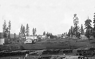
Plummer is a city in Benewah County, Idaho, United States. The population was 1,044 at the 2010 census, up from 990 in 2000. It is the largest city within the Coeur d'Alene Reservation, and is accessed by U.S. Route 95, the state's primary north–south highway.
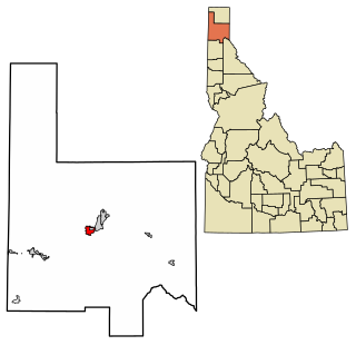
Dover is a city in Bonner County, Idaho. The population was 556 at the 2010 census.
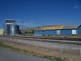
Iona is a city in Bonneville County, Idaho, United States. It is part of the Idaho Falls, Idaho Metropolitan Statistical Area. The population was 1,803 at the 2010 census.
Wilder is a city in Canyon County, Idaho, United States. The population was 1,533 at the 2010 census.
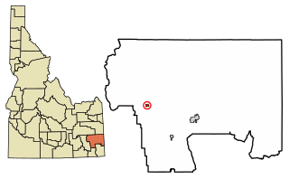
Bancroft is a city in the Gem Valley in Caribou County, Idaho, United States. The population was 299 at the 2020 census, and 377 at the 2010 census.
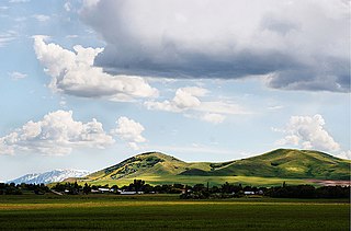
Weston is a city in Franklin County, Idaho, United States. The population was 511 at the 2020 census. It is part of the Logan, Utah-Idaho Metropolitan Statistical Area. It was first settled in 1865. The community was so named due to its location at the west bank of the Bear River.
Parker is a city in southeastern Fremont County, Idaho, United States. The population was 305 at the 2010 census. It is part of the Rexburg, Idaho Micropolitan Statistical Area.
Teton is a city in Fremont County, Idaho, United States. The population was 735 at the 2010 census. It is part of the Rexburg, Idaho Micropolitan Statistical Area.
Wendell is a city in southern Gooding County, Idaho, United States. The population was 2,782 at the 2010 census.
Hazelton is a city in Jerome County, Idaho, United States. The population was 807 at the 2020 census. It is part of the Twin Falls, Idaho Micropolitan Statistical Area.
Jerome is a city in and county seat of Jerome County, Idaho, United States. The population was 10,890 at the 2010 census, up from 7,780 in 2000. The city is the county seat of Jerome County, and is part of the Twin Falls Micropolitan Statistical Area. It is the second largest city in Idaho's Magic Valley region, second only to Twin Falls which is located 10 miles (16 km) southeast. Jerome's economy is largely agrarian, with dairy farming being one of the main revenue sources for the local economy.
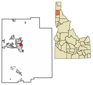
Dalton Gardens is a city in Kootenai County, Idaho, United States. It is considered a suburb of Coeur d'Alene and borders the city to the north and east. The city of Dalton Gardens is also part of the larger Spokane-Coeur d'Alene Combined Metropolitan Statistical Area which encompasses Kootenai County, Idaho. The population of Dalton Gardens was 2,335 at the time of the 2010 census.
Hauser is a city in Kootenai County, Idaho, United States. The population was 678 at the 2010 census. The city is located on the southern end of Hauser Lake.
Grand View is a city along the Snake River in Owyhee County, Idaho, United States. The population was 440 at the 2020 census. It is part of the Boise City–Nampa, Idaho Metropolitan Statistical Area.
Marsing is a city in Owyhee County, Idaho, United States. The population was 1,031 at the time of the 2010 census. It is part of the Boise metropolitan area.
Fruitland is a city along the Snake and Payette rivers in Payette County, Idaho, United States. It lies along U.S. Route 95 in the Treasure Valley of southwest Idaho, about 50 miles (80 km) west of Boise on the border with Oregon. It is part of the Ontario Micropolitan Area. Fruitland is named after apple orchards that surround the community, and its slogan is "The Big Apple of Idaho."
Osburn is a city in Shoshone County, Idaho, United States. Located in the Silver Valley mining region of northern Idaho, its population was 1,555 at the 2010 census.
Hansen is a city in Twin Falls County, Idaho, United States. The population was 1,086 at the 2020 census, and 1,144 at the 2010 census. It is part of the Twin Falls, Idaho Micropolitan Statistical Area.