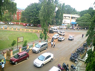
Chikmagalur, officially Chikkamagaluru is an administrative district in the Malnad subregion of Karnataka, India. Coffee was first cultivated in India in Chikmagalur. The hills of Chikmagalur are parts of the Western Ghats and the source of Tunga and Bhadra rivers. Mullayanagiri, the highest peak in Karnataka is located in the district. The area is well known for the Sringeri Mutt that houses the Dakshina Peeta established by Adi Shankaracharya.

Chikmagalur is a city and the headquarters of Chikmagalur district in the Indian state of Karnataka. Located on the foothills of the Mullayanagiri peak of the Western Ghats, the city attracts tourists from around the world for its pleasant and favourable hill station climate, tropical rainforest and coffee estates. The pristine Baba Budangiri lies to the north of Chikmagalur where it's believed Baba Budan first introduced coffee to India.

Kaduru, also known as Kadur, is second largest town in the district and a Taluk in Chikmagalur district, in Karnataka. It is located at 13.553345°N 76.011260°E in the rain shadow region of western ghats. Most of the taluk is dry, unlike much of the district. Kadur is known for areca nut and also coconut production.

Mudigere is a Town Panchayath and Taluk in Chikmagalur district in the Indian state of Karnataka. It is 30 km from the district headquarters.
Lingadahalli is a village and a hobli in Tarikere Taluk, Chikmagalur district, Karnataka, India. Lingadahalli is one of the prominent pre-historic sites in Karnataka state. The location code number of Lingadahalli as per census of India 2011 are, 609336 and 609334 (kaval).
Nagaral(ನಾಗರಾಳ) is a village in the southern state of Karnataka, India. It is located in the Bilagi taluk of Bagalkot district in Karnataka. It is about 35 kilometres (22 mi) from the district headquarters of Bagalkot town and is about 5 kilometres (3.1 mi) from taluka headquarters of Bilagi and on the left bank of the Krishna River. It is famous for the Digamabareshwara temple and well educated persons.
B.Kanabur is a village in the southern state of Karnataka, India. It is located in the Narasimharajapura taluk of Chikkamagaluru district in Karnataka.
Sakharayapatna is a village in the southern state of Karnataka, India. It is located in the Kadur taluk of Chikkamagaluru district in Karnataka.

Samse is a village in the southern state of Karnataka, India. It is located in the Kalasa taluk of Chikkamagaluru district in Karnataka.
A. Rangapura is a village in the southern state of Karnataka, India. It is located in the Tarikere taluk of Chikkamagaluru district in Karnataka.
Aadigere is a village in the southern state of Karnataka, India. It is located in the Kadur taluk of Chikkamagaluru district in Karnataka.
Abbalagere is a village of the Shimoga taluk of Shimoga district in Karnataka, India.
Abbanakuppe is a village in the southern state of Karnataka, India. It is located in the Gubbi taluk of Tumkur district.
Abbinaholalu is a village in the southern state of Karnataka, India. It is located in the Tarikere taluk of Chikkamagaluru district in Karnataka.
Abrugodige Estate is a village in the southern state of Karnataka, India. It is located in the Mudigere taluk of Chikkamagaluru district in Karnataka.
Addagadde is a village on the banks of river Tunga in the southern state of Karnataka, India. It is located in Sringeri taluk of Chikkamagaluru district at a distance of 8 km away from Sringeri, on Sringeri to Shivamogga highway. It is a panchayat village, filled with plenty of greenery and a classic example of a Malnad village set up. The village has a population of around 1500, where majority depends on arecanut cultivation. Addagadde has a historical Veerabhadreshwara temple.
Adigebylu is a village in the southern state of Karnataka, India. It is located in the Koppa taluk of Chikkamagaluru district in Karnataka.
Aduvalli (Narasimharajapura) is a village in the southern state of Karnataka, India. It is located in the Narasimharajapura taluk of Chikkamagaluru district in Karnataka.
Agalagandi is a village in the southern state of Karnataka, India. It is located in the Koppa taluk of Chikkamagaluru district in Karnataka.

Agrahara, Kadur is a village in the southern state of Karnataka, India. It is located in the Kadur taluk of Chikkamagaluru district in Karnataka.


