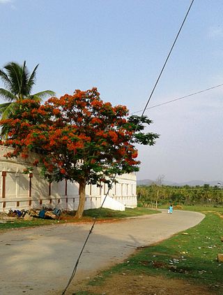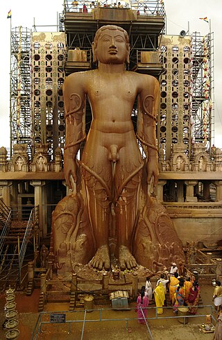
Sringeri also called Shringeri is a hill town and Taluk headquarters located in Chikkamagaluru district in the Indian state of Karnataka. It is the site of the first maṭha established by Adi Shankara, Hindu theologian and exponent of the Advaita Vedanta philosophy. Located on the banks of the river Tungā, the town draws a large number of pilgrims to its temples of Sri Sharadamba, Sri Vidyashankara, Sri Malahanikareshvara and other deities.

Tumakuru district is an administrative district in the state of Karnataka in India. It is the third largest district in Karnataka by land area with an area of 10,598 km2, and fourth largest by Population. It is a one-and-a-half-hour drive from Bengaluru, the state capital. The district is known for the production of coconuts and is also called as 'Kalpataru Nadu'. It is the only discontiguous district in Karnataka.

Arsikere is a city and taluka in the Hassan district in the state of Karnataka, India. It is the second largest city in Hassan district, demographically. Arsikere city municipal council consists of 35 wards. This region is known for its coconut production and is also called Kalpataru Nadu. Arsikere Junction is a major railway junction in the South Western Railway which links Mangalore and Mysore to North Karnataka and a central place for tourists who visit nearby places that do not have rail access, such as Belur, Halebidu and Shravanabelagola, Harnahalli, and Kodimata.

Gadag district is a district in the state of Karnataka, India. It was formed in 1997, when it was split from Dharwad district. As of 2011, it had a population of 1064570. The overall population increased by 13.14 percent from 1991 to 2001. Gadag district borders Bagalkot district on the north, Koppal district on the east, Vijayanagara district on the southeast, Haveri district on the southwest, Dharwad district on the west and Belgaum District on the northwest. It is famous for the many monuments from the Western Chalukya Empire. It has seven talukas: Gadag, Gajendragad, Ron, Shirhatti, Nargund, Lakshmeshwar and Mundargi.

Tumkur is a city located in the southern part of the Indian state of Karnataka. It is situated at a distance of 70 km (43 mi) northwest of Bangalore, the state capital, along NH 48 and NH 73, located at an altitude of 835 m (2739.5 ft). The city serves as the headquarters of Tumakuru district.
Kunigal is a town in Tumakuru district in the Indian state of Karnataka. It is the headquarters of Kunigal taluk. As of 2011 census, the town has a population of 34155.

Tirumakudalu Narasipura the temple city of Karnataka, commonly known as T. Narasipura or T.N. Pura, is a town in Mysore district in the Indian state of Karnataka. The first name refers to the land at the confluence, (trimakuta in Sanskrit at the confluence of the Kaveri, Kabini and Spatika Sarovara. The city is a Taluk of Mysore district and 32 km south-east of the district headquarters and has five Hobli centers. This taluk is bordered by Chamarajanagar district to the south and Mandya districts to the north with an area of 598 sq km. Agriculture is the main occupation of the people here. Rice is the main food crop and silk is the main commercial crop. Fossils of Neolithic age have been found by excavation in some lands of this Taluk. Vyasatirtha, the guru of Purandara Dasa, and T Chowdiah, the unique violinist, were born in this Taluk. Talakad, the capital of the Western Ganga dynasty, is in this Taluk.

Veerabhadra temple is a Hindu temple located in the Lepakshi, in the state of Andhra Pradesh, India. The temple is dedicated to the Virabhadra, a fierce form of the god Shiva.

Karnataka, the sixth largest state in India, has been ranked as the third most popular state in the country for tourism in 2014. It is home to 507 of the 3600 centrally protected monuments in India, second only to Uttar Pradesh. The State Directorate of Archaeology and Museums protects an additional 752 monuments and another 25,000 monuments are yet to receive protection.
Temples of the Indian State of Karnataka illustrate the variety of architecture prevalent in various periods. The architectural designs have found a distinguished place in forming a true atmosphere of devotion for spiritual attainment.
Located in South Bangalore, Karnataka, India, Kumaraswamy Layout is a sub locality in Banashankari.
Huvina Hipparagi also Huvin Hipparagi is a Town in the southern state of Karnataka, India. It is located in the Basavana Bagevadi taluk of Vijayapura district in Karnataka.

Belluru is a village in the southern state of Karnataka, India. It is located in the Nagamangala taluk of Mandya district in Karnataka.

Hutridurga, also known as Uttari Betta is a village and also a fortified hill in the south-east of Kunigal taluk. The hill is 1,142 metres (3,747 ft) above mean sea level that is located 15 km south-east of Kunigal. Hutridurga is situated about 65 km west of Bengaluru. It is situated off the Kunigal-Magadi State Highway 94 (Karnataka), at a distance of about 7 km from it and 10 km from the Anchepalya industrial area on the Bengaluru-Mangalore National Highway (India) near Kunigal.
Shri Kuruvathi Basaveshwara temple at Kuruvathi is one of the ancient and historic temples at the extreme south-western corner of Hoovina Hadagali taluk, Vijayanagara District, Karnataka, India. This temple is on the bank of Tungabhadra river, 10 km from Halavagalu and 2 km from Mylara and 36 km from Ranebennur and 326 km from Bangalore.

Kenchanagudda is a village in the southern state of Karnataka, India. The village is located in the Siruguppa taluk of Ballari district.

Nava Brindavana ;, is located on an island in the Tungabhadra River at Anegundi, near Hampi, Karnataka, India. The Brindavanas of nine Hindu Madhva saints present in Nava Brindavana belongs to [ Nanjangudu Sri Raghvandra swami math] and Uttaradi Math, Vyasaraja Math and Raghavendra Math. All these saints are descended from Padmanabha Tirtha, direct disciple of Jagadguru Madhvacharya.
Kaggere is the name of three separate villages in southern Karnataka, in the south of India.

Sagara is a city located in the Indian state of Karnataka. It is also a sub divisional and a taluk headquarters. Located in the Sahyadri Mountain range on the banks of river Varada, it is known for its proximity to Jog Falls and to the historical places of Ikkeri, Keladi and Varadamoola. The river Varada originates near Varada-moola. Sagara subdivision consists of Sagara, Soraba, Hosanagara and Shikaripur taluks.


