A peninsula (Latin: paeninsula from paene "almost" and insula "island") is a piece of land that is bordered mostly by water but connected to mainland.[1][2][3][4] The surrounding water is usually understood to be continuous, though not necessarily named as such. A peninsula can also be a headland, cape, island promontory, bill, point, or spit.[5] A point is generally considered a tapering piece of land projecting into a body of water that is less prominent than a cape.[6] In English, the plural of peninsula is peninsulas or, less commonly, peninsulae. A river which courses through a very tight meander is also sometimes said to form a "peninsula" within the (almost closed) loop of water.
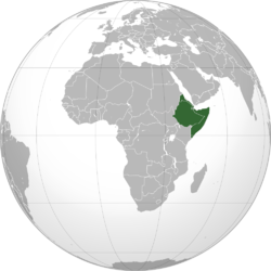
The Horn of Africa is a peninsula in Northeast Africa that juts into the Guardafui Channel, and is the easternmost projection of the African continent. It denotes the region containing the countries of Djibouti, Eritrea, Ethiopia, and Somalia.
The whole landmass encompassing North and South Korea is a peninsula, surrounded by the East Sea to the east and south, and the Yellow Sea to the west and south, with the Korea Strait connecting them.
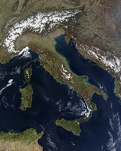
Europe is sometimes considered to be a large peninsula extending off Eurasia.[8] As such, it is one of the largest peninsulas in the world and the only one to have the status as a full continent, largely as a matter of convention rather than science. It is composed of many smaller peninsulas, the four main and largest component peninsulas being the Scandinavian, Iberian, Balkan, and Apennine peninsulas.
The Balkans is a region which natural borders do not coincide with the technical definition of a peninsula hence modern geographers reject the idea of a Balkan Peninsula. It would include Albania, Bosnia and Herzegovina, Bulgaria, Croatia, Greece, Kosovo, North Macedonia, Montenegro, Romania, Serbia, Slovenia and the European part of Turkey.
Florida is a well-known example of a large peninsula, with its land area divided between the larger Florida peninsula and the smaller Florida Panhandle on the north and west. It has several smaller peninsulas within it:
The St. Johns River creates a large peninsula over 75 miles (121km) in length that stretches from eastern Jacksonville down to the border of Flagler and Volusia counties, where the river emanates from Lake George.
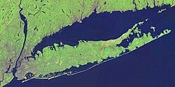
Long Island was once a peninsula connected to North America during the great Ice Ages, and includes two large peninsulas at its east end: the South Fork and the North Fork.
Satellite images of the Southern Cone extending off South America month by month
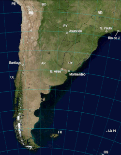
Southern Cone
The Southern Cone, like Europe, is sometimes considered to be a large peninsula.[9] Geographically, the peninsula encompasses most of Chile, Argentina, Uruguay and Southern Brazil and the southernmost portion of Paraguay, which makes it one of the largest peninsulas in the world. Like the Indian Peninsula, the Southern Cone is sometimes considered to be a subcontinent.[10]
This page is based on this Wikipedia article Text is available under the CC BY-SA 4.0 license; additional terms may apply. Images, videos and audio are available under their respective licenses.