
A trail, also known as a path or track, is an unpaved lane or a small paved road not intended for usage by motorized vehicles, usually passing through a natural area. In the United Kingdom and the Republic of Ireland, a path or footpath is the preferred term for a pedestrian or hiking trail. The term is also applied in North America to accompanying routes along rivers, and sometimes to highways. In the US, the term was historically used for a route into or through wild territory used by explorers and migrants. In the United States, "trace" is a synonym for trail, as in Natchez Trace.
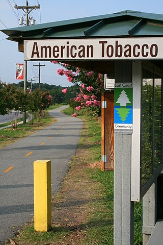

A rail trail is a shared-use path on railway right of way. Rail trails are typically constructed after a railway has been abandoned and the track has been removed, but may also share the right of way with active railways, light rail, or streetcars, or with disused track. As shared-use paths, rail trails are primarily for non-motorized traffic including pedestrians, bicycles, horseback riders, skaters, and cross-country skiers, although snowmobiles and ATVs may be allowed. The characteristics of abandoned railways—gentle grades, well-engineered rights of way and structures, and passage through historical areas—lend themselves to rail trails and account for their popularity. Many rail trails are long-distance trails, while some shorter rail trails are known as greenways or linear parks.

The Monon Trail is a rail trail located entirely within the state of Indiana. The Monon Railroad was a popular railroad line connecting the cities of Chicago and Indianapolis, with stops at major settlements along its route. After the decline of railroad travel and the sale of the company in 1987, the portion of the line between Indianapolis and Delphi, Indiana, was abandoned.

The Francis Marion National Forest is located north of Charleston, South Carolina. It is named for revolutionary war hero Francis Marion, who was known to the British as the Swamp Fox. It lies entirely within the Middle Atlantic coastal forests ecoregion. The park is also entirely in the Subtropical coniferous forest.

A greenway is usually a shared-use path along a strip of undeveloped land, in an urban or rural area, set aside for recreational use or environmental protection. Greenways are frequently created out of disused railways, canal towpaths, utility company rights of way, or derelict industrial land. Greenways can also be linear parks, and can serve as wildlife corridors. The path's surface may be paved and often serves multiple users: walkers, runners, bicyclists, skaters and hikers. A characteristic of greenways, as defined by the European Greenways Association, is "ease of passage": that is that they have "either low or zero gradient", so that they can be used by all "types of users, including mobility impaired people".
Taconic State Park is located in Columbia and Dutchess County, New York abutting Massachusetts and Connecticut within the Taconic Mountains. The state park is located off New York State Route 344 south of Interstate 90 and 110 miles (180 km) north of New York City. It features camping, hiking, bicycling, hunting, cross county skiing and other recreational opportunities.
This is a list of trails in Ithaca, New York.

The Cape Cod Rail Trail (CCRT) is a 25.5-mile (41.0 km) paved rail trail located on Cape Cod in Massachusetts. The trail route passes through the towns of Yarmouth, Dennis, Harwich, Brewster, Orleans, Eastham, and Wellfleet. It connects to the 6-plus mile (10 km) Old Colony Rail Trail leading to Chatham, the 2 mile Yarmouth multi-use trail, and 8 miles (13 km) of trails within Nickerson State Park. Short side trips on roads lead to national seashore beaches including Coast Guard Beach at the end of the Nauset Bike Trail in Cape Cod National Seashore. The trail is part of the Claire Saltonstall Bikeway.
The Mount Savage Railroad was a railroad operated by the Maryland and New York Coal and Iron Company of Mount Savage, Maryland between 1845 and 1854. The 14.9 miles (24 km) rail line ran from Frostburg to Cumberland, Maryland.
The Palmetto Trail is a planned 500-mile-long (805 km) foot and mountain bike trail in South Carolina for recreational hiking and biking. Several of the sections are also equestrian trails. It will extend from the Oconee County mountains to the Intracoastal Waterway in Charleston County. It currently consists of 26 segments totaling 350 miles (563 km). Maps and trail guides are available.

The Norwottuck Branch Rail Trail, formerly the Norwottuck Rail Trail, is an 11-mile (18 km) combination bicycle/pedestrian paved rail trail running from Northampton, Massachusetts, through Hadley and Amherst, to Belchertown, Massachusetts. It opened in 1992, and is now part of the longer Mass Central Rail Trail.
Bicycling has been a popular activity in Minnesota since the late 19th century. Since at least 2001, the state has claimed to have more miles of bike trails than any other in the U.S. For 2017, Minnesota was ranked as the 2nd most bicycle-friendly state by the League of American Bicyclists, moving up from its 5th-ranked position in 2008 and 2009. It was only exceeded by Washington. Much of the state's bicycle culture is centered in Minneapolis, the state's largest city, but the extensive network of trails has helped make cycling common throughout the state.

The Sussex Branch Trail is a rail trail in New Jersey, United States, with a total length of 20 miles (32 km).

The Charleston, Cincinnati and Chicago or Triple C Rail Trail is a rail trail in the Piedmont region of north-central South Carolina.

Minneapolis is often considered one of the top biking and walking cities in the United States due to its vast network of trails and dedicated pedestrian areas. In 2020, Walk Score rated Minneapolis as 13th highest among cities over 200,000 people. Some bicycling ratings list Minneapolis at the top of all United States cities, while others list Minneapolis in the top ten. There are over 80 miles (130 km) of paved, protected pathways in Minneapolis for use as transportation and recreation. The city's Grand Rounds National Scenic Byway parkway system accounts for the vast majority of the city's shared-use paths at approximately 50 miles (80 km) of dedicated biking and walking areas. By 2008, other city, county, and park board areas accounted for approximately 30 miles (48 km) of additional trails, for a city-wide total of approximately 80 miles (130 km) of protected pathways. The network of shared biking and walking paths continued to grow into the late 2010s with the additions of the Hiawatha LRT Trail gap remediation, Min Hi Line pilot projects, and Samatar Crossing. The city also features several natural-surface hiking trails, mountain-biking paths, groomed cross-country ski trails in winter, and other pedestrian walkways.

