Pike's Peak gold rush

Last updated
Gold prospectors in the Rocky Mountains of western Kansas Territory Pikes Peak miners.jpg
Gold prospectors in the Rocky Mountains of western Kansas Territory

The Pike's Peak gold rush (later known as the Colorado gold rush) was the boom in gold prospecting and mining in the Pike's Peak Country of western Kansas Territory and southwestern Nebraska Territory of the United States that began in July 1858 and lasted until roughly the creation of the Colorado Territory on February 28, 1861. An estimated 100,000 gold seekers took part in one of the greatest gold rushes in North American history. [1]

Contents

The participants in the gold rush were known as "Fifty-Niners" after 1859, the peak year of the rush and often used the motto Pike's Peak or Bust! In fact, the location of the Pike's Peak gold rush was centered 85 miles (137 km) north of Pike's Peak. The name Pike's Peak gold rush was used mainly because of how well known and important Pike's Peak was at the time. [2] The rush created a few mining camps such as Denver City and Boulder City that would develop into cities.

Overview

Prospector on Pikes Peak Prospector on Pikes Peak, CO 4a09164a original.jpg
Prospector on Pikes Peak

The Pike's Peak gold rush, which followed the California gold rush by approximately one decade, produced a dramatic but temporary influx of migrants and immigrants into the Pike's Peak Country of the Southern Rocky Mountains. The rush was exemplified by the slogan "Pike's Peak or Bust!", a reference to the prominent mountain at the eastern edge of the Rocky Mountains that guided many early prospectors to the region westward over the Great Plains. The prospectors provided the first major European-American population in the region.

The rush created a few mining camps such as Denver City and Boulder City that would develop into cities. Many smaller camps such as Auraria and Saint Charles City were absorbed by larger camps and towns. Scores of other mining camps have faded into ghost towns, but quite a few camps such as Central City, Black Hawk, Georgetown, and Idaho Springs survived.

Discovery

"At timber line, Pike's Peak trail" ~ circa unknown At timber line, Pike's Peak trail. Colo, by Martin, Alexander, d. 1929.jpg
"At timber line, Pike's Peak trail" ~ circa unknown

For many years, people had suspected the mountains in present-day Colorado contained numerous rich gold deposits. In 1835, French trapper Eustace Carriere lost his party and ended up wandering through the mountains for many weeks. During those weeks he found many gold specimens which he later took back to New Mexico for examination. Upon examination, they turned out to be "pure gold". But when he tried to lead an expedition back to the location of where he found the gold, they came up short because he could not quite remember the location. [3]

On January 24, 1848, James W. Marshall found placer gold near Coloma, California, and unbeknownst nine days later, Mexico ceded California and the rest of northern Mexico to the United States with the Treaty of Guadalupe Hidalgo. The California Gold Rush ensued. In the spring of 1850, John Beck led a party of predominately Cherokee veterans of the Georgia Gold Rush to the California gold fields. The party followed the Trail of Tears west, and on June 22, 1850, they crossed the South Platte River (a few miles north of what is today Denver) and camped near the confluence of two streams. One of the prospectors, Lewis Ralston panned for gold near the mouth of the smaller stream (in what is now Gold Strike Park in Arvada, Colorado.) He found about ¼ troy ounce (8 g) of gold, then worth about five dollars (about $550 USD today.) While Ralston was elated, the rest of the party was unimpressed and continued on to California the next morning. Ralston continued panning for gold, but gave up after a few days and caught up with his party. [4] [5] [6]

As the hysteria of the California Gold Rush faded, many discouraged gold seekers returned home. Rumors of gold in the Rocky Mountains persisted and several small parties explored the region. In the summer of 1857, a party of Spanish-speaking gold seekers from Taos, New Mexico, worked a placer deposit along the South Platte River about 5 miles (8.0 km) above Cherry Creek at a location later known as Mexican Diggings near Grant-Frontier Park in Denver. [1]

Sluicing for gold, photo by the U.S. Geological and Geographic Survey of the Territories. (1874-1879) Photographer: William Henry Jackson Gold mining in Boren's Gulch. La Plata County, Colorado - NARA - 517143.jpg
Sluicing for gold, photo by the U.S. Geological and Geographic Survey of the Territories. (1874–1879) Photographer: William Henry Jackson

William Greeneberry "Green" Russell was a Georgian who worked in the California gold fields in the 1850s. Russell was married to a Cherokee woman, and through his connections to the tribe, he heard about Ralston's 1850 discovery of gold along the South Platte River. Green Russell organized a party to prospect along the South Platte River, setting off with his two brothers and six companions in February 1858. They rendezvoused with Cherokee tribe members along the Arkansas River in present-day Oklahoma and continued westward along the Santa Fe Trail. Others joined the party along the way until their number reached 107. [6]

Upon reaching Bent's Fort, they turned to the northwest, reaching the confluence of Cherry Creek and the South Platte on May 23. The site of their initial explorations is in present-day Confluence Park in Denver. They began prospecting in the river beds, exploring Cherry Creek and nearby Ralston Creek but without success. In the first week of July 1858, Green Russell and Sam Bates found a small placer deposit near the mouth of Little Dry Creek that yielded about 20 troy ounces (620 g) of gold, then worth about 380 dollars (about $44,000 USD today.) This was the first significant gold discovery in the Rocky Mountain region. The site of the discovery is in the present-day Denver suburb of Englewood, just north of the junction of U.S. Highway 285 and U.S. Highway 85. [6] This discovery was announced with great excitement by the Kansas City Journal of Commerce on 26 August 1858 with the headline, "THE NEW ELDORADO!! GOLD IN KANSAS!!" [7]

Initial boom

A map from the late 1850s showing prominent routes to the gold regions Pikes peak-gold rush-map01.jpg
A map from the late 1850s showing prominent routes to the gold regions

The first decade of the boom was largely concentrated along the South Platte River at the base of the Rocky Mountains, in the canyon of Clear Creek in the mountains west of Golden City, at Breckenridge and in South Park at Como, Fairplay, and Alma. By 1860, Denver City, Golden City, and Boulder City were substantial towns that served the mines. Rapid population growth led to the creation of the Colorado Territory in 1861.

The Pike's Peak gold rush sent many Americans into a frenzy, prompting them to pack up their belongings and head to Colorado. This initial boom influenced people to begin falsifying information, often sending people out to the west without any proof of a true presence of gold. [8] As early as the spring of 1859, people raced to the Pike's Peak country. Some even dared to go out in the winter of 1858 to try to get a head start, only to realize that they would have to wait until the snow melted to begin mining. [9]

Free gold

Hardrock mining boomed for a few years, but then declined in the mid-1860s as the miners exhausted the shallow parts of the veins that contained free gold, and found that their amalgamation mills could not recover gold from the deeper sulfide ores. [10] Colorado produced 150,000 ounces of gold in 1861 and 225,000 troy ounces in 1862. This led Congress to establish the Denver Mint. Cumulative Colorado production by 1865 was 1.25 million ounces, of which sixty percent was placer gold. [11] :28–30

See also

Related Research Articles

<span class="mw-page-title-main">Jefferson County, Colorado</span> County in Colorado, United States

Jefferson County is a county located in the U.S. state of Colorado. As of the 2020 census, the population was 582,910, making it the fourth-most populous county in Colorado. The county seat is Golden, and the most populous city's Lakewood.

<span class="mw-page-title-main">Arvada, Colorado</span> City in Colorado, United States

Arvada is a home rule municipality on the border between Jefferson and Adams counties, Colorado, United States. The city population was 124,402 at the 2020 United States Census, with 121,510 residing in Jefferson County and 2,892 in Adams County. Arvada is the seventh most populous city in Colorado. The city is a part of the Denver–Aurora–Lakewood, CO Metropolitan Statistical Area and the Front Range Urban Corridor. The Olde Town Arvada historic district is 7 miles (11 km) northwest of the Colorado State Capitol in Denver.

<span class="mw-page-title-main">History of Colorado</span> History of the U.S. State of Colorado

The region that is today the U.S. State of Colorado has been inhabited by Native Americans and their Paleoamerican ancestors for at least 13,500 years and possibly more than 37,000 years. The eastern edge of the Rocky Mountains was a major migration route that was important to the spread of early peoples throughout the Americas. The Lindenmeier site in Larimer County contains artifacts dating from approximately 8720 BCE.

<span class="mw-page-title-main">Colorado Territory</span> Historic region of the US, 1861 to 1876

The Territory of Colorado was an organized incorporated territory of the United States that existed from February 28, 1861, until August 1, 1876, when it was admitted to the Union as the State of Colorado.

<span class="mw-page-title-main">Fifty-Niner</span>

A "Fifty-Niner" is the term used for the gold seekers who streamed into the Pike's Peak Country of western Kansas Territory and southwestern Nebraska Territory in 1859. The discovery of placer gold deposits along the South Platte River at the foot of the Rocky Mountains in northwestern Kansas Territory by a party of miners led by William Greeneberry "Green" Russell in July 1858 precipitated the Pike's Peak Gold Rush.

<span class="mw-page-title-main">Auraria, Denver</span> Early neighborhood in Denver, Colorado

Auraria was a small mining settlement in the Kansas Territory in the United States. Today it survives in its original location as a neighborhood of Denver, Colorado, south of the confluence of Cherry Creek and the South Platte River.
<span class="mw-page-title-main">Kenosha Pass</span>

Kenosha Pass, elevation 10,000 ft (3,000 m), is a high mountain pass located in the Rocky Mountains of central Colorado in the United States.

<span class="mw-page-title-main">Ralston Creek (Colorado)</span> River

Ralston Creek is a tributary of Clear Creek, approximately 32 miles (51 km) long, in central Colorado in the United States. It drains a suburban and urban area of the northwestern Denver Metropolitan Area. It rises in the foothills in northeastern Gilpin County, in southern Golden Gate Canyon State Park. It descends through a valley eastward into Jefferson, following Drew Hill Road, emerging from the mountains approximately 3 miles (5 km) north of Golden, where it is impounded to form Ralston Reservoir and Arvada/Blunn Reservoir on both sides of State Highway 93. It flows eastward through Arvada and joins Clear Creek from the north in southeast Arvada, near the intersection of Sheridan Avenue and Interstate 76.

Thomas L. "Tom" Golden was a miner from Georgia, United States, who was one of the earliest prospectors in present-day Jefferson County, Colorado. Golden arrived in the then-Kansas Territory in 1858 around the beginning of the Pike's Peak Gold Rush. He later partnered with George A. Jackson, a native of Glasgow, Missouri who discovered gold at the confluence of Chicago Creek and Clear Creek on January 7, 1859.

<span class="mw-page-title-main">Montana City, Colorado</span> First settlement in what later became Denver, Colorado

Montana City was the first settlement in what was later to become Denver, Colorado. It was established during the Pikes Peak Gold Rush on the east bank of the South Platte River, just north of the confluence with Little Dry Creek, in 1858. At the time, the site was in the Kansas Territory.
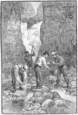
<span class="mw-page-title-main">Georgia Gold Rush</span>

The Georgia Gold Rush was the second significant gold rush in the United States and the first in Georgia, and overshadowed the previous rush in North Carolina. It started in 1829 in present-day Lumpkin County near the county seat, Dahlonega, and soon spread through the North Georgia mountains, following the Georgia Gold Belt. By the early 1840s, gold became difficult to find. Many Georgia miners moved west when gold was found in the Sierra Nevada in 1848, starting the California Gold Rush. Since the 16th century, American Indians in Georgia told European explorers that the small amounts of gold which they possessed came from mountains of the interior. Some poorly documented accounts exist of Spanish or French mining gold in North Georgia between 1560 and 1690, but they are based on supposition and on rumors passed on by Indians. In summing up known sources, W.S. Yeates observed: "Many of these accounts and traditions seem to be quite plausible. Nevertheless, it is hardly probable that the Spaniards would have abandoned mines which were afterwards found to be quite profitable, as those in North Georgia."

William Greeneberry "Green" Russell (1818–1877) was an American gold prospector and miner.

Jefferson County was a county of the extralegal United States Territory of Jefferson that existed from November 28, 1859, until February 28, 1861. Its territory covered a broad swath surrounding the region of the Pike's Peak Gold Rush, and was a functioning democratically elected government until the organization of the Territory of Colorado in 1861. At that time, the successor Jefferson County was permanently created, taking its name from its predecessor and incorporating the heart of its territory.

Gold mining in Colorado, a state of the United States, has been an industry since 1858. It also played a key role in the establishment of the state of Colorado.

<span class="mw-page-title-main">Oro City, Colorado</span> Ghost town in Lake County, Colorado, United States

Oro City is a ghost town in Lake County, Colorado, United States

Arapahoe County was a county of the extralegal United States Territory of Jefferson that existed from November 28, 1859, until February 28, 1861. The county name was also spelled Arapaho County, Arapahoe County, Arrapahoe County, and Arappahoe County. The county seat was Denver City.

The Overland Trail was a stagecoach and wagon trail in the American West during the 19th century. While portions of the route had been used by explorers and trappers since the 1820s, the Overland Trail was most heavily used in the 1860s as a route alternative to the Oregon, California, and Mormon trails through central Wyoming. The Overland Trail was famously used by the Overland Stage Company owned by Ben Holladay to run mail and passengers to Salt Lake City, Utah, via stagecoaches in the early 1860s. Starting from Atchison, Kansas, the trail descended into Colorado before looping back up to southern Wyoming and rejoining the Oregon Trail at Fort Bridger. The stage line operated until 1869 when the completion of the First transcontinental railroad eliminated the need for mail service via stagecoach.

Lewis Ralston was an American placer gold prospector from Georgia who made the first recorded discovery of gold in the Rocky Mountain region.

Jimmy's Camp was a trading post established in 1833. The site is east of present-day Colorado Springs, Colorado on the southeast side of U.S. Route 24 and east of the junction with State Highway 94. Located along Trapper's Trail / Cherokee Trail, it was a rest stop for travelers and was known for its spring. Jimmy Camp was a ranch by 1870 and then a railway station on a spur of the Colorado and Southern Railway. After the ranch was owned by several individuals, it became part of the Banning Lewis Ranch. Now the land is an undeveloped park in Colorado Springs.

Henry Allen was an American pioneer and politician. He served in the United States Army before settling in Council Bluffs, where he was a postmaster. He was at the front of the Pike's Peak Gold Rush, arriving in Denver of the Kansas Territory in October 1858. He prospected for gold and was the first official postmaster of the Pikes Peak region. As a surveyor, he helped establish Auraria, Highland, which later came part of the city of Denver. He was a founder of a company that diverted water from the South Platte River through irrigation ditches. He held the first meeting in his cabin for what became the Auraria Masonic Lodge. He was a delegate from Auraria for the first Constitutional Convention of the Jefferson Territory. Allen and his wife lived in mining towns in Colorado, Idaho, and Montana. Due to poor health, Henry and Susan Allen moved to California, where Allen died in 1871.

References

  1. 1 2 Thomas J. Noel (December 19, 2006). "Denver History – The Arapaho Camp". Mile High City. City and County of Denver. Archived from the original (ASP/HTML) on October 13, 2007. Retrieved December 19, 2006.
  2. Brown, Robert (1985). The Great Pikes Peak Gold Rush. Caldwell, Idaho: Caxton Press. ISBN   0-87004-412-5.
  3. Hafen, Le Roy Reuben (1859). The Illustrated Miners' Hand-book and Guide to Pike's Peak: With a New and Reliable Map, Showing All the Routes and the Gold Regions of Western Kansas and Nebraska. Saint Louis: Parker and Huyett.
  4. Kennedy, Lois Cunniff Lindstrom (2011), Ralston's Gold, Coloradream Publishing
  5. "The curious case of Lewis Ralston". Arvada Press. February 9, 2022. Retrieved February 27, 2024.
  6. 1 2 3 Gehling, Richard (2006). "The Pike's Peak Gold Rush". Richard Gehling. Archived from the original on 2006-02-15. Retrieved December 19, 2006.
  7. Limerick, Patricia Nelson; Hanson, Jason L. (2012). A Ditch in Time : the City, the West, and Water (1st ed.). Golden, Colorado: Fulcrum Pub. p. 22. ISBN   978-1-55591-366-3 . Retrieved 8 November 2023.
  8. "Colorado Gold Rush". Colorado Encyclopedia. May 6, 2016. Retrieved November 16, 2017.
  9. "Pike's Peak Gold Rush". Explore Old West Colorado. Archived from the original on August 8, 2014. Retrieved July 29, 2014.
  10. A. H. Koschman and M. H. Bergendahl (1968) Principal Gold-Producing Districts of the United States, US Geological Survey, Professional Paper 610, p.86.
  11. Voynick, S.M., 1992, Colorado Gold, Missoula: Mountain Press Publishing Company, ISBN   0878424555

39°39′35″N105°00′10″W / 39.65972°N 105.00278°W / 39.65972; -105.00278