Bunche Park, Florida

Last updated
Bunche Park
Neighborhood of Miami Gardens
FLMap-doton-BunchePark.PNG
Location in the state of Florida
Coordinates: 25°55′19″N80°14′4″W / 25.92194°N 80.23444°W / 25.92194; -80.23444 Coordinates: 25°55′19″N80°14′4″W / 25.92194°N 80.23444°W / 25.92194; -80.23444
Country Flag of the United States.svg  United States
State Flag of Florida.svg  Florida
County Flag of Miami-Dade County, Florida.png Miami-Dade
City  Miami Gardens
Area
  Total0.8 sq mi (2.0 km2)
  Land0.8 sq mi (2.0 km2)
  Water0.0 sq mi (0.0 km2)
Population
 (2000)
  Total3,972
  Density5,240.0/sq mi (2,023.2/km2)
Time zone UTC-5 (Eastern (EST))
  Summer (DST) UTC-4 (EDT)
FIPS code 12-09500 [1]

Bunche Park is a neighborhood in Miami Gardens, Florida, United States. It was formerly a census-designated place.

Contents

Geography

Bunche Park is located at 25°55′19″N80°14′4″W / 25.92194°N 80.23444°W / 25.92194; -80.23444 (25.921871, -80.234469). [2]

According to the United States Census Bureau, the CDP has a total area of 2.0 km2 (0.8 mi2), all land.

Demographics

Historical population
CensusPop.
1970 5,773
1990 4,388
2000 3,972−9.5%
source: [3] [4]

As of the census [1] of 2000, there were 3,972 people, 1,350 households, and 981 families residing in the CDP. The population density was 2,017.9/km2 (5,240.0/mi2). There were 1,432 housing units at an average density of 727.5/km2 (1,889.1/mi2). The racial makeup of the CDP was 1.36% White, 96.45% Blacks or African American, 0.08% Native American, 0.13% Asian, 0.63% from other races, and 1.36% from two or more races. Hispanic or Latino of any race were 3.05% of the population.

In 2000 Bunche Park was the place in the United States that had the highest percentage of Bahamians, with 3.8% of the population reporting this ancestry. [5]

There were 1,350 households, out of which 25.4% had children under the age of 18 living with them, 29.7% were married couples living together, 34.4% had a female householder with no husband present, and 27.3% were non-families. 24.1% of all households were made up of individuals, and 13.8% had someone living alone who was 65 years of age or older. The average household size was 2.93 and the average family size was 3.45.

In the CDP, the population was spread out, with 28.4% under the age of 18, 7.9% from 18 to 24, 24.7% from 25 to 44, 17.7% from 45 to 64, and 21.3% who were 65 years of age or older. The median age was 38 years. For every 100 females, there were 83.8 males. For every 100 females age 18 and over, there were 75.9 males.

The median income for a household in the CDP was $25,898, and the median income for a family was $28,645. Males had a median income of $25,677 versus $22,259 for females. The per capita income for the CDP was $11,438. About 22.5% of families and 27.0% of the population were below the poverty line, including 38.4% of those under age 18 and 20.2% of those age 65 or over.

As of 2000, before being annexed to Miami Gardens, English as a first language accounted for 95.97% of all residents, while Spanish was at 3.07%, and French Creole as a mother tongue made up 0.94% of the population. [6]

As of 2000, the Bunche Park section of Miami Gardens had the ninth highest percentage of African-American and black residents in the US, with 96.5% of the populace. [7] It was the most Bahamian place in the United States, [8] as well as having the highest percentage of British West Indians in the US, at 1.8% (which tied with Brentwood, Maryland.) [9] It was also home to the fifty-third highest percentage of Haitians in the US, at 2.8% of all residents (which also tied with Sunrise, Florida; Lake Alfred, Florida; and Brentwood, New York). [9]

Education

Miami-Dade County Public Schools operates public schools. Schools in the former CDP: [10]

Related Research Articles

Pembroke Park, Florida Town in Florida

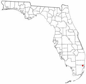
Pembroke Park is a town in Broward County, Florida, United States. The town took its name from its location along Pembroke Road. As of the 2020 census, the population was 6,260. It is part of the South Florida metropolitan area, which was home to 5,564,635 people at the 2010 census. Almost one-half of its residents live in mobile homes.

Carol City, Florida Neighborhood of Miami Gardens in Miami-Dade, Florida, United States

Carol City is a neighborhood in Miami Gardens, Florida, United States. The population was 61,233 at the 2010 census. It was formerly a census-designated place.

Country Club, Florida Census-designated place & Unincorporated community in Florida, United States

Country Club is a census-designated place and a suburban unincorporated community located in northwest Miami-Dade County, Florida, United States. It is named after the Country Club of Miami, which was established in 1961 in what was then an unpopulated and undeveloped section of the county. The population was 36,310 at the 2000 census.

Fontainebleau, Florida CDP in Florida, United States

Fontainebleau is a census-designated place (CDP) in Miami-Dade County, Florida, United States. The population was 59,870 during the 2020 census.

Golden Glades, Florida CDP in Florida, United States

Golden Glades is a census-designated place (CDP) in Miami-Dade County, Florida, United States. The population was 32,499 at the 2020 census.

Kendall, Florida Census-designated place in Florida, United States

Kendall is a census-designated place in Miami-Dade County, Florida, United States. At the 2010 census, the area had a population of 75,371.

Leisure City, Florida CDP in Florida, United States

Leisure City is a census-designated place (CDP) in Miami-Dade County, Florida, United States, that includes the smaller, older community of Modello in its northwestern section. The population was 22,152 at the 2000 census. Leisure City is most notable for the Coral Castle Museum, located in the Modello area.

Miami Springs, Florida City in Florida

Miami Springs is a city located in Miami-Dade County, Florida. The city was founded by Glenn Hammond Curtiss, "The Father of Naval Aviation", and James Bright, during the famous "land boom" of the 1920s and was originally named Country Club Estates. It, along with other cities in Miami-Dade County such as Coral Gables, Florida, and Opa-locka, Florida, formed some of the first planned communities in the state. Like its counterparts, the city had an intended theme which in its case, was to reflect a particular architecture and ambiance.

Ojus, Florida Census-designated place & Unincorporated community in Florida, United States

Ojus is a census-designated place and formerly incorporated town in Miami-Dade County, Florida, United States. The population was 16,642 at the 2000 census. Ojus is bordered by Aventura to the east, I-95 to the west, North Miami Beach to the south and Broward County to the north.

Olympia Heights, Florida Neighborhood in Miami-Dade, Florida, United States

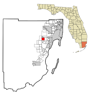
Olympia Heights is a neighborhood in Miami-Dade County, Florida, United States. The population was 13,488 at the 2010 census.

Opa-locka, Florida City in Florida

Opa-locka is a city located in Miami-Dade County, Florida, United States. As of the 2010 U.S. Census, the population was 15,219. The city was developed by Glenn Curtiss. Developed based on a One Thousand and One Nights theme, Opa-locka has the largest collection of Moorish Revival architecture in the Western Hemisphere, and streets with such names as Sharazad Boulevard, Sinbad Avenue, Sabur Lane, Sultan Avenue, Ali Baba Avenue, Perviz Avenue, and Sesame Street. Opa-locka has an area of 4.2 square miles and is located in the northwestern area of Miami-Dade County, Florida.

Opa-locka North, Florida Neighborhood of Miami Gardens in Miami-Dade, Florida, United States

Opa-locka North is a neighborhood in Miami Gardens, Florida, United States. It was formerly a census-designated place. The population was 6,224 at the 2000 census.

Richmond Heights, Florida CDP in Florida, United States

Richmond Heights is a census-designated place (CDP) in Miami-Dade County, Florida, United States. The population was 8,541 at the 2010 census.

Tamiami, Florida CDP in Florida, United States

Tamiami is a census-designated place (CDP) in Miami-Dade County, Florida, United States. The population was 55,271 at the 2010 census.

The Hammocks, Florida CDP in Florida, United States

The Hammocks is an unincorporated census-designated place in Miami-Dade County, Florida, United States. The population was 51,003 at the 2010 census.

University Park, Florida CDP and Neighborhood in Miami-Dade, Florida, United States

University Park is a census-designated place (CDP) and neighborhood in Miami-Dade County, Florida, United States. The population was 26,995. It encompasses the Modesto A. Maidique Campus of Florida International University.

Virginia Gardens, Florida Village in Florida

Virginia Gardens is a village in Miami-Dade County, Florida, United States. According to the U.S. Census Bureau, the village had a population of 2,375 in 2010.

West Little River, Florida CDP in Miami-Dade County, Florida, US

West Little River is a census-designated place (CDP) in Miami-Dade County, Florida, United States. The population was 34,699 at the 2010 census.

Westchester, Florida Census-designated place in Florida, United States

Westchester is a census-designated place (CDP) and neighborhood in Miami-Dade County, Florida, United States. The population was 29,778 at the 2020 cencus.

Miami Gardens, Florida City in Florida, United States

Miami Gardens is a city in north-central Miami-Dade County, Florida, United States. It is 16 miles north of Downtown Miami and its boundaries stretch from I-95 and NE 2nd Avenue on the east to NW 47th and NW 57th Avenues on the west, and from the Broward County line on the north to 151st Street on the south. The city name comes from one of the major roadways through the area, Miami Gardens Drive. According the US Census Bureau, the city had a population of 110,001 as of 2019, and it is Florida's largest city with a majority African American population. It is a principal city of the Miami metropolitan area, which was home to an estimated 6,012,331 people in 2015.

References

  1. 1 2 "U.S. Census website". United States Census Bureau . Retrieved 2008-01-31.
  2. "US Gazetteer files: 2010, 2000, and 1990". United States Census Bureau. 2011-02-12. Retrieved 2011-04-23.
  3. "CENSUS OF POPULATION AND HOUSING (1790-2000)". U.S. Census Bureau . Retrieved 2010-07-17.
  4. Census area not separately enumerated in 1980.
  5. Bahamian ancestry by city – ePodunk
  6. "MLA Data Center Results of Bunche Park, Florida". Modern Language Association . Retrieved 2007-11-03.
  7. "Ancestry Map of African-American Communities". Epodunk.com. Archived from the original on 2015-03-17. Retrieved 2007-11-03.
  8. "Ancestry Map of Bahamian Communities". Epodunk.com. Retrieved 2007-11-03.
  9. 1 2 "Ancestry Map of British West Indian Communities". Epodunk.com. Archived from the original on 2015-07-13. Retrieved 2007-11-03.
  10. "CENSUS 2000 BLOCK MAP: BUNCHE PARK CDP" (PDF). U.S. Census Bureau . Retrieved 2020-05-11. - Compare this map to school addresses.
  11. "North Dade MS". Miami-Dade County Public Schools . Retrieved 2020-05-11. 1840 NW 157 STREET MIAMI GARDENS, FL 33054
  12. "Home". Bunche Park Elementary School. Retrieved 2020-05-11. 16001 Bunche Park Drive, Miami Gardens, Fl 33054
  13. "Home". North Dade Center for Modern Language. Retrieved 2020-05-11. 1840 NW 157th St, Opa-locka, FL 33054 - Despite the "Opa locka" address, it is in the city of Miami Gardens and in the former Bunche Park CDP. Compare with maps of Miami Gardens, the former Bunche Park CDP, and/or the city of Opa locka.

Further reading