The 20th Air Division is an inactive United States Air Force organization. Its last assignment was with Tactical Air Command at Tyndall Air Force Base, Florida where it was inactivated on 1 March 1983.

Charleston Air Force Station is a defunct Air Force Station that opened in 1952 and closed in 1980. It was located in Charleston, Maine and is the site of a radar station and other buildings. After closure, it was redeveloped into a juvenile jail for the state of Maine.

The 17th Defense Systems Evaluation Squadron is an inactive United States Air Force unit. It was last assigned to the 24th Air Division of Aerospace Defense Command at Malmstrom AFB, Montana. It was inactivated on 13 July 1979.

Calumet Air Force Station is a closed United States Air Force General Surveillance Radar station. It is located 5.2 miles (8.4 km) east-northeast of Phoenix, Michigan. It was closed in 1988 by the Air Force, and turned over to the Federal Aviation Administration (FAA).
Bedford Air Force Station is a closed United States Air Force General Surveillance Radar station. It is located 12.7 miles (20.4 km) north of Bedford, Virginia. It was closed in 1975.
Palermo Air Force Station is a closed United States Air Force (USAF) General Surveillance Radar station. It was located in Palermo, New Jersey, 4.8 miles (7.7 km) north of Sea Isle City, in Cape May County, New Jersey, United States. It was closed in 1970.
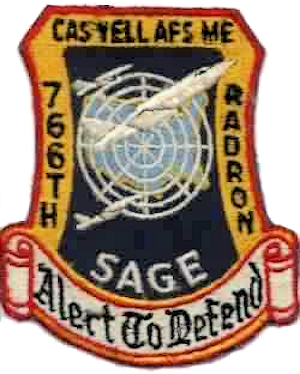
Caswell Air Force Station is a closed United States Air Force General Surveillance Radar station. It is located 4.3 miles (6.9 km) north of Limestone, Maine. It was closed in 1980.
Snow Mountain Air Force Station is a closed United States Air Force General Surveillance Radar station. It is located 1.9 miles (3.1 km) west-southwest of Godman Army Airfield, Kentucky. It was closed in 1968.

The 635th Radar Squadron is an inactive United States Air Force unit. It was last assigned to the 20th Air Division, Aerospace Defense Command, stationed at Dauphin Island Air Force Station, Alabama. It was inactivated on 1 July 1974. The unit was a General Surveillance Radar squadron providing for the air defense of the United States.

Custer Air Force Station is a closed United States Air Force General Surveillance Radar and Direction Center station. It is located 5.3 miles (8.5 km) west-northwest of Battle Creek, Michigan. It was closed in 1969.
Port Austin Air Force Station is a closed United States Air Force General Surveillance Radar station. It is located 1.2 miles (1.9 km) south-southwest Port Austin, Michigan. It was closed in 1988 by the Air Force.

Havre Air Force Station is a Formerly Used Defense Site that was used as a Cold War general surveillance radar station. In addition to radar facilities and a NORAD Control Center the site had support services: NCO club, bowling alley, hobby shops, library, movie theater, barber shop, exchange, commissary, grade school, and housing for officers and senior NCOs.

Ground Equipment Facility J-31 is a Joint Surveillance System radar site of the Western Air Defense Sector (WADS) and the Federal Aviation Administration's air traffic control radar network for the Los Angeles Air Route Traffic Control Center. The facility's Air Route Surveillance Radar Model 1E with an ATCBI-6 beacon interrogator system are operated by the FAA and provide sector data to North American Aerospace Defense Command. The site provided Semi-Automatic Ground Environment data to the 1959-66 Norton AFB Direction Center for the USAF Los Angeles Air Defense Sector. The site also provided Project Nike data to the 1960-74 Fort MacArthur Direction Center ~3 mi (4.8 km) away for the smaller US Army Los Angeles Defense Area—as well as gap-filler radar coverage for the 1963-74 Integrated Fire Control area of Malibu Nike battery LA-78 on San Vicente Mountain.

Mount Laguna Air Force Station is a closed United States Air Force General Surveillance Radar station. It is located 24.3 miles (39.1 km) north-northeast of Tecate, California. It was closed in 1981 by the Air Force, and turned over to the Federal Aviation Administration (FAA).

The 669th Radar Squadron is an inactive United States Air Force unit. It was last assigned to the 27th Air Division, Aerospace Defense Command, stationed at Lompoc Air Force Station, California. It was discontinued on 18 June 1968.

Madera Air Force Station is a closed United States Air Force General Surveillance Radar station. It is located 5.2 miles (8.4 km) north-northeast of Madera, California. It was closed in 1966.
Othello Air Force Station is a closed United States Air Force General Surveillance Radar station. It is located 7.2 miles (11.6 km) south of Othello, Washington. It was the home station of the 637th Aircraft Control and Warning Squadron and the 637th Air Defense Group, closing in 1975.

Blaine Air Force Station is a closed United States Air Force General Surveillance Radar station. It is located 5.5 miles (8.9 km) south of Blaine, Washington. It was closed in 1979.
Makah Air Force Station is a closed United States Air Force General Surveillance Radar station. It is located 2.4 miles (3.9 km) south of Neah Bay, Washington. It was closed in 1988 by the Air Force, and turned over to the Federal Aviation Administration (FAA).
Naselle Air Force Station is a closed United States Air Force General Surveillance Radar station. It is located 3.9 miles (6.3 km) north of Naselle, Washington. It was decommissioned by the Air Force in 1966 and later used for commercial and recreational uses.

