Mount Hebo Air Force Station is a closed United States Air Force General Surveillance Radar station. It is located 5.2 miles (8.4 km) east-southeast of Hebo, Oregon, located at the top of 3,154-foot (961 m) Mount Hebo. It was closed in 1980.

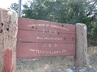
Ground Equipment Facility J-33 is a Federal Aviation Administration (FAA) radar station of the Joint Surveillance System's Western Air Defense Sector (WADS) with an Air Route Surveillance Radar (ARSR-4). The facility was previously a USAF general surveillance radar station during the Cold War.
Minot Air Force Station [Permanent Installation Number (PIN): 1445; Installation Location Code (ILC): QJVM]) is a closed United States Air Force General Surveillance Radar station. It is located 16.2 miles (26.1 km) south of Minot, North Dakota; on the west side of US Highway 83. It was closed in 1979. A portion of the property was reopened in 1984 as the Minot Communications Site and served until 1997.

Fortuna Air Force Station is a closed United States Air Force General Surveillance Radar station. It is located 4.2 miles (6.8 km) west of Fortuna, North Dakota. It was closed in 1979 as a radar station, remaining as a Long-Range Radar (LRR) facility until 1984.
Dickinson Air Force Station is a closed United States Air Force General Surveillance Radar station. It is located 3.8 miles (6.1 km) northeast of Dickinson, North Dakota. It was closed in 1965.
Thomasville Air Force Station is a closed United States Air Force General Surveillance Radar station. It is located 1.9 miles (3.1 km) north-northwest of Thomasville, Alabama. It was closed in 1969.

Charleston Air Force Station is a defunct Air Force Station that opened in 1952 and closed in 1980. It was located in Charleston, Maine and is the site of a radar station and other buildings. After closure, it was redeveloped into a juvenile jail for the state of Maine.

Gibbsboro Air Force Station is a closed United States Air Force General Surveillance Radar station. It is located 1.1 miles (1.8 km) south-southeast of Gibbsboro, in Camden County, New Jersey, United States. It was closed in 1994 by the Air Force, and turned over to the Federal Aviation Administration (FAA).

Calumet Air Force Station is a closed United States Air Force General Surveillance Radar station. It is located 5.2 miles (8.4 km) east-northeast of Phoenix, Michigan. It was closed in 1988 by the Air Force, and turned over to the Federal Aviation Administration (FAA).

Ground Equipment Facility QRC is an FAA radar station that was part of a Cold War SAGE radar station for aircraft control and warning "from Massachusetts to southern Virginia, and as far out to sea as possible." Benton AFS was also the first operational "regional data processing center" for the GE 477L Nuclear Detection and Reporting System.
North Charleston Air Force Station is a closed United States Air Force General Surveillance Radar station. It is located in the City of North Charleston, South Carolina. It was closed in 1980.
Port Austin Air Force Station is a closed United States Air Force General Surveillance Radar station. It is located 1.2 miles (1.9 km) south-southwest Port Austin, Michigan. It was closed in 1988 by the Air Force.

Baudette Air Force Station is a closed United States Air Force General Surveillance Radar station. It is located 3.1 miles (5.0 km) south-southwest of Baudette, Minnesota. It was closed in 1979.

Havre Air Force Station is a Formerly Used Defense Site that was used as a Cold War general surveillance radar station. In addition to radar facilities and a NORAD Control Center the site had support services: NCO club, bowling alley, hobby shops, library, movie theater, barber shop, exchange, commissary, grade school, and housing for officers and senior NCOs.
Boron Air Force Station is a closed United States Air Force General Surveillance Radar station. It is located 6.8 miles (10.9 km) northeast of Boron, California. It was closed by the Air Force in 1975 and turned over to the Federal Aviation Administration (FAA). The radar site is still operated by the FAA as part of the Joint Surveillance System (JSS).
Cambria Air Force Station is a closed United States Air Force General Surveillance Radar station. It is located 3 miles (4.8 km) south-southeast of Cambria, California. It was closed in 1980.
North Bend Air Force Station is a closed United States Air Force General Surveillance Radar station. It is located 3.9 miles (6.3 km) north-northeast of Hauser, Oregon. It was closed in 1980.

Condon Air Force Station is a closed United States Air Force General Surveillance Radar station. It is located 5.7 miles (9.2 km) west of Condon, Oregon. It was closed in 1970.

Keno Air Force Station is a closed United States Air Force General Surveillance Radar station. It is located 4.6 miles (7.4 km) south-southwest of Keno, Oregon. It was closed in 1979 by the Air Force, and turned over to the Federal Aviation Administration (FAA).

The 14th Test Squadron is a United States Air Force unit located at Schriever Air Force Base, Colorado. It is an Air Force Reserve unit that augments the 17th Test Squadron. The squadron is responsible for testing and evaluating space systems and associated support equipment. The unit was originally established in 1972 as the 14th Missile Warning Squadron. The missile warning squadron was an active duty unit that operated early warning radars at eight locations around the United States until it was inactivated in 1980. The squadron was reactivated and given its current space test mission in 2000.


