Almond, New York

Last updated

Almond
I-86 eb near West Almond, NY, July 2023.jpg
Eastbound I-86 in Almond
USA New York location map.svg
Red pog.svg
Almond
Location within the state of New York
Coordinates: 42°19′14″N77°44′15″W / 42.32056°N 77.73750°W / 42.32056; -77.73750
CountryUnited States
State New York
County Allegany County
Incorporated1821
Government
  Town SupervisorDawn Wildrick-Cole
Area
[1]
  Total45.78 sq mi (118.58 km2)
  Land45.72 sq mi (118.41 km2)
  Water0.07 sq mi (0.17 km2)
Elevation
2,051 ft (625 m)
Population
 (2020) [2]
  Total1,526 Decrease2.svg
  Estimate 
(2021) [2]
1,511
  Density34.04/sq mi (13.14/km2)
Time zone UTC-5 (EST)
  Summer (DST) UTC-4 (EDT)
ZIP code
14804
Area code 607
FIPS code 36-003-01451
Website www.almondny.us

Almond is a town in Allegany County, New York, United States. The population was 1,526 at the 2020 census. [2]

Contents

The Town of Almond is on the eastern edge of the county. The town has a village also called Almond. The town is west of Hornell and is accessible from Interstate 86 at Exit 33 and New York State Route 21.

History

Former Almond Erie Railroad station in 1909 Almond.jpg
Former Almond Erie Railroad station in 1909

The first part of the town to be settled was near Karrdale in 1796. When Allegany County was established in 1806, the region now in the Town of Almond was part of the Town of Alfred. The Town of Almond was formed in 1821. After Almond was established, parts were removed to form the towns of West Almond and Birdsall.

A history of the area, The Almond Story - The Early Years, was published by John Reynolds, Town Historian, in 1962. (Copies are available from the Almond Historical Society, whose website is at https://almondhistory.wordpress.com/ . See also https://www.facebook.com/AlmondHistoricalSociety/ .) According to Mr. Reynolds, the town is named for a place in Scotland, and not for the nut, which would most likely not have been available here in the wilderness when the town was named. Consequently, the pronunciation is not the same as that of the nut: the word Almond properly begins with the same sound as the nearby towns of Alfred, Alma, Addison, and Angelica.

The Almond Historical Society maintains a museum of local history at the Hagadorn House, a large yellow house on the corner by the town's only traffic light. The House was built in 1830 and features a large open fireplace and stone oven with original cookware, which had been walled in to conserve heat, but was rediscovered by the last couple to occupy the House, Ken and Marie Hagadorn. These Hagadorns had no children, and left their house to the then-recently formed Historical Society in 1971 to serve as a Museum of treasured furniture, clothing, tools, artwork, and much more. The Society maintains genealogical records and news files for families in the town in the adjacent archives building. The archives are open to the public Fridays from 2 - 4 p.m., and the Museum may be visited at that time or by appointment. The Society holds several open houses throughout the year and publishes a quarterly newsletter.

The Almond 20th Century Club Library had its beginning in 1904, when a small group of energetic and forward-thinking women of the community formed a Reading Circle with weekly meetings. Today, the Library offers up-to-date computers, free wifi, and extensive collections of books, audiobooks, and DVDs for all ages, with access to the resources of the Southern Tier Library System, of which it is a member. It has regular story and craft times for children, a book discussion group for adults, an annual mystery theater, and meeting rooms available for use by the public. The Library's historic brick building, constructed in 1912, is in need of major renovation, and various fund-raising activities are being held. Reconstruction is scheduled to begin in the spring of 2020. More information can be found at https://www.facebook.com/almondlibrary or http://almondlibrary.org/ .

Geography

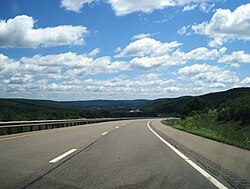
The scenic area consists primarily of long, wooded hills with homes and active or abandoned farmland in the valleys between. According to the United States Census Bureau, the town has a total area of 45.8 square miles (118.7 km2), of which, 45.8 square miles (118.6 km2) of it is land and 0.02% is water.

The east town line is the border of the Town of Hornellsville in Steuben County, New York. The Town of Burns is on the northern boundary, Alfred lies to the south, and West Almond and Birdsall lie to the west.

The Southern Tier Expressway (Interstate 86 and New York State Route 17) and New York State Route 21 pass through the town.

Canacadea Creek, after joining with the confluence of McHenry Valley and Karr Valley Creeks, flows out the eastern town line toward the Canisteo River.

[3]

Climate

Climate data for Almond (Cornell Almond Dam), New York (1991–2020 precipitation/snow normals, 2000-2020 temperature normals, extremes 2000-present)
MonthJanFebMarAprMayJunJulAugSepOctNovDecYear
Record high °F (°C)62
(17)
73
(23)
77
(25)
88
(31)
92
(33)
95
(35)
100
(38)
100
(38)
92
(33)
85
(29)
75
(24)
67
(19)
100
(38)
Mean maximum °F (°C)55
(13)
54
(12)
65
(18)
79
(26)
87
(31)
90
(32)
91
(33)
89
(32)
87
(31)
78
(26)
67
(19)
56
(13)
92
(33)
Mean daily maximum °F (°C)30.0
(−1.1)
32.8
(0.4)
41.4
(5.2)
55.2
(12.9)
68.1
(20.1)
76.3
(24.6)
81.0
(27.2)
78.6
(25.9)
71.3
(21.8)
58.2
(14.6)
45.6
(7.6)
35.3
(1.8)
56.2
(13.4)
Daily mean °F (°C)21.2
(−6.0)
22.9
(−5.1)
30.9
(−0.6)
42.7
(5.9)
54.7
(12.6)
63.3
(17.4)
67.7
(19.8)
66.1
(18.9)
59.2
(15.1)
47.6
(8.7)
36.7
(2.6)
27.5
(−2.5)
45.0
(7.2)
Mean daily minimum °F (°C)12.4
(−10.9)
12.9
(−10.6)
20.3
(−6.5)
30.2
(−1.0)
41.3
(5.2)
50.3
(10.2)
54.3
(12.4)
53.5
(11.9)
47.0
(8.3)
37.0
(2.8)
27.8
(−2.3)
19.8
(−6.8)
33.9
(1.1)
Mean minimum °F (°C)−8
(−22)
−6
(−21)
1
(−17)
18
(−8)
28
(−2)
38
(3)
45
(7)
44
(7)
35
(2)
24
(−4)
13
(−11)
3
(−16)
−11
(−24)
Record low °F (°C)−21
(−29)
−22
(−30)
−22
(−30)
5
(−15)
22
(−6)
35
(2)
40
(4)
40
(4)
28
(−2)
19
(−7)
−3
(−19)
−10
(−23)
−22
(−30)
Average precipitation inches (mm)2.38
(60)
1.89
(48)
2.62
(67)
3.28
(83)
3.37
(86)
4.11
(104)
3.97
(101)
3.86
(98)
3.85
(98)
3.61
(92)
2.74
(70)
2.71
(69)
38.39
(975)
Average snowfall inches (cm)16.4
(42)
13.9
(35)
11.6
(29)
2.3
(5.8)
0.1
(0.25)
0
(0)
0
(0)
0
(0)
0
(0)
0.3
(0.76)
3.5
(8.9)
14.0
(36)
62.1
(158)
Average precipitation days (≥ 0.01 in)181315151513121213151417172
Average snowy days (≥ 0.1 in)108510000002730
Source: NOAA [4]

Demographics

Historical population
CensusPop.Note
1830 1,804
1840 1,434−20.5%
1850 1,91433.5%
1860 1,739−9.1%
1870 1,686−3.0%
1880 1,567−7.1%
1890 1,419−9.4%
1900 1,4361.2%
1910 1,297−9.7%
1920 1,121−13.6%
1930 1,101−1.8%
1940 1,23412.1%
1950 1,3317.9%
1960 1,3733.2%
1970 1,52411.0%
1980 1,6719.6%
1990 1,640−1.9%
2000 1,604−2.2%
2010 1,6331.8%
2020 1,526−6.6%
2021 (est.)1,511 [2] −1.0%
U.S. Decennial Census [5]

As of the census [6] of 2000, there were 1,604 people, 632 households, and 439 families residing in the town. The population density was 35.0 inhabitants per square mile (13.5/km2). There were 789 housing units at an average density of 17.2 per square mile (6.7/km2). The racial makeup of the town was 96.95% White, 0.06% Black or African American, 2.12% Asian, 0.56% from other races, and 0.31% from two or more races. Hispanic or Latino of any race were 0.50% of the population.

There were 632 households, out of which 32.6% had children under the age of 18 living with them, 56.6% were married couples living together, 8.4% had a female householder with no husband present, and 30.5% were non-families. 25.2% of all households were made up of individuals, and 8.9% had someone living alone who was 65 years of age or older. The average household size was 2.54 and the average family size was 3.05.

In the town, the population was spread out, with 26.4% under the age of 18, 8.4% from 18 to 24, 26.0% from 25 to 44, 27.3% from 45 to 64, and 11.8% who were 65 years of age or older. The median age was 39 years. For every 100 females, there were 99.5 males. For every 100 females age 18 and over, there were 99.3 males.

The median income for a household in the town was $38,472, and the median income for a family was $48,839. Males had a median income of $32,026 versus $25,000 for females. The per capita income for the town was $18,805. About 6.1% of families and 11.0% of the population were below the poverty line, including 13.8% of those under age 18 and 8.9% of those age 65 or over.

The local public school, Alfred-Almond Central School, is consistently one of the highest-ranked schools in western NY. See Alfred-Almond Junior-Senior High School. There is also an active and supportive homeschool community in the area.

Communities and locations in the Town of Almond

Notable people

See also

Related Research Articles

<span class="mw-page-title-main">Allegany County, New York</span> County in New York, United States

Allegany County is a county in the Southern Tier of the U.S. state of New York. As of the 2020 census, the population was 46,456. Its county seat is Belmont. Its name derives from a Lenape word, applied by European-American settlers of Western New York State to a trail that followed the Allegheny River; they also named the county after this.

<span class="mw-page-title-main">Allen, New York</span> Town in New York, United States

Allen is a town in Allegany County, New York, United States. The population was 493 at the 2020 census. The town is named after Ethan Allen.

<span class="mw-page-title-main">Amity, Allegany County, New York</span> Town in New York, United States

Amity is a town in Allegany County, New York, United States. The population was 2,185 at the 2020 census. The name of the town means "friendship."

Birdsall is a town in Allegany County, New York, United States. The population was 221 at the 2010 census. The town is named after John Birdsall, a circuit judge. Birdsall is in the northeast part of Allegany County.

<span class="mw-page-title-main">Clarksville, New York</span> Town in New York, United States

Clarksville is a town located in Allegany County, New York, United States. As of the 2020 census, the town had a total population of 982. The town is named after S.N. Clark, an agent of the Holland Land Company.

Independence is a town in Allegany County, New York, United States. The population was 1,095 at the 2020 census. The town is in the southeast corner of Allegany County, southeast of the village of Wellsville.

Willing is a town in Allegany County, New York, United States. The population was 1,295 at the 2020 census. The town is on the southern border of the county, south of the village of Wellsville.

<span class="mw-page-title-main">Carrollton, New York</span> Town in New York, United States

Carrollton is a town in Cattaraugus County, New York, United States. The population was 1,214 at the 2020 census. The town was named after Guy Carrollton Irvine, an early settler of the region.

Coldspring is a town in Cattaraugus County, New York, United States. As of the 2020 census it had a population of 661. It is located in the southwest part of the county, west of the city of Salamanca.

<span class="mw-page-title-main">East Otto, New York</span> Town in New York, United States

East Otto is a town in Cattaraugus County, New York, United States. The population was 977 at the 2020 census. The town, along with neighboring Otto, is named after an agent of the Holland Land Company, Jacob Otto. The town of East Otto is on the northern border of the county.

Great Valley is a town in Cattaraugus County, New York, United States. The population was 1,991 at the 2020 census. The town is named after its local geographical setting, a relative comparison of two tributaries of the Allegheny River.

<span class="mw-page-title-main">Hinsdale, New York</span> Town in New York, United States

Hinsdale is a town in Cattaraugus County, New York, United States. The population was 2,119 at the 2020 census. The town was named after Hinsdale in New Hampshire.

Humphrey is a town in Cattaraugus County, New York, United States. The population was 701 at the 2020 census. The town is named after Charles Humphrey, who at the time of the town's founding was Speaker of the New York State Assembly.

South Valley is a town in Cattaraugus County, New York, United States. The population was 250 at the 2020 census. The name is derived from the town's geographical attributes.

Almond is a village located partially in the town of Almond in Allegany County, and partially in the town of Hornellsville in Steuben County, New York, United States. The population was 466 at the 2010 census.

Andover is a town in Allegany County, New York, United States. The population was 1,634 at the 2020 census. The town is on the eastern edge of Allegany County and contains the village of Andover.

<span class="mw-page-title-main">Bolivar, New York</span> Town in New York, United States

Bolivar is a town in Allegany County, New York, United States. The population was 2,051 at the 2020 census. The town is named after Simón Bolívar.

<span class="mw-page-title-main">Cuba, New York</span> Town in New York, United States

Cuba is a town on the western border of Allegany County, New York, United States. The village of Cuba lies within its borders. The federally recognized tribe of Seneca Native Americans has a reservation on the western town line. As of the 2020 Census, the total population was 3,154.

Allegany is a town in Cattaraugus County, New York, United States. The population was 7,493 at the 2020 census.

Salamanca is a town in Cattaraugus County, New York, United States. The population was 470 at the 2020 census. The name is from José de Salamanca y Mayol, Marquis of Salamanca, a major Spanish investor in the Atlantic and Great Western Railroad, a local railroad.

References

  1. "2016 U.S. Gazetteer Files". United States Census Bureau. Retrieved July 4, 2017.
  2. 1 2 3 4 Bureau, US Census. "City and Town Population Totals: 2020—2021". Census.gov. US Census Bureau. Retrieved September 7, 2022.
  3. "Almond Map" (PDF). Allegany County. 2017.
  4. "NowData – NOAA Online Weather Data". National Oceanic and Atmospheric Administration . Retrieved April 3, 2023.
  5. "Census of Population and Housing". Census.gov. Retrieved June 4, 2015.
  6. "U.S. Census website". United States Census Bureau . Retrieved January 31, 2008.