Anderson Place Historic District | |
 | |
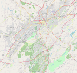
| Location | Roughly bounded by 14th Ave., S., 18th St., S., 16th Ave., S., and 15th St., S.; also roughly 16th Ave., S. from 15th St. to a line south from 18th St., Birmingham, Alabama |
|---|---|
| Coordinates | 33°29′37″N86°48′00″W / 33.49361°N 86.80000°W |
| Area | 23 acres (9.3 ha) (original) 14 acres (5.7 ha) (increase) |
| Architect | D.O. Whilldin, S. Scott, D.O.; Et al. |
| Architectural style | Bungalow/Craftsman, Tudor Revival, Queen Anne (original) Colonial Revival (increase) |
| NRHP reference No. | 86001981 [1] (original) 91000592 [1] (increase) |
| Significant dates | |
| Added to NRHP | August 28, 1986 |
| Boundary increase | May 15, 1991 |


The Anderson Place Historic District, in Birmingham, Alabama, United States, is a residential historic district which was listed on the National Register of Historic Places in 1986, and the listing was expanded in 1991. [1] The houses date from 1907 to 1912 and include Tudor Revival, Queen Anne, and Bungalow/Craftsman architecture. [2]
The district originally included 89 contributing buildings on 23 acres (9.3 ha). [2]
The original area is roughly bounded by Fourteenth Avenue South, Eighteenth Street South, Sixteenth Avenue South, and Fifteenth Street South. It includes work by architect D. O. Whilldin and others. [1]
The increase added 35 contributing buildings on 14 acres (5.7 ha) and included additional Tudor Revival and Bungalow/craftsman architecture, as well as Colonial Revival architecture. The increase area is roughly bounded by Sixteenth Avenue South from Fifteenth Street to a line south from Eighteenth Street. [1] [3]