Bald Knob, Arkansas

Last updated

Bald Knob
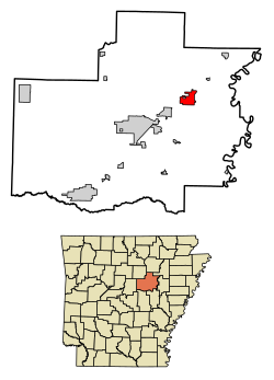
White County Arkansas Incorporated and Unincorporated areas Bald Knob Highlighted 0503280.svg
Location of Bald Knob in White County, Arkansas.
USA Arkansas location map.svg
Red pog.svg
Bald Knob
Location in Arkansas.
Coordinates: 35°18′44″N91°34′15″W / 35.31222°N 91.57083°W / 35.31222; -91.57083
Country United States
State Arkansas
County White
Area
[1]
  Total
5.03 sq mi (13.01 km2)
  Land4.96 sq mi (12.83 km2)
  Water0.07 sq mi (0.18 km2)
Elevation
[2]
246 ft (75 m)
Population
 (2020)
  Total
2,522
  Density508.98/sq mi (196.52/km2)
Time zone UTC-6 (Central (CST))
  Summer (DST) UTC-5 (CDT)
ZIP code
72010
Area code 501
FIPS code 05-03280
GNIS feature ID2403148 [2]

Bald Knob is a city in White County, Arkansas, United States. The population was 2,897 at the 2010 census.

Contents

Etymology

Bald Knob was named for a prominent, treeless ridge of layered rock that served as a landmark to pioneers. [3]

Points of interest

The Campbell-Chrisp House, built in 1899, was designed by Charles L. Thompson. It is listed on the U.S. National Register of Historic Places. [4]

Geography

According to the United States Census Bureau, the city has a total area of 4.6 square miles (12 km2), of which 4.5 square miles (12 km2) is land and 0.1 square miles (0.26 km2) is water.

Historical population
CensusPop.Note
1880 221
1900 707
1910 617−12.7%
1920 95855.3%
1930 1,27332.9%
1940 1,44513.5%
1950 2,02239.9%
1960 1,705−15.7%
1970 2,09422.8%
1980 2,75631.6%
1990 2,653−3.7%
2000 3,21021.0%
2010 2,897−9.8%
2020 2,522−12.9%
U.S. Decennial Census [5]
2014 Estimate [6]

Transportation

Airports

Bald Knob Municipal Airport (FAA Identifier: M74), owned by the City of Bald Knob, features a 2,228’ x 50’ paved runway, as well as a 1,850’ by 100’ turf runway. [7] Commercial air transport is available at the Bill and Hillary Clinton National Airport in Little Rock, about 62 miles southwest. [8]

Railroads

Bald Knob is at a junction of the Union Pacific Railroad, with the town’s old Depot being the exact division of the Memphis and Chicago lines from Little Rock. [9] Over 60 trains per day pass this point. [9] Union Pacific said Bald Knob as a "Train Town USA," one of 131 communities out of 7,300 communities the railroad serves, because of the town's long-standing relationship with the line. [9]

Demographics

2020 census

Bald Knob racial composition [10]
RaceNumberPercentage
White (non-Hispanic)2,13284.54%
Black or African American (non-Hispanic)1024.04%
Native American 100.4%
Asian 90.36%
Other/Mixed 1445.71%
Hispanic or Latino 1254.96%

As of the 2020 United States census, there were 2,522 people, 1,123 households, and 682 families residing in the city.

2000 census

As of the census [11] of 2000, there were 3,210 people, 1,257 households, and 878 families residing in the city. The population density was 715.5 inhabitants per square mile (276.3/km2). There were 1,395 housing units at an average density of 311.0 per square mile (120.1/km2). The racial makeup of the city was 89.91% White, 6.07% Black or African American, 0.62% Native American, 0.59% Asian, 0.03% Pacific Islander, 1.21% from other races, and 1.56% from two or more races. 3.18% of the population were Hispanic or Latino of any race.

There were 1,257 households, out of which 33.3% had children under the age of 18 living with them, 51.9% were married couples living together, 13.5% had a female householder with no husband present, and 30.1% were non-families. 26.7% of all households were made up of individuals, and 15.1% had someone living alone who was 65 years of age or older. The average household size was 2.55 and the average family size was 3.08.

In the city, the population was spread out, with 27.2% under the age of 18, 10.3% from 18 to 24, 27.8% from 25 to 44, 20.5% from 45 to 64, and 14.2% who were 65 years of age or older. The median age was 34 years. For every 100 females, there were 92.0 males. For every 100 females age 18 and over, there were 87.9 males.

The median income for a household in the city was $26,970, and the median income for a family was $36,500. Males had a median income of $27,978 versus $19,000 for females. The per capita income for the city was $13,218. About 10.4% of families and 16.5% of the population were below the poverty line, including 22.7% of those under age 18 and 20.0% of those age 65 or over.
See also

Related Research Articles

<span class="mw-page-title-main">White County, Arkansas</span> County in Arkansas, United States

White County is a county located in the U.S. state of Arkansas. As of the 2020 census, the population was 76,822. The county seat is Searcy. White County is Arkansas's 31st county, formed on October 23, 1835, from portions of Independence, Jackson, and Pulaski counties and named for Hugh Lawson White, a Whig candidate for President of the United States. It is an alcohol prohibition or dry county, though a few private establishments can serve alcohol.

<span class="mw-page-title-main">Hampton, Arkansas</span> Town in Arkansas, United States

Hampton is a town in Calhoun County, Arkansas, United States. The population was 1,181 according to the 2020 United States Census. The town is the county seat of Calhoun County.

<span class="mw-page-title-main">Egypt, Arkansas</span> Town in Arkansas, United States

Egypt is a town in Craighead County, Arkansas, United States. The population was 112 at the 2010 census. It is included in the Jonesboro, Arkansas Metropolitan Statistical Area.

<span class="mw-page-title-main">Horseshoe Bend, Arkansas</span> City in Arkansas, United States

Horseshoe Bend is a city in Fulton, Izard, and Sharp counties in the U.S. state of Arkansas. The population was 2,184 at the 2010 census. It is named for the large loop or horseshoe bend in the nearby Strawberry River.

<span class="mw-page-title-main">Harrisburg, Arkansas</span> City in Arkansas, United States

Harrisburg is a city in Poinsett County, Arkansas, United States. The population was 2,212 at the 2020 census. It is included in the Jonesboro, Arkansas Metropolitan Statistical Area. The city is the county seat of Poinsett County.

<span class="mw-page-title-main">Colt, Arkansas</span> Town in Arkansas, United States

Colt is a Second Class City in St. Francis County, Arkansas, United States. The population was 378 at the 2010 census, an increase from 368 in 2000.

<span class="mw-page-title-main">Huttig, Arkansas</span> City in Arkansas, United States

Huttig is a city in Union County, Arkansas, United States. The population was 597 at the 2010 census.

<span class="mw-page-title-main">Beebe, Arkansas</span> City in Arkansas, United States

Beebe is a city in White County, Arkansas, United States. The population was 8,437 at the 2020 U.S. Census, making it the second most populous in the county. The city is home to Arkansas State University-Beebe. ASU-Beebe also has branch campuses in Heber Springs and Searcy and at Little Rock Air Force Base.

<span class="mw-page-title-main">Danville, Arkansas</span> City in Arkansas, United States

Danville is a city in Yell County, Arkansas, United States. The population was 2,409 at the 2010 census. Along with Dardanelle, it is one of two county seats for Yell County.

<span class="mw-page-title-main">West Bradenton, Florida</span> Census-designated place in Florida, United States

West Bradenton is an unincorporated area and census-designated place (CDP) in Manatee County, Florida, United States. The population was 4,247 at the 2020 census, up from 4,192 at the 2010 census. It is part of the North Port–Bradenton–Sarasota, Florida Metropolitan Statistical Area.

<span class="mw-page-title-main">Waltonville, Illinois</span> Village in Illinois, United States

Waltonville is a village in Jefferson County, Illinois, United States. The population was 434 at the 2010 census. It is part of the Mount Vernon Micropolitan Statistical Area.

<span class="mw-page-title-main">Alto Pass, Illinois</span> Village in Illinois, United States

Alto Pass is a village in Union County, Illinois, United States. The population was 342 at the 2020 census, a decrease from 391 in 2010. The Bald Knob Cross and Bald Knob Wilderness are nearby. Alto Pass lies roughly 5.1 miles to the northwest of downtown Cobden, Illinois. Illinois Route 127 runs just west of the village's downtown area.

<span class="mw-page-title-main">Central City, Iowa</span> City in Iowa, United States

Central City is a city in Linn County, Iowa, United States. The population was 1,264 at the 2020 census. It is part of the Cedar Rapids Metropolitan Statistical Area.

<span class="mw-page-title-main">Pilot Knob, Missouri</span> City in Missouri, United States

Pilot Knob is a city in northeast Iron County, Missouri, United States. The population was 671 at the 2020 census. It lies eighteen miles (29 km) south-east of Belgrade and twenty-seven miles (43 km) north-east of Centerville.

<span class="mw-page-title-main">Knob Noster, Missouri</span> City in Missouri, United States

Knob Noster is a city in Johnson County, Missouri, United States. The population was 2,782 at the 2020 census. It is located adjacent to and closely associated with Whiteman Air Force Base. Knob Noster State Park is nearby.

<span class="mw-page-title-main">La Monte, Missouri</span> City in Missouri, United States

La Monte is a city in Pettis County, Missouri, United States. The population was 1,140 at the 2010 census.

<span class="mw-page-title-main">West Siloam Springs, Oklahoma</span> Town in Oklahoma, United States

West Siloam Springs is a town in Delaware County, Oklahoma, United States. The population was 1,000 at the 2020 census, an 18.2 percent increase from the figure of 846 recorded in 2010. A bedroom community for Siloam Springs, Arkansas, it is notable for its Cherokee casino, and is the closest town to Natural Falls State Park.

<span class="mw-page-title-main">Imbler, Oregon</span> City in Oregon, United States

Imbler is a city in Union County, Oregon, United States. The population was 306 at the 2010 census.

<span class="mw-page-title-main">Keshena, Wisconsin</span> CDP in Wisconsin, United States

Keshena is a census-designated place (CDP) in and the county seat of Menominee County, Wisconsin, United States. Located on the Menominee Indian Reservation, it had a population of 1,257 at the 2020 census. Keshena was named for an Indian chief; the Menominee name is Kesīqnaeh which means "Swift Flying".

<span class="mw-page-title-main">Shell Knob, Missouri</span> Census-designated place in Missouri, United States

Shell Knob is a census-designated place (CDP) located within White River Township, Barry County, Missouri. The population was 1,254 at the 2020 census.

References

  1. "2020 U.S. Gazetteer Files". United States Census Bureau. Retrieved October 29, 2021.
  2. 1 2 U.S. Geological Survey Geographic Names Information System: Bald Knob, Arkansas
  3. "Encyclopedia of Arkansas". Encyclopedia of Arkansas.
  4. "National Register Information System". National Register of Historic Places . National Park Service. July 9, 2010.
  5. "Census of Population and Housing". Census.gov. Retrieved June 4, 2015.
  6. "Annual Estimates of the Resident Population for Incorporated Places: April 1, 2010 to July 1, 2014". Archived from the original on May 22, 2015. Retrieved June 4, 2015.
  7. "Bald Knob Municipal Airport". AirNav.com. Retrieved June 9, 2022.
  8. "Bill and Hillary Clinton National Airport to Bald Knob, Arkansas". Google Maps. Retrieved June 9, 2022.
  9. 1 2 3 "Train Town USA". Union Pacific. Retrieved June 9, 2022.
  10. "Explore Census Data". data.census.gov. Retrieved December 31, 2021.
  11. "U.S. Census website". United States Census Bureau . Retrieved January 31, 2008.

Commons-logo.svg Media related to Bald Knob, Arkansas at Wikimedia Commons