Barrine

Last updated

Barrine
Queensland
Australia Queensland location map.svg
Red pog.svg
Barrine
Coordinates 17°13′40″S145°36′58″E / 17.2277°S 145.6161°E / -17.2277; 145.6161 (Barrine (centre of locality))
Population241 (2016 census) [1]
 • Density9.23/km2 (23.92/sq mi)
Postcode(s) 4872
Area26.1 km2 (10.1 sq mi)
Time zone AEST (UTC+10:00)
LGA(s) Tablelands Region
State electorate(s) Hill
Federal division(s) Kennedy
Suburbs around Barrine:
Lake Tinaroo Lake Tinaroo Danbulla
Lake Tinaroo Barrine Lake Barrine
Lake Tinaroo Yungaburra Lake Barrine

Barrine is a rural locality in the Tablelands Region, Queensland, Australia. [2] In the 2016 census, Barrine had a population of 241 people. [1]

History

Boar Pocket State School opened in 1909. In 1912 it was renamed Barrine State School. It closed in 1958. [3]

In January 1911, residents of Kulara (then a small town to the north of Yungaburra) began lobbying for a school, claiming there were 42 children in the district. [4] Kulara State School opened on 17 June 1912. It closed on 1 September 1958, when the Tinaroo Dam began to fill, inundating the town. [5] However, being on higher ground, the school building was not flooded and became a private residence at 85 Backshall Road (now in Barrine, 17°14′39″S145°34′59″E / 17.24420°S 145.58306°E / -17.24420; 145.58306 (Kulara State School (former)) ). [6] [7] [8]

In the 2016 census, Barrine had a population of 241 people. [1]

Related Research Articles

<span class="mw-page-title-main">Yungaburra</span> Town in Queensland, Australia

Yungaburra is a rural town and locality in the Tablelands Region, Queensland, Australia. In the 2016 census, the locality of Yungaburra had a population of 1,239 people.

<span class="mw-page-title-main">Tinaroo Dam</span> Dam in Far North Queensland

The Tinaroo Dam, officially the Tinaroo Falls Dam, is a major ungated concrete gravity dam with a central ogee spillway across the Barron River located on the Atherton Tableland in Far North Queensland, Australia. The dam's purpose includes irrigation for the Mareeba-Dimbulah Irrigation Scheme, water supply, hydroelectricity, and recreation. Completed between 1953 and 1958, the dam creates the impounded reservoir, Lake Tinaroo.

<span class="mw-page-title-main">Tinaroo, Queensland</span> Suburb of Tablelands Region, Queensland, Australia

Tinaroo is a rural locality in the Tablelands Region, Queensland, Australia. In the 2021 census, Tinaroo had a population of 293 people.

<span class="mw-page-title-main">Kairi, Queensland</span> Town in Queensland, Australia

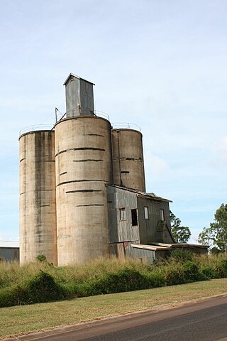
Kairi is a rural town and locality in the Tablelands Region, Queensland, Australia. In the 2016 census, Kairi had a population of 442 people.

<span class="mw-page-title-main">Millaa Millaa, Queensland</span> Town in Queensland, Australia

Millaa Millaa is a rural town and locality in the Tablelands Region, Queensland, Australia. In the 2016 census, the locality of Millaa Millaa had a population of 514 people.

<span class="mw-page-title-main">Lake Eacham, Queensland</span> Suburb of Tablelands Region, Queensland, Australia

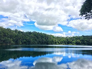
Lake Eacham is a rural locality in the Tablelands Region, Queensland, Australia. In the 2021 census, Lake Eacham had a population of 459 people.

Evelyn is a rural locality in the Tablelands Region, Queensland, Australia. In the 2016 census, Evelyn had a population of 241 people.

<span class="mw-page-title-main">Innot Hot Springs</span> Town in Queensland, Australia

Innot Hot Springs is a rural town and locality in the Tablelands Region, Queensland, Australia. In the 2016 census, the locality of Innot Hot Springs had a population of 177 people.

Beatrice is a rural locality in the Tablelands Region, Queensland, Australia. In the 2021 census, Beatrice had a population of 126 people.

<span class="mw-page-title-main">Gadgarra</span> Suburb of Tablelands Region, Queensland, Australia

Gadgarra is a rural locality in the Tablelands Region, Queensland, Australia. In the 2016 census Gadgarra had a population of 3 people.

Kureen is a rural locality in the Tablelands Region, Queensland, Australia. In the 2016 census Kureen had a population of 122 people.

<span class="mw-page-title-main">Lake Barrine, Queensland</span> Suburb of Tablelands Region, Queensland, Australia

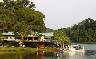
Lake Barrine is a rural locality in the Tablelands Region, Queensland, Australia. In the 2021 census, Lake Barrine had a population of 170 people.

Mungalli is a rural locality in the Tablelands Region, Queensland, Australia. In the 2016 census Mungalli had a population of 44 people.

Minbun is a rural locality in the Tablelands Region, Queensland, Australia. In the 2016 census Minbun had a population of 75 people.

<span class="mw-page-title-main">Peeramon</span> Town in Queensland, Australia

Peeramon is a rural town and locality in the Tablelands Region, Queensland, Australia. In the 2016 census, the locality of Peeramon had a population of 628 people.

<span class="mw-page-title-main">Tarzali</span> Town in Queensland, Australia

Tarzali is a rural town and locality in the Tablelands Region, Queensland, Australia. In the 2016 census, the locality of Tarzali had a population of 398 people.

Tumoulin is a rural town and locality in the Tablelands Region, Queensland, Australia. In the 2016 census, Tumoulin had a population of 109 people.

<span class="mw-page-title-main">Upper Barron</span> Suburb of Tablelands Region, Queensland, Australia

Upper Barron is a rural locality in the Tablelands Region, Queensland, Australia. In the 2021 census, Upper Barron had a population of 503 people.

<span class="mw-page-title-main">Danbulla, Queensland</span> Suburb of Tablelands Region, Queensland, Australia

Danbulla is a locality in the Tablelands Region, Queensland, Australia. In the 2021 census, Danbulla had a population of 88 people.

Moregatta is a rural locality in the Tablelands Region, Queensland, Australia. In the 2021 census, Moregatta had a population of 62 people.

References

  1. 1 2 3 Australian Bureau of Statistics (27 June 2017). "Barrine (SSC)". 2016 Census QuickStats. Retrieved 20 October 2018. OOjs UI icon edit-ltr-progressive.svg
  2. "Barrine – locality in Tablelands Region (entry 50211)". Queensland Place Names. Queensland Government . Retrieved 19 September 2020.
  3. Queensland Family History Society (2010), Queensland schools past and present (Version 1.01 ed.), Queensland Family History Society, ISBN   978-1-921171-26-0
  4. "COUNTRY NEWS". The Evening Telegraph . No. 2994. Queensland, Australia. 31 January 1911. p. 4. Archived from the original on 25 March 2021. Retrieved 28 November 2019 via National Library of Australia.
  5. Queensland Family History Society (2010), Queensland schools past and present (Version 1.01 ed.), Queensland Family History Society, ISBN   978-1-921171-26-0
  6. "Queensland Two Mile series sheet 2m404" (Map). Queensland Government. 1943. Retrieved 4 December 2023.
  7. "Kulara reunion event". The Express Newspaper. 1 July 2023. Retrieved 4 December 2023.
  8. "The town that disappeared under water leaving only a school behind". ABC News. 13 August 2023. Retrieved 4 December 2023.