Tumoulin

Last updated

Tumoulin
Queensland
Australia Queensland location map.svg
Red pog.svg
Tumoulin
Coordinates 17°33′52″S145°27′13″E / 17.5644°S 145.4536°E / -17.5644; 145.4536 (Tumoulin (town centre)) Coordinates: 17°33′52″S145°27′13″E / 17.5644°S 145.4536°E / -17.5644; 145.4536 (Tumoulin (town centre))
Population109 (2016 census) [1]
 • Density2.266/km2 (5.87/sq mi)
Postcode(s) 4888
Area48.1 km2 (18.6 sq mi)
Time zone AEST (UTC+10:00)
Location
LGA(s) Tablelands Region
State electorate(s) Hill
Federal Division(s) Kennedy
Localities around Tumoulin:
Kaban Kaban Evelyn
Millstream Tumoulin Evelyn
Millstream Millstream Ravenshoe

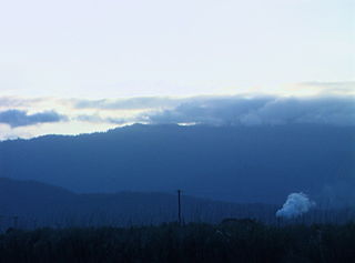
Tumoulin is a rural town and locality in the Tablelands Region, Queensland, Australia. [2] [3] In the 2016 census, Tumoulin had a population of 109 people. [1]

Contents

Geography

From south to north Tumoulin is a flat valley with Diddleluma Creek flowing through it, elevation approx 950 metres (3,120 ft) above sea level. However, it is more mountainous in both the east and west, rising to approx 1,100 metres (3,600 ft). [4]

The town lies slightly to the east of centre of the locality. The eastern part of the locality is mostly protected areas including Tumoulin Forest Reserve and Tumoulin State Forest. There is also an area in the south of the locality within the Ravenshoe State Forest No 3 which extends into Ravenshoe. [4]

The land use is cropping on the valley floor, grazing on the lower slopes, and forestry in the more mountainous areas. [4]

History

The Tablelands railway line from Herberton to Tumoulin opened on 31 July 1911 with Tumoulin railway station ( 17°33′51″S145°27′09″E / 17.5641°S 145.4526°E / -17.5641; 145.4526 (Tumoulin railway station) ) being Queensland’s highest railway station at 965 metres (3,166 ft) above sea level. [5] [6] The name Tumoulin is thought to be an Aboriginal word meaning waterfall. [2] The railway line from Atherton to Ravenshoe was closed in 1988 due to the World Heritage Listing of Queensland's Wet Tropics. However, the section between Herberton and Tumoulin can still be used and the Ravenshoe Steam Railway operate heritage steam train tours along the route. [7]

On 3 August 1911 the Queensland Government auctioned 59 town allotments in the new town of Tumoulin. [8] The township of Tumoulin appears on a 1916 survey plan. [2]

Tumoulin Provisional School opened on 4 May 1912. In 1914 there were plans to build a new school building. [9] On 1 April 1915 it became Tumoulin State School. It closed on 11 September 1960. [10] It was located at approx 17°33′36″S145°27′09″E / 17.5600°S 145.4524°E / -17.5600; 145.4524 (Tumoulin State School (site)) . [11] [12]

In the 2016 census, Tumoulin had a population of 109 people. [1]

Education

There are no schools in Tumoulin. The nearest primary and secondary school is Ravenshoe State School (Prep-12) in neighbouring Ravenshoe to the south-east. [4]

Related Research Articles

Gordonvale, Queensland Town in Queensland, Australia

Gordonvale is a rural sugar-growing town and locality situated on the southern side of Cairns in the Cairns Region, Queensland, Australia. In the 2016 census the locality of Gordonvale had a population of 6,671 people.

The Atherton Tableland is a fertile plateau which is part of the Great Dividing Range in Queensland, Australia. The Atherton Tablelands is a diverse region, covering an area of 64,768 square kilometres and home to 45,243 people. The main population centres on the Atherton Tablelands are Mareeba and Atherton. Smaller towns include Tolga, Malanda, Herberton, Kuranda, Ravenshoe, Millaa Millaa, Chillagoe, Dimbulah, Mt Garnet, Mt Molloy, Tinaroo and Yungaburra.

Atherton, Queensland Town in Queensland, Australia

Atherton is a rural town and locality in the Tablelands Region, Queensland, Australia that has a large range of native birds. In the 2016 census, Atherton had a population of 7,331 people.

Kuranda, Queensland Town in Queensland, Australia

Kuranda is a rural town and locality on the Atherton Tableland in the Shire of Mareeba, Queensland, Australia. In the 2016 census, Kuranda had a population of 3,008 people. It is 25 kilometres (16 mi) from Cairns, via the Kuranda Range road. It is surrounded by tropical rainforest and adjacent to the Wet Tropics World Heritage listed Barron Gorge National Park.
Herberton, Queensland Town in Queensland, Australia

Herberton is a rural town and locality in the Tablelands Region, Queensland, Australia. In the 2016 census, Herberton had a population of 855 people.

Mount Garnet, Queensland Town in Queensland, Australia

Mount Garnet is a rural town and locality in the Tablelands Region, Queensland, Australia. In the 2016 census, Mount Garnet had a population of 430 people.

Malanda, Queensland Town in Queensland, Australia

Malanda is a rural town and locality in the Tablelands Region, Queensland, Australia. In the 2016 census, Malanda had a population of 1,985 people. The economy is based upon agriculture and tourism.

Kairi, Queensland Town in Queensland, Australia

Kairi is a rural town and locality in the Tablelands Region, Queensland, Australia. In the 2016 census, Kairi had a population of 442 people.

Millaa Millaa, Queensland Town in Queensland, Australia

Millaa Millaa is a rural town and locality in the Tablelands Region, Queensland, Australia. In the 2016 census, Millaa Millaa had a population of 514 people.

Ravenshoe, Queensland Town in Queensland, Australia

Ravenshoe is a rural town and locality in the Tablelands Region, Queensland, Australia. In the 2016 census, Ravenshoe had a population of 1,400 people.

Mutchilba, Queensland Town in Queensland, Australia

Mutchilba is a rural town and locality in the Shire of Mareeba, in Far North Queensland, Australia. In the 2016 census, Mutchilba had a population of 495 people.

Shire of Herberton Local government area in Queensland, Australia

The Shire of Herberton was a local government area of Queensland. It was located on the Atherton Tableland, a plateau forming part of the Great Dividing Range west of the city of Cairns. The shire, administered from the town of Herberton, covered an area of 9,607.0 square kilometres (3,709.3 sq mi), and existed as a local government entity from 1895 until 2008, when it amalgamated with several other councils in the Tableland area to become the Tablelands Region.

Shire of Atherton Local government area in Queensland, Australia

The Shire of Atherton was a local government area of Queensland. It was located on the Atherton Tableland, a plateau forming part of the Great Dividing Range west of the city of Cairns. The shire, administered from the town of Atherton, covered an area of 623.1 square kilometres (240.6 sq mi), and existed as a local government entity from 1881 until 2008, when it amalgamated with several other councils in the Tableland area to become the Tablelands Region.

Tablelands Region Local government area in Queensland, Australia

The Tablelands Region is a local government area in Far North Queensland, Australia inland from the city of Cairns. Established in 2008, it was preceded by four previous local government areas which dated back more than a century. On 1 January 2014, one of those local government areas, the Shire of Mareeba, was re-established independent of the Tablelands Region.
Tablelands railway line, Queensland

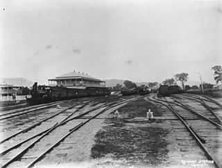
The Tablelands railway line is a railway line in North Queensland, Australia. It was opened in a series of sections between 1887 and 1916. It commences at Cairns and at its maximum extent, reached Ravenshoe at the southern end of the Atherton Tableland. The rail system served by this line was unusual for Queensland in that the majority of lines that connected to it were built by private companies and later purchased by the Queensland Government.

Innot Hot Springs Town in Queensland, Australia

Innot Hot Springs is a small town and locality in the Tablelands Region, Queensland, Australia. In the 2016 census, Innot Hot Springs had a population of 177 people.

Wondecla, Queensland Suburb of Tablelands Region, Queensland, Australia

Wondecla is a locality in the Tablelands Region, Queensland, Australia.

Wongabel Suburb of Tablelands Region, Queensland, Australia

Wongabel is a locality in the Tablelands Region, Queensland, Australia.

Moomin, Queensland Suburb of Tablelands Region, Queensland, Australia

Moomin is a rural locality in the Tablelands Region, Queensland, Australia. In the 2016 census Moomin had a population of 133 people.

Moregatta, Queensland Suburb of Tablelands Region, Queensland, Australia

Moregatta is a rural locality in the Tablelands Region, Queensland, Australia. In the 2016 census, Moregatta had a population of 9 people.

References

  1. 1 2 3 Australian Bureau of Statistics (27 June 2017). "Tumoulin (SSC)". 2016 Census QuickStats. Retrieved 20 October 2018. OOjs UI icon edit-ltr-progressive.svg
  2. 1 2 3 "Tumoulin - town in Tablelands Region (entry 35322)". Queensland Place Names. Queensland Government . Retrieved 19 September 2020.
  3. "Tumoulin - locality in Tablelands Region (entry 48909)". Queensland Place Names. Queensland Government . Retrieved 19 September 2020.
  4. 1 2 3 4 "Queensland Globe". State of Queensland . Retrieved 4 October 2020.
  5. "Railway stations and sidings - Queensland". Queensland Open Data. Queensland Government. 27 August 2020. Archived from the original on 5 October 2020. Retrieved 5 October 2020.
  6. Kerr, John (1990). Triumph of narrow gauge : a history of Queensland Railways. Boolarong Publications. p. 225. ISBN   978-0-86439-102-5.
  7. "Ravenshoe Steam Railway" . Retrieved 5 October 2020.
  8. "Advertising". Cairns Post . XXV (1061). Queensland, Australia. 15 July 1911. p. 4. Retrieved 5 October 2020 via National Library of Australia.
  9. "NEW SCHOOLS". Cairns Post . XXVII (1877). Queensland, Australia. 20 April 1914. p. 4. Retrieved 5 October 2020 via National Library of Australia.
  10. Queensland Family History Society (2010), Queensland schools past and present (Version 1.01 ed.), Queensland Family History Society, ISBN   978-1-921171-26-0
  11. "Mount Garnet" (Map). Queensland Government. 1944. Retrieved 5 October 2020.
  12. "Queensland Two Mile series sheet 2m404" (Map). Queensland Government. 1953. Retrieved 5 October 2020.