Silver Valley, Queensland

Last updated

Silver Valley
Queensland
Coolgarra Battery.jpg
Remains of the Coolgarra Battery, Silver Valley
Australia Queensland location map.svg
Red pog.svg
Silver Valley
Coordinates 17°32′16″S145°15′45″E / 17.5377°S 145.2625°E / -17.5377; 145.2625 (Silver Valley (centre of locality)) Coordinates: 17°32′16″S145°15′45″E / 17.5377°S 145.2625°E / -17.5377; 145.2625 (Silver Valley (centre of locality))
Population144 (2016 census) [1]
 • Density0.4340/km2 (1.124/sq mi)
Postcode(s) 4872
Area331.8 km2 (128.1 sq mi)
Time zone AEST (UTC+10:00)
Location
LGA(s) Tablelands Region
State electorate(s) Dalrymple
Federal Division(s) Kennedy
Suburbs around Silver Valley:
Irvinebank Watsonville Kalunga
Irvinebank Silver Valley Kaban
Mount Garnet Innot Hot Springs Millstream

Silver Valley is a rural locality in the Tablelands Region, Queensland, Australia. [2] In the 2016 census Silver Valley had a population of 144 people. [1]

Contents

It is known for its mining in the late 1800s and early 1900s.

Geography

The Wild River forms the western boundary of the locality. The Kennedy Highway passes from west to east through the southern edge of the locality. The locality is mountainous, rising from an elevation of 650m in Bulldog Gully in the south of the locality through to numerous unnamed peaks of up to 1050m. The land is relatively undeveloped apart from some areas now laid bare as the result of mining. [3]

History

James Venture Mulligan is credited with the first discovery of silver at Silver Valley in 1880. [4] [5] [6] By 1883, outcrops of silver, lead and galena had been found in the area and it was named Silver Valley and mining commenced. [7] It was also known as Newellton after a pioneer family. However, while the silver mines were initially productive (one yielding up to 150 ounces of metal per ton), after a few years the silver lode was exhausted and the mines abandoned. [8] However, in 1895, three prospector George Harrod discovered two rich lodes of tin and, with Hammond and White, established the Lancelot mine and, with Hammond, White and Daniels, established the Hadleigh Castle mine. [9] In 1899 a German company (the German Lancelot Tin Mining Company) purchased the Lancelot Mine [10] and proposed naming the area Lancelot after the mine and later proposed to establish a new town called New Frankfurt (although there is no evidence that this occurred). [7] However, the German company did build a dam and a 5-head battery. [8] However, by 1910 the lodes were exhausted and diamond drills were used to search for new lodes, but without success. [7] In 1911 the mines were sold to John Moffat. [11] However, the popular story is that the Germans operated the mine up until the start of World War I whereupon they suddenly disappeared overnight, but this story reflects the anti-German sentiment in response to World War I rather than actual events. [11]

Despite the apparent cessation of mining in the area, Silver Valley was described in 1912 as being "rich in minerals" with "beautiful scenery, fishing and shooting". The Silver Valley Hotel (licensee James Ramsay) could provide accommodation for 20 people for 6/- per day or 30/- per week. [12]

Like most old mines, there were occasional flurries of renewed activity whenever there were prospects of poorer ore lodes being profitably mined, usually in response to rising metal prices or more efficient extraction technologies, but generally such mining is short-lived as it is extremely price-sensitive. [13] [14]

Coolgarra Provisional School opened on 29 April 1901 and closed on 1934. On 1 January 1909 it became Coolgarra State School. In July 1916 it became a half time provisional school in conjunction with Lower Nettles Provisional School (meaning a single teacher shared between two schools). However Lower Nettles closed later in 1916 and Coolgarra was again a full -time state school. Coolgarra State School closed in 1934. [15]

Lancelot Provisional School opened in 1905 but closed in 1906 when insufficient students enrolled. It reopened circa 1920 and closed in 1926. [15]

In the 2016 census Silver Valley had a population of 144 people. [1]

Heritage listings

Silver Valley has a number of heritage-listed sites, including:

Related Research Articles

The Atherton Tableland is a fertile plateau which is part of the Great Dividing Range in Queensland, Australia. The Atherton Tablelands is a diverse region, covering an area of 64,768 square kilometres and home to 45,243 people. The main population centres on the Atherton Tablelands are Mareeba and Atherton. Smaller towns include Tolga, Malanda, Herberton, Kuranda, Ravenshoe, Millaa Millaa, Chillagoe, Dimbulah, Mt Garnet, Mt Molloy, Tinaroo and Yungaburra.

Chillagoe, Queensland Town in Queensland, Australia

Chillagoe is a town and locality in the Shire of Mareeba, Queensland, Australia. It was once a thriving mining town for a range of minerals, but is now reduced to a small zinc mine and some marble quarries.

Atherton, Queensland Town in Queensland, Australia

Atherton is a rural town and locality in the Tablelands Region, Queensland, Australia. In the 2016 census, Atherton had a population of 7,331 people.

Herberton, Queensland Town in Queensland, Australia

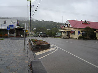
Herberton is a rural town and locality in the Tablelands Region, Queensland, Australia. In the 2016 census, Herberton had a population of 855 people.

Mount Garnet, Queensland Town in Queensland, Australia

Mount Garnet is a rural town and locality in the Tablelands Region, Queensland, Australia. In the 2016 census, Mount Garnet had a population of 430 people.

Malanda, Queensland Town in Queensland, Australia

Malanda is a rural town and locality in the Tablelands Region, Queensland, Australia. In the 2016 census, Malanda had a population of 1,985 people. The economy is based upon agriculture and tourism.

Kairi, Queensland Town in Queensland, Australia

Kairi is a rural town and locality in the Tablelands Region, Queensland, Australia. In the 2016 census, Kairi had a population of 442 people.

Ravenshoe, Queensland Town in Queensland, Australia

Ravenshoe is a rural town and locality in the Tablelands Region, Queensland, Australia. In the 2016 census, Ravenshoe had a population of 1,400 people.

Tablelands Region Local government area in Queensland, Australia

The Tablelands Region is a local government area in Far North Queensland, Australia inland from the city of Cairns. Established in 2008, it was preceded by four previous local government areas which dated back more than a century. On 1 January 2014, one of those local government areas, the Shire of Mareeba, was re-established independent of the Tablelands Region.

Irvinebank Town in Queensland, Australia

Irvinebank is a town and locality in the Shire of Mareeba, Queensland, Australia.

Watsonville, Queensland Town in Queensland, Australia

Watsonville is a town and locality in North Queensland, Australia. It is within the local government area of Shire of Mareeba.

Innot Hot Springs Town in Queensland, Australia

Innot Hot Springs is a small town and locality in the Tablelands Region, Queensland, Australia. In the 2016 census, Innot Hot Springs had a population of 177 people.

Historic Village Herberton

The Historic Village Herberton is an open-air historic museum in Herberton, Queensland. It was opened in 1977 by then Queensland Premier Joh Bjelke Petersen and was owned by Harry and Ellen Skenner, who closed it in April 2003 due to escalating public liability costs. It was reopened in 2009 by Just Jeans retail chain store founder Craig Kimberly and his wife Connie. The Village is located on a 16-acre site and comprises over 50 historically restored period buildings dating back to the 1860s, set out like a tin mining town. It is the largest private collection of its type in Queensland.

Great Northern Mine

Great Northern Mine is a heritage-listed mine off Jacks Road, Herberton, Tablelands Region, Queensland, Australia. It was built from 1880 to 1940s. It was added to the Queensland Heritage Register on 21 October 1992.

Coolgarra Battery

Coolgarra Battery is a heritage-listed stamper battery at Coolgarra Station, Silver Valley, Tablelands Region, Queensland, Australia. It was built from 1896 to 1901. It is also known as Coolgarra Old Furnace. It was added to the Queensland Heritage Register on 25 August 2000.

Irvinebank School of Arts Hall

Irvinebank School of Arts Hall is a heritage-listed school of arts at McDonald Street, Irvinebank, Shire of Mareeba, Queensland, Australia. It was built in 1900. It was added to the Queensland Heritage Register on 29 May 1995.

Wilsons Pocket Suburb of Gympie Region, Queensland, Australia

Wilsons Pocket is a locality in the Gympie Region, Queensland, Australia.

Tumoulin Town in Queensland, Australia

Tumoulin is a rural town and locality in the Tablelands Region, Queensland, Australia. In the 2016 census, Tumoulin had a population of 109 people.

Wongabel Suburb of Tablelands Region, Queensland, Australia

Wongabel is a locality in the Tablelands Region, Queensland, Australia.

Moomin, Queensland Suburb of Tablelands Region, Queensland, Australia

Moomin is a rural locality in the Tablelands Region, Queensland, Australia. In the 2016 census Moomin had a population of 133 people.

References

  1. 1 2 3 Australian Bureau of Statistics (27 June 2017). "Silver Valley (SSC)". 2016 Census QuickStats. Retrieved 20 October 2018. OOjs UI icon edit-ltr-progressive.svg
  2. "Silver Valley - locality in Tablelands Region (entry 48868)". Queensland Place Names. Queensland Government . Retrieved 29 December 2020.
  3. "Queensland Globe". State of Queensland . Retrieved 3 January 2017.
  4. "Pre-Settlement History". Eacham Historical Society. Archived from the original on 3 January 2017. Retrieved 3 January 2017.
  5. "James Venture Mulligan". Monument Australia. Archived from the original on 3 January 2017. Retrieved 3 January 2017.
  6. "1880". Cairns Post (14, 398). Queensland. 28 April 1948. p. 5. Archived from the original on 26 January 2021. Retrieved 3 January 2017 via National Library of Australia.
  7. 1 2 3 "SILVER VALLEY". The Worker . 58 (3139). Brisbane. 15 September 1947. p. 13. Archived from the original on 26 January 2021. Retrieved 3 January 2017 via National Library of Australia.
  8. 1 2 Rimmer, Michael Albert (2008), Up the Palmerston : a history of the Cairns hinterland up to 1920. Volume 2 (PDF), Mike Rimmer, p. 174, ISBN   978-0-646-50093-5, archived (PDF) from the original on 8 April 2016, retrieved 3 January 2017
  9. "The Metal Market". The North Queensland Register . 1 February 1893. p. 36. Archived from the original on 26 January 2021. Retrieved 3 January 2017 via National Library of Australia.
  10. "German Launcelot Tin Mining Co". Morning Post . 10 (7). Cairns, Queensland. 22 August 1900. p. 2. Archived from the original on 26 January 2021. Retrieved 3 January 2017 via National Library of Australia.
  11. 1 2 "Lancelot Mine". Tablelands Regional Council. 20 April 2015. Archived from the original on 3 January 2017. Retrieved 3 January 2017.
  12. Hotel & boarding house directory of the principal cities, towns, and tourist resorts in Queensland (2nd ed.), Queensland Government Intelligence and Tourist Bureau, 1912, archived from the original on 3 January 2017, retrieved 3 January 2017
  13. "MINING". The Northern Herald . XXXIII (419). Queensland, Australia. 13 April 1921. p. 28. Archived from the original on 26 January 2021. Retrieved 3 January 2017 via National Library of Australia.
  14. "HERBERTON MINING". The Northern Herald . XLV (584). Queensland, Australia. 11 June 1924. p. 50. Archived from the original on 26 January 2021. Retrieved 3 January 2017 via National Library of Australia.
  15. 1 2 Queensland Family History Society (2010), Queensland schools past and present (Version 1.01 ed.), Queensland Family History Society, ISBN   978-1-921171-26-0
  16. "Coolgarra Battery (entry 601791)". Queensland Heritage Register . Queensland Heritage Council. Retrieved 14 July 2013.

Further reading

Commons-logo.svg Media related to Silver Valley, Queensland at Wikimedia Commons