Maalan, Queensland

Last updated

Maalan
Queensland
Queensland State Archives 4939 Cleared and Grassed Maalan Country North Queensland 1953.png
Cleared land, Maalan, 1953
Australia Queensland location map.svg
Red pog.svg
Maalan
Coordinates 17°36′28″S145°35′30″E / 17.6077°S 145.5916°E / -17.6077; 145.5916 (Maalan (centre of locality))
Population26 (2021 census) [1]
 • Density1.074/km2 (2.78/sq mi)
Postcode(s) 4886
Area24.2 km2 (9.3 sq mi)
Time zone AEST (UTC+10:00)
Location
LGA(s) Tablelands Region
State electorate(s) Hill
Federal division(s) Kennedy
Suburbs around Maalan:
Beatrice Beatrice Middlebrook
Ravenshoe Maalan Palmerston
Koombooloomba Koombooloomba Koombooloomba

Maalan is a rural locality in the Tablelands Region, Queensland, Australia. [2] In the 2021 census, Maalan had a population of 26 people. [1]

Contents

Geography

The land use is predominantly dairy farming which occurs in the valley areas (elevation approximately 900–1000 metres above sea level). In the west of the locality is the Cardwell Range with peaks to 1170 metres; part of this land is within the Tully Falls National Park. In the north is the Maalan National Park. [3]

Maalan Road is the main route through the locality. [3]

History

In 1950, the Millaa Millaa branch of the Queensland Dairymen's Association proposing opening up the land in Maalan for farming. The Minister for Lands responded that the land had valuable cabinet timbers which would be sold and removed before opening up the land for sale. [4] In June 1952, the Surveyor General of Queensland, John Percival Harvey, inspected the area. [5] In November 1952, the Queensland Government proposed releasing 6,300 acres (2,500 ha) of land in Maalan. [6]

In April 1953, 36 blocks each of approximately 240 acres were sold to intending dairy farmers. [7] In September 1953, the selectors were busy clearing the land with a number of them already living on their blocks. [8] In October 1953, the Maalan settlers met to negotiate a route for the supply of their milk and cream to the factory at Millaa Millaa. [9] In November 1953, a bush fire brigade was formed at Maalan. [10] In April 1954, the Maalan settlers were praised for their efforts in pioneering this new district. [11] [12] In November 1954, plans to commence dairying in the district were delayed by a plague of grasshoppers which ate the newly established dairy pastures. [13]

Demographics

In the 2016 census, Maalan had a population of 26 people. [14]

In the 2021 census, Maalan had a population of 26 people. [1]

Education

There are no schools in Maalan. The nearest government primary schools are Millaa Millaa State School in Millaa Millaa to the north and Ravenshoe State School in neighbouring Ravenshoe to the west. The nearest government secondary school is Ravenshoe State School (to Year 12). [15]

Related Research Articles

<span class="mw-page-title-main">Atherton Tableland</span> Fertile plateau in northern Queensland, Australia

The Atherton Tableland is a fertile plateau, which is part of the Great Dividing Range in Queensland, Australia. It has very deep, rich basaltic soils and the main industry is agriculture. The principal river flowing across the plateau is the Barron River, which was dammed to form the irrigation reservoir named Lake Tinaroo. Unlike many other rural areas, the Tablelands is experiencing a significant growth in population.

<span class="mw-page-title-main">Atherton, Queensland</span> Town in Queensland, Australia

Atherton is a rural town and locality in the Tablelands Region, Queensland, Australia. In the 2021 census, the locality of Atherton had a population of 7,724 people.
<span class="mw-page-title-main">Herberton, Queensland</span> Town in Queensland, Australia

Herberton is a rural town and locality in the Tablelands Region, Queensland, Australia. In the 2021 census, the locality of Herberton had a population of 895 people.

<span class="mw-page-title-main">Mount Garnet, Queensland</span> Town in Queensland, Australia

Mount Garnet is a rural town and locality in the Tablelands Region, Queensland, Australia. In the 2021 census, the locality of Mount Garnet had a population of 532 people.

<span class="mw-page-title-main">Malanda, Queensland</span> Town in Queensland, Australia

Malanda is a rural town and locality in the Tablelands Region, Queensland, Australia. In the 2021 census, the locality of Malanda had a population of 2,000 people. The economy is based upon agriculture and tourism.
<span class="mw-page-title-main">Kairi, Queensland</span> Town in Queensland, Australia

Kairi is a rural town and locality in the Tablelands Region, Queensland, Australia. In the 2021 census, the locality of Kairi had a population of 490 people.

<span class="mw-page-title-main">Millaa Millaa, Queensland</span> Town in Queensland, Australia

Millaa Millaa is a rural town and locality in the Tablelands Region, Queensland, Australia. In the 2021 census, the locality of Millaa Millaa had a population of 523 people.

<span class="mw-page-title-main">Ravenshoe, Queensland</span> Town in Queensland, Australia

Ravenshoe is a rural town and locality in the Tablelands Region, Queensland, Australia. In the 2021 census, the locality of Ravenshoe had a population of 1,332 people.

<span class="mw-page-title-main">Roman Catholic Diocese of Cairns</span> Catholic ecclesiastical territory

The Roman Catholic Diocese of Cairns is located in the state of Queensland, Australia. It is a suffragan diocese of the Archdiocese of Brisbane. The diocese was erected as a vicariate apostolic in 1877 and was elevated to a diocese in 1941. Its territorial remit is Far North Queensland.
<span class="mw-page-title-main">Tablelands Region</span> Local government area in Queensland, Australia

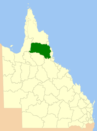
The Tablelands Region is a local government area in Far North Queensland, Australia inland from the city of Cairns. Established in 2008, it was preceded by four previous local government areas which dated back more than a century. On 1 January 2014, one of those local government areas, the Shire of Mareeba, was re-established independent of the Tablelands Region.

<span class="mw-page-title-main">Evelyn, Queensland</span> Suburb of Tablelands Region, Queensland, Australia

Evelyn is a rural locality in the Tablelands Region, Queensland, Australia. In the 2021 census, Evelyn had a population of 209 people.

<span class="mw-page-title-main">Innot Hot Springs</span> Town in Queensland, Australia

Innot Hot Springs is a rural town and locality in the Tablelands Region, Queensland, Australia. In the 2021 census, the locality of Innot Hot Springs had a population of 189 people.

Jaggan is a rural town and locality in the Tablelands Region, Queensland, Australia. In the 2021 census, the locality of Jaggan had a population of 217 people.

Beatrice is a rural locality in the Tablelands Region, Queensland, Australia. In the 2021 census, Beatrice had a population of 126 people.

Ellinjaa is a rural locality in the Tablelands Region, Queensland, Australia. In the 2021 census, Ellinjaa had a population of 66 people.

<span class="mw-page-title-main">Peeramon</span> Town in Queensland, Australia

Peeramon is a rural town and locality in the Tablelands Region, Queensland, Australia. In the 2021 census, the locality of Peeramon had a population of 778 people.

<span class="mw-page-title-main">Tarzali</span> Town in Queensland, Australia

Tarzali is a rural town and locality in the Tablelands Region, Queensland, Australia. In the 2021 census, the locality of Tarzali had a population of 431 people.

Tumoulin is a rural town and locality in the Tablelands Region, Queensland, Australia. In the 2021 census, the locality of Tumoulin had a population of 135 people.

Moregatta is a rural locality in the Tablelands Region, Queensland, Australia. In the 2021 census, Moregatta had a population of 62 people.

<span class="mw-page-title-main">Middlebrook, Queensland</span> Suburb of Tablelands Region, Queensland, Australia

Middlebrook is a rural locality in the Tablelands Region, Queensland, Australia. In the 2021 census, Middlebrook had a population of 62 people.

References

  1. 1 2 3 Australian Bureau of Statistics (28 June 2022). "Maalan (SAL)". 2021 Census QuickStats. Retrieved 28 February 2023. OOjs UI icon edit-ltr-progressive.svg
  2. "Maalan – locality in Tablelands Region (entry 48736)". Queensland Place Names. Queensland Government . Retrieved 31 December 2017.
  3. 1 2 "Queensland Globe". State of Queensland . Retrieved 9 October 2018.
  4. "Maalan Timber First". Cairns Post . No. 15, 216. Queensland, Australia. 13 December 1950. p. 5. Archived from the original on 29 October 2023. Retrieved 10 October 2018 via National Library of Australia.
  5. "Opening of New Lands Sought". Cairns Post . No. 15, 679. Queensland, Australia. 10 June 1952. p. 3. Archived from the original on 29 October 2023. Retrieved 10 October 2018 via National Library of Australia.
  6. "N.Q. LANDS IN STATE PLAN". Brisbane Telegraph . Queensland, Australia. 21 November 1952. p. 2 (CITY FINAL). Archived from the original on 29 October 2023. Retrieved 10 October 2018 via National Library of Australia.
  7. "LANDS DEPARTMENT BALLOT". Cairns Post . No. 15, 945. Queensland, Australia. 18 April 1953. p. 1. Archived from the original on 29 October 2023. Retrieved 10 October 2018 via National Library of Australia.
  8. "MILLAA MILLAA NOTES". Cairns Post . No. 16, 075. Queensland, Australia. 17 September 1953. p. 4. Archived from the original on 29 October 2023. Retrieved 10 October 2018 via National Library of Australia.
  9. "MAALAN SETTLERS' MEETING". Cairns Post . No. 16, 108. Queensland, Australia. 26 October 1953. p. 5. Archived from the original on 29 October 2023. Retrieved 10 October 2018 via National Library of Australia.
  10. "THREE BOARDS ON TABLELAND INTERESTED IN THE ACQUISITION OF FIRE ENGINES". The Evening Advocate . Queensland, Australia. 18 November 1953. p. 4. Archived from the original on 29 October 2023. Retrieved 10 October 2018 via National Library of Australia.
  11. "MAALAN PIONEERING EFFORT". Queensland Country Life . Vol. 19, no. 38. Queensland, Australia. 1 April 1954. p. 16. Archived from the original on 29 October 2023. Retrieved 10 October 2018 via National Library of Australia.
  12. "MAALAN GROUP". Cairns Post . No. 16, 258. Queensland, Australia. 21 April 1954. p. 4. Archived from the original on 29 October 2023. Retrieved 10 October 2018 via National Library of Australia.
  13. "HOPPERS STRIKE IN MILLAA". The Evening Advocate . Queensland, Australia. 17 November 1954. p. 2. Archived from the original on 29 October 2023. Retrieved 10 October 2018 via National Library of Australia.
  14. Australian Bureau of Statistics (27 June 2017). "Maalan (SSC)". 2016 Census QuickStats. Retrieved 20 October 2018. OOjs UI icon edit-ltr-progressive.svg
  15. "Layers: Locality; Schools and school catchments". Queensland Globe. Queensland Government. Archived from the original on 19 December 2017. Retrieved 29 October 2023.

Further reading

Commons-logo.svg Media related to Maalan, Queensland at Wikimedia Commons