
Atherton is a rural town and locality in the Tablelands Region, Queensland, Australia. In the 2021 census, the locality of Atherton had a population of 7,724 people.
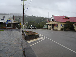
Herberton is a rural town and locality in the Tablelands Region, Queensland, Australia. In the 2021 census, the locality of Herberton had a population of 895 people.
Tolga is a rural town and locality in the Tablelands Region, Queensland, Australia. In the 2021 census, the locality of Tolga had a population of 3,177 people.

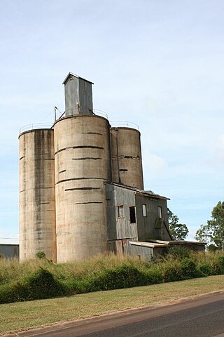
Malanda is a rural town and locality in the Tablelands Region, Queensland, Australia. In the 2021 census, the locality of Malanda had a population of 2,000 people. The economy is based upon agriculture and tourism.
Kairi is a rural town and locality in the Tablelands Region, Queensland, Australia. In the 2021 census, the locality of Kairi had a population of 490 people.

Ravenshoe is a rural town and locality in the Tablelands Region, Queensland, Australia. In the 2021 census, the locality of Ravenshoe had a population of 1,332 people.

The Shire of Atherton was a local government area of Queensland. It was located on the Atherton Tableland, a plateau forming part of the Great Dividing Range west of the city of Cairns. The shire, administered from the town of Atherton, covered an area of 623.1 square kilometres (240.6 sq mi), and existed as a local government entity from 1881 until 2008, when it amalgamated with several other councils in the Tableland area to become the Tablelands Region.

The Tablelands Region is a local government area in Far North Queensland, Australia inland from the city of Cairns. Established in 2008, it was preceded by four previous local government areas which dated back more than a century. On 1 January 2014, one of those local government areas, the Shire of Mareeba, was re-established independent of the Tablelands Region.
Evelyn is a rural locality in the Tablelands Region, Queensland, Australia. In the 2021 census, Evelyn had a population of 209 people.

Watsonville is a rural town and locality in the Shire of Mareeba, Queensland, Australia. In the 2021 census, the locality of Watsonville had a population of 176 people.
Wondecla is a rural locality in the Tablelands Region, Queensland, Australia. In the 2021 census, Wondecla had a population of 661 people.

Julatten is a rural town and locality in the Shire of Mareeba, Queensland, Australia. In the 2021 census, the locality of Julatten had a population of 1,020 people.
Carrington is a rural locality in the Tablelands Region, Queensland, Australia. In the 2021 census, Carrington had a population of 191 people.

Tarzali is a rural town and locality in the Tablelands Region, Queensland, Australia. In the 2021 census, the locality of Tarzali had a population of 431 people.
Tumoulin is a rural town and locality in the Tablelands Region, Queensland, Australia. In the 2021 census, the locality of Tumoulin had a population of 135 people.

Upper Barron is a rural locality in the Tablelands Region, Queensland, Australia. In the 2021 census, Upper Barron had a population of 503 people.
Moomin is a rural locality in the Tablelands Region, Queensland, Australia. In the 2021 census, Moomin had a population of 191 people.
Moregatta is a rural locality in the Tablelands Region, Queensland, Australia. In the 2021 census, Moregatta had a population of 62 people.
Kalunga is a rural locality in the Tablelands Region, Queensland, Australia. In the 2021 census, Kalunga had a population of 103 people.
Atherton–Herberton–Longlands Gap Road is a continuous 33.5-kilometre (20.8 mi) road route in the Tablelands local government area of Queensland, Australia. It has two official names, Atherton–Herberton Road and Longlands Gap–Herberton Road. The entire route is signed as part of State Route 52. Both parts are state-controlled district roads, numbered 663 and 665, and the entire road is rated as a local road of regional significance (LRRS).
