
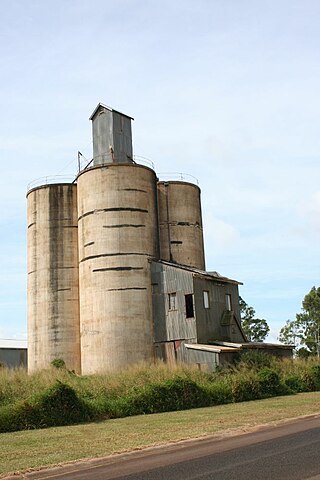
The Atherton Tableland is a fertile plateau, which is part of the Great Dividing Range in Queensland, Australia. It has very deep, rich basaltic soils and the main industry is agriculture. The principal river flowing across the plateau is the Barron River, which was dammed to form the irrigation reservoir named Lake Tinaroo. Unlike many other rural areas, the Tablelands is experiencing a significant growth in population.

Atherton is a rural town and locality in the Tablelands Region, Queensland, Australia. In the 2021 census, the locality of Atherton had a population of 7,724 people.
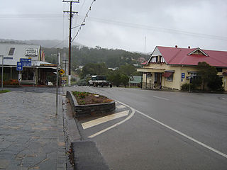
Herberton is a rural town and locality in the Tablelands Region, Queensland, Australia. In the 2021 census, the locality of Herberton had a population of 895 people.

Malanda is a rural town and locality in the Tablelands Region, Queensland, Australia. In the 2021 census, the locality of Malanda had a population of 2,000 people. The economy is based upon agriculture and tourism.
Kairi is a rural town and locality in the Tablelands Region, Queensland, Australia. In the 2021 census, the locality of Kairi had a population of 490 people.
Millaa Millaa is a rural town and locality in the Tablelands Region, Queensland, Australia. In the 2021 census, the locality of Millaa Millaa had a population of 523 people.

The Shire of Atherton was a local government area of Queensland. It was located on the Atherton Tableland, a plateau forming part of the Great Dividing Range west of the city of Cairns. The shire, administered from the town of Atherton, covered an area of 623.1 square kilometres (240.6 sq mi), and existed as a local government entity from 1881 until 2008, when it amalgamated with several other councils in the Tableland area to become the Tablelands Region.

The Tablelands Region is a local government area in Far North Queensland, Australia inland from the city of Cairns. Established in 2008, it was preceded by four previous local government areas which dated back more than a century. On 1 January 2014, one of those local government areas, the Shire of Mareeba, was re-established independent of the Tablelands Region.
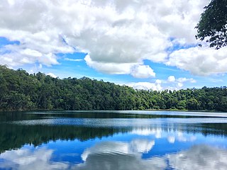
Lake Eacham is a rural locality in the Tablelands Region, Queensland, Australia. In the 2021 census, Lake Eacham had a population of 459 people.

Watsonville is a rural town and locality in the Shire of Mareeba, Queensland, Australia. In the 2021 census, the locality of Watsonville had a population of 176 people.

Innot Hot Springs is a rural town and locality in the Tablelands Region, Queensland, Australia. In the 2021 census, the locality of Innot Hot Springs had a population of 189 people.

Peeramon is a rural town and locality in the Tablelands Region, Queensland, Australia. In the 2021 census, the locality of Peeramon had a population of 778 people.
Tumoulin is a rural town and locality in the Tablelands Region, Queensland, Australia. In the 2021 census, the locality of Tumoulin had a population of 135 people.

Upper Barron is a rural locality in the Tablelands Region, Queensland, Australia. In the 2021 census, Upper Barron had a population of 503 people.
Wongabel is a rural locality in the Tablelands Region, Queensland, Australia. In the 2021 census, Wongabel had a population of 251 people.
Moomin is a rural locality in the Tablelands Region, Queensland, Australia. In the 2021 census, Moomin had a population of 191 people.

Waugh Pocket is a locality in the Cairns Region, Queensland, Australia. In the 2021 census, Waugh Pocket had a population of 46 people.
Moregatta is a rural locality in the Tablelands Region, Queensland, Australia. In the 2021 census, Moregatta had a population of 62 people.

Middlebrook is a rural locality in the Tablelands Region, Queensland, Australia. In the 2021 census, Middlebrook had a population of 62 people.
Atherton–Herberton–Longlands Gap Road is a continuous 33.5-kilometre (20.8 mi) road route in the Tablelands local government area of Queensland, Australia. It has two official names, Atherton–Herberton Road and Longlands Gap–Herberton Road. The entire route is signed as part of State Route 52. Both parts are state-controlled district roads, numbered 663 and 665, and the entire road is rated as a local road of regional significance (LRRS).
