Tarzali

Last updated

Tarzali
Queensland
Looking south along Malanda Millaa Milla Road south of the town of Tarzali, 2013.jpg
Looking south along Malanda Millaa Milla Road south of the town of Tarzali, 2013
Australia Queensland location map.svg
Red pog.svg
Tarzali
Coordinates 17°25′31″S145°36′13″E / 17.4252°S 145.6036°E / -17.4252; 145.6036 (Tarzali (town centre))
Population398 (2016 census) [1]
 • Density5.149/km2 (13.335/sq mi)
Postcode(s) 4885
Area77.3 km2 (29.8 sq mi)
Time zone AEST (UTC+10:00)
Location
LGA(s) Tablelands Region
State electorate(s) Hill
Federal division(s) Kennedy
Localities around Tarzali:
Upper Barron Jaggan Glen Allyn
Upper Barron Tarzali Wooroonooran
Minbun Moregatta Millaa Millaa

Tarzali is a rural town and locality in the Tablelands Region, Queensland, Australia. [2] [3] In the 2016 census, the locality of Tarzali had a population of 398 people. [1]

Contents

Geography

The locality is on the Atherton Tableland. It is bounded to the east by the Johnstone River, to the south-east and south by Dirran Creek, and to the north-west by Seamark Road. The town is located in the centre of the locality. The Millaa Millaa–Malanda Road enters the locality from the north (Jaggan), passes through the town, and exits to the south-west (Minbun). [4]

The terrain is elevated and hilly with one named peak, Bartletts Hill ( 17°25′48″S145°36′56″E / 17.4300°S 145.6155°E / -17.4300; 145.6155 (Bartletts Hill) ) which rises to 837 metres (2,746 ft) above sea level. [4] [5]

The land use around the town centre is residential. In the rest of the locality, the predominant land use is grazing on native vegetation. [4]

History

The town takes its name from the Tarzali railway station on the Millaa Milla branch of the Tablelands railway line. The name Tarzali is said to be an Aboriginal word meaning water gum, Syzygium gustavioides. The railway station was in use from 1915 to 1964. [2]

The Millaa Millaa branch railway line from Tolga opened to Tarzali on 15 December 1916 with the town being served by Tarzali railway station ( 17°25′35″S145°36′16″E / 17.4264°S 145.6044°E / -17.4264; 145.6044 (Tarzali railway station) ). [6] The line was opened through to Millaa Millaa on 19 December 1921. [7] [8] The line has now closed and the Tarzali railway station has been dismantled. [6]

In April 1914, a tent school was approved for Dirran (the name of the parish) on the land of Mr William's selection until a state school could be constructed. [9] Dirran State School opened on 3 May 1915. On 21 October 1918, it was renamed Tarzali State School. It closed on 31 December 1967. [10] The school was at Millaa Millaa Malanda Road ( 17°25′41″S145°36′12″E / 17.4280°S 145.6032°E / -17.4280; 145.6032 (Tarzali State School (former)) ). [11] [12] [13]

In the 2016 census, the locality of Tarzali had a population of 398 people. [1]

Education

There are no schools in Tarzali. The nearest government primary schools are Malanda State School in Malanda to the north and Millaa Millaa State School in neighbouring Millaa Millaa to the south. The nearest government secondary school is Malanda State High School in Malanda to the north. [4]

Related Research Articles

<span class="mw-page-title-main">Yungaburra</span> Town in Queensland, Australia

Yungaburra is a rural town and locality in the Tablelands Region, Queensland, Australia. In the 2016 census, the locality of Yungaburra had a population of 1,239 people.

<span class="mw-page-title-main">Tolga, Queensland</span> Town in Queensland, Australia

Tolga is a rural town and locality in the Tablelands Region, Queensland, Australia. In the 2016 census, Tolga had a population of 2,718 people.

<span class="mw-page-title-main">Malanda, Queensland</span> Town in Queensland, Australia

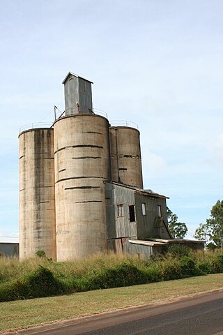
Malanda is a rural town and locality in the Tablelands Region, Queensland, Australia. In the 2016 census, the locality of Malanda had a population of 1,985 people. The economy is based upon agriculture and tourism.

<span class="mw-page-title-main">Kairi, Queensland</span> Town in Queensland, Australia

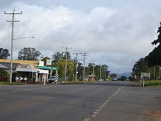
Kairi is a rural town and locality in the Tablelands Region, Queensland, Australia. In the 2016 census, Kairi had a population of 442 people.

<span class="mw-page-title-main">Millaa Millaa, Queensland</span> Town in Queensland, Australia

Millaa Millaa is a rural town and locality in the Tablelands Region, Queensland, Australia. In the 2016 census, the locality of Millaa Millaa had a population of 514 people.

<span class="mw-page-title-main">Mutchilba, Queensland</span> Town in Queensland, Australia

Mutchilba is a rural town and locality in the Shire of Mareeba, in Far North Queensland, Australia. It is known for its production of mangoes.

<span class="mw-page-title-main">Shire of Eacham</span> Local government area in Queensland, Australia

The Shire of Eacham was a local government area of Queensland. It was located on the Atherton Tableland, a plateau forming part of the Great Dividing Range west of the city of Cairns. The shire, administered from the town of Malanda, covered an area of 1,126.4 square kilometres (434.9 sq mi), and existed as a local government entity from 1910 until 2008, when it amalgamated with several other councils in the Tableland area to become the Tablelands Region.

<span class="mw-page-title-main">Tablelands Region</span> Local government area in Queensland, Australia

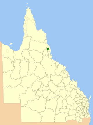
The Tablelands Region is a local government area in Far North Queensland, Australia inland from the city of Cairns. Established in 2008, it was preceded by four previous local government areas which dated back more than a century. On 1 January 2014, one of those local government areas, the Shire of Mareeba, was re-established independent of the Tablelands Region.

<span class="mw-page-title-main">Lake Eacham, Queensland</span> Suburb of Tablelands Region, Queensland, Australia

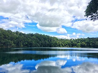
Lake Eacham is a rural locality in the Tablelands Region, Queensland, Australia. In the 2016 census, Lake Eacham had a population of 457 people.

<span class="mw-page-title-main">Tablelands railway line</span> Railway line in Queensland, Australia

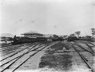
The Tablelands railway line is a railway line in North Queensland, Australia. It was opened in a series of sections between 1887 and 1916. It commences at Cairns and at its maximum extent, reached Ravenshoe at the southern end of the Atherton Tableland. The rail system served by this line was unusual for Queensland in that the majority of lines that connected to it were built by private companies and later purchased by the Queensland Government.

Jaggan is a rural town and locality in the Tablelands Region, Queensland, Australia. In the 2016 census, the locality of Jaggan had a population of 188 people.

<span class="mw-page-title-main">Malanda Falls Swimming Pool</span> Historic site in Queensland, Australia

Malanda Falls Swimming Pool is a heritage-listed swimming pool at Malanda Falls Park, Malanda, Tablelands Region, Queensland, Australia. It was built from 1906 onwards. It was added to the Queensland Heritage Register on 5 February 2010.

Ellinjaa is a rural locality in the Tablelands Region, Queensland, Australia. In the 2016 census, Ellinjaa had a population of 31 people.

Kureen is a rural locality in the Tablelands Region, Queensland, Australia. In the 2016 census Kureen had a population of 122 people.

Minbun is a rural locality in the Tablelands Region, Queensland, Australia. In the 2016 census Minbun had a population of 75 people.

<span class="mw-page-title-main">Peeramon</span> Town in Queensland, Australia

Peeramon is a rural town and locality in the Tablelands Region, Queensland, Australia. In the 2016 census, the locality of Peeramon had a population of 628 people.

Tumoulin is a rural town and locality in the Tablelands Region, Queensland, Australia. In the 2016 census, Tumoulin had a population of 109 people.

<span class="mw-page-title-main">Upper Barron</span> Suburb of Tablelands Region, Queensland, Australia

Upper Barron is a rural locality in the Tablelands Region, Queensland, Australia. In the 2021 census, Upper Barron had a population of 503 people.

Moregatta is a rural locality in the Tablelands Region, Queensland, Australia. In the 2016 census, Moregatta had a population of 9 people.

Atherton–Malanda–Millaa Millaa Road is a continuous 39.0-kilometre (24.2 mi) road route in the Tablelands local government area of Queensland, Australia. It has two official names, Malanda–Atherton Road and Millaa Millaa–Malanda Road. The entire route is signed as part of State Route 25. Malanda–Atherton Road is a state-controlled district road, while Millaa Millaa–Malanda Road is part regional and part district.

References

  1. 1 2 3 Australian Bureau of Statistics (27 June 2017). "Tarzali (SSC)". 2016 Census QuickStats. Retrieved 20 October 2018. OOjs UI icon edit-ltr-progressive.svg
  2. 1 2 "Tarzali – town in Tablelands Region (entry 33421)". Queensland Place Names. Queensland Government . Retrieved 29 December 2020.
  3. "Tarzali – locality in Tablelands Region (entry 49860)". Queensland Place Names. Queensland Government . Retrieved 29 December 2020.
  4. 1 2 3 4 "Queensland Globe". State of Queensland . Retrieved 20 July 2022.
  5. "Mountain peaks and capes - Queensland". Queensland Open Data. Queensland Government. 12 November 2020. Archived from the original on 25 November 2020. Retrieved 25 November 2020.
  6. 1 2 "Railway stations and sidings - Queensland". Queensland Open Data. Queensland Government. 2 October 2020. Archived from the original on 5 October 2020. Retrieved 5 October 2020.
  7. "Railway stations and sidings - Queensland". Queensland Open Data. Queensland Government. 27 August 2020. Archived from the original on 5 October 2020. Retrieved 5 October 2020.
  8. Kerr 1990, p. 225
  9. "NEW SCHOOLS". The Northern Herald . Vol. V, no. 55. Queensland, Australia. 24 April 1914. p. 5. Archived from the original on 20 July 2022. Retrieved 20 July 2022 via National Library of Australia.
  10. Queensland Family History Society (2010), Queensland schools past and present (Version 1.01 ed.), Queensland Family History Society, ISBN   978-1-921171-26-0
  11. "Bartle Frere" (Map). Queensland Government. 1943. Archived from the original on 27 October 2020. Retrieved 20 July 2022.
  12. "Queensland Two Mile series sheet 2m404" (Map). Queensland Government. 1943. Archived from the original on 14 January 2021. Retrieved 20 July 2022.
  13. "County of Nares sheet 1" (Map). Queensland Government. 1919. Archived from the original on 12 January 2021. Retrieved 20 July 2022.

Further reading