Minbun

Last updated

Minbun
Queensland
Australia Queensland location map.svg
Red pog.svg
Minbun
Coordinates 17°29′13″S145°32′56″E / 17.4869°S 145.5488°E / -17.4869; 145.5488 (Minbun (centre of locality))
Population60 (2021 census) [1]
 • Density1.74/km2 (4.5/sq mi)
Postcode(s) 4886
Area34.5 km2 (13.3 sq mi)
Time zone AEST (UTC+10:00)
LGA(s) Tablelands Region
State electorate(s) Hill
Federal division(s) Kennedy
Suburbs around Minbun:
Tarzali Tarzali Tarzali
Upper Barron Minbun Moregatta
Evelyn Evelyn Moregatta

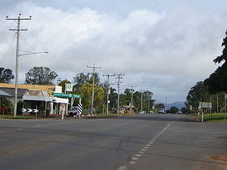
Minbun is a rural locality in the Tablelands Region, Queensland, Australia. [2] In the 2021 census, Minbun had a population of 60 people. [1]

Contents

Geography

Minbun railway station is an abandoned railway station ( 17°28′27″S145°34′57″E / 17.4742°S 145.5825°E / -17.4742; 145.5825 (Minbun railway station (former)) ) on the now-closed Millaa Millaa branch of the Tablelands railway line. [3]

The Millaa Millaa–Malanda Road runs through the northeast corner. [4]

History

The locality takes its name from the Minbun railway station name, which was assigned on 23 July 1920 by the Queensland Railways Department. It is an Aboriginal word meaning brown possum. [2]

Nash Road State School opened on 1 September 1922. In May 1925, it was renamed Minbun State School. It closed in 1974. [5] It was located on the north-eastern corner or Nash Road and Millaa Millaa - Malanda Road ( 17°28′43″S145°34′49″E / 17.47854°S 145.58027°E / -17.47854; 145.58027 (Minbun State School (former)) ). [6] [7] [8]

The railway line between Kairi railway station and Millaa Millaa railway station (including Minbun railway station) closed in 1964.

Demographics

In the 2016 census Minbun had a population of 75 people. [9]

In the 2021 census, Minbun had a population of 60 people. [1]

Related Research Articles

<span class="mw-page-title-main">Atherton, Queensland</span> Town in Queensland, Australia

Atherton is a rural town and locality in the Tablelands Region, Queensland, Australia. In the 2021 census, the locality of Atherton had a population of 7,724 people.

<span class="mw-page-title-main">Tolga, Queensland</span> Town in Queensland, Australia

Tolga is a rural town and locality in the Tablelands Region, Queensland, Australia. In the 2021 census, the locality of Tolga had a population of 3,177 people.

<span class="mw-page-title-main">Malanda, Queensland</span> Town in Queensland, Australia

Malanda is a rural town and locality in the Tablelands Region, Queensland, Australia. In the 2021 census, the locality of Malanda had a population of 2,000 people. The economy is based upon agriculture and tourism.

<span class="mw-page-title-main">Palmerston Highway</span>

The Palmerston Highway, serves as a link between the southern part of the Tablelands Region and the Cassowary Coast coastal strip, in Far North Queensland, Australia.

<span class="mw-page-title-main">Millaa Millaa, Queensland</span> Town in Queensland, Australia

Millaa Millaa is a rural town and locality in the Tablelands Region, Queensland, Australia. In the 2021 census, the locality of Millaa Millaa had a population of 523 people.
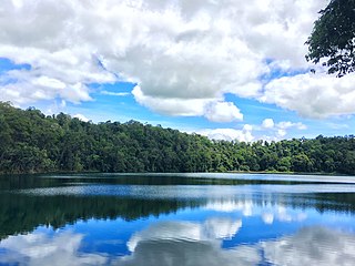
<span class="mw-page-title-main">Lake Eacham, Queensland</span> Suburb of Tablelands Region, Queensland, Australia

Lake Eacham is a rural locality in the Tablelands Region, Queensland, Australia. In the 2021 census, Lake Eacham had a population of 459 people.

Jaggan is a rural town and locality in the Tablelands Region, Queensland, Australia. In the 2021 census, the locality of Jaggan had a population of 217 people.

Barrine is a rural locality in the Tablelands Region, Queensland, Australia. In the 2021 census, Barrine had a population of 303 people.

Beatrice is a rural locality in the Tablelands Region, Queensland, Australia. In the 2021 census, Beatrice had a population of 126 people.

Ellinjaa is a rural locality in the Tablelands Region, Queensland, Australia. In the 2021 census, Ellinjaa had a population of 66 people.

Kureen is a rural locality in the Tablelands Region, Queensland, Australia. In the 2021 census, Kureen had a population of 158 people.
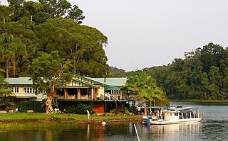
<span class="mw-page-title-main">Lake Barrine, Queensland</span> Suburb of Tablelands Region, Queensland, Australia

Lake Barrine is a rural locality in the Tablelands Region, Queensland, Australia. In the 2021 census, Lake Barrine had a population of 170 people.

<span class="mw-page-title-main">Peeramon</span> Town in Queensland, Australia

Peeramon is a rural town and locality in the Tablelands Region, Queensland, Australia. In the 2021 census, the locality of Peeramon had a population of 778 people.

<span class="mw-page-title-main">Tarzali</span> Town in Queensland, Australia

Tarzali is a rural town and locality in the Tablelands Region, Queensland, Australia. In the 2021 census, the locality of Tarzali had a population of 431 people.

<span class="mw-page-title-main">Upper Barron</span> Suburb of Tablelands Region, Queensland, Australia

Upper Barron is a rural locality in the Tablelands Region, Queensland, Australia. In the 2021 census, Upper Barron had a population of 503 people.

Moomin is a rural locality in the Tablelands Region, Queensland, Australia. In the 2021 census, Moomin had a population of 191 people.

<span class="mw-page-title-main">Danbulla, Queensland</span> Suburb of Tablelands Region, Queensland, Australia

Danbulla is a locality in the Tablelands Region, Queensland, Australia. In the 2021 census, Danbulla had a population of 88 people.

Moregatta is a rural locality in the Tablelands Region, Queensland, Australia. In the 2021 census, Moregatta had a population of 62 people.

<span class="mw-page-title-main">Middlebrook, Queensland</span> Suburb of Tablelands Region, Queensland, Australia

Middlebrook is a rural locality in the Tablelands Region, Queensland, Australia. In the 2021 census, Middlebrook had a population of 62 people.

Atherton–Malanda–Millaa Millaa Road is a continuous 39.0-kilometre (24.2 mi) road route in the Tablelands local government area of Queensland, Australia. It has two official names, Malanda–Atherton Road and Millaa Millaa–Malanda Road. The entire route is signed as part of State Route 25. Malanda–Atherton Road is a state-controlled district road, while Millaa Millaa–Malanda Road is part regional and part district.

References

  1. 1 2 3 Australian Bureau of Statistics (28 June 2022). "Minbun (SAL)". 2021 Census QuickStats. Retrieved 28 February 2023. OOjs UI icon edit-ltr-progressive.svg
  2. 1 2 "Minbun – locality in Tablelands Region (entry 49859)". Queensland Place Names. Queensland Government . Retrieved 29 December 2020.
  3. "Railway stations and sidings - Queensland". Queensland Open Data. Queensland Government. 2 October 2020. Archived from the original on 5 October 2020. Retrieved 5 October 2020.
  4. Google (10 August 2023). "Minbun, Queensland" (Map). Google Maps . Google. Retrieved 10 August 2023.
  5. Queensland Family History Society (2010), Queensland schools past and present (Version 1.01 ed.), Queensland Family History Society, ISBN   978-1-921171-26-0
  6. "Bartle Frere" (Map). Queensland Government. 1943. Retrieved 4 December 2023.
  7. "Queensland Two Mile series sheet 2m404" (Map). Queensland Government. 1943. Retrieved 4 December 2023.
  8. "Queensland Globe". State of Queensland . Retrieved 4 December 2023.
  9. Australian Bureau of Statistics (27 June 2017). "Minbun (SSC)". 2016 Census QuickStats. Retrieved 20 October 2018. OOjs UI icon edit-ltr-progressive.svg