Baudette Air Force Station

Last updated

Baudette Air Force Station
Air Defense Command.svg
Part of Air Defense Command
USA Minnesota location map.svg
Red pog.svg
Baudette AFS
Location of Baudette AFS, Minnesota
Coordinates 48°40′12″N094°37′07″W / 48.67000°N 94.61861°W / 48.67000; -94.61861
TypeAir Force Station
CodeADC ID: SM-132, NORAD ID: Z-132
Site information
Controlled byFlag of the United States Air Force.svg  United States Air Force
Site history
Built1958
In use1958-1979
Garrison information
Garrison692d Air Defense Group
692d Aircraft Control and Warning Squadron (later Radar Squadron)
Emblem of the 692d Radar Squadron 692d Radar Squadron - Emblem.png
Emblem of the 692d Radar Squadron

Baudette Air Force Station is a closed United States Air Force General Surveillance Radar station. It is located 3.1 miles (5.0 km) south-southwest of Baudette, Minnesota. It was closed in 1979.

Contents

History

Baudette Air Force Station was initially part of Phase II of the Air Defense Command Mobile Radar program. The Air Force approved this expansion of the Mobile Radar program on 23 October 1952. Radars in this network were designated "SM."

The station became operational on 1 October 1958 when the 692d Aircraft Control and Warning Squadron [1] began operating an AN/FPS-3 and a pair of AN/FPS-6 height-finder radars, and initially the station functioned as a Ground-Control Intercept (GCI) and warning station. As a GCI station, the squadron's role was to guide interceptor aircraft toward unidentified intruders picked up on the unit's radar scopes.

During 1959 Baudette AFS joined the Semi Automatic Ground Environment (SAGE) system, feeding data to DC-10 at Duluth IAP, Minnesota. After joining, the squadron was redesignated as the 692d Radar Squadron (SAGE) on 15 December 1959. [1] The radar squadron provided information around the clock to the SAGE Direction Center where it was analyzed to determine range, direction altitude speed and whether or not aircraft were friendly or hostile.

In 1962 Baudette received an AN/FPS-24 search radar, and during 1963 an AN/FPS-26A height-finder radar was installed, replacing one AN/FPS-6, and the other AN/FPS-6 height-finder radar was upgraded to an AN/FPS-90. On 31 July 1963, the site was redesignated as NORAD ID Z-132.

In addition to the main facility, Baudette operated the following AN/FPS-18 Gap Filler sites:

Over the years, the equipment at the station was upgraded or modified to improve the efficiency and accuracy of the information gathered by the radars. The AN/FPS-90 height-finder radar was retired in late 1971.

The 692nd Radar Sq was inactivated [1] and replaced by the 692d Air Defense Group in March 1970. [2] The upgrade to group status was done because of Baudette AFS' status as a Backup Interceptor Control (BUIC) site. BUIC sites were alternate control sites in case SAGE Direction Centers became disabled and unable to control interceptor aircraft. The group was awarded the Air Force Outstanding Unit Award for exceptionally meritorious service for the period 1 June 1971 through 31 May 1973 [3] The group was inactivated [2] and replaced by the 692nd Radar Squadron [1] as defenses against manned bombers were reduced. The group was disbanded in 1984. [4] The 692d Radar Squadron was inactivated on 1 July 1979 [1] as part of the phase-down of Aerospace Defense Command.

Today, the former Baudette Air Force Station is a cold-weather automobile test facility used by Acura. Many USAF buildings remain and in use and the station is well maintained, along with the large AN/FPS-24 search radar tower.

Air Force units and assignments

Units

Activated at Snelling AFS, Minnesota, 8 August 1958 (not manned or equipped)
Moved to Baudette AFS on 1 October 1958
Redesignated 692nd Radar Squadron (SAGE) on 15 December 1959
Inactivated on 1 March 1970
Redesignated 692nd Radar Squadron on 1 January 1974
Activated on 17 January 1974
Inactivated on 1 July 1979 [1]
Activated on 1 March 1970
Inactivated on 17 January 1974 [2]
Disbanded on 27 September 1984 [4]

Awards

Award streamerAwardDatesNotes
AFOUA Streamer.JPG Air Force Outstanding Unit Award 692d Air Defense Group 1 June 1971 – 31 May 1973 [3]

Commanders

  • Lt Col. B.E. Thayer, 1 March 1970 - 1970 [5]
  • Lt Col. Walter M. Adcock, 1970 - unknown [6]
  • Lt Col Carl A. Lindberg, 30 August 1961 - 3 August 1963 Source: That Officer's AF Form 11 (supplied by his oldest son, Carl A. Lindberg Jr.).

Assignments

See also

Related Research Articles

<span class="mw-page-title-main">Finley Air Force Station</span> Former US Air Force radar station

Finley Air Force Station is a closed United States Air Force General Surveillance Radar station. It is located 1.5 miles (2.4 km) west-northwest of Finley, North Dakota. It was closed in 1979 by the Air Force, and turned over to the Federal Aviation Administration (FAA).

<span class="mw-page-title-main">Tonopah Air Force Station</span> Radar station in Nevada, US 1956–1970

Tonopah Air Force Station is a closed United States Air Force General Surveillance Radar station. It is located 1.1 miles (1.8 km) south of Tonopah, Nevada. It was closed in 1970.

<span class="mw-page-title-main">Charleston Air Force Station</span> Defunct Air Force Station

Charleston Air Force Station is a defunct Air Force Station that opened in 1952 and closed in 1980. It was located in Charleston, Maine and is the site of a radar station and other buildings. After closure, it was redeveloped into a juvenile jail for the state of Maine.

<span class="mw-page-title-main">Antigo Air Force Station</span> Closed United States Air Force General Surveillance Radar station

Antigo Air Force Station is a closed United States Air Force General Surveillance Radar station. It is located 7.5 miles (12.1 km) south-southwest of Antigo, Wisconsin. It was closed in 1977 and is currently classified as a high risk toxic waste site involving groundwater, sediment, soil and surface water.

<span class="mw-page-title-main">Calumet Air Force Station</span> Abandoned Aircraft Control and Warning System located near Calumet, Michigan

Calumet Air Force Station is a closed United States Air Force General Surveillance Radar station. It is located 5.2 miles (8.4 km) east-northeast of Phoenix, Michigan. It was closed in 1988 by the Air Force, and turned over to the Federal Aviation Administration (FAA).

<span class="mw-page-title-main">Kirksville Air Force Station</span> Former US Air Force radar station in Missouri

Kirksville Air Force Station is a closed United States Air Force General Surveillance Radar station. It is located 7.1 miles (11.4 km) north of Kirksville, Missouri. It was closed by the Air Force in 1968. Today the radar site is used by the Federal Aviation Administration (FAA) as a Joint Surveillance System (JSS) site.

Omaha Air Force Station is a closed United States Air Force General Surveillance Radar station. It is located 7.5 miles (12.1 km) north of Omaha, Nebraska. It was closed in 1968.

<span class="mw-page-title-main">Osceola Air Force Station</span> Closed United States Air Force General Surveillance Radar station

Osceola Air Force Station is a closed United States Air Force General Surveillance Radar station. It is located 5.6 miles (9.0 km) south-southeast of Osceola, Wisconsin. It was closed in 1975.

<span class="mw-page-title-main">Grand Rapids Air Force Station</span> Closed US military installation

Grand Rapids Air Force Station is a closed United States Air Force General Surveillance Radar station. It is located 0.7 miles (1.1 km) east-northeast of Grand Rapids, Minnesota. It was closed in 1963.

<span class="mw-page-title-main">Gettysburg Air Force Station</span> Radar station in South Dakota, US 1956–1965

Gettysburg Air Force Station is a closed United States Air Force General Surveillance Radar station. It is located 2.6 miles (4.2 km) north of Gettysburg, South Dakota. It was closed in 1968.

<span class="mw-page-title-main">Opheim Air Force Station</span> Closed United States Air Force General Surveillance Radar station

Opheim Air Force Station is a closed United States Air Force General Surveillance Radar station. It is located 3.3 miles (5.3 km) west of Opheim, Montana. It was closed in 1979.

<span class="mw-page-title-main">Havre Air Force Station</span> Surveillance radar station during the Cold War

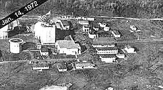
Havre Air Force Station is a Formerly Used Defense Site that was used as a Cold War general surveillance radar station. In addition to radar facilities and a NORAD Control Center the site had support services: NCO club, bowling alley, hobby shops, library, movie theater, barber shop, exchange, commissary, grade school, and housing for officers and senior NCOs.

<span class="mw-page-title-main">Condon Air Force Station</span> United States radar station

Condon Air Force Station is a closed United States Air Force General Surveillance Radar station. It is located 5.7 miles (9.2 km) west of Condon, Oregon. It was closed in 1970.

<span class="mw-page-title-main">Ground Equipment Facility J-82</span> Radar station in Oregon, US 1957–1979

Keno Air Force Station is a closed United States Air Force General Surveillance Radar station. It is located 4.6 miles (7.4 km) south-southwest of Keno, Oregon. It was closed in 1979 by the Air Force, and turned over to the Federal Aviation Administration (FAA).

Red Bluff Air Force Station is a closed United States Air Force General Surveillance Radar station. It is located 4.3 miles (6.9 km) west-southwest of Red Bluff, California. It was closed in 1970.

Othello Air Force Station is a closed United States Air Force General Surveillance Radar station. It is located 7.2 miles (11.6 km) south of Othello, Washington. It was the home station of the 637th Aircraft Control and Warning Squadron and the 637th Air Defense Group, closing in 1975.

Mica Peak Air Force Station is a closed United States Air Force General Surveillance Radar station. It is located atop Mica Peak, 6.3 miles (10.1 km) east-northeast of Mica, Washington. It was closed in 1975 by the Air Force, and turned over to the Federal Aviation Administration (FAA).

<span class="mw-page-title-main">Kalispell Air Force Station</span>

Kalispell Air Force Station is a closed United States Air Force General Surveillance Radar station. It is located 13.3 miles (21.4 km) south of Kalispell, Montana near the community of Lakeside.

<span class="mw-page-title-main">Blaine Air Force Station</span> Closed United States Air Force General Surveillance Radar station

Blaine Air Force Station is a closed United States Air Force General Surveillance Radar station. It is located 5.5 miles (8.9 km) south of Blaine, Washington. It was closed in 1979.

Houma Air Force Station is a closed United States Air Force General Surveillance Radar station. It is located 3.5 miles (5.6 km) southeast Houma, Louisiana. It was closed in 1970.

References

Notes

  1. 1 2 3 4 5 6 7 Cornett & Johnson, p. 161
  2. 1 2 3 4 Cornett, & Johnson, p. 86
  3. 1 2 AF Pamphlet 900-2, 30 Sep 76, p. 87
  4. 1 2 Department of the Air Force/MPM Letter 575q, 27 Sep 1984, Subject: Disbandment of Units
  5. "Abstract, History of 692nd Air Defense Group, Jan (sic)-Mar 1970". Air Force History Index. Retrieved 12 January 2012.
  6. "Abstract, History of 692nd Air Defense Group, Jul-Sep 1970". Air Force History Index. Retrieved 12 January 2012.

Bibliography

PD-icon.svg This article incorporates public domain material from the Air Force Historical Research Agency

Further reading