Beartown, New York

Last updated
Beartown, New York
Hamlet
USA New York location map.svg
Red pog.svg
Beartown, New York
Usa edcp location map.svg
Red pog.svg
Beartown, New York
Coordinates: 43°21′03″N75°27′15″W / 43.35083°N 75.45417°W / 43.35083; -75.45417 Coordinates: 43°21′03″N75°27′15″W / 43.35083°N 75.45417°W / 43.35083; -75.45417
County Oneida
Town Western
Elevation 384 m (1,260 [1]  ft)
Time zone Eastern (EST) (UTC-5)
  Summer (DST) EDT (UTC-4)
ZIP code 13303
Area code(s) 315

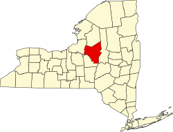
Beartown is a hamlet located on Beartown Road in the Town of Western in Oneida County, New York.

Western, New York Town in New York, United States

Western is a town in Oneida County, New York, United States. The population was 1,951 at the 2010 census.

Oneida County, New York County in the United States

Oneida County is a county located in the state of New York, in the United States. As of the 2010 census, the population was 234,878. The county seat is Utica. The name is in honor of the Oneida, one of the Five Nations of the Iroquois League or Haudenosaunee, which had long occupied this territory at the time of European encounter and colonization. The federally recognized Oneida Indian Nation has had a reservation in the region since the late 18th century, after the American Revolutionary War.

Related Research Articles

Granite County, Montana County in the United States

Granite County is a county located in the U.S. state of Montana. As of the 2010 United States Census, the population was 3,079. Its county seat is Philipsburg. The county was founded in 1893, and was named for a mountain which contains the Granite Mountain silver mine.

Brimfield Township, Portage County, Ohio Civil township in Ohio, United States

Brimfield Township is one of the eighteen townships of Portage County, Ohio, United States. The 2010 census found 10,376 people in the township.

Hillsboro, West Virginia Town in West Virginia, United States

Hillsboro is a town in Pocahontas County, West Virginia, United States. The population was 260 at the 2010 census.

Beartown State Park

Beartown State Park is a 110-acre (45 ha) state park located on the eastern summit of Droop Mountain, 7 miles (11 km) southwest of Hillsboro, West Virginia, in northern Greenbrier County, West Virginia. The land was purchased in 1970 with funds from the Nature Conservancy and a donation from Mrs. Edwin G. Polan, in memory of her son, Ronald Keith Neal, a local soldier who was killed in the Vietnam War. Development of the park has been minimal in order to preserve the natural attractions of the area. Recreation in the park consists of hiking along improved trails and boardwalks. Markers explain the natural processes at work in the area. The name "Beartown State Park" was chosen because local residents claimed that many cave-like openings in the rocks made ideal winter dens for the native black bears, the state animal of West Virginia. Also because the many deep, narrow crevasses were formed in a regular criss-cross pattern which appear from above like the streets of a small town. Beartown is noted for its unusual rock formations, which consist of Droop, or Pottsville, Sandstone formed during the Pennsylvanian age. Massive boulders, overhanging cliffs and deep crevasses make up the beauty of the park. On the face of the cliffs are hundreds of eroded pits. These pits range from the size of a marble to others large enough to hold two grown men. It is not unusual to see ice and snow remaining in the deeper crevasses until midsummer.

Droop Mountain Battlefield State Park

Droop Mountain Battlefield State Park is a state park located on Droop Mountain in Pocahontas County, West Virginia. Droop Mountain was the site of the last major battle of the American Civil War in the state. A West Virginia private in the Union Army at the Battle of Droop Mountain, John D. Sutton, became the leader in the movement to create the park when he served in the West Virginia House of Delegates. Dedicated on July 4, 1928, Droop Mountain Battlefield became the first state park in West Virginia.

Beartown, West Virginia Unincorporated community in West Virginia, United States

Beartown is an unincorporated community located in McDowell County, West Virginia, United States. Beartown lies along the Norfolk and Western Railroad on Dry Fork.

Beartown State Forest

Beartown State Forest is a publicly owned forest with recreational features located in the towns of Great Barrington, Monterey, Lee, and Tyringham, Massachusetts. The state forest's more than 10,000 acres (4,000 ha) include 198 acres (80 ha) of recreational parkland. It is managed by the Massachusetts Department of Conservation and Recreation.

Dry Fork (Tug Fork tributary) river in the United States of America

The Dry Fork is a 47.7-mile-long (76.8 km) tributary of the Tug Fork, belonging to the Ohio River watershed. The river is located in McDowell County, West Virginia, and Tazewell County, Virginia, in the United States. The mouth of the Dry Fork into the Tug Fork is located at Iaeger.

Clinch Mountain Wildlife Management Area

Clinch Mountain Wildlife Management Area is a 25,477-acre (103.10 km2) Wildlife Management Area (WMA) in Virginia. It is the second-largest WMA in the Commonwealth, covering portions of Smyth, Washington, Russell, and Tazewell counties.

Wyoming Highway 150 is a 23.05-mile (37.1 km) north-south Wyoming State Road that runs from the Wyoming–Utah state border to north to Evanston. It is the Wyoming portion of the Mirror Lake Scenic Byway.

Droop, West Virginia Unincorporated community in West Virginia, United States

Droop is an unincorporated community in Pocahontas County, West Virginia, in the Greenbrier River Valley.

Hop Brook Valley

The Hop Brook Valley is a valley in southeastern Berkshire County, Massachusetts. The valley lies predominantly in the town of Tyringham, Massachusetts, although a good portion of it is located in the neighboring town of Lee. Because of its rural location, scenic views, and variety of hiking trails, it is considered as a destination for travellers of the region.

Monterey, Pennsylvania populated place in Pennsylvania, United States

Monterey, Pennsylvania, is an unincorporated community which was added to the USGS Geographic Names Information System on August 2, 1979. After the site was surveyed c. 1839 for the never-completed Tapeworm Railroad, the summit community was settled on the Emmitsburg & Waynesboro Turnpike east of the Nichol's Gap Road intersection near the Toll Gate and Brown's Spring and later bypassed by the 20th century Pennsylvania Route 16 highway.

Beartown Mountain is in the Clinch Mountain range, which is in eastern Russell County, Virginia, United States. At 4,689 feet (1,429 m), it is the 7th highest summit in Virginia. It is the 41st highest County High Point of the Eastern United States.

Beartown, Lancaster County, Pennsylvania Unincorporated community in Pennsylvania, United States

Beartown is an unincorporated community in Caernarvon Township in Lancaster County, Pennsylvania, United States. Beartown is located at the intersection of U.S. Route 322 and Pool Forge Road/Narvon Road.

Beartown, Pennsylvania may refer to:

Fredrik Backman Swedish writer

Fredrik Backman is a Swedish columnist, blogger and writer. He is the author of A Man Called Ove (2012), My Grandmother Asked Me to Tell You She's Sorry (2013), Britt-Marie Was Here (2014), Beartown (2017), and Us Against You (2018). They were number one bestsellers in his native Sweden. They have been published around the world in more than twenty-five languages.

Beartown Wilderness

Beartown Wilderness is a U.S. wilderness area in the Eastern Divide Ranger District of the George Washington and Jefferson National Forests. It is a very rural Wilderness, consisting of an area of 5,613 acres (22.72 km2) with elevations ranging from 2,400 to 4,800 feet. It was created from existing National Forest lands in 1984 by the Virginia Wilderness Act of 1984.

Balsam Beartown Mountain

Balsam Beartown Mountain is a mountain located in Tazewell County, Virginia, in the United States. Coincidentally, the mountain is sixth in the state by elevation, sixth by prominence, and sixth by isolation.

McMullen Brook flows into the Mohawk River northeast of Beartown, New York.

References