Beartown, New York | |
|---|---|
 Beartown, New York  Beartown, New York | |
| Coordinates: 43°21′03″N75°27′15″W / 43.35083°N 75.45417°W | |
| Country | |
| State | |
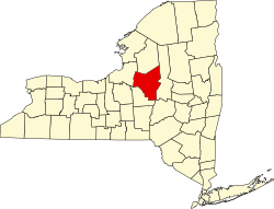
| County | Oneida |
| Town | Western |
| Elevation | 384 m (1,260 [1] ft) |
| Time zone | UTC-5 (Eastern (EST)) |
| • Summer (DST) | UTC-4 (EDT) |
| ZIP code | 13303 |
| Area code | 315 |
Beartown is a hamlet located on Beartown Road in the Town of Western in Oneida County, New York.