
Fincastle is a town in Botetourt County, Virginia, United States. The population was 755 at the 2020 census. It is the county seat of Botetourt County.

York River State Park is located near the unincorporated town of Croaker in James City County, Virginia on the south bank of the York River about 10 miles downstream from West Point.

The Thunderbird Archaeological District, near Limeton, Virginia, is an archaeological district described as consisting of "three sites—Thunderbird Site, the Fifty Site, and the Fifty Bog—which provide a stratified cultural sequence spanning Paleo-Indian cultures through the end of Early Archaic times with scattered evidence of later occupation."

Eagle Rock is a census-designated place (CDP) in Botetourt County, Virginia, United States, located along the James River between Iron Gate and Buchanan. It was first listed as a CDP in the 2020 census with a population of 209.
The Bull Thistle Cave Archaeological Site is an archaeological site on the National Register of Historic Places, located in Tazewell County, Virginia. It is a vertical shaft pit burial cave. The distribution of the skeletal remains indicates that bodies were either thrown or lowered into the cave. On the surface of the cave floor, researchers have discovered the remains of a minimum of 11 bodies. Based on an artifact recovered from the site, it is estimated that the cave was used for burials between 1300 and 1600 AD.
This is a list of the National Register of Historic Places listings in Augusta County, Virginia.

This is a list of the National Register of Historic Places listings in Botetourt County, Virginia.

This is a list of the National Register of Historic Places listings in Chesterfield County, Virginia.
This is a list of the National Register of Historic Places listings in Gloucester County, Virginia.

This is a list of the National Register of Historic Places listings in Madison County, Virginia.

This is a list of the National Register of Historic Places listings in Mecklenburg County, Virginia.

This is a list of the National Register of Historic Places listings in York County, Virginia.

Fort Van Meter — or Fort VanMeter — is a mid-18th century frontier fort in the South Branch Potomac River Valley about 9 miles (14 km) southwest of Romney in Hampshire County, West Virginia, USA. It is located 15 miles (24 km) northeast of Moorefield and about a mile northeast of the former community of Glebe at the northern end of the rugged river gorge known as The Trough.

Buchanan Historic District is a national historic district located at Buchanan, Botetourt County, Virginia. It encompasses 277 contributing buildings, 5 contributing sites, and 4 contributing structures in Buchanan and Pattonsburg on both sides of the James River. They include commercial, transportation-related, domestic, religious, and industrial resources associated with the community's development from the late-18th century through the late-20th century. Notable buildings include the Pattonsburg Mill (1838), Buchanan Presbyterian Church (1845), Trinity Episcopal Church (1842), Hotel Botetourt (1851), Sorrell House (1850), James Evans Mason Lodge (1884), Virginia Can Company complex (1903), "Oak Hill" (1840), Town Hall Municipal Building, Bank of Buchanan, Ransone's Drugstore, Buchanan Theatre (1919), and Buchanan High School (1928). The contributing sites include the James River & Kanawha Canal project site, Johnston-Boyd Cemetery (1835–1906), and Mountain View Cemetery (1854). The contributing structures include the Stone Arch Tunnel (1870s). Also located in the district is the separately listed Wilson Warehouse.

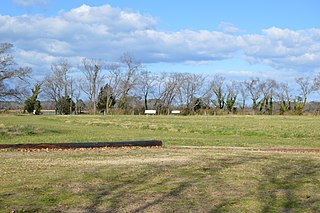
Greenfield, also known as Col. William Preston Plantation, Preston House, and Botetourt Center at Greenfield, is a historic plantation site located at Fincastle, Botetourt County, Virginia. It is the site of a large forced-labor farm AKA enslaved people established in the mid-18th century by Colonel William Preston (1729-1783) before he moved to Smithfield in 1774. The plantation house was destroyed by fire in 1959. The remaining buildings are kitchen/quarters and saddlebag slave dwelling.

Taft Archeological Site No. 029-5411 is a historic archaeological site located at Lorton, Fairfax County, Virginia. The site includes a multi-component, stratified, upland, prehistoric and possibly proto-historic (Dogue), American Indian camp covering a 50x80-meter area and dating to between ca. 2000 B.C. and A.D. 1560. The site was excavated in three stages in May through August 1987. The site is located in Mason Neck State Park.
Arlington Archeological Site is a historic archaeological site located near Capeville, Northampton County, Virginia. It is located east of the Custis Tombs. The site includes archaeological features ranging from Accomack Plantation, the first English settlement of the Eastern Shore in 1619, to probable tenant or slave quarter features dating to the second half of the 18th century. The site also includes the foundations of Arlington mansion, established about 1670 and demolished about 1720. Arlington plantation was the ancestral home of the Custis family of Virginia. Archaeological investigations and excavations of the site were conducted in 1987-1988 and 1994.

Gala Site is a historic archaeological site located near Gala, Botetourt County, Virginia. The site was occupied by Native Americans from circa 3000-1000 B.C. to ca. 900–1607. Archaeological resources at the site include intact remains ranging in function from mortuary to architectural to subsistence as well as community refuse. The site has the potential to provide scholars invaluable information about Native American funerary practices, settlement patterns, ethnic diversity, and other information about the people who inhabited the upper James River portion of southwestern Virginia.

Bowyer-Holladay House, also known as the Lewis Holladay House, is a historic archaeological site located near Fincastle, Botetourt County, Virginia. The site is located in The Botetourt Center at Greenfield industrial park. The site consists of the ruins of an Early Republic/Federal Style two-story brick house with a limestone lined cellar in a rear-centered ell configuration. The house was part of the plantation complex commonly referred to as the "Holladay Place." In addition to the ruins of the main house, a log structure with an early timber and modern frame addition survives 25 feet north of the bulkhead entrance to the limestone cellar.
The Looney Mill Creek Site is a prehistoric and historic archaeological site near Buchanan in Botetourt County, Virginia. The site, located near the confluence of Looney's Mill Creek and the James River, has evidence of Native American occupation dating as far back as 6000BC, and was the site of the settlement and mill established c. 1742 by Robert Looney, one of the area's first European settlers.

