| Big Snow Mountain | |
|---|---|
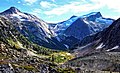
 Southwest aspect | |
| Highest point | |
| Elevation | 2,357 m (7,733 ft) [1] [2] |
| Prominence | 1,196 m (3,924 ft) [1] |
| Parent peak | Mount Saugstad (2,908 m) [1] |
| Isolation | 8.2 km (5.1 mi) [1] |
| Listing | Mountains of British Columbia |
| Coordinates | 52°14′17″N126°41′15″W / 52.23806°N 126.68750°W [3] |
| Geography | |
 Big Snow Mountain Location in British Columbia  Big Snow Mountain Location in Canada | |
 | |
| Interactive map of Big Snow Mountain | |
| Country | Canada |
| Province | British Columbia |
| District | Range 3 Coast Land District |
| Parent range | Coast Mountains |
| Topo map | NTS 93D2 South Bentinck Arm [3] |
Big Snow Mountain is a 2,357-metre (7,733-foot) mountain summit located in British Columbia, Canada. [4]