Enfield is a town in Hartford County, Connecticut, United States, first settled by John and Robert Pease of Salem, Massachusetts Bay Colony. The town is part of the Capitol Planning Region. The population was 42,141 at the 2020 census. It is bordered by Longmeadow, Massachusetts, and East Longmeadow, Massachusetts, to the north, Somers to the east, East Windsor and Ellington to the south, and the Connecticut River to the west.

Tariffville is a neighborhood and census-designated place (CDP) in the town of Simsbury in Hartford County, Connecticut, United States. The population was 1,324 at the 2010 census. It is a popular location for whitewater paddlers who use the Farmington River.

Thompsonville is a census-designated place (CDP) in the town of Enfield in Hartford County, Connecticut, United States. The population of the CDP was 8,577 at the 2010 census.

The Mechanic Street Historic District encompasses a historic 19th-century mill and mill village in a 14-block area of the Pawcatuck section of Stonington, Connecticut. Extending along the Pawcatuck River and south of West Broad Street, the area includes a large brick mill complex on the banks of the river, and a neighborhood of well-preserved worker housing on the road grid to its west. The district was listed on the National Register of Historic Places in 1988.

The Cheney Brothers Historic District was a center of the silk industry in Manchester, Connecticut, in the late 19th and early 20th century. The 175-acre (71 ha) district includes over 275 mill buildings, workers houses, churches, schools and Cheney family mansions. These structures represent the well-preserved company town of the Cheney Brothers silk manufacturing company, the first America-based silk company to properly raise and process silkworms, and to develop the difficult techniques of spinning and weaving silk. The area was declared a National Historic Landmark in 1978.

Enfield station is a planned CTrail Hartford Line station in Enfield, Connecticut. As of September 2023, construction is expected to begin in 2025. A previous station at the site was open from 1844 to 1986.

Route 190 is a state route in the northern part of the U.S. state of Connecticut. It starts at Route 75 in the town of Suffield and proceeds eastward across the Connecticut River through the towns of Enfield, Somers, and Stafford. It ends at Route 171, in the town of Union. Route 190 was established in 1932 as a route between the state line at Southwick and the town of Enfield. The route was later extended eastward to Union but was truncated in the west to Suffield center.

The Somersville Historic District encompasses the historic components of the mill village of Somersville in western Somers, Connecticut, United States. The district is centered on a mill complex on the Scantic River, which divides the district. The most significant years of development were between about 1835 and 1935, although the area has a history dating to the 1760s. The district was listed on the National Register of Historic Places in 1995. The Mill itself has since burned down and as of October 2018 is currently open field, although the canal structure remains in place.

The Hazardville Historic District is a historic district in the Hazardville section of Enfield, Connecticut, United States, that is listed on the National Register of Historic Places.

The Pine Meadow Historic District encompasses most of the historic 19th-century village of Pine Meadow in New Hartford, Connecticut, United States. Located at a bend in the West Branch of the Farmington River southeast of New Hartford center, it is a well-preserved example of a rural industrial village. The district was listed on the National Register of Historic Places in 1996.

The Ware Millyard Historic District encompasses a 19th-century mill complex and industrial mill village in the town of Ware, Massachusetts. It is roughly bounded by South Street, the Ware River, Upper Dam Complex, Park Street, Otis Avenue and Church Street. The area includes surviving mill buildings, the oldest of which date to the 1840s, and a collection of tenement-style housing built for the millworkers, built between 1845 and the 1880s.

The Ipswich Mills Historic District encompasses a major textile mill complex and associated worker housing along the Ipswich River near the center of Ipswich, Massachusetts. The district includes the factories of the Ipswich Mill Company, and several blocks of modest worker cottages mostly on side streets off Estes and Kimball Streets. The site had been used as for mills since the 17th century, and was purchased by the Ipswich Mill Company in 1868. Mill worker housing was built surrounding the complex through the early 20th century, when River Court, Peatfield Street, and 1st through 6th Streets were laid out. The district was listed on the National Register of Historic Places in 1996.

District B is a historic worker housing district located in Manchester, New Hampshire, United States, near the former Amoskeag Manufacturing Company millyard. It is roughly bounded by Canal, Mechanic, Franklin, and Pleasant Streets, and was added to the National Register of Historic Places on November 12, 1982. It contains 32 contributing properties, including seventeen rowhouse tenement blocks built mainly between 1838 and 1850, in an area of approximately 170 acres (69 ha).

The Main Street Historic District encompasses the historic civic, commercial, and residential center of Durham, Connecticut. The district is primarily linear and runs along Main Street from between Higganum Road and Town House Road in the south to Talcott Lane in the north, and along Maple Avenue, which parallels Main Street. The district includes most of its colonial architecture, as well as many of its civic buildings. It was listed on the National Register of Historic Places in 1986.

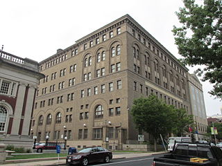
The Elm Street Historic District encompasses a collection of architecturally distinguished institutional and residential buildings near the Connecticut State Capitol in Hartford, Connecticut. Located on Capitol Avenue and Trinity and Elm Streets, it includes the city's best concentration of early 20th-century architecture, including Bushnell Memorial Hall and several state office buildings. It was listed on the National Register of Historic Places in 1984.

The Holden–Leonard Workers Housing Historic District encompasses a collection of mill-related tenement houses, plus a former mill store, in Bennington, Vermont. They are located on Benmont and Holden Avenues, near the former Holden–Leonard Mill Complex, Bennington's largest employer in the late 19th century. The district was listed on the National Register of Historic Places in 2011.

The Bigelow-Hartford Carpet Mills were once one of the largest manufacturers of carpeting in the United States. The company's early 20th-century factories, located in Thompsonville, Connecticut, were listed on the National Register of Historic Places in 1983. Used by a succession of carpet makers until the 1960s, the company complex has for the most part been converted to residential use.

The Curtisville Historic District encompasses a predominantly residential area along Naubuc Avenue and Pratt Streets in northwestern Glastonbury, Connecticut. Developed mainly in the 19th century, it illustrates the coexistence of agricultural and industrial pursuits in a single village area, mixing worker housing, former farm properties, and a small mill complex. The district was listed on the National Register of Historic Places in 1992.

The Enfield Historic District encompasses a two-mile stretch of Enfield Street, the main north-south road of Enfield, Connecticut. Centered on the town common with its church and old town hall, it includes a diversity of residential architecture from the 18th to early 20th centuries. The district was listed on the National Register of Historic Places in 1979.

The Upper Albany Historic District encompasses a predominantly residential area of the North End of Hartford, Connecticut. It extends along Albany Avenue between Garden and Woodland Streets, including side streets to the south, and extends northward to include the southern portion of Keney Park. This area was developed in the first two decades of the 20th century, and has a fine array of period middle-class housing in the Queen Anne and Colonial Revival styles. It was listed on the National Register of Historic Places in 1986.


