
Oconee County is the westernmost county in the U.S. state of South Carolina. As of the 2020 census, the population was 78,607. Its county seat is Walhalla and its largest city is Seneca. Oconee County is included in the Seneca, SC Micropolitan Statistical Area, which is also included in the Greenville-Spartanburg-Anderson, SC Combined Statistical Area. South Carolina Highway 11, the Cherokee Foothills National Scenic Highway, begins in southern Oconee County at Interstate Highway 85 at the Georgia state line.
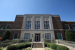
Oconee County is a county located in the northeastern part of the U.S. state of Georgia. As of the 2020 census, the population was 41,799. The county seat is Watkinsville.
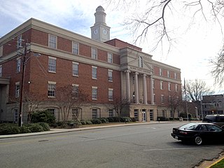
Baldwin County is a county located in the central portion of the U.S. state of Georgia. As of the 2020 census, its population was 43,799. The county seat is Milledgeville, which was developed along the Oconee River.

Milledgeville is a city in and the county seat of Baldwin County in the U.S. state of Georgia. It is northeast of Macon and bordered on the east by the Oconee River. The rapid current of the river here made this an attractive location to build a city. It was the capital of Georgia from 1804 to 1868, including during the American Civil War. Milledgeville was preceded as the capital city by Louisville and was succeeded by Atlanta, the current capital. Today U.S. Highway 441 connects Milledgeville to Madison, Athens, and Dublin.
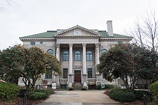
Decatur is a city in, and the county seat of, DeKalb County, Georgia, United States, part of the Atlanta metropolitan area. With a population of 24,928 in the 2020 census, the municipality is sometimes assumed to be larger since multiple ZIP Codes in unincorporated DeKalb County bear Decatur as the address. The city is served by three MARTA rail stations. The city is located approximately five miles northeast of Downtown Atlanta and shares its western border with both the city of Atlanta and unincorporated DeKalb County. The Druid Hills neighborhood is to the northwest of Decatur.

Dublin is a city in Laurens County, Georgia, United States. As of the 2020 census, the city had a population of 16,074. It is the county seat of Laurens County.

Madison is a city in Morgan County, Georgia, United States. It is part of the Atlanta-Athens-Clarke-Sandy Springs Combined Statistical Area. The population was 4,447 at the 2020 census, up from 3,979 in 2010. The city is the county seat of Morgan County and the site of the Morgan County Courthouse.
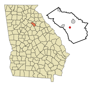
Bishop is a town in Oconee County, Georgia, United States. As of the 2020 census, the city had a population of 332.

Watkinsville is the largest town and county seat of Oconee County, Georgia, United States. As of the 2020 census, the town had a total population of 2,896. It served as the seat of Clarke County until 1872 when the county seat of that county was moved to Athens, a move which ultimately led to the creation of Oconee County in 1875. It is included in the Athens-Clarke County, Georgia Metropolitan Statistical Area.

Seneca is a city in Oconee County, South Carolina, United States. The population was 8,102 at the 2010 census. It is the principal city of the Seneca Micropolitan Statistical Area, an (MSA) that includes all of Oconee County, and that is included within the greater Greenville-Spartanburg-Anderson, South Carolina Combined Statistical Area. Seneca was named for the nearby Cherokee town of Isunigu, which English colonists knew as "Seneca Town".

Walhalla is a city in the foothills of the Blue Ridge Mountains in Oconee County, South Carolina. Designated in 1868 as the county seat, it lies within the area of the Blue Ridge Escarpment, an area of transition between mountains and piedmont, and contains numerous waterfalls. It is located 16 miles (26 km) from Clemson University in Clemson, South Carolina.
The Cherokee Path was the primary route of English and Scots traders from Charleston to Columbia, South Carolina in Colonial America. It was the way they reached Cherokee towns and territories along the upper Keowee River and its tributaries. In its lower section it was known as the Savannah River. They referred to these towns along the Keowee and Tugaloo rivers as the Lower Towns, in contrast to the Middle Towns in Western North Carolina and the Overhill Towns in present-day southeastern Tennessee west of the Appalachian Mountains.

The Chattahoochee–Oconee National Forest in northern Georgia comprises two United States National Forests, the Oconee National Forest in eastern Georgia and the Chattahoochee National Forest located in the North Georgia Mountains. The Chattahoochee National Forest is composed of an eastern and western forest. The western forest contains Johns Mountain, Little Sand Mountain, and Taylor Ridge (Georgia). The combined total area of the Chattahoochee–Oconee National Forest is 867,265 acres (3,510 km2), of which the Chattahoochee National Forest comprises 751,069 acres (3,039 km2) and the Oconee National Forest comprises 116,196 acres (470 km2). The county with the largest portion of the eastern forest is Rabun County, Georgia, which has 148,684 acres (601.7 km2) within its boundaries.

Oconee Hill Cemetery is a cemetery in Athens, Georgia, United States. The extant cemetery opened in 1856 and is located near the University of Georgia.

Old Stone Church is a church building built in 1802. When it was constructed, it was in the Pendleton District, South Carolina. When Pendleton District was divided in 1826, the church was in Pickens District. When Pickens District was split in 1868, it was in Oconee County, South Carolina. In 1968, this section of Oconee County was annexed back to Pickens County. The church is about midway between the centers of Pendleton and Clemson. It is now in the city limits of Clemson.
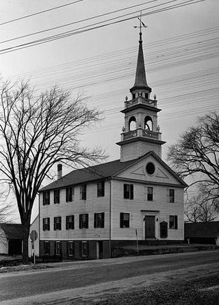
Preston City is a village and the original town center of the town of Preston, Connecticut. The core of the village around the junction of Old Northwest Road and Route 164 is designated as the Preston City Historic District, a historic district that is listed on the National Register of Historic Places. The district is located along Old Shetucket and Amos Roads, which, prior to the 1930s, were major thoroughfares.

Glenville Historic District, also known as Sherwood's Bridge, is a 33.9 acres (13.7 ha) historic district in the Glenville neighborhood of the town of Greenwich, Connecticut. It is the "most comprehensive example of a New England mill village within the Town of Greenwich". It "is also historically significant as one of the town's major staging areas of immigrants, predominantly Irish in the 19th century and Polish in the 20th century" and remains "the primary settlement of Poles in the town". Further, "[t]he district is architecturally significant because it contains two elaborate examples of mill construction, designed in the Romanesque Revival and a transitional Stick-style/Queen Anne; an excellent example of a Georgian Revival school; and notable examples of domestic and commercial architecture, including a Queen Anne mansion and an Italianate store building."

Midtown has an area of six square miles in Columbus, Georgia. It possesses residential neighbourhoods, eleven public schools, the Columbus Museum, the Columbus Public Library, the Muscogee County Public Education Center, the Columbus Aquatic Center and the international headquarters for Aflac. The population of Midtown is 22,000 residents living in 8500 households and is 10 kilometres north of Fort Benning on I-185.
This is a list of properties and districts in Oconee County, Georgia that are listed on the National Register of Historic Places (NRHP).

The historic Cherokee settlements were Cherokee settlements established in Southeastern North America up to the removals of the early 19th century. Several settlements had existed prior to and were initially contacted by explorers and colonists of the colonial powers as they made inroads into frontier areas. Others were established later.


