
Mount Waddington, once known as Mystery Mountain, is the highest peak in the Coast Mountains of British Columbia, Canada. Although it is lower than Mount Fairweather and Mount Quincy Adams, which straddle the United States border between Alaska and British Columbia, Mount Waddington is the highest peak that lies entirely within British Columbia. It and the subrange which surround it, known as the Waddington Range, stand at the heart of the Pacific Ranges, a remote and extremely rugged set of mountains and river valleys.

Mount Garibaldi is a dormant stratovolcano in the Garibaldi Ranges of the Pacific Ranges in southwestern British Columbia, Canada. It has a maximum elevation of 2,678 metres and rises above the surrounding landscape on the east side of the Cheakamus River in New Westminster Land District. In addition to the main peak, Mount Garibaldi has two named sub-peaks. Atwell Peak is a sharp, conical peak slightly higher than the more rounded peak of Dalton Dome. Both were volcanically active at different times throughout Mount Garibaldi's eruptive history. The northern and eastern flanks of Mount Garibaldi are obscured by the Garibaldi Névé, a large snowfield containing several radiating glaciers. Flowing from the steep western face of Mount Garibaldi is the Cheekye River, a tributary of the Cheakamus River. Opal Cone on the southeastern flank is a small volcanic cone from which a lengthy lava flow descends. The western face is a landslide feature that formed in a series of collapses between 12,800 and 11,500 years ago. These collapses resulted in the formation of a large debris flow deposit that fans out into the Squamish Valley.

The Waddington Range is a subrange of the Pacific Ranges of the Coast Mountains in southwestern British Columbia, Canada. It is only about 4,000 km2 (1,500 sq mi) in area, relatively small in area within the expanse of the range, but it is the highest area of the Pacific Ranges and of the Coast Mountains, being crowned by its namesake Mount Waddington 4,019 m (13,186 ft). The Waddington Range is also extremely rugged and more a complex of peaks than a single icefield, in contrast to the other huge icefield-massifs of the southern Coast Mountains, which are not so peak-studded and tend to have more contiguous icemasses.
Mount Queen Bess is one of the principal summits of the Pacific Ranges of the Coast Mountains of southern British Columbia. It stands west of Chilko Lake and to the south of Tatlayoko Lake, and crowns a peak-studded ridge to the north of the Homathko Icefield.

Mount Tiedemann 3,838 m (12,592 ft), prominence 848 m (2,782 ft), is one of the principal summits of the Pacific Ranges subdivision of the Coast Mountains of British Columbia. It is located 3 km (1.9 mi) northeast of Mount Waddington in the Waddington Range massif between the Homathko and Klinaklini Rivers.
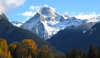
Mount Bute, also known as Bute Mountain, is a 2,810-metre (9,220-foot) mountain located in the Coast Mountains of British Columbia, Canada. Situated at the southern extreme of the Homathko Icefield, Mount Bute has an impressive 800-metre sheer granite west face, and Bute Glacier dominates the north aspect. This imposing mountain is visible from Waddington Harbour at the head of Bute Inlet, in a remote wilderness area that few visit. Its nearest higher peak is Mount Grenville, 13.0 km (8.1 mi) to the east-northeast. Mount Grenville is the highest summit of the icefield. Mount Bute is 63.0 km (39.1 mi) southeast of Mount Waddington, the highest peak of the entire Coast Mountains range.

Joffre Peak is a 2,721-metre (8,927-foot) mountain summit located in the Coast Mountains, in Joffre Lakes Provincial Park, in southwestern British Columbia, Canada. It is the second-highest point of the Joffre Group, which is a subset of the Lillooet Ranges. It is situated 26 km (16 mi) east of Pemberton and 11 km (7 mi) northeast of Lillooet Lake. Joffre is more notable for its steep rise above local terrain than for its absolute elevation as topographic relief is significant with the summit rising 1,500 meters (4,920 ft) above Cayoosh Creek in 4 km (2.5 mi). The nearest higher peak is Mount Matier, 1.6 km (1 mi) to the south. The mountain's climate supports the Matier Glacier on the southwest slope, and the Anniversary Glacier on the southeast slope. Precipitation runoff from the peak drains into Joffre Creek and Cayoosh Creek which are both within the Fraser River watershed.

Mount Weart is a 2,835-metre (9,301-foot) triple-summit mountain located in the Garibaldi Ranges of the Coast Mountains, in northwestern Garibaldi Provincial Park of southwestern British Columbia, Canada. It is situated 14 km (9 mi) northeast of Whistler, and its nearest higher peak is Wedge Mountain, 3.7 km (2 mi) to the south, which is the only peak within the park higher than Weart. The Armchair Glacier rests below the west aspect of the summit, and the massive Weart Glacier spans the northern and eastern aspects of the mountain. Precipitation runoff from the peak and meltwater from the glaciers drains into Wedgemount Lake and tributaries of the Lillooet River.

Mount Fitzsimmons is a 2,603-metre (8,540-foot) glacier-clad peak located in the Garibaldi Ranges of the Coast Mountains, in Garibaldi Provincial Park of southwestern British Columbia, Canada. It is the third-highest point of the Fitzsimmons Range, which is a subset of the Garibaldi Ranges. It is situated 15 km (9 mi) southeast of Whistler, and its nearest higher peak is Mount Benvolio, 0.5 km (0 mi) to the west-southwest. The Diavolo Glacier spreads out below the southeast aspect of the summit, and the Fitzsimmons Glacier descends the northwest slopes. Precipitation runoff from the peak and meltwater from its glaciers drains into tributaries of the Cheakamus River. The first ascent of the mountain was made on August 19, 1924, by a party of the British Columbia Mountaineering Club. The peak was named for prospector James Fitzsimmons, who built a trail along Fitzsimmons Creek in an effort to haul supplies to a small copper mine he staked and worked. The mountain's name was officially adopted on September 2, 1930, by the Geographical Names Board of Canada.
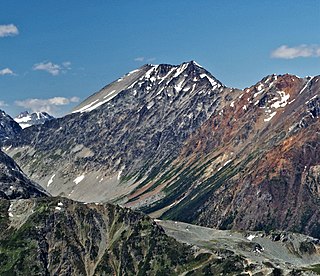
Sessel Mountain is a 2,746-metre (9,009-foot) mountain summit located in the Thiassi Range of the Coast Mountains, in southwestern British Columbia, Canada. It is the fourth-highest point in the Thiassi Range. Sessel is situated 46 km (29 mi) northwest of Pemberton, and 4.3 km (3 mi) northwest of Mount Sampson, which is its nearest higher peak. An unnamed icefield rests on the northern side of the peak, and the Boomerang Glacier lies at the base of the south slopes. Precipitation runoff from the peak drains into tributaries of the Lillooet and Hurley Rivers. The mountain's descriptive name was submitted by mountaineer Karl Ricker of the Alpine Club of Canada for its similar shape to a sessel, the German word for "armchair". The name was officially adopted January 23, 1979, by the Geographical Names Board of Canada. The first ascent of the mountain was made in 1974 by John Clarke.

Mount Hanover is a mountain summit located in British Columbia, Canada.

Mount Lindeman is a 2,312-meter-elevation (7,585-foot) mountain summit located in the North Cascades in British Columbia, Canada.
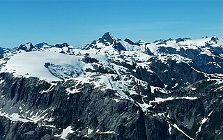
Mount Tinniswood is a 2,606-metre (8,550-foot) mountain summit located in British Columbia, Canada.

Grenelle Mountain is a 3,047-metre (9,997-foot) mountain summit located in British Columbia, Canada.

Spearman Peak is a 3,365-metre (11,040-foot) summit located in British Columbia, Canada.

Stupendous Mountain is a 2,682-metre (8,799-foot) mountain summit located in British Columbia, Canada.
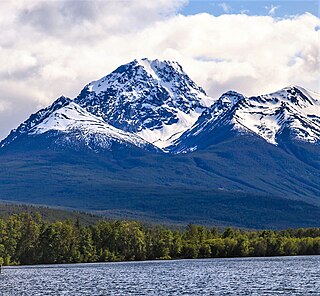
Whitesaddle Mountain is a summit located in British Columbia, Canada.
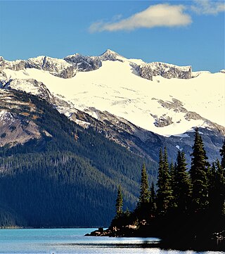
Mount Carr is a 2,590-metre (8,497-foot) mountain summit located in British Columbia, Canada.

Mount Bagot is a 2,181-metre (7,156-foot) mountain summit located on, and in part defining, the international border between British Columbia, Canada, and Alaska, United States.

Combatant Mountain, also called Mount Combatant, is a 3,762-metre (12,343-foot) summit in British Columbia, Canada.


