Blunt, South Dakota | |
---|---|
Coordinates: 44°30′57″N99°59′19″W / 44.51583°N 99.98861°W | |
Country | United States |
State | South Dakota |
County | Hughes |
Settled | 1882 [1] |
Government | |
• Mayor | Chip King |
Area | |
• Total | 0.49 sq mi (1.26 km2) |
• Land | 0.49 sq mi (1.26 km2) |
• Water | 0.00 sq mi (0.00 km2) |
Elevation | 1,621 ft (494 m) |
Population | |
• Total | 342 |
• Density | 702.26/sq mi (271.02/km2) |
Time zone | UTC-6 (Central (CST)) |
• Summer (DST) | UTC-5 (CDT) |
ZIP code | 57522 |
Area code | 605 |
FIPS code | 46-06180 [5] |
GNIS feature ID | 1267287 [3] |
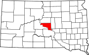
Blunt is a city in Hughes County, South Dakota, United States. It is part of the Pierre, South Dakota Micropolitan Statistical Area. The population was 342 at the 2020 census. [6]
Blunt was named for John E. Blunt, a railroad official. [7] [8] Blunt was founded in 1881 as a stop on the Chicago and North Western Railway. It received its city rights in 1884. [9]
According to the United States Census Bureau, the city has a total area of 0.49 square miles (1.27 km2), all land. [10]
Census | Pop. | Note | %± |
---|---|---|---|
1890 | 353 | — | |
1900 | 246 | −30.3% | |
1910 | 566 | 130.1% | |
1920 | 512 | −9.5% | |
1930 | 477 | −6.8% | |
1940 | 322 | −32.5% | |
1950 | 423 | 31.4% | |
1960 | 532 | 25.8% | |
1970 | 445 | −16.4% | |
1980 | 424 | −4.7% | |
1990 | 342 | −19.3% | |
2000 | 370 | 8.2% | |
2010 | 354 | −4.3% | |
2020 | 342 | −3.4% | |
U.S. Decennial Census [11] [4] |
As of the census [12] of 2010, there were 354 people, 150 households, and 102 families residing in the city. The population density was 722.4 inhabitants per square mile (278.9/km2). There were 167 housing units at an average density of 340.8 per square mile (131.6/km2). The racial makeup of the city was 89.3% White, 2.5% African American, 4.8% Native American, 0.3% Asian, 1.7% from other races, and 1.4% from two or more races. Hispanic or Latino of any race were 4.0% of the population.
There were 150 households, of which 25.3% had children under the age of 18 living with them, 58.0% were married couples living together, 3.3% had a female householder with no husband present, 6.7% had a male householder with no wife present, and 32.0% were non-families. 28.0% of all households were made up of individuals, and 14% had someone living alone who was 65 years of age or older. The average household size was 2.36 and the average family size was 2.76.
The median age in the city was 46.6 years. 23.2% of residents were under the age of 18; 5.9% were between the ages of 18 and 24; 19.2% were from 25 to 44; 33.4% were from 45 to 64; and 18.4% were 65 years of age or older. The gender makeup of the city was 52.0% male and 48.0% female.
As of the census [5] of 2000, there were 370 people, 153 households, and 106 families residing in the city. The population density was 752.7 inhabitants per square mile (290.6/km2). There were 178 housing units at an average density of 362.1 per square mile (139.8/km2). The racial makeup of the city was 94.86% White, 2.70% Native American, 1.35% from other races, and 1.08% from two or more races. Hispanic or Latino of any race were 1.35% of the population.
There were 153 households, out of which 31.4% had children under the age of 18 living with them, 60.8% were married couples living together, 6.5% had a female householder with no husband present, and 30.1% were non-families. 28.1% of all households were made up of individuals, and 11.1% had someone living alone who was 65 years of age or older. The average household size was 2.42 and the average family size was 2.99.
In the city, the population was spread out, with 26.8% under the age of 18, 4.3% from 18 to 24, 27.3% from 25 to 44, 24.6% from 45 to 64, and 17.0% who were 65 years of age or older. The median age was 41 years. For every 100 females, there were 106.7 males. For every 100 females age 18 and over, there were 103.8 males.
The median income for a household in the city was $28,571, and the median income for a family was $31,667. Males had a median income of $22,727 versus $19,500 for females. The per capita income for the city was $14,155. About 3.4% of families and 6.5% of the population were below the poverty line, including 6.6% of those under age 18 and 8.8% of those age 65 or over.
Dakota is a city in Winona County, Minnesota, United States. The population was 295 at the 2020 census.
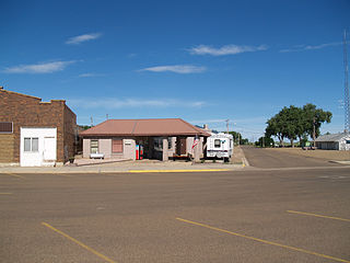
Hettinger is a city in and the county seat of Adams County, North Dakota, United States. The population was 1,074 at the 2020 census.
Esmond is a city in Benson County, North Dakota, United States. The population was 91 at the 2020 census. Esmond was founded in 1901.
Minnewaukan is a city in Benson County, North Dakota, United States. It serves as the county seat and is fourth largest city in the county, after Fort Totten, Leeds, and Maddock. The population was 199 at the 2020 census. Minnewaukan was founded in 1884.
Ayr is a city in Cass County, North Dakota, United States. The population was 11 at the 2020 census. Ayr was founded in 1883.
Wishek is a city in McIntosh County, North Dakota, United States. The population was 864 at the 2020 census.
Hankinson is a city in Richland County, North Dakota, United States. The population was 921 at the 2020 census. Hankinson was founded in 1886. It is part of the Wahpeton, ND–MN Micropolitan Statistical Area.
Park River is a city in Walsh County, North Dakota, United States. The population was 1,424 at the 2020 census. Park River was founded in 1884.
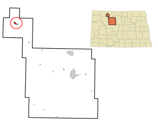
Kenmare is a city in Ward County, North Dakota, United States. The population was 961 at the 2020 census. Kenmare is part of the Minot Micropolitan Statistical Area.
White is a city in Brookings County, South Dakota, United States. The population was 537 at the 2020 census.
Groton is a city in southeastern Brown County, South Dakota, United States. The population was 1,380 at the 2020 census.
Wagner is a city in Charles Mix County, South Dakota, United States. The population was 1,490 at the 2020 census. The city is served by Wagner Municipal Airport as well as YST Transit buses.
Clear Lake is a city in and the county seat of Deuel County, South Dakota, United States. The population was 1,218 at the 2020 census.
Milbank is a city in Grant County, South Dakota, United States, located along the South Fork of the Whetstone River. The population was 3,544 at the 2020 census. It is the county seat of Grant County. Milbank is the birthplace of American Legion Baseball. The program was created in Milbank in 1925 and is now enjoyed by high school aged youth on more than five thousand teams in all fifty states.
Parkston is a city in Hutchinson County, South Dakota, United States. The population was 1,567 at the 2020 census.
Whitewood is a city in Lawrence County, South Dakota, United States. The population was 879 at the 2020 census.
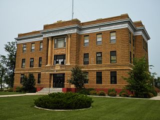
Leola is a small city in and the county seat of McPherson County, South Dakota, United States. It was founded on May 1, 1884, and named for Leola Haynes, daughter of one of the town's founders. The population was 434 as of the 2020 census.
Crooks is a city in Minnehaha County, South Dakota, United States and is a suburb of Sioux Falls. The population was 1,362 at the 2020 census. Crooks was named New Hope until 1904. The town's present name honors W. A. Crooks, a local politician.
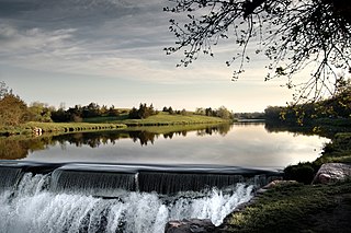
Garretson is a city in Minnehaha County, South Dakota, United States. The city had a population of 1,228 at the 2020 census.
Hartford is a suburban American city in Minnehaha County, South Dakota, a few miles northwest of Sioux Falls. Its population was 3,354 at the 2020 census.