
Millington is a village within the town of East Haddam, Connecticut, United States. Millington lies halfway between East Haddam center and Salem center. It is the section of East Haddam that is the closest to Devil's Hopyard State Park. The village is connected to East Haddam Center and to Devil's Hopyard State Park by a series of secondary roads that are maintained by the state. The road is given an unsigned designation "Special Service Road 434", which runs on Mount Parnassus Road, Millington Road, Haywardville Road, and Hopyard Road.

Litchfield Historic District, in Litchfield, Connecticut, is a National Historic Landmark District designated in 1968 as a notable and well-preserved example of a typical late 18th century New England village. As a National Historic Landmark, it is listed on the National Register of Historic Places (NRHP). It is the core area of a larger NRHP-listed historic district that includes the entire borough of Litchfield and was designated a state historic district in 1959.

Windham Center Historic District is a 205-acre (83 ha) area in the town of Windham, Connecticut, that is designated as a historic district. The district was listed on the National Register of Historic Places in 1979. At the time, it included 61 contributing buildings out of a total of 78 buildings, and it included 2 other contributing sites.
Preston City is a village and the original town center of the town of Preston, Connecticut, United States. The core of the village around the junction of Old Northwest Road and Route 164 is designated as the Preston City Historic District, a historic district that is listed on the National Register of Historic Places. The district is located along Old Shetucket and Amos Roads, which, prior to the 1930s, were major thoroughfares.

The Thompson Hill Historic District encompasses the historic village center of Thompson, Connecticut. The district covers 550 acres (220 ha), whose central focus is the Thompson Center Green, laid out when the town was established in 1735. Thompson Hill was the town's early civic and economic center, later supplanted by industrial villages, and retains well-preserved architecture from the 18th and early 19th centuries. The district was listed on the National Register of Historic Places in 1987.

The Fairfield Historic District encompasses the historic town center of Fairfield, Connecticut, roughly along Old Post Road between U.S. Route 1 and Turney Road. The area contains Fairfield's town hall, public library, and houses dating from the late 18th century, and includes portions of the town's earliest colonial settlement area. The district was listed on the National Register of Historic Places in 1971.

Norwichtown is a historic neighborhood in the city of Norwich, Connecticut, United States. It is generally the area immediately north of the Yantic River between I-395 and Route 169.
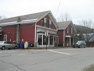
Marion is a neighborhood in the town of Southington, Connecticut, United States. It is generally the area in the vicinity of the intersection of Route 322 and Marion Avenue, just north of the Cheshire town line.

Willington Common Historic District is a historic district that includes the town green, Willington Common, of the town of Willington, Connecticut. The common and the surrounding buildings were listed on the National Register of Historic Places in 1990.

Madison Green is the town green of the New England town of Madison, Connecticut. The green is the centerpiece of the Madison Green Historic District, and is located just west of the commercial strip of Madison on United States Route 1. The green is bounded on the south by US 1, Meeting House Lane on the east and north, and Copse Road on the west. Surrounding the green are several buildings, most prominent being the First Congregational Church. Other buildings around the green include Memorial Hall (1896), a community meeting building, Academy Elementary School (1884), and Lee Academy (1821), as well as many historic houses.

West Haven Green is the town green of the New England town of West Haven, Connecticut. The green is bordered by Church Street on the south, Savin Avenue on the west, Main Street on the north and Campbell Avenue on the east. The green and surrounding buildings are part of the West Haven Green Historic District.
The Bethlehem Green Historic District is a historic district in the center of the town of Bethlehem, Connecticut, listed on the National Register of Historic Places in 1982 for the architectural significance of the houses around the town green. The historic district includes the green and 63 contributing properties over an area of 55 acres (22 ha).

The Woodbridge Green Historic District is a historic district encompassing the historic town center of Woodbridge, Connecticut. It is located in the block bounded on the south by Center Road, on the east by Newton Road, and on the north and west by Meetinghouse Lane. The center is a good example of early 20th-century town planning, with good examples of Colonial and Classical Revival architecture. The district was added to the National Register of Historic Places in 2003.

The Caleb Baldwin Tavern is a historic house at 32 Main Street in the Newtown Borough Historic District in Newtown, Connecticut, built around 1763. The two-and-a-half-story house is considered historically significant for its role in movement of French Army forces under General Rochambeau, as it housed some of the army's officers in June 1781 on their march to the Siege of Yorktown. It is also an example of traditional 18th-century New England architecture and retains some details from that time period. It was listed on the National Register of Historic Places on August 23, 2002.

The Putnam Hill Historic District encompasses a former town center of Greenwich, Connecticut. Located on United States Route 1 between Milbank Avenue and Old Church Road, the district includes the churches of two historic congregations, a former tavern, and a collection of fine mid-Victorian residential architecture. The district was listed on the National Register of Historic Places in 1979.
The Oliver White Tavern is a historic former tavern at 2 Brandy Street in Bolton, Connecticut. Built approximately 1750 as a residence, it is a good example of Georgian architecture. The tavern is historically significant because of its association with the march of Rochambeau's army during the American Revolutionary War, on their way to the Battle of Yorktown. The building, now a private residence, was listed on the National Register of Historic Places in 2002.

Hebron Center Historic District encompasses most of the historic village center of Hebron, Connecticut. Centered on the junction of Connecticut Routes 66 and 85, it has served as the rural community's civic center since its incorporation in 1708. The district was listed on the National Register of Historic Places in 1993.

The Town Center Historic District encompasses the historic village center of South Hampton, New Hampshire. Centered around the Barnard Green, the town common, on New Hampshire Route 107A, it includes architectural reminders of the town's growth and change over time. The district was listed on the National Register of Historic Places in 1983.
The Charlotte Center Historic District encompasses the historic 19th-century town center of Charlotte, Vermont. Settled c. 1790 and developed mainly in the mid-19th century, the village, stretched along Church Hill Road west of Hinesburg Road, retains a well-preserved 19th-century atmosphere of residential, civic, and commercial buildings. The district was listed on the National Register of Historic Places in 1984.


