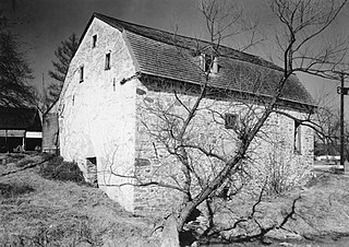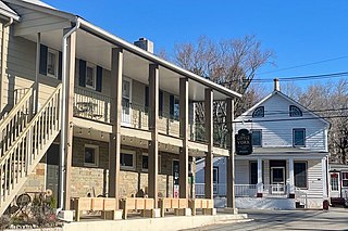
The South Glastonbury Historic District is a historic district in Glastonbury, Connecticut. It encompasses the historic village center of South Glastonbury, which was first settled in the 17th century. The district was listed on the National Register of Historic Places in 1984, and enlarged in 2009 to include properties further along Main Street as far as Chestnut Hill Road. Locals refer to it as SoG.

The Riverview Terrace Historic District is a 15.2-acre (6.2 ha) historic district in Davenport, Iowa, United States, that was listed on the National Register of Historic Places in 1984. It was listed on the Davenport Register of Historic Properties in 1993. The neighborhood was originally named Burrow's Bluff and Lookout Park and contains a three-acre park on a large hill.

The Hamburg Historic District, also known as the Gold Coast, is a residential neighborhood located on a bluff northwest of downtown Davenport, Iowa, United States. It is listed on the National Register of Historic Places in 1983. In 1999, it was listed on the Davenport Register of Historic Properties The historic district is where the city's middle and upper-income German community built their homes in the 19th and early 20th centuries. Germans were the largest ethnic group to settle in Davenport.

The Boyd–Wilson Farm is a 157-acre (64 ha) historic district in Franklin, Tennessee, United States. The circa 1840 farm includes an I-house.

The Oak Hall Historic District is a national historic district that is located in College Township, Centre County, Pennsylvania.

The Kise Mill Bridge Historic District, also known as Mickley's Mill, is a national historic district that is located in Newberry Township in York County, Pennsylvania.

The Jervis Gordon Grist Mill Historic District, also known as the Milford Grist Mill and Rowe's Mill, is an historic grist mill and national historic district that are located in Milford, Pike County, Pennsylvania.

The Mount Pleasant Historic District is a national historic district that is located in Mount Pleasant, Westmoreland County, Pennsylvania.

Dyerstown Historic District is a national historic district located in Dyerstown, Plumstead Township, Bucks County, Pennsylvania. The district includes 17 contributing buildings and 3 contributing structures in the crossroads village of Dyerstown. It is a largely residential district, with dwellings dating to the turn of the 19th century. The most recent dwelling was built about 1870. Some of the houses are reflective of vernacular Georgian style. The district also includes a former grist mill and associated outbuildings. The contributing structures are a stone arch bridge, and head race, dam, and remains of the mill race.

The Roger Hunt Mill is an historic, American grist mill complex that is located in Downingtown, Chester County, Pennsylvania.

Bare House and Mill is a historic home and grist mill ruins located at Stuarts Draft, Augusta County, Virginia. The house was built about 1857, and is a two-story, three bay brick dwelling with Greek Revival and Italianate style design influences. It has a metal-sheathed hipped roof one-story entry porches on the front and rear. Also on the property are a contributing wellhouse and meathouse, barn, privy, cistern, and pumphouse. The ruins of the Bare Mill and related mill race and piers are also located on the property. The two-story, stone grist mill was built about 1800, and may have shut down after the floods of September 1870.

Little York is an unincorporated community located along the border of Alexandria and Holland townships in Hunterdon County, in the U.S. state of New Jersey. Little York is located on County Route 614 3.1 miles (5.0 km) north-northeast of Milford. Little York has a post office with ZIP Code 08834.

Myrick's Mill is a populated place in Twiggs County, Georgia,. Originally known as Big Sandy, for a large creek in the area, the settlement included a post office, churches, sawmills, ice house and J.D. Myrick's grist mill. Residents produced cotton, fruits and vegetables. The site was added to the National Register of Historic Places on December 6, 1975. The settlement was located northeast of Fitzpatrick, Georgia on county road 378.

Headquarters is an unincorporated community located within the Amwell Valley of Delaware Township in Hunterdon County, New Jersey. The settlement is centered around the intersection of Zentek Road and County Route 604. It is about 3 miles (4.8 km) from Ringoes to the east and 1 mile (1.6 km) from Sergeantsville to the west. The Headquarters Historic District was listed on the state and national registers of historic places in 2011 and had its boundary increased in 2016.

The Terrace Mill is a historic watermill in Terrace, Minnesota, United States, now operated as a museum. Managed by the non-profit Terrace Mill Foundation, the mill contains a gallery, theatre, and gift shop, while the grounds host outdoor events. The mill and four associated structures are listed on the National Register of Historic Places as the Terrace Mill Historic District for having local significance in commerce, engineering, industry, and transportation.

Star Milling and Electric Company Historic District, also known as Star Mill Falls and Star Gristmill, is a historic industrial complex and national historic district located in Lima Township, LaGrange County, Indiana. The district encompasses one contributing building, one contributing site, and two contributing structures. They are a small hydroelectric powerhouse (1929), two dams (1929), and the site of the original 1870 grist mill / hydroelectric generating plant. The old mill generated electric power from 1911 to 1929, and in 1930 the new powerhouse began operation.

The Asbury Historic District is a 288-acre (117 ha) historic district encompassing the community of Asbury in Franklin Township of Warren County, New Jersey. It is bounded by County Route 632, County Route 643, Maple Avenue, Kitchen Road, and School Street and extends along the Musconetcong River into Bethlehem Township of Hunterdon County. It was listed on the National Register of Historic Places on March 19, 1993 for its significance in architecture, industry, religion, community development, politics/government, and commerce. The district includes 141 contributing buildings, a contributing structure, two contributing sites, and four contributing objects.

The Imlaydale Historic District is a 32-acre (13 ha) historic district primarily in Washington Township of Warren County, New Jersey. It was added to the National Register of Historic Places on March 27, 1991 for its significance in architecture, community development, industry, politics/government, and transportation. The listing includes 12 contributing buildings, four contributing structures, and two contributing sites.

Ruff's Mill and Concord Covered Bridge is a historical site in Smyrna, Georgia. It was listed on the National Register of Historic Places in 1980.

The Hixson–Skinner Mill Complex, also known as Cole's Grist Mill Complex, encompasses a historic grist mill and two houses located where Still Valley Road crosses the Pohatcong Creek, about one half mile east of Springtown, in Pohatcong Township in Warren County, New Jersey, United States. It was added to the National Register of Historic Places on December 2, 1982, for its significance in commerce and industry. The 2.5-acre (1.0 ha) district includes four contributing buildings and two contributing structures.


