The Arctic Archipelago, also known as the Canadian Arctic Archipelago, is a group of islands north of the Canadian mainland.

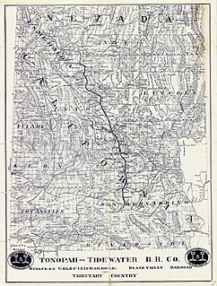
Stovepipe Wells is a small way-station in the northern part of Death Valley, in unincorporated community Inyo County, California.

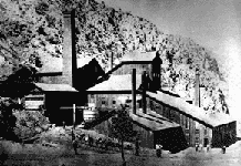
Panamint City is a ghost town in the Panamint Range, near Death Valley, in Inyo County, California, USA. It is also known by the official Board of Geographic Names as Panamint. Panamint was a boom town founded after silver and copper were found there in 1872. By 1874, the town had a population of about 2,000. Its main street was one mile (1.6 km) long. Panamint had its own newspaper, the Panamint News. Silver was the principal product mined in the area. The town is located about three miles northwest of Sentinel Peak. According to the National Geographic Names Database, NAD27 latitude and longitude for the locale are 36°07′06″N117°05′43″W, and the feature ID number is 1661185. The elevation of this location is identified as being 6,280 feet AMSL. The similar-sounding Panamint Springs, California, is located about 25.8 miles at 306.4 degrees off true north near Panamint Junction.

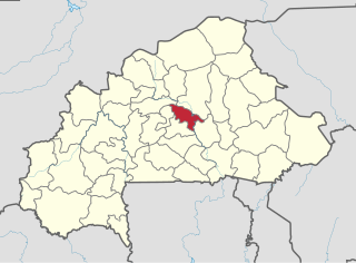
Oubritenga is one of the 45 provinces of Burkina Faso, located in its Plateau-Central Region.
Ezprogui is a town and municipality located in the province and autonomous community of Navarra, northern Spain.

El Espino is a town and municipality in the Colombian Department of Boyacá, part of the subregion of the Gutiérrez Province.
Benedict Glacier is a glacier on central Ellesmere Island, Nunavut, Canada.
Youngou is a town in the Zabré Department of Boulgou Province in south-eastern Burkina Faso. As of 2005, the town has a population of 6,343.
The Chino Fault is a fault that extends along the eastern Chino Hills range region, from Corona in Riverside County to the Los Serranos, Chino Hills area of San Bernardino County in Southern California.

Elk is an unincorporated community in Fresno County, California. It is located on the Atchison, Topeka and Santa Fe Railroad 7.25 miles (12 km) southwest of Piedra, at an elevation of 413 feet.

Gordon is an unincorporated community in Fresno County, California. It is located on the Southern Pacific Railroad 5.25 miles (8 km) north-northwest of Clovis, at an elevation of 394 feet.
Skyes is a former settlement in Inyo County, California. It was located on the Southern Pacific Railroad 6.5 miles (10 km) north-northwest of Little Lake.
Carthage is a former settlement in Inyo County, California.
Cerro Gordo Landing is a former settlement in Inyo County, California. The port for steamboats crossing the lake from Carthago was located on the west shore of the Owens Lake 1 mile (1.6 km) south-southeast of Keeler. It served the Cerro Gordo Mines.
Tule Station is a former settlement in Inyo County, California. It was located on the west shore of the Owens Lake 2 miles (3.2 km) south-southeast of Cerro Gordo Landing.

Daguerre Glacier is a glacier on Kiev Peninsula, Graham Land, which joins with Niepce Glacier and flows into Lauzanne Cove, Flandres Bay. It was shown on an Argentine government chart of 1954, and named by the UK Antarctic Place-Names Committee in 1960 for Louis Daguerre, a French painter and physicist who, with J.N. Niepce, invented the daguerreotype process of photography perfected in 1839.
Illoula Oumalou is a town and commune in Tizi Ouzou Province in northern Algeria.
Navalvillar de Ibor is a municipality located in the province of Cáceres, in the autonomous community of Extremadura, Spain. The municipality covers an area of 54.5 square kilometres (21.0 sq mi) and as of 2011 had a population of 484 people.

Tokat is an electoral district of the Grand National Assembly of Turkey. It elects 5 members of parliament (deputies) to represent the province of the same name for a four-year term by the D'Hondt method, a party-list proportional representation system.


