Britain, Virginia

Last updated

Britain, Virginia
USA Virginia location map.svg
Red pog.svg
Britain
Usa edcp location map.svg
Red pog.svg
Britain
Coordinates: 39°15′10″N77°41′49″W / 39.25278°N 77.69694°W / 39.25278; -77.69694
CountryFlag of the United States.svg  United States
State Flag of Virginia.svg  Virginia
County Flag of Loudoun County, Virginia.svg Loudoun
Time zone UTC−5 (Eastern (EST))
  Summer (DST) UTC−4 (EDT)

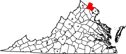
Britain is an unincorporated community village in Loudoun County, Virginia lying along Milltown Creek. It is located on the eastern flanks of Short Hill Mountain along Mountain Road (VA Route 690) at its junction with Britain Road.

History

Originally known as Guinea, the village of Britain—named after Michigan senator Calvin Britain—became the place of settlement for a free African American community in the mid 19th century. Mount Sinai Free Baptist Church was built here in 1880 and served as a school for the community until 1915. Unlike most of the black settlements in Loudoun County, Britain had a post office in operation. Its African American residents began to move elsewhere in the early 19th century with the last black families leaving Britain in the 1920s.


Related Research Articles

<span class="mw-page-title-main">Loudoun County, Virginia</span> County in Virginia, United States

Loudoun County is in the northern part of the Commonwealth of Virginia in the United States. In 2020, the census returned a population of 420,959, making it Virginia's third-most populous county. Loudoun County's seat is Leesburg. Loudoun County is part of the Washington–Arlington–Alexandria, DC–VA–MD–WV Metropolitan Statistical Area. As of 2020, Loudoun County had a median household income of $147,111. Since 2008, the county has been ranked first in the U.S. in median household income among jurisdictions with a population of 65,000 or more.

<span class="mw-page-title-main">Monroe County, Tennessee</span> County in Tennessee, United States

<span class="mw-page-title-main">Loudon County, Tennessee</span> County in Tennessee, United States

Loudon County is a county in the U.S. state of Tennessee. It is located in the central part of East Tennessee. As of the 2020 census, the population was 54,886. Its county seat is Loudon. Loudon County is included in the Knoxville, TN Metropolitan Statistical Area.

<span class="mw-page-title-main">Leesburg, Virginia</span> Town in Virginia, United States

Leesburg is a town in and the county seat of Loudoun County, Virginia, United States. Settlement in the area began around 1740, which is named for the Lee family, early leaders of the town. Located in the far northeast of the state, in the War of 1812 it was a refuge for important federal documents evacuated from Washington, DC, and in the Civil War, it changed hands several times.

<span class="mw-page-title-main">Vonore, Tennessee</span> Town in Tennessee, United States

Vonore is a town in Monroe County, Tennessee, which is located on the southeast border of the state. The population was 1,574 as of the 2020 census. The city hall, library, community center, police department, and fire department are located on Church Street.

<span class="mw-page-title-main">Point of Rocks, Maryland</span> Census-designated place in Maryland, United States

Point of Rocks is an unincorporated community and census-designated place (CDP) in Frederick County, Maryland. As of the 2010 census, it had a population of 1,466.

<span class="mw-page-title-main">Shelburne, Nova Scotia</span> Town in Nova Scotia, Canada

Shelburne is a town located in southwestern Nova Scotia, Canada.

The Cherokee Path was the primary route of English and Scots traders from Charleston to Columbia, South Carolina in Colonial America. It was the way they reached Cherokee towns and territories along the upper Keowee River and its tributaries. In its lower section it was known as the Savannah River. They referred to these towns along the Keowee and Tugaloo rivers as the Lower Towns, in contrast to the Middle Towns in Western North Carolina and the Overhill Towns in present-day southeastern Tennessee west of the Appalachian Mountains.

<span class="mw-page-title-main">Waterford, Virginia</span> Unincorporated community in Virginia, United States

Waterford is an unincorporated village and census-designated place (CDP) in the Catoctin Valley of Loudoun County, Virginia, located along Catoctin Creek. Waterford is 47 miles (76 km) northwest of Washington, D.C., and 7 miles (11 km) northwest of Leesburg. The entire village and surrounding countryside is a National Historic Landmark District, noted for its well-preserved 18th and 19th-century character.

Philomont is an unincorporated community in western Loudoun County, Virginia. The name is derived from the Greek word philo meaning "beloved" and the French word mont or "mountain"; Philomont means "beloved mountain."

<span class="mw-page-title-main">Lucketts, Virginia</span> Unincorporated community in Virginia, United States

Lucketts is an unincorporated historic hamlet in Loudoun County, Virginia, along U.S. Route 15 north of Leesburg. It was originally known as "Black Swamp" due to the large number of black oak trees growing in the area at the time of its settlement. From the late 18th century until the mid-19th century, it was known as "Goresville" after the name of prominent local landowner, Thomas Gore. The name was finally changed to "Lucketts" in 1865. The town's Lucketts School is listed on the National Register of Historic Places.

<span class="mw-page-title-main">U.S. Route 50 in Virginia</span>

U.S. Route 50 is a transcontinental highway which stretches from Ocean City, Maryland to West Sacramento, California. In the U.S. state of Virginia, US 50 extends 86 miles (138 km) from the border with Washington, D.C. at a Potomac River crossing at Rosslyn in Arlington County to the West Virginia state line near Gore in Frederick County.

<span class="mw-page-title-main">Southwest Philadelphia</span> Neighborhood of Philadelphia in Philadelphia, Pennsylvania

Southwest Philadelphia is a section of Philadelphia, Pennsylvania, United States. The section can be described as extending from the western side of the Schuylkill River to the city line, with the SEPTA. The northern border is defined by the Philadelphia City Planning Commission as east from the city line along Baltimore Avenue moving south along 51st Street to Springfield Ave. It follows the train tracks until 49th Street. From 49th and Kingsessing Ave the line moves east along Kingsessing Ave. The line then moves south along 46th St to Paschall Ave where it jogs to join Grays Ferry where the line runs to the Schuylkill River.

Neersville is an unincorporated community in northwestern Loudoun County, Virginia, United States. It is located in the Between the Hills area of the Loudoun Valley on Harpers Ferry Road at the foot of Short Hill Mountain. It is notable for being the birthplace of Confederate guerrilla John Mobberly.

<span class="mw-page-title-main">Lakeview, Illinois</span> Unincorporated community in Illinois, United States

Lakeview is an unincorporated predominantly African American community in the Carrier Mills township, Saline County, Illinois, United States. Lakeview was originally called "The Pond Settlement." It was named after the Cypress swampland and wetlands that surrounds the area of Carrier Mills. It is one of the oldest settlements in Illinois, and holds the oldest predominantly African American cemetery in Illinois. Similar to the Maroon Communities in Louisiana, it is the oldest community in Illinois founded by runaway slaves. The community is drained by the Saline River

<span class="mw-page-title-main">Overhill Cherokee</span> 18th century Cherokee people who lived on the west side of the Appalachian Mountains

Overhill Cherokee was the term for the Cherokee people located in their historic settlements in what is now the U.S. state of Tennessee in the Southeastern United States, on the western side of the Appalachian Mountains. This name was used by 18th-century European traders and explorers from British colonies along the Atlantic coast, as they had to cross the mountains to reach these settlements.

<span class="mw-page-title-main">Timbuctoo, New Jersey</span> Populated place in Burlington County, New Jersey, US

Timbuctoo is an unincorporated community in Westampton Township, Burlington County, New Jersey. Located along the Rancocas Creek, Timbuctoo was settled by formerly enslaved and free Black people, beginning in 1826. It includes Church St., Blue Jay Hill Road, and adjacent areas. At its peak in the mid-nineteenth century, Timbuctoo had more than 125 residents, a school, an AME Zion Church, and a cemetery. The key remaining evidence of this community is the cemetery on Church Street, which was formerly the site of Zion Wesleyan Methodist Episcopal African Church. Some current residents are descendants of early settlers.

The Carolina Road or the "Old Carolina Road" are names for various sections of the Great Wagon Road and other routes in colonial America. "The 'Old Carolina Road', extending from Lancaster, Pennsylvania to the Yadkin Valley, was one of the most heavily traveled roads in eighteenth century America." Parts of the 180-mile-long (290 km) Journey Through Hallowed Ground National Heritage Area scenic byway follow the Old Carolina Road through Pennsylvania, Maryland and Virginia.

<span class="mw-page-title-main">Yarrowsburg, Maryland</span> Census-designated place in Maryland, United States

Yarrowsburg is an unincorporated community and census-designated place in Washington County, Maryland, United States. Its population was 133 as of the 2010 census.

The African-American diaspora refers to communities of people outside of the United States who are descended from people of African descent who were enslaved in the United States or its preceding European colonies along the east coast of North America.