Willard, Virginia

Last updated
Willard, Virginia
Map of Willard, Virginia.jpg
Willard c. 1958 atop footprint of current runways and taxiways
USA Virginia Northern location map.svg
Red pog.svg
Willard, Virginia
Location within the Commonwealth of Virginia
USA Virginia location map.svg
Red pog.svg
Willard, Virginia
Willard, Virginia (Virginia)
Usa edcp location map.svg
Red pog.svg
Willard, Virginia
Willard, Virginia (the United States)
Coordinates: 38°56′25″N77°27′2″W / 38.94028°N 77.45056°W / 38.94028; -77.45056
Country Flag of the United States.svg  United States of America
State Flag of Virginia.svg  Virginia
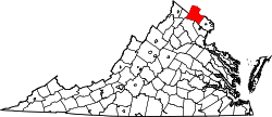
County Flag of Loudoun County, Virginia.svg Loudoun
Time zone UTC-5 (Eastern (EST))
  Summer (DST) UTC-4 (EDT)

Willard (also known as Willard Crossroads) was an unincorporated community located in what is now a part of Washington Dulles International Airport in the U.S. state of Virginia.

The village was named after Joseph Edward Willard, a delegate to the Virginia General Assembly from 1893 to 1901, then Lieutenant Governor of Virginia. Although Willard lived in Loudoun County, he represented Fairfax County, because the village was only 1,500 feet (460 meters) from the county border. Willard owned a 50-acre (20-hectare) estate in Fairfax. His father was Joseph Clapp Willard, the owner of the famed Willard Hotel in Washington, D.C.

Willard was at the intersection of Willard Road (now Stonecroft Boulevard) and the old Sterling Road. Willard was surrounded by extensive farmland, housing, schools, places of worship, the Willard store (until 1907), and Blue Ridge Airfield (1938–1951). Willard stood west of Floris, north of Pleasant Valley, and south of Farmwell (now Ashburn). Willard was regarded as a crossroads and a distinctive community until construction of Washington Dulles International Airport began in 1958.

Approximately 26 square miles (67 square kilometers) of Virginia land from Willard, Chantilly, Pleasant Valley, Sterling, and Ashburn was bought for construction. By the airport's completion, all remains of civilization before 1958 on this land had virtually disappeared, except a stretch of Willard Rd (used as a service road), and three storage outbuildings between Runways 1C/19C and 1R/19L.


Related Research Articles

<span class="mw-page-title-main">Loudoun County, Virginia</span> County in Virginia, United States

Loudoun County is in the northern part of the Commonwealth of Virginia in the United States. In 2020, the census returned a population of 420,959, making it Virginia's third-most populous county. Loudoun County's seat is Leesburg. Loudoun County is part of the Washington–Arlington–Alexandria, DC–VA–MD–WV Metropolitan Statistical Area. As of 2020, Loudoun County had a median household income of $147,111. Since 2008, the county has been ranked first in the U.S. in median household income among jurisdictions with a population of 65,000 or more.

<span class="mw-page-title-main">Chantilly, Virginia</span> CDP in Virginia, United States

Chantilly is a census-designated place (CDP) in western Fairfax County, Virginia. The population was 24,301 as of the 2020 census. Chantilly is named after an early-19th-century mansion and farm, which in turn took the name of an 18th-century plantation that was located in Westmoreland County, Virginia. The name "Chantilly" originated in France with the Château de Chantilly, about 28 miles north of Paris.

<span class="mw-page-title-main">Sterling, Virginia</span> Census-designated place in Virginia

Sterling, Virginia, refers most specifically to a census-designated place (CDP) in Loudoun County, Virginia, United States. The population of the CDP as of the 2020 United States Census was 30,337 The CDP boundaries are confined to a relatively small area between Virginia State Route 28 on the west and Virginia State Route 7 on the northeast, excluding areas near SR 606 and the Dulles Town Center.

<span class="mw-page-title-main">Ashburn, Virginia</span> Census-designated place in Virginia, United States

Ashburn is a rapidly growing census-designated place (CDP) in Loudoun County, Virginia, United States. At the 2010 United States census, its population was 43,511, up from 3,393 in 1990. It is 30 miles (48 km) northwest of Washington, D.C., and part of the Washington metropolitan area.

<span class="mw-page-title-main">South Riding, Virginia</span> Census-designated place in Virginia

South Riding is a census-designated place and planned community in Loudoun County, Virginia, United States. The South Riding homeowner association was founded in January 1995 to provide services to the community. Neighboring U.S. Route 50 and State Route 28 provide access to the Dulles/Reston/Tysons Corner technology corridor and other major employment centers in Northern Virginia and Washington, D.C.

<span class="mw-page-title-main">Brambleton, Virginia</span> Census-designated place in Virginia

Brambleton is a census-designated place (CDP) in Loudoun County, Virginia, United States, south of the Dulles Greenway. The population as of the 2010 United States Census was 9,845. In 2017, Brambleton had an estimated population of 19,900, with a median age of 34.3 and a median household income of $173,690. Between 2016 and 2017 the population of Brambleton, VA grew from 17,063 to 19,876, a 16.5% increase and its median household income grew from $164,321 to $173,690, a 5.7% increase. Construction started on the Brambleton community in 2001.

<span class="mw-page-title-main">Virginia State Route 28</span> State highway in Virginia, United States

State Route 28 in the U.S. state of Virginia is a primary state highway that traverses the counties of Loudoun, Fairfax, Prince William, and Fauquier in the U.S. state of Virginia. The route serves as a major artery in the Northern Virginia region, with it being an important two-lane highway in rural Fauquier and Prince William Counties, the main thoroughfare through Manassas and Manassas Park, and a high-capacity freeway through Fairfax and Loudoun Counties.

<span class="mw-page-title-main">Loudoun County Public Schools</span> Public school division serving Loudoun County, Virginia, United States

Loudoun County Public Schools (LCPS) is a branch of the Loudoun County, Virginia, United States government, and administers public schools in the county. LCPS's headquarters is located at 21000 Education Court in Ashburn, an unincorporated section of the county.

The 4A Dulles District is a high school conference in the state of Virginia that includes schools from Northern Virginia, with all of its full-time members from Loudoun County. 4A is the third largest enrollment class of the Virginia High School League and is typically very competitive in Virginia high school sports.

<span class="mw-page-title-main">U.S. Route 50 in Virginia</span> Segment of American highway

U.S. Route 50 is a transcontinental highway which stretches from Ocean City, Maryland to West Sacramento, California. In the U.S. state of Virginia, US 50 extends 86 miles (138 km) from the border with Washington, D.C. at a Potomac River crossing at Rosslyn in Arlington County to the West Virginia state line near Gore in Frederick County.

<span class="mw-page-title-main">Broadlands, Virginia</span> Census-designated place in Virginia

Broadlands is a census-designated place (CDP) in Loudoun County, Virginia, United States. It is a 1,500-acre (610 ha) master-planned community started and developed by Van Metre Homes in the 1990s. It is built on wetlands and is certified as a Community Wildlife Habitat by the National Wildlife Federation.

<span class="mw-page-title-main">Dulles Technology Corridor</span> US business cluster of defense and technology companies

The Dulles Technology Corridor is a business cluster containing many defense and technology companies, located in Northern Virginia near Washington Dulles International Airport. The area was called "The Silicon Valley of the East" by Atlantic magazine. It was dubbed the "Netplex" in a 1993 article by Fortune magazine. Another article in 2000 claimed that the area contained "vital electronic pathways that carry more than half of all traffic on the Internet. The region is home to more telecom and satellite companies than any other place on earth."

<span class="mw-page-title-main">Loudoun County Transit</span> Loudoun County, Virginia public bus service

Loudoun County Transit is a public-transportation service provided by the Loudoun County, Virginia government. Loudoun County Transit provides fixed routes and on-demand/paratransit bus service.

<span class="mw-page-title-main">Virginia State Route 606 (Fairfax and Loudoun Counties)</span> State highway in Virginia, United States

State Route 606 in Fairfax and Loudoun Counties, Virginia is a secondary state highway traversing the communities of Reston, Herndon, Sterling, Arcola, and South Riding. The road is important not only because it is an inter-county connector, but it goes around the back of Dulles Airport, is part of the Loudoun County Parkway, and it provides a shortcut between the Reston / Herndon area and U.S. Route 50. Although the Herndon streets are not technically part of SR 606, they are signed as SR 606, and they connect to streets that are part of SR 606, thus providing a continuous route.

<span class="mw-page-title-main">Dulles Town Center, Virginia</span> Census-designated place in Virginia

Dulles Town Center is a census-designated place (CDP) in Loudoun County, Virginia, United States. It is located about 7 miles (11 km) north of Washington Dulles International Airport. The CDP is the location of the Dulles Town Center shopping mall, for which it is named. The United States Postal Service considers Dulles Town Center to be a subsection of Dulles, which is itself a subsection of Sterling; none of these locations is an incorporated municipality.

Sugarland Run is a planned community and census-designated place in Loudoun County, Virginia, United States. The population at the 2010 census was 11,799. In 2020, it was estimated to be 12,956. Sugarland Run is part of the Washington metropolitan area and is 26 miles (42 km) by road northwest of Washington, D.C.

<span class="mw-page-title-main">National Weather Service Baltimore/Washington</span>

The National Weather Service Baltimore/Washington is a local office of the National Weather Service responsible for monitoring weather conditions in 44 counties in eastern West Virginia, northern and central Virginia, the majority of the state of Maryland, as well as the city of Washington, D.C. Although labeled as the NWS Baltimore/Washington, its actual location is off Old Ox Road in the Dulles section of Sterling, Virginia, adjacent to Washington Dulles International Airport.

The Potomac District is a high school conference in the United States Virginia High School League that is made up of mostly schools from Loudoun County that have a high enrollment capacity.

Goose Creek Village is a census-designated place (CDP) in Loudoun County, Virginia, United States. It was first drawn as a CDP prior to the 2020 census.