Little Washington, Virginia

Last updated

Little Washington, Virginia
USA Virginia Northern location map.svg
Red pog.svg
Little Washington
USA Virginia location map.svg
Red pog.svg
Little Washington
Usa edcp location map.svg
Red pog.svg
Little Washington
Coordinates: 39°2′25″N77°35′42″W / 39.04028°N 77.59500°W / 39.04028; -77.59500
CountryUnited States
State Virginia
County Loudoun
Time zone UTC−5 (Eastern (EST))
  Summer (DST) UTC−4 (EDT)
GNIS feature ID1749628 [1]

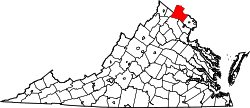
Little Washington is a now mostly uninhabited African American village in Loudoun County, Virginia, United States. [1]

Contents

Geography

It is located south of Gleedsville off The Woods Road. Little Washington lies on a hill overlooking Gleedsville Cemetery where the community once consisted of several homes belonging to the Washington family.

Education

Little Washington was served by the Mountain Gap Colored School, which remained standing until the 1980s, when it burned down.

Related Research Articles

<span class="mw-page-title-main">George Washington</span> Founding Father, 1st president of the United States

George Washington was an American military officer, statesman, and Founding Father who served as the first president of the United States from 1789 to 1797. Appointed by the Second Continental Congress as commander of the Continental Army in June 1775, Washington led Patriot forces to victory in the American Revolutionary War and then served as president of the Constitutional Convention in 1787, which drafted and ratified the Constitution of the United States and established the American federal government. Washington has thus been called the "Father of his Country".

<span class="mw-page-title-main">Potomac River</span> River in the Mid-Atlantic United States

The Potomac River is a major river in the Mid-Atlantic region of the United States that flows from the Potomac Highlands in West Virginia to the Chesapeake Bay in Maryland. It is 405 miles (652 km) long, with a drainage area of 14,700 square miles (38,000 km2), and is the fourth-largest river along the East Coast of the United States and the 21st-largest in the United States. Over 5 million people live within its watershed.

<span class="mw-page-title-main">East Coast of the United States</span> Atlantic coastal region of the United States

The East Coast of the United States, also known as the Eastern Seaboard, the Atlantic Coast, and the Atlantic Seaboard, is the region encompassing the coastline where the Eastern United States meets the Atlantic Ocean.

<span class="mw-page-title-main">Loudoun County, Virginia</span> County in Virginia, United States

Loudoun County is in the northern part of the Commonwealth of Virginia in the United States. In 2020, the census returned a population of 420,959, making it Virginia's third-most populous county. Loudoun County's seat is Leesburg. Loudoun County is part of the Washington–Arlington–Alexandria, DC–VA–MD–WV Metropolitan Statistical Area. As of 2020, Loudoun County had a median household income of $147,111. Since 2008, the county has been ranked first in the U.S. in median household income among jurisdictions with a population of 65,000 or more.

<span class="mw-page-title-main">Arlington County, Virginia</span> County in Virginia, United States

Arlington County is a county in the U.S. state of Virginia. The county is located in Northern Virginia on the southwestern bank of the Potomac River directly across from Washington, D.C. The county is coextensive with the U.S. Census Bureau's census-designated place of Arlington. Arlington County is the second-largest city in the Washington metropolitan area, although it does not have the legal designation of an independent city or incorporated town under Virginia state law.

<span class="mw-page-title-main">Washington, D.C.</span> Capital city of the United States

Washington, D.C., formally the District of Columbia and commonly called Washington or D.C., is the capital city of the United States. The city is located on the east bank of the Potomac River, which forms its southwestern border with Virginia and borders Maryland to its north and east. The city was named for George Washington, a Founding Father, victorious commanding general of the Continental Army in the American Revolutionary War and the first president of the United States who is sometimes referred to as "Father of his country". The district is named for Columbia, the female personification of the nation.

<span class="mw-page-title-main">Annandale, Virginia</span> Census-designated place in Virginia, US

Annandale is a census-designated place (CDP) in Fairfax County, Virginia. The population of the CDP was 43,363 as of the 2020 United States Census. It is home to the oldest and largest branch of the Northern Virginia Community College system, and to one of the D.C. area's Koreatowns.

<span class="mw-page-title-main">McLean, Virginia</span> Census-designated place and unincorporated community in Virginia, United States

McLean is an unincorporated community and census-designated place (CDP) in Fairfax County, Virginia, United States. McLean is home to many diplomats, military, members of Congress, and high-ranking government officials partially due to its proximity to Washington, D.C., the Pentagon and the Central Intelligence Agency. It is the location of Hickory Hill, the former home of Ethel Kennedy, the widow of Robert F. Kennedy. It is also the location of Salona, the former home of Light-Horse Harry Lee, the Revolutionary War hero.

<span class="mw-page-title-main">Mount Vernon, Virginia</span> Census-designated place in Virginia, United States

Mount Vernon is a census-designated place (CDP) and unincorporated community in Fairfax County, Virginia, United States. The population was 12,416 at the 2010 census. Primarily due to its historical significance and natural recreation and beauty, the Mount Vernon area receives over one million tourists each year.

<span class="mw-page-title-main">Mount Vernon</span> Plantation estate of George Washington, in Fairfax County, Virginia, US

Mount Vernon is an American landmark and former plantation of Founding Father, commander of the Continental Army in the Revolutionary War, and the first president of the United States George Washington and his wife, Martha. The estate is on the banks of the Potomac River in Fairfax County, Virginia. It is located south of Washington, D.C., and Alexandria, Virginia, and is across the river from Prince George's County, Maryland.

<span class="mw-page-title-main">United States Navy Judge Advocate General's Corps</span> Military unit

The Judge Advocate General's Corps, also known as the "JAG Corps" or "JAG", is the legal arm of the United States Navy. Today, the corps consists of a worldwide organization of more than 730 commissioned officers serving as judge advocates, 30 limited duty officers (law), 500 enlisted members and nearly 275 civilian personnel, all serving under the direction of the Judge Advocate General of the Navy.

<span class="mw-page-title-main">George Washington and Jefferson National Forests</span> Pair of National Forests in the United States

The George Washington and Jefferson National Forests is an administrative entity combining two U.S. National Forests into one of the largest areas of public land in the Eastern United States. The forests cover 1.8 million acres (2,800 sq mi) of land in the Appalachian Mountains of Virginia, West Virginia, and Kentucky. Approximately 1 million acres (1,600 sq mi) of the forest are remote and undeveloped and 139,461 acres (218 sq mi) have been designated as wilderness areas, which prohibits future development.

<span class="mw-page-title-main">Washington metropolitan area</span> Metropolitan area in the United States

The Washington metropolitan area, also sometimes referred to as the National Capital Region or colloquially as the DMV, is the metropolitan area containing Washington, D.C., the federal capital of the United States. The metropolitan area includes all of Washington, D.C. and parts of Maryland, Virginia, and West Virginia. It is part of the larger Washington–Baltimore combined statistical area.

<span class="mw-page-title-main">Augustine Washington</span> American planter and merchant (1694–1743)

Augustine Washington Sr. was an American planter and merchant. He was the father of the first president of the United States, George Washington. Born into the planter class of the British colony of Virginia, Washington owned several slave plantations, from which he derived the primary source of his wealth. He also speculated in land development and owned an iron mine. Although Washington never sat in the House of Burgesses, unlike his father and son, he served in various government positions in the counties where he owned land.

<span class="mw-page-title-main">Gleedsville, Virginia</span> Unincorporated community in Virginia, United States

Gleedsville is an unincorporated village in Loudoun County, Virginia. Gleedsville lies south of Leesburg on Gleedsville Road. According to the Geographic Names Information System, the village has also been known as Leedsville.

<span class="mw-page-title-main">Mount Rogers National Recreation Area</span>

Mount Rogers National Recreation Area is a United States national recreation area (NRA) in southwestern Virginia near the border with Tennessee and North Carolina. It centerpiece is the Lewis Fork Wilderness containing Mount Rogers, the highest point in the state of Virginia with a summit elevation of 5,729 feet. The recreation area is under the jurisdiction of the George Washington and Jefferson National Forests. The recreation area was established by an act of the United States Congress on May 31, 1966.

<span class="mw-page-title-main">Mount Vernon Conference</span> Meeting of Virginia and Maryland delegates, March 21–28, 1785

The Mount Vernon Conference was a meeting of delegates from Virginia and Maryland held March 21–28, 1785, to discuss navigational rights in the states' common waterways. On March 28, 1785, the group drew up a thirteen-point proposal to govern the rights of both states on the Potomac River, Pocomoke River, and Chesapeake Bay. Known as the Mount Vernon Compact and formally titled as the Compact of 1785, this agreement not only covered tidewater navigation but also extended to issues such as toll duties, commerce regulations, fishing rights, and debt collection. Ratified by the legislature of both states, the compact helped set a precedent for later meetings between states for discussions into areas of mutual concern.

<span class="mw-page-title-main">Washington District, Jackson County, West Virginia</span> Magisterial district in West Virginia, United States

Washington District, formerly Washington Magisterial District, is one of five historic magisterial districts in Jackson County, West Virginia, United States. The district was originally established as one of five civil townships in Jackson County after West Virginia became a state in 1863; in 1872, all of West Virginia's townships were converted into magisterial districts. When Jackson County was redistricted in the 1990s, Washington District was combined with the eastern portion of Ripley District, including the city of Ripley, to form the new Eastern Magisterial District. However, the county's historic magisterial districts continue to exist in the form of tax districts, serving all of their former administrative functions except for the election of county officials.

<span class="mw-page-title-main">Northern District, Jackson County, West Virginia</span> Magisterial district in West Virginia, United States

The Northern Magisterial District is one of three magisterial districts in Jackson County, West Virginia, United States. It was established during a process of redistricting undertaken in the 1990s. In 2010, 8,753 people lived in the district.

References

  1. 1 2 "Little Washington, Virginia". Geographic Names Information System . United States Geological Survey, United States Department of the Interior.