Lenah, Virginia

Last updated

Lenah, Virginia
USA Virginia Northern location map.svg
Red pog.svg
Lenah
USA Virginia location map.svg
Red pog.svg
Lenah
Usa edcp location map.svg
Red pog.svg
Lenah
Coordinates: 38°57′10″N77°34′49″W / 38.95278°N 77.58028°W / 38.95278; -77.58028
CountryFlag of the United States.svg  United States
State Flag of Virginia.svg  Virginia
County Flag of Loudoun County, Virginia.svg Loudoun
Time zone UTC−5 (Eastern (EST))
  Summer (DST) UTC−4 (EDT)
ZIP code
20105 (Aldie)

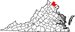
Lenah is an unincorporated community located in the Aldie ZIP code area on U.S. Route 50 in Loudoun County, Virginia. It lies at the crossroads of U.S. Route 50 and Lenah Road.


Related Research Articles

<span class="mw-page-title-main">Interstate 64</span> East–west Interstate in eastern US

Interstate 64 (I-64) is an east–west Interstate Highway in the Eastern United States. Its western terminus is at I-70, US Route 40 (US 40), and US 61 in Wentzville, Missouri. Its eastern terminus is at an interchange with I-264 and I-664 at Bower's Hill in Chesapeake, Virginia. I-64 connects the major metropolitan areas of St. Louis, Missouri; Louisville and Lexington in Kentucky; Charleston, West Virginia; and Richmond and Hampton Roads in Virginia.

<span class="mw-page-title-main">Capon Bridge, West Virginia</span> Town in West Virginia, United States

Capon Bridge is a town in eastern Hampshire County, West Virginia, United States, along the Northwestern Turnpike, approximately 20 miles (32 km) west of Winchester, Virginia. The population was 418 at the 2020 census. Originally known as "Glencoe", Capon Bridge was incorporated in 1902 by the Hampshire County Circuit Court. It is named because of the construction of the bridge over the Cacapon River at that place, the name of the river being derived from the Shawnee Cape-cape-de-hon, meaning "river of medicine water".

<span class="mw-page-title-main">U.S. Route 50</span> Highway in the United States

U.S. Route 50 or U.S. Highway 50 (US 50) is a major east–west route of the U.S. Highway system, stretching 3,019 miles (4,859 km) from Interstate 80 (I-80) in West Sacramento, California, to Maryland Route 528 in Ocean City, Maryland, on the Atlantic Ocean. Until 1972, when it was replaced by Interstate Highways west of the Sacramento area, it extended to San Francisco, near the Pacific Ocean. The Interstates were constructed later and are mostly separate from this route. It generally serves a corridor south of I-70 and I-80 and north of I-64 and I-40.

<span class="mw-page-title-main">Lenah Higbee</span> United States Navy nurse (1874–1941)

Lenah H. Sutcliffe Higbee was a pioneering Canadian-born United States Navy military nurse, who served as Superintendent of the U.S. Navy Nurse Corps during World War I. She is best known for the first woman to be awarded the Navy Cross., and was also the first woman to have a U.S. Navy Warship named for her

<span class="mw-page-title-main">U.S. Route 13</span> Highway in the United States

U.S. Route 13 or U.S. Highway 13 (US 13) is a north–south United States Numbered Highway established in 1926 that runs for 518 miles (834 km) from Interstate 95 (I-95) just north of Fayetteville, North Carolina, to US 1 in the northeastern suburbs of Philadelphia, Pennsylvania, near Morrisville. In all, it traverses five states in the Atlantic coastal plain region. It follows the Atlantic coast more closely than does the main north–south U.S. Highway of the region, US 1. Due to this, its number is out of place on the general U.S. Highway numbering grid, as it should be running west of US 11 but does not. Its routing is largely rural, the notable exceptions being the Hampton Roads area in Virginia and the northern end of the highway in Delaware and Pennsylvania. It is also notable for being the main thoroughfare for the Delmarva Peninsula and carrying the Chesapeake Bay Bridge–Tunnel to it in Virginia.

<span class="mw-page-title-main">U.S. Route 211</span>

U.S. Route 211 is a spur of US 11 in the U.S. state of Virginia. Known for most of its length as Lee Highway, the U.S. Highway runs 59.09 miles (95.10 km) from Interstate 81 (I-81) and Virginia State Route 211 in New Market east to US 15 Business, US 29 Business, and US 211 Business in Warrenton. US 211 connects the Shenandoah Valley with the Piedmont town of Warrenton via Luray and Sperryville, where the highway runs concurrently with US 340 and US 522, respectively.

<span class="mw-page-title-main">U.S. Route 219</span>

U.S. Route 219 is a spur of US 19. It runs for 535 miles (861 km) from West Seneca, New York, at an interchange with Interstate 90 (I-90) to Rich Creek, Virginia, intersecting at US 460. US 219 is found in New York, Pennsylvania, Maryland, West Virginia, and Virginia. Much of the Route in West Virginia follows the old Indian warpath known as the Seneca Trail.

<span class="mw-page-title-main">U.S. Route 250</span> Highway in the United States

U.S. Route 250 is a route of the United States Numbered Highway System, and is a spur of U.S. Route 50. It currently runs for 514 miles (827 km) from Richmond, Virginia to Sandusky, Ohio. It passes through the states of Virginia, West Virginia, and Ohio. It goes through the cities of Richmond, Charlottesville, Staunton, and Waynesboro, Virginia; and Wheeling, West Virginia. West of Pruntytown, West Virginia, US 250 intersects and forms a short overlap with its parent US 50.

<span class="mw-page-title-main">Shanks, West Virginia</span> Unincorporated community in West Virginia, United States

Shanks is an unincorporated community in Hampshire County in the U.S. state of West Virginia. According to the 2000 census, the Shanks community has a population of 806.

Loom is an unincorporated community in Hampshire County, West Virginia, United States. Loom is located between Capon Bridge and Hanging Rock along the Northwestern Turnpike on the western flanks of Cooper Mountain. Timber Mountain Road and Beck's Gap Road converge at Loom on U.S. Route 50.

<span class="mw-page-title-main">Mill Creek (South Branch Potomac River tributary)</span>

Mill Creek is a 14.0-mile-long (22.5 km) tributary stream of the South Branch Potomac River, belonging to the Potomac River and Chesapeake Bay watersheds. The stream is located in Hampshire County in West Virginia's Eastern Panhandle. Mill Creek flows into the South Branch west of Romney Bridge near Vanderlip along the Northwestern Turnpike.

<span class="mw-page-title-main">U.S. Route 50 in West Virginia</span>

U.S. Route 50 in West Virginia runs from the border with Ohio to Virginia, passing briefly through Garrett County, Maryland, and following the Northwestern Turnpike. Prior to the U.S. Highway System it was West Virginia Route 1 and in the 1930s, the road was not finished in Maryland. Today the section of US 50 from Clarksburg to Parkersburg on the Ohio River is part of Corridor D of the Appalachian Development Highway System.

Stone Ridge is a census-designated place in Loudoun County, Virginia, United States. Residences use Aldie mailing addresses, and it is near Washington Dulles International Airport. The population as of the 2020 census was 15,039. Stone Ridge is a Van Metre Homes planned, mixed-use community.

<span class="mw-page-title-main">U.S. Route 50 in Virginia</span>

U.S. Route 50 is a transcontinental highway which stretches from Ocean City, Maryland to West Sacramento, California. In the U.S. state of Virginia, US 50 extends 86 miles (138 km) from the border with Washington, D.C. at a Potomac River crossing at Rosslyn in Arlington County to the West Virginia state line near Gore in Frederick County.

Gilberts Corner is an unincorporated area at the intersection of U.S. Route 50 and U.S. Route 15 in Loudoun County, Virginia, located east of the historic village of Aldie.

<span class="mw-page-title-main">U.S. Route 250 in West Virginia</span> Section of U.S. Highway in West Virginia

U.S. Route 250 (US 250) is a United States Numbered Highway that runs from Sandusky, Ohio, to Richmond, Virginia. Within the state of West Virginia, the route runs from the Ohio border in Wheeling to the Virginia border near Thornwood.

USS <i>Lenah Sutcliffe Higbee</i> US Navy guided-missile destroyer

USS Lenah Sutcliffe Higbee (DDG-123) is a United States Navy Arleigh Burke-class Flight IIA guided missile destroyer, the 73rd overall for the class. She is named for Chief Nurse Lenah H. Sutcliffe Higbee (1874–1941), a pioneering Navy nurse who served as Superintendent of the U.S. Navy Nurse Corps during World War I.

Lenah may refer to: