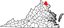
Mountville, Virginia | |
---|---|
Coordinates: 39°01′31″N77°42′43″W / 39.02528°N 77.71194°W | |
Country | United States |
State | Virginia |
County | Loudoun |
Time zone | UTC−5 (Eastern (EST)) |
• Summer (DST) | UTC−4 (EDT) |
Mountville is an unincorporated community in the Loudoun Valley of Loudoun County, Virginia. The village is situated on Snickersville Turnpike halfway between Aldie and Philomont at the intersection of Mountville Road.
Mountville is located on a promontory between the main branch of the Goose Creek and its tributary, Beaverdam Creek, at the western base of Catoctin Mountain.
Despite its geographic location, Mountville is named not for its elevation but rather for Ezekiel Mount, [1] who first settled the area in 1797, after moving to Loudoun from Mountville, Pennsylvania. The village was officially christened Mountville in 1817 with the establishment of a post office in the village bearing that name.[ citation needed ]
Mountville was the scene of early skirmishing during the American Civil War's Battle of Unison.
Hamilton is a town in the Loudoun Valley of Loudoun County, Virginia, United States. The population was 506 as of the 2010 census.
The Battle of Aldie took place on June 17, 1863, in Loudoun County, Virginia, as part of the Gettysburg Campaign of the American Civil War.
The Battle of Upperville took place in Loudoun County, Virginia on June 21, 1863 during the Gettysburg Campaign of the American Civil War.
Virginia State Route 7 (VA 7) is a major primary state highway and busy commuter route in northern Virginia, United States. It travels southeast from downtown Winchester to SR 400 in downtown Alexandria. Its route largely parallels those of the Washington & Old Dominion Trail and the Potomac River. Between its western terminus and Interstate 395 (I-395), SR 7 is part of the National Highway System. In 1968, the Virginia State Highway Commission designated the road as the "Harry Flood Byrd Highway" between Alexandria and Winchester to commemorate Harry F. Byrd Sr. (1887–1966).
Bluemont is an unincorporated village in Loudoun County, Virginia located at the eastern base of Snickers Gap in the Blue Ridge Mountains. The village's center is located along Snickersville Turnpike, 4 miles (6.4 km) west of the incorporated town of Round Hill. The village borders Virginia's fox hunting country and is within 1 mile (1.6 km) of the Appalachian Trail and the Bears Den and Raven Rocks formations in the Blue Ridge.
Waterford is an unincorporated village and census-designated place (CDP) in the Catoctin Valley of Loudoun County, Virginia, located along Catoctin Creek. Waterford is 47 miles (76 km) northwest of Washington, D.C., and 7 miles (11 km) northwest of Leesburg. The entire village and surrounding countryside is a National Historic Landmark District, noted for its well-preserved 18th and 19th-century character.
Philomont is an unincorporated community in western Loudoun County, Virginia. The name is derived from the Greek word philo meaning "beloved" and the French word mont or "mountain"; Philomont means "beloved mountain."
Aldie is an unincorporated community and census-designated place (CDP) located between Chantilly and Middleburg in Loudoun County, Virginia, United States. The historic village of Aldie is located on the John Mosby Highway in a gap between the Catoctin Mountains and Bull Run Mountains, through which the Little River flows. Aldie traditionally serves as the gateway to the Loudoun Valley and beyond.
Airmont is an unincorporated community in the Loudoun Valley of Loudoun County, Virginia, United States. It is located at the crossroads of Snickersville Pike and Airmont Road approximately 7 miles (11 km) south of the town of Round Hill and 3 miles (4.8 km) east of the village of Bluemont.
Colchester is a historic unincorporated community on the Occoquan River in Fairfax County, Virginia.
Goose Creek is a 53.9-mile-long (86.7 km) tributary of the Potomac River in Fauquier and Loudoun counties in northern Virginia. It comprises the principal drainage system for the Loudoun Valley.
Leithtown is an unincorporated village in Loudoun County, Virginia. Leithtown lies to the west of Goose Creek at the crossroads of Foxcroft, Pot House, and Mountville roads. It is the home of the Foxcroft School and saw cavalry action in the Battle of Middleburg and Battle of Upperville in 1863.
Loudoun County, Virginia, was destined to be an area of significant military activity during the American Civil War. Located on Virginia's northern frontier, the Potomac River, Loudoun County became a borderland after Virginia's secession from the Union in early 1861. Loudoun County's numerous Potomac bridges, ferries and fords made it an ideal location for the Union and Confederate armies to cross into and out of Virginia. Likewise, the county's several gaps in the Blue Ridge Mountains that connected the Piedmont to the Shenandoah Valley and Winchester were of considerable strategic importance. The opposing armies would traverse the county several times throughout the war leading to several small battles, most notably the Battle of Ball's Bluff.
Paxson is an unincorporated community in Loudoun County, Virginia. Paxson lies south of Round Hill at the crossroads of Snickersville Turnpike and Yellow Schoolhouse Road.
Little River is a 23.4-mile-long (37.7 km) tributary stream of Goose Creek in Fauquier and Loudoun counties in Northern Virginia. Via Goose Creek, it is a tributary of the Potomac River.
The Snicker's Gap Turnpike was a turnpike road in the northern part of the U.S. state of Virginia. Part of it is now maintained as State Route 7, a primary state highway, but the road between Aldie and Bluemont in Loudoun County, via Mountville, Philomont, and Airmont, is a rural Virginia Byway known as Snickersville Turnpike, and includes the about 180-year-old Hibbs Bridge over Beaverdam Creek. This turnpike replaced, in part, the first toll road in the United States, which consisted of two roads from Alexandria northwest into the Shenandoah Valley.
The Battle of Unison or Battle of Union refers to a series of American Civil War cavalry skirmishes in Loudoun County, Virginia, between October 31 – November 2, 1862, between the Confederate forces of J.E.B. Stuart and various units of the Union Army of the Potomac. Although driven from the field in individual engagements, Stuart accomplished his mission to delay the enemy and screen the movements of the retreating Army of Northern Virginia.
Broad Run is a tributary of the Potomac River in Loudoun County, Virginia. The creek, located between Goose Creek and Sugarland Run, principally drains portions of eastern Loudoun County, as well as a small portion of western Fairfax County.
The Burning Raid was a Union raid conducted in the Loudoun Valley of Loudoun and Fauquier counties in Virginia in 1864 during the American Civil War. It was aimed at destroying the forage on which Confederate partisans operating in the area, specifically Mosby's Rangers, subsisted as well as at breaking the will of the citizens of the area for supporting the partisans.
The Bluemont Historic District comprises the historic core of Bluemont, Virginia. The town is located on the eastern side of Snickers Gap, with the majority of the district fronting on the Snickersville Turnpike, also designated Virginia State Route 734. The district includes 43 buildings, of which 36 are houses, five are commercial structure, a church and a community center. The oldest structure in Bluemont is Clayton Hall (1797), a large stone house. The Amos Clayton farm was located at the junction of Routes 734 and 760, now in the center of town. Relatively few pre-Civil War structures remain in Bluemont. Apart from Clayton Hall, the most significant is the Bluemont Methodist Church.