Wheatland, Virginia

Last updated

Wheatland, Virginia
USA Virginia Northern location map.svg
Red pog.svg
Wheatland
USA Virginia location map.svg
Red pog.svg
Wheatland
Usa edcp location map.svg
Red pog.svg
Wheatland
Coordinates: 39°11′27″N77°40′32″W / 39.19083°N 77.67556°W / 39.19083; -77.67556
CountryFlag of the United States.svg  United States
State Flag of Virginia.svg  Virginia
County Flag of Loudoun County, Virginia.svg Loudoun
Time zone UTC−5 (Eastern (EST))
  Summer (DST) UTC−4 (EDT)

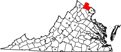
Wheatland is an unincorporated community in Loudoun County, Virginia located north of Purcellville and south of Lovettsville on Berlin Turnpike (VA 287). Originally located at the intersection of Berlin Turnpike and the Charles Town Pike (State Route 9), the present day road bed of Charles Town Pike lies south of its historical right of way so the village is just north of that intersection.


Related Research Articles

<span class="mw-page-title-main">New Jersey Route 168</span> State highway in Camden and Gloucester counties in New Jersey, US

Route 168 is a 10.75-mile (17.30 km) state highway in the southern part of New Jersey. The route's southern terminus is an interchange with Route 42 and the Atlantic City Expressway in the Turnersville section of Washington Township, Gloucester County. The northern terminus is an intersection with County Route 603 on the border of Camden and Woodlynne in Camden County. At this point, the route continues toward downtown Camden as CR 605. Route 168 follows the Black Horse Pike for most of its length, running through suburban areas in Gloucester Township, Runnemede, Bellmawr, and Mount Ephraim. It intersects many major roads, including the Route 42 freeway in Gloucester Township, Route 41 in Runnemede, the New Jersey Turnpike and Interstate 295 (I-295) in Bellmawr, Route 76C in Haddon Township, and U.S. Route 130 in Camden.

<span class="mw-page-title-main">U.S. Route 340</span> US Numbered Highway in Virginia, West Virginia and Maryland, United States

U.S. Route 340 is a spur route of US 40, and runs from Greenville, Virginia, to Frederick, Maryland. In Virginia, it runs north–south, parallel and east of US 11, from US 11 north of Greenville via Waynesboro, Grottoes, Elkton, Luray, Front Royal, and Berryville to the West Virginia state line. A short separate piece crosses northern Loudoun County on its way from West Virginia to Maryland.

<span class="mw-page-title-main">Rhode Island Route 104</span> State highway in Rhode Island, US

Route 104 is a 13.4-mile-long (21.6 km) numbered state highway in the U.S. state of Rhode Island. It runs from US 44 in North Providence to Worrall Street in Downtown Woonsocket. The route connects the cities of Providence and Woonsocket via the town center of Smithfield.

<span class="mw-page-title-main">Virginia State Route 244</span>

State Route 244 is a primary state highway in the U.S. state of Virginia. Known as Columbia Pike, the state highway runs 8.25 miles (13.28 km) from SR 236 in Annandale east to SR 27 and Interstate 395 (I-395) at The Pentagon in Arlington. SR 244 is a major southwest–northeast thoroughfare in northeastern Fairfax County and eastern Arlington County, connecting Annandale with SR 7 at Bailey's Crossroads and SR 120 in the multicultural Westmont neighborhood of Arlington.

<span class="mw-page-title-main">Virginia State Route 7</span>

Virginia State Route 7 (VA 7) is a major primary state highway and busy commuter route in northern Virginia, United States. It travels southeast from downtown Winchester to SR 400 in downtown Alexandria. Its route largely parallels those of the Washington & Old Dominion Trail and the Potomac River. Between its western terminus and Interstate 395 (I-395), SR 7 is part of the National Highway System. In 1968, the Virginia State Highway Commission designated the road as the "Harry Flood Byrd Highway" between Alexandria and Winchester to commemorate Harry F. Byrd Sr. (1887–1966).

<span class="mw-page-title-main">Virginia State Route 259</span>

State Route 259 is a primary state highway in the U.S. state of Virginia. The state highway runs a total of 26.80 miles (43.13 km) in two sections. The southern section, in northern Rockingham County, has a length of 21.81 miles (35.10 km) from Interstate 81 (I-81) and U.S. Route 11 at Mauzy through Broadway to the West Virginia state line into Mathias. The northern section, in western Frederick County, covers 4.99 miles (8.03 km) from the West Virginia state line north to US 50 at Gore. The two sections of SR 259 are joined by West Virginia Route 259.

The Abandoned Pennsylvania Turnpike is the common name of a 13-mile (21 km) stretch of the Pennsylvania Turnpike that was bypassed in 1968 when a modern stretch opened to ease traffic congestion in the tunnels. In this case, the Sideling Hill Tunnel and Rays Hill Tunnel were bypassed, as was one of the Turnpike's travel plazas. The bypass is located just east of the heavily congested Breezewood interchange for Interstate 70 (I-70) eastbound at what is now I-76 exit 161. The section of the turnpike was at one time part of the South Pennsylvania Railroad.

Loudoun County, Virginia, was destined to be an area of significant military activity during the American Civil War. Located on Virginia's northern frontier, the Potomac River, Loudoun County became a borderland after Virginia's secession from the Union in early 1861. Loudoun County's numerous Potomac bridges, ferries and fords made it an ideal location for the Union and Confederate armies to cross into and out of Virginia. Likewise, the county's several gaps in the Blue Ridge Mountains that connected the Piedmont to the Shenandoah Valley and Winchester were of considerable strategic importance. The opposing armies would traverse the county several times throughout the war leading to several small battles, most notably the Battle of Ball's Bluff.

<span class="mw-page-title-main">Virginia State Route 287</span>

State Route 287 is a primary state highway in the U.S. state of Virginia. Known as Berlin Pike, the state highway runs 12.71 miles (20.45 km) from SR 7 Business in Purcellville north to the Maryland state line at the Potomac River near Lovettsville, where the highway continues as Maryland Route 17. SR 287 is the main north–south highway of the Catoctin Valley of northern Loudoun County.

<span class="mw-page-title-main">Pennsylvania Route 31</span> State highway in Pennsylvania, US

Pennsylvania Route 31 is a 74-mile-long (119 km) state highway located in Western Pennsylvania, paralleling U.S. Route 30 and the Pennsylvania Turnpike for most of its length. The designation begins at PA 136 near West Newton and ends at US 30 near Bedford.

<span class="mw-page-title-main">Virginia State Route 231</span>

State Route 231 is a primary state highway in the U.S. state of Virginia. The state highway runs 49.82 miles (80.18 km) from SR 22 in Cismont north to U.S. Route 522 near Sperryville. SR 231 forms part of the connection between Charlottesville and Gordonsville, where the highway meets US 15 and US 33. The state highway also serves as the main north–south highway of Madison County, connecting the county seat of Madison, where the highway intersects US 29, with Gordonsville to the south and passing through the foothills of the Blue Ridge Mountains to the north.

<span class="mw-page-title-main">U.S. Route 15 in Maryland</span> Part of the U.S. Highway System in Maryland

U.S. Route 15 (US 15) is a part of the United States Numbered Highway System that runs from Walterboro, South Carolina, north to Painted Post, New York. In Maryland, the highway runs 37.85 miles (60.91 km) from the Virginia state line at the Potomac River in Point of Rocks north to the Pennsylvania state line near Emmitsburg. Known for most of its length as Catoctin Mountain Highway, US 15 is the primary north–south highway of Frederick County. The highway connects the county seat of Frederick with Point of Rocks, Leesburg, Virginia, and Charles Town, West Virginia, to the south and with Thurmont, Emmitsburg, and Gettysburg, Pennsylvania, to the north. US 15 is a four-lane divided highway throughout the state except for the portion between the Point of Rocks Bridge and the highway's junction with US 340 near Jefferson. The highway is a freeway along its concurrency with US 340 and through Frederick, where the highway meets US 40 and Interstate 70 (I-70). US 15 has a business route through Emmitsburg.

<span class="mw-page-title-main">U.S. Route 29 in Maryland</span> State highway in Maryland, US

U.S. Route 29 (US 29) is a north–south United States Numbered Highway that runs for 1,029.6 miles (1,657.0 km) from Pensacola, Florida, to the western suburbs of Baltimore, Maryland. In the U.S. state of Maryland, US 29 is a major highway that emerges from Washington DC and runs north into eastern Montgomery County, stretching over 25.859 miles (41.616 km) through the state and terminating at Maryland Route 99 (MD 99) outside of Ellicott City. It serves the cities of Columbia and Ellicott City and provides the westernmost north–south route between Washington DC and Baltimore.

<span class="mw-page-title-main">Pennsylvania Route 194</span> State highway in Pennsylvania, US

Pennsylvania Route 194 is a 31-mile-long (50 km) north–south state highway located in south-central Pennsylvania. The southern end is at the Maryland state line, where it continues south as Maryland Route 194, and the northern terminus is at the intersection with PA 74 near the borough of Dillsburg. PA 194 heads northeast from the state line through rural areas in southeastern Adams County, intersecting PA 97 in Littlestown. The route continues into the southwestern section of York County and passes through Hanover, where it forms a concurrency with PA 116 and crosses PA 94 in the downtown area. Past here, PA 194 heads north and crosses back into the eastern portion of Adams County, passing through rural land and intersecting U.S. Route 30 in Abbottstown and PA 234 in East Berlin. The route heads into the northwestern portion of York County and passes through Franklintown before coming to its northern terminus.

<span class="mw-page-title-main">U.S. Route 11 in Maryland</span> Section of U.S. Highway in Washington County, Maryland, U.S.

U.S. Route 11 (US 11) is a part of the United States Numbered Highway System that runs from New Orleans, Louisiana, to Rouses Point, New York. In Maryland, the federal highway runs 12.83 miles (20.65 km) from the West Virginia state line at the Potomac River in Williamsport north to the Pennsylvania state line near Maugansville. US 11 is the primary north–south surface highway in central Washington County, connecting Hagerstown with Williamsport to the south and Hagerstown Regional Airport to the north. The federal highway was once a major long-distance highway, but that role has been assumed by Interstate 81 (I-81), which parallels US 11 not only in Maryland but for most of its course from Tennessee to Upstate New York. US 11 is maintained by the Maryland State Highway Administration except for the municipally-maintained portions within the corporate limits of Williamsport and Hagerstown.

<span class="mw-page-title-main">Winchester, Virginia, in the American Civil War</span> Site of numerous battles during the American Civil War

The city of Winchester, Virginia, and the surrounding area, were the site of numerous battles during the American Civil War, as contending armies strove to control the lower Shenandoah Valley. Winchester changed hands more often than any other Confederate city.

<span class="mw-page-title-main">Pennsylvania Route 152</span> State highway in Pennsylvania, US

Pennsylvania Route 152 (PA 152) is a 25.3-mile-long (40.7 km) state highway located in the U.S. state of Pennsylvania. The route travels north–south from an interchange with PA 309 located in the Cedarbrook neighborhood of Cheltenham Township in Montgomery County north to another interchange with PA 309 located northeast of Telford in Bucks County. PA 152 is known as Limekiln Pike for most of its length. From the southern terminus, the route passes through suburban areas to the north of Philadelphia, serving Dresher, Maple Glen, and Chalfont. North of Chalfont, PA 152 runs through rural suburbs of Philadelphia before reaching Silverdale. Past here, the road continues northwest through Perkasie, where it turns southwest and passes through Sellersville before reaching its northern terminus.

<span class="mw-page-title-main">U.S. Route 30 in New Jersey</span> Highway in New Jersey

U.S. Route 30 is a U.S. highway running from Astoria, Oregon east to Atlantic City, New Jersey. In the U.S. state of New Jersey, US 30 runs 58.26 miles (93.76 km) from the Benjamin Franklin Bridge at the Delaware River in Camden, Camden County, while concurrent with Interstate 676 (I-676), southeast to Virginia Avenue in Atlantic City, Atlantic County. Most of the route in New Jersey is known as the White Horse Pike and is four lanes wide. The road runs through mostly developed areas in Camden County, with surroundings becoming more rural as the road approaches Atlantic County. US 30 runs through several towns including Collingswood, Berlin, Hammonton, Egg Harbor City, and Absecon.

The Affair at Glenmore Farm was a small cavalry skirmish that took place October 16, 1862 in Loudoun County, Virginia between Confederate forces under First Lieutenant Frank Myers and Union forces under General John Geary during the American Civil War. The skirmish resulted in a Union victory.

<span class="mw-page-title-main">Capon Lake Whipple Truss Bridge</span> Bridge in West Virginia

The Capon Lake Whipple Truss Bridge, formerly known as South Branch Bridge or Romney Bridge, is a historic Whipple truss bridge in Capon Lake, West Virginia. It is located off Carpers Pike and crosses the Cacapon River. The bridge formerly carried Capon Springs Road over the river, connecting Capon Springs and Capon Lake.