Bloomfield, Virginia

Last updated

Bloomfield, Virginia
USA Virginia Northern location map.svg
Red pog.svg
Bloomfield
USA Virginia location map.svg
Red pog.svg
Bloomfield
Usa edcp location map.svg
Red pog.svg
Bloomfield
Coordinates: 39°3′12″N77°49′14″W / 39.05333°N 77.82056°W / 39.05333; -77.82056
CountryFlag of the United States.svg  United States
State Flag of Virginia.svg  Virginia
County Flag of Loudoun County, Virginia.svg Loudoun
Elevation
535 ft (163 m)
Time zone UTC−5 (Eastern (EST))
  Summer (DST) UTC−4 (EDT)
GNIS feature ID1492591 [1]

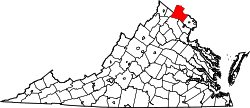
Bloomfield is an unincorporated community in Loudoun County, Virginia. [1] It is situated at the intersection of Airmont (VA 719) and Bloomfield (VA 626) Roads.

The town of Bloomfield was founded by the Virginia General Assembly on January 13, 1816. The town was named for fields of wildflowers along the Blue Ridge near the town. During the Civil War, Confederate forces under Maj. Gen J.E.B. Stuart biouvacked in Bloomfield during the Battle of Unison. Later in the war Col. Mosby and his Rangers visited the town to divide up $173,000 they had robbed from a Union payroll train in West Virginia during the Greenback Raid.

The Ebenezer Baptist Churches were listed on the National Register of Historic Places in 1994. [2]

Related Research Articles

<span class="mw-page-title-main">Bloomfield, Missouri</span> City in Missouri, United States

Bloomfield is a city in Stoddard County, Missouri, United States. The population was 1,933 at the 2010 census. It is the county seat of Stoddard County. In September 1864 during the Civil War, the town was reduced to ashes.

<span class="mw-page-title-main">The Plains, Virginia</span> Town in Virginia, United States

The Plains is a small incorporated town in Fauquier County, Virginia, United States. The population was 245 as of the 2020 census, up from 217 at the 2010 census. It is centered on the intersection of VA 55 and VA 245. The town of The Plains is situated off I-66. As of 2022, the mayor of The Plains is Lori Sisson.

<span class="mw-page-title-main">Honaker, Virginia</span> Town in Virginia, United States

Honaker is a town in Russell County, Virginia, United States. The population was 1,449 at the 2010 census.

<span class="mw-page-title-main">Cedar Bluff, Virginia</span> Town in Virginia, United States

Cedar Bluff is a town in Tazewell County, Virginia, United States. The population was 1,139 at the 2010 census. It is part of the Bluefield, WV-VA micropolitan area, which has a population of 107,578.

<span class="mw-page-title-main">Clarksville, Virginia</span> Town in Virginia, United States

Clarksville is a town in Mecklenburg county in the U.S. state of Virginia, near the southern border of the commonwealth. The population was 1,139 at the 2010 census. Since the town has numerous buildings of the 18th-, 19th-, and early 20th-century architecture, the downtown area of Clarksville has been designated a Historic District on the National Register of Historic Places and Virginia's Historic Register. Clarksville claims the title of Virginia's only Lakeside town. Nearby the town of Clarksville is Occoneechee State Park.

<span class="mw-page-title-main">Gordonsville, Virginia</span> Town in Virginia, United States

Gordonsville is a town in Orange County in the Commonwealth of Virginia in the United States. Located about 19 miles northeast of Charlottesville and 65 miles northwest of Richmond, the population was 1,496 at the 2010 census.

<span class="mw-page-title-main">Saltville, Virginia</span> Town in Virginia, United States

Saltville is a town in Smyth and Washington counties in the U.S. state of Virginia. The population was 2,077 at the 2010 census. It is part of the Kingsport–Bristol (TN)–Bristol (VA) Metropolitan Statistical Area, which is a component of the Johnson City–Kingsport–Bristol, TN-VA Combined Statistical Area – commonly known as the "Tri-Cities" region.

<span class="mw-page-title-main">Waterford, Virginia</span> Unincorporated community in Virginia, United States

Waterford is an unincorporated village and census-designated place (CDP) in the Catoctin Valley of Loudoun County, Virginia, located along Catoctin Creek. Waterford is 47 miles (76 km) northwest of Washington, D.C., and 7 miles (11 km) northwest of Leesburg. The entire village and surrounding countryside is a National Historic Landmark District, noted for its well-preserved 18th and 19th-century character.

<span class="mw-page-title-main">Alexandria National Cemetery (Virginia)</span> Civil War era war cemetery in Virginia

Alexandria National Cemetery is a United States National Cemetery, of approximately 5.5 acres (2.2 ha), located in the city of Alexandria, Virginia. Administered by the United States Department of Veterans Affairs, it is one of the original national cemeteries that were established in 1862. As of 2014, it was site to over 4,500 interments. The cemetery can accommodate the cremated remains of eligible individuals.

<span class="mw-page-title-main">Culpeper National Cemetery</span> United States National Cemetery in Virginia

Culpeper National Cemetery is a United States National Cemetery located in the town of Culpeper, in Culpeper County, Virginia. Administered by the United States Department of Veterans Affairs, it encompasses 29.6 acres (120,000 m2) of land, and as 2021, had over 14,000 interments.

<span class="mw-page-title-main">City Point National Cemetery</span> Historic veterans cemetery in Hopewell, Virginia

City Point National Cemetery is a United States National Cemetery in the community of City Point within the city of Hopewell, Virginia. Administered by the United States Department of Veterans Affairs, it encompasses 6.7 acres (2.7 ha), and as of the end of 2005, had 6,909 interments. It is managed by Hampton National Cemetery.

<span class="mw-page-title-main">Hampton National Cemetery</span> Cemetery in Hampton City, Virginia

Hampton National Cemetery is a United States National Cemetery in the city of Hampton, Virginia. It encompasses 27.1 acres (11.0 ha), and as of 2014, had over 30,000 interments. There are two separate parts to this facility. The original cemetery is called the "Hampton Section" and is located on Cemetery Road in Hampton, VA. It is on the western side of I-64. The new section which is called the "Phoebus Addition" or the "Phoebus Section" West County Street in Hampton, VA east of I-64. It is less than a mile from the original cemetery. Both sections of the Hampton National Cemetery are closed to new interments.

<span class="mw-page-title-main">Fort Harrison National Cemetery</span> Historic veterans cemetery in Henrico County, Virginia

Fort Harrison National Cemetery is a United States National Cemetery located seven miles (11 km) south of the city of Richmond, in Henrico County, Virginia. Administered by the United States Department of Veterans Affairs, It encompasses 1.5 acres (0.61 ha), and as of the end of 2005, had 1,570 interments.

<span class="mw-page-title-main">Winchester National Cemetery</span> Historic veterans cemetery in Winchester County, Virginia

Winchester National Cemetery is a United States National Cemetery located in the city of Winchester in Frederick County, Virginia. Administered by the United States Department of Veterans Affairs, it encompasses 4.9 acres (2.0 ha), and as of the end of 2005, it had 5,561 interments. It is closed to new interments.

<span class="mw-page-title-main">Staunton National Cemetery</span> Historic veterans cemetery in Staunton, Virginia

Staunton National Cemetery is a United States National Cemetery located in the Shenandoah Valley, in Staunton, Virginia. Administered by the United States Department of Veterans Affairs, it encompasses just over a single acre, and as of the end of 2005 had 994 interments. It is closed to new interments, and is maintained by the Culpeper National Cemetery.

<span class="mw-page-title-main">Glendale National Cemetery</span> Historic veterans cemetery in Henrico County, Virginia

Glendale National Cemetery is a United States National Cemetery located near the city of Richmond, in Henrico County, Virginia. Administered by the United States Department of Veterans Affairs, it encompasses 2.1 acres (0.85 ha), and as of the end of 2005 had 2,064 interments. It is closed to new interments.

<span class="mw-page-title-main">Danville National Cemetery (Virginia)</span> Historic cemetery in Virginia, United States

Danville National Cemetery is a United States National Cemetery located in the city of Danville, Virginia. Administered by the United States Department of Veterans Affairs, it encompasses 3.5 acres (1.4 ha) and, as of the end of 2005, it had 2,282 interments. It is managed by Salisbury National Cemetery.

<span class="mw-page-title-main">Greenwood, Albemarle County, Virginia</span> Unincorporated community in Virginia, United States

Greenwood is an unincorporated community in Albemarle County, Virginia, United States. It is home to the Greenwood Country Store and the Greenwood Community Center, which has the area's only roller skating rink. Greenwood has a post office with ZIP code 22943 The Greenwood Tunnel, built by Claudius Crozet for the Blue Ridge Railroad and used by the Chesapeake and Ohio Railway until its abandonment during World War II, is near Greenwood by the Buckingham Branch Railroad tracks.

<span class="mw-page-title-main">National Register of Historic Places listings in Winchester, Virginia</span>

This is a list of the National Register of Historic Places listings in Winchester, Virginia.

<span class="mw-page-title-main">Bacova, Virginia</span> Human settlement in Virginia, United States of America

Bacova is an unincorporated community in Bath County, Virginia, in the United States. It was created in the early 20th century as a company town; its name is simply an abbreviation of Bath County, VA.

References

  1. 1 2 "Bloomfield". Geographic Names Information System . United States Geological Survey, United States Department of the Interior.
  2. "National Register Information System". National Register of Historic Places . National Park Service. July 9, 2010.