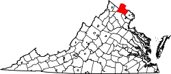
Paeonian Springs, Virginia

Last updated

Paeonian Springs, Virginia
USA Virginia Northern location map.svg
Red pog.svg
Paeonian Springs
USA Virginia location map.svg
Red pog.svg
Paeonian Springs
Usa edcp location map.svg
Red pog.svg
Paeonian Springs
Coordinates: 39°8′57″N77°37′9″W / 39.14917°N 77.61917°W / 39.14917; -77.61917
CountryFlag of the United States.svg  United States
State Flag of Virginia.svg  Virginia
County Flag of Loudoun County, Virginia.svg Loudoun
Elevation
561 ft (171 m)
Time zone UTC−5 (Eastern (EST))
  Summer (DST) UTC−4 (EDT)
GNIS feature ID1499832 [1]

Paeonian Springs is an unincorporated community in Loudoun County, Virginia, United States. It is located at the intersection of the Charles Town Pike (State Route 9) and the Harry Byrd Highway (State Route 7). Paeonian Springs was established in 1890 and is currently served by a post office. The town is named after Paean, the Ancient Greek physician of the gods. [2]

Contents

The Paeonian Springs Historic District was listed on the National Register of Historic Places in 2006. [3]

History

Developers began construction of the town in 1871 and the town was established in 1890. It was originally developed as a resort town for citizens of Washington, D.C. trying to escape the city in the summer. [4] When developers advertised the town upon its completion they said it had "excellent water, mountain air and magnificent scenery". [2]

The Washington & Ohio railroad (later renamed Washington & Old Dominion) played an integral role in the town's development for its first 50 years, making eight stops in the town every day. [2]

By 1901 the town had three hotels, a downtown area, and a village green. By 1912, it also had a boardwalk, a church, and two private schools, among numerous other new shops. [2]

Beginning in 1920 though the town started to decline. This happened for a number of reasons including: the loss of the boardwalk, mill, and church; the Pure Food and Drug Act's passage; and the discovery of antibiotics. [2]

The Washington & Old Dominion railroad ended service in 1968. Twenty years later in 1988, the Washington and Old Dominion Trail, built on the old railroad's right-of-way, was extended through Paeonian Springs to Purcellville, Virginia. [5]

Related Research Articles

<span class="mw-page-title-main">Loudoun County, Virginia</span> County in Virginia, United States

Loudoun County is in the northern part of the Commonwealth of Virginia in the United States. In 2020, the census returned a population of 420,959, making it Virginia's third-most populous county. Loudoun County's seat is Leesburg. Loudoun County is part of the Washington–Arlington–Alexandria, DC–VA–MD–WV Metropolitan Statistical Area. As of 2020, Loudoun County had a median household income of $147,111. Since 2008, the county has been ranked first in the U.S. in median household income among jurisdictions with a population of 65,000 or more.

<span class="mw-page-title-main">Hamilton, Virginia</span> Town in Virginia

Hamilton is a town in the Loudoun Valley of Loudoun County, Virginia, United States. The population was 506 as of the 2010 census.

<span class="mw-page-title-main">Leesburg, Virginia</span> Town in Virginia, United States

Leesburg is a town in and the county seat of Loudoun County, Virginia, United States. Settlement in the area began around 1740, which is named for the Lee family, early leaders of the town. Located in the far northeast of the state, in the War of 1812 it was a refuge for important federal documents evacuated from Washington, DC, and in the Civil War, it changed hands several times.

<span class="mw-page-title-main">Purcellville, Virginia</span> Small Town in Virginia

Purcellville is a town in Loudoun County, Virginia. The population was 8,929 according to the 2020 Census. Purcellville is the major population center for Western Loudoun and the Loudoun Valley. Many of the older structures remaining in Purcellville reflect the Victorian architecture popular during the early twentieth century.

<span class="mw-page-title-main">Round Hill, Loudoun County, Virginia</span> Town in Virginia

Round Hill is a town in Loudoun County, Virginia, United States. Its population was 539 at the 2010 census and an estimated 656 in 2019. The town is located at the crossroads of Virginia Routes 7 and 719, approximately 50 miles (80 km) northwest of Washington, D.C. The town's name refers a hill two miles northeast of a 910-foot (280 m) hill used during the American Civil War as a signal post by both Confederate and Union troops. House of Round Hill was built in 2004. Patsy Cline went to Round Hill Elementary School.

<span class="mw-page-title-main">Sterling, Virginia</span> Census-designated place in Virginia

Sterling, Virginia, refers most specifically to a census-designated place (CDP) in Loudoun County, Virginia, United States. The population of the CDP as of the 2020 United States Census was 30,337 The CDP boundaries are confined to a relatively small area between Virginia State Route 28 on the west and Virginia State Route 7 on the northeast, excluding areas near SR 606 and the Dulles Town Center.

<span class="mw-page-title-main">Virginia State Route 7</span> State highway in northern Virginia, US

Virginia State Route 7 (VA 7) is a major primary state highway and busy commuter route in northern Virginia, United States. It travels southeast from downtown Winchester to SR 400 in downtown Alexandria. Its route largely parallels those of the Washington & Old Dominion Trail and the Potomac River. Between its western terminus and Interstate 395 (I-395), SR 7 is part of the National Highway System. In 1968, the Virginia State Highway Commission designated the road as the "Harry Flood Byrd Highway" between Alexandria and Winchester to commemorate Harry F. Byrd Sr. (1887–1966).

Unison is an unincorporated community village in Loudoun County, Virginia. It is located approximately five miles from Middleburg in the Loudoun Valley close to the Fauquier County border.

<span class="mw-page-title-main">Washington and Old Dominion Railroad</span> Defunct railroad in Virginia, United States

The Washington and Old Dominion Railroad was an intrastate short-line railroad located in Northern Virginia, United States. The railroad was a successor to the bankrupt Washington and Old Dominion Railway and to several earlier railroads, the first of which began operating in 1859. The railroad closed in 1968.

<span class="mw-page-title-main">Washington and Old Dominion Railroad Regional Park</span> Regional park in Northern Virginia

The Washington and Old Dominion Railroad Regional Park is a linear regional park in Northern Virginia. The park's primary feature is the Washington and Old Dominion Railroad Trail, an asphalt-surfaced paved rail trail that runs through densely populated urban and suburban communities as well as through rural areas. Most of the trail travels on top of the rail bed of the former Washington and Old Dominion Railroad, which closed in 1968.

<span class="mw-page-title-main">Bluemont, Virginia</span> Unincorporated community in Virginia, United States

Bluemont is an unincorporated village in Loudoun County, Virginia located at the eastern base of Snickers Gap in the Blue Ridge Mountains. The village's center is located along Snickersville Turnpike, 4 miles (6.4 km) west of the incorporated town of Round Hill. The village borders Virginia's fox hunting country and is within 1 mile (1.6 km) of the Appalachian Trail and the Bears Den and Raven Rocks formations in the Blue Ridge.

<span class="mw-page-title-main">Waterford, Virginia</span> Unincorporated community in Virginia, United States

Waterford is a unique place of historic significance. The entire village and surrounding countryside is a National Historic Landmark District, noted for its well-preserved 18th and 19th-century character. It is an unincorporated village and census-designated place (CDP) in the Catoctin Valley of Loudoun County, Virginia, located along Catoctin Creek. Waterford is 47 miles (76 km) northwest of Washington, D.C., and 7 miles (11 km) northwest of Leesburg.

<span class="mw-page-title-main">Aldie, Virginia</span> Unincorporated community in Virginia, United States

Aldie is an unincorporated community and census-designated place (CDP) located between Chantilly and Middleburg in Loudoun County, Virginia, United States. The historic village of Aldie is located on the John Mosby Highway in a gap between the Catoctin Mountains and Bull Run Mountains, through which the Little River flows. Aldie traditionally serves as the gateway to the Loudoun Valley and beyond.

Arcola is a census-designated place in Loudoun County, Virginia, United States. The population as of the 2010 United States Census was 233.

<span class="mw-page-title-main">Great Falls and Old Dominion Railroad</span> Former trolley line in Virginia

The Great Falls and Old Dominion Railroad (GF&OD) was an interurban trolley line that ran in Northern Virginia during the early 20th century.

<span class="mw-page-title-main">Virginia State Route 9</span> State highway in Loudoun County, Virginia, US

Virginia State Route 9 is a primary state highway in the U.S. state of Virginia. Known as Charles Town Pike, the state highway runs 13.08 miles (21.05 km) from the West Virginia state line near Mechanicsville, where the highway continues west as West Virginia Route 9, east to SR 7 and SR 7 Business in Paeonian Springs. SR 9 is the main east–west highway of northwestern Loudoun County, connecting Leesburg with Hillsboro and the West Virginia cities of Charles Town and Martinsburg. As a result, the state highway and its West Virginia continuation are a major, overburdened commuter route between the Eastern Panhandle of West Virginia and Washington, D.C.

<span class="mw-page-title-main">Paris, Virginia</span> Unincorporated Village in Fauquier County, Virginia, U.S.

Paris is an unincorporated hamlet in Fauquier County, Virginia, United States. Located in Virginia's hunt country, it was established in a strategic spot at the eastern base of Ashby Gap along U.S. Route 17 and U.S. Route 50.

<span class="mw-page-title-main">Herndon Depot Museum</span> United States historic place

The Herndon Depot Museum, also known as the Herndon Historical Society Museum, is located in the town of Herndon in Fairfax County, Virginia. Built in 1857 for the Alexandria, Loudoun & Hampshire Railroad, the depot later served the Richmond and Danville Railroad, the Southern Railway and the Washington and Old Dominion Railroad. In 1875, the original shed was replaced with the current depot.

<span class="mw-page-title-main">Bluemont Historic District</span> Historic district in Virginia, United States

The Bluemont Historic District comprises the historic core of Bluemont, Virginia. The town is located on the eastern side of Snickers Gap, with the majority of the district fronting on the Snickersville Turnpike, also designated Virginia State Route 734. The district includes 43 buildings, of which 36 are houses, five are commercial structure, a church and a community center. The oldest structure in Bluemont is Clayton Hall (1797), a large stone house. The Amos Clayton farm was located at the junction of Routes 734 and 760, now in the center of town. Relatively few pre-Civil War structures remain in Bluemont. Apart from Clayton Hall, the most significant is the Bluemont Methodist Church.

<span class="mw-page-title-main">Purcellville Train Station</span> United States historic place

Purcellville Train Station is a historic railway station located in Purcellville, Loudoun County, Virginia. The station is adjacent to the Washington and Old Dominion Railroad Trail. The Southern Railway constructed the station in 1904. The station is a one-story, rectangular frame building with a hipped roof and deeply overhanging eaves supported by triangular knee braces. It was a station on the Washington and Old Dominion Railway and later, the Washington and Old Dominion Railroad from 1912 until the line closed in 1968, with passenger service ceasing in 1951.

References

  1. "Paeonian Springs". Geographic Names Information System . United States Geological Survey, United States Department of the Interior.
  2. 1 2 3 4 5 "History of Paeonian Springs". The History of Loudoun County, Virginia. Retrieved August 6, 2016.
  3. "National Register Information System". National Register of Historic Places . National Park Service. July 9, 2010.
  4. Fishback, Mary (February 1, 2001). Loudoun County: a Family Album. Arcadia Publishing. p. 116. ISBN   9780738506708.
  5. Harwood, H.H. Jr. (April 2000). Rails to the Blue Ridge: The Washington and Old Dominion Railroad, 1847 — 1968 (PDF) (3rd ed.). Fairfax Station, Virginia: Northern Virginia Parks Authority. pp. 106–109. ISBN   0-615-11453-9. LCCN   77104382. OCLC   44685168. Archived (PDF) from the original on September 28, 2017. Retrieved December 6, 2023.