Waxpool, Virginia

Last updated

Waxpool, Virginia
USA Virginia Northern location map.svg
Red pog.svg
Waxpool
USA Virginia location map.svg
Red pog.svg
Waxpool
Usa edcp location map.svg
Red pog.svg
Waxpool
Coordinates: 39°0′50″N77°31′26″W / 39.01389°N 77.52389°W / 39.01389; -77.52389
CountryFlag of the United States.svg  United States
State Flag of Virginia.svg  Virginia
County Flag of Loudoun County, Virginia.svg Loudoun
Time zone UTC−5 (Eastern (EST))
  Summer (DST) UTC−4 (EDT)

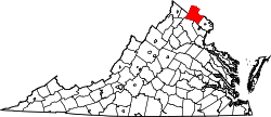
Waxpool is an unincorporated community in Loudoun County, Virginia. Waxpool is centered on Waxpool Road (Virginia Secondary Route 625) in the vicinity of Beaver Dam Reservoir and is part of the Broadlands census-designated place.

Waxpool once contained a general store and post office in one building near the intersection of Waxpool Road (Rte. 625) and Belmont Ridge Rd (Rte. 659). The store and was reportedly opened in 1947. The post office was reportedly opened in 1953. Both the store and post office continued operation until 1966.

Waxpool currently contains William D. Parsell Field, baseball field. [1] Formerly named "Waxpool Baseball Field", it is currently named for the former owner and lessor of the field to Dulles Little League for use of the Waxpool Mustangs and Waxpool Orioles from the early 1970s through the early 1990s.

Waxpool's name was derived from the fact that much of the local soil is Iredell clay loam, known locally as "wax land" from the waxy nature of the subsoil. [2]

Waxpool contained three dairy farms in the 1970s. Two of them were separately purchased and zoned for planned community development in the 1990s. One farm currently remains, located near the intersection of Waxpool Road (Rte. 625) and Belmont Ridge Rd (Rte. 659).

Related Research Articles

<span class="mw-page-title-main">Leesburg, Virginia</span> Town in Virginia, United States

Leesburg is a town in and the county seat of Loudoun County, Virginia, United States. Settlement in the area began around 1740, which is named for the Lee family, early leaders of the town. Located in the far northeast of the state, in the War of 1812 it was a refuge for important federal documents evacuated from Washington, DC, and in the Civil War, it changed hands several times.

<span class="mw-page-title-main">Purcellville, Virginia</span> Small Town in Virginia

Purcellville is a town in Loudoun County, Virginia. The population was 8,929 according to the 2020 Census. Purcellville is the major population center for Western Loudoun and the Loudoun Valley. Many of the older structures remaining in Purcellville reflect the Victorian architecture popular during the early twentieth century.

<span class="mw-page-title-main">Woodbridge, Virginia</span> Census-designated place in Virginia, United States

Woodbridge is a census-designated place (CDP) in Prince William County, Virginia, United States, located 20 miles (32 km) south of Washington, D.C. Bounded by the Occoquan and Potomac rivers, Woodbridge had 44,668 residents at the 2020 census.

<span class="mw-page-title-main">Sterling, Virginia</span> Census-designated place in Virginia

Sterling, Virginia, refers most specifically to a census-designated place (CDP) in Loudoun County, Virginia, United States. The population of the CDP as of the 2010 United States Census was 27,822. The CDP boundaries are confined to a relatively small area between Virginia State Route 28 on the west and Virginia State Route 7 on the northeast, excluding areas near SR 606 and the Dulles Town Center.

<span class="mw-page-title-main">Virginia State Route 620 (Fairfax and Loudoun Counties)</span> Highway in Virginia

State Route 620 in Fairfax and Loudoun Counties, Virginia is a secondary state highway. The entire length of SR 620 is also known as Braddock Road. SR 620 also has a short concurrency with SR 659 / Union Mill Road in Centreville.

<span class="mw-page-title-main">Ashburn, Virginia</span> Census-designated place in Virginia

Ashburn is a census-designated place (CDP) in Loudoun County, Virginia, United States. At the 2010 United States Census, its population was 43,511, up from 3,393 twenty years earlier. It is 30 miles (48 km) northwest of Washington, D.C., and part of the Washington metropolitan area.

<span class="mw-page-title-main">South Riding, Virginia</span> Census-designated place in Virginia

South Riding is a census-designated place and planned community in Loudoun County, Virginia, United States. The South Riding homeowner association was founded in January 1995 to provide services to the community. Neighboring U.S. Route 50 and State Route 28 provide access to the Dulles/Reston/Tysons Corner technology corridor and other major employment centers in Northern Virginia and Washington, D.C.

Unison is an unincorporated community village in Loudoun County, Virginia. It is located approximately five miles from Middleburg in the Loudoun Valley close to the Fauquier County border.

<span class="mw-page-title-main">Bluemont, Virginia</span> Unincorporated community in Virginia, United States

Bluemont is an unincorporated village in Loudoun County, Virginia located at the eastern base of Snickers Gap in the Blue Ridge Mountains. The village's center is located along Snickersville Turnpike, 4 miles (6.4 km) west of the incorporated town of Round Hill. The village borders Virginia's fox hunting country and is within 1 mile (1.6 km) of the Appalachian Trail and the Bears Den and Raven Rocks formations in the Blue Ridge.

<span class="mw-page-title-main">Aldie, Virginia</span> Unincorporated community in Virginia, United States

Aldie is an unincorporated community and census-designated place (CDP) located between Chantilly and Middleburg in Loudoun County, Virginia, United States. The historic village of Aldie is located on the John Mosby Highway in a gap between the Catoctin Mountains and Bull Run Mountains, through which the Little River flows. Aldie traditionally serves as the gateway to the Loudoun Valley and beyond.

<span class="mw-page-title-main">Virginia State Route 28</span> State highway in Virginia, United States

State Route 28 in the U.S. state of Virginia is a primary state highway that traverses the counties of Loudoun, Fairfax, Prince William, and Fauquier in the U.S. state of Virginia. The route serves as a major artery in the Northern Virginia region, with it being an important two-lane highway in rural Fauquier and Prince William Counties, the main thoroughfare through Manassas and Manassas Park, and a high-capacity freeway through Fairfax and Loudoun Counties.

Stone Ridge is a census-designated place in Loudoun County, Virginia, United States. Residences use Aldie mailing addresses, and it is near Washington Dulles International Airport. The population as of the 2020 census was 15,039. Stone Ridge is a Van Metre Homes planned, mixed-use community.

Belmont is a census-designated place (CDP) in Loudoun County, Virginia, United States. The population as of the 2010 United States Census was 5,966. It is 5 miles (8 km) southeast of Leesburg, the Loudoun county seat, and 31 miles (50 km) northwest of Washington, D.C. The Belmont Manor House, built between 1799 and 1802 by a son of Richard Henry Lee, is in the northeast part of the CDP and is now the clubhouse for a gated golf community.

<span class="mw-page-title-main">Belmont Greene</span>

Belmont Greene is a traditional neighborhood development in Ashburn, Virginia, located off Belmont Ridge Road about 35 miles (56 km) west of Washington, DC. It is part of the Belmont census-designated place. The development is situated adjacent to Stone Bridge High School and Trailside Park. The Washington & Old Dominion Railroad Trail also goes along the border of the development. The development consists of over 700 housing units and a 65-acre (260,000 m2) shopping center, including a bank and a number of stores and restaurants. There are two playgrounds and a small community pool that serve the needs of the Belmont Greene community.

<span class="mw-page-title-main">Willard, Virginia</span> Unincorporated area in Virginia

Willard was an unincorporated community located in what is now a part of Washington Dulles International Airport in the U.S. state of Virginia.

<span class="mw-page-title-main">Virginia State Route 234</span>

Virginia State Route 234 is a primary state highway in the U.S. state of Virginia. It runs from U.S. Route 1 near Dumfries via Independent Hill as Dumfries Road, a bypass of Manassas as Prince William Parkway, has a brief concurrency with Interstate 66 for 2.27 miles (3.65 km) between exits 44 and 47, and Catharpin to U.S. Route 15 near Woolsey as Sudley Road.

<span class="mw-page-title-main">Virginia State Route 659 (Loudoun and Prince William Counties)</span>

State Route 659 in Loudoun and Prince William Counties, Virginia is a secondary state highway. Otherwise known as Belmont Ridge Road north of Arcola, and Gum Spring Road to the south, the road is heavily used by commuters in the suburbs and bedroom communities of Loudoun County.

Bells Crossroad is an unincorporated community in Spotsylvania County, in the U.S. state of Virginia. This community is centered on the intersection of Stubbs Bridge Road and Lawyer's Road.

Belmont is an unincorporated community in Spotsylvania County, in the U.S. state of Virginia. It is marked with a highway sign at the intersection of Belmont Road and Orange Springs Road by the Virginia Department of Transportation, however is marked as being the intersection with Belmont Road and Jones Powell Road by the United States Geological Survey (USGS). The immediate area has Fletcher's Store and the Belmont Christmas Tree farm. Further south, there are other buildings identifying with Belmont, such as Belmont Baptist Church, the Belmont Ruritan Community Building where the Belmont Ruritan Club meets each evening at 7 p.m. and serves as the district's polling place for registered voters, and the Belmont Fire & Rescue station staffed by Spotsylvania County Volunteer Company 9.

Paytes is an unincorporated community in Spotsylvania County, in the U.S. state of Virginia. The community is marked at the intersection of Lawyer's Road and Catharpin Road by an electrical substation owned by Rappahannock Electric Co-op. A telecommunications tower was approved to be built on the site to expand cell coverage in the area on February 28, 2001.

References

  1. "Other Parks". www.loudoun.gov. Archived from the original on November 14, 2007.
  2. Head, James William (1908). History and Comprehensive Description of Loudoun County, Virginia. Park View Press. p. 57. ISBN   1-103-75673-7.