Broadway Junction station

Last updated

 Broadway Junction
  NYCS-bull-trans-A-Std.svg NYCS-bull-trans-C-Std.svg NYCS-bull-trans-J-Std.svg NYCS-bull-trans-L-Std.svg NYCS-bull-trans-Z-Std.svg
MTA NYC logo.svg New York City Subway station complex
Broadway Junction from outside vc.jpg
The elevated part of the complex
Station statistics
AddressVan Sinderen Avenue & Fulton Street
Brooklyn, NY 11233
Borough Brooklyn
Locale East New York, Cypress Hills, Ocean Hill
Coordinates 40°40′44.11″N73°54′12.43″W / 40.6789194°N 73.9034528°W / 40.6789194; -73.9034528
Division B (BMT/IND) [1]
Line BMT Canarsie Line
IND Fulton Street Line
BMT Jamaica Line
Services    A   NYCS-SSI-alltimes.svg (all times)
   C   NYCS-SSI-allexceptnights.svg (all except late nights)
   J   NYCS-SSI-alltimes.svg (all times)
   L   NYCS-SSI-alltimes.svg (all times)
   Z   NYCS-SSI-rushpeak.svg (rush hours, peak direction)
Transit
Levels3
Other information
Accessible not ADA-accessible; accessibility planned
Traffic
20221,445,460 [2] Increase2.svg 9.7%
Rank205 out of 423 [2]
Location
NYCS map blank.svg
Map pointer.svg
USA New York City location map.svg
Map pointer.svg
USA New York location map.svg
Map pointer.svg
Street map

Broadway Junction station

Station service legend
SymbolDescription
NYCS-SSI-rushpeak.svg Stops rush hours in the peak direction only
NYCS-SSI-allexceptnights.svg Stops all times except late nights
NYCS-SSI-alltimes.svg Stops all times

The Broadway Junction station is a New York City Subway station complex shared by the elevated BMT Canarsie Line and BMT Jamaica Line, and the underground IND Fulton Street Line. It was also served by trains of the Fulton Street Elevated until that line closed in 1956. It is located roughly at the intersection of Broadway, Fulton Street and Van Sinderen Avenue at the border of Bedford–Stuyvesant and East New York, Brooklyn. The complex is served by the A, J, and L trains at all times; the C train at all times except late nights; and the Z train during rush hours in the peak direction only.

Contents

The station is adjacent to the East New York Yard and a complex track junction between the tracks leading to the yard, the Canarsie Line, and the Jamaica Line. The structure of the elevated station still contains the ironwork for the trackways used by the old Fulton Elevated. The station has a single exit and entrance through a fare control building located at the eastern end of the Fulton Street Line station. There is evidence of closed exits from the Jamaica Line platforms.

The station opened as Manhattan Junction as part of the BMT Lexington Avenue Line in 1885. In 1900, an elevated connection was made with the Fulton Street Elevated, resulting in a change in service patterns. Lexington Avenue and Fulton Street trains were through-routed, going around the East New York Loop, with service to Cypress Hills requiring a transfer. The station started to be used by service to Canarsie in 1906. In 1919, the Manhattan Junction station was replaced by the current station which was then known as Eastern Parkway. The modern-day Canarsie Line platforms, known as Broadway Junction, opened in 1928 when that line was connected to the 14th Street–Eastern District Line. The Independent Subway System's Fulton Street Line was extended to Broadway–East New York in 1946, and the three stations were combined as one station complex on July 1, 1948. The names of the stations in the complex were conformed to Broadway Junction in 2003.

Although Broadway Junction ranked 166th in the system for passenger entries in 2016, with 3,085,401 total entries, [2] it is Brooklyn's third-busiest station in terms of passenger activity. It sees 100,000 passengers per day as of 2017, the vast majority of whom use it to make transfers. In 2017, the New York City Economic Development Corporation started studying options to rezone the surrounding area as a transit hub. [3]

History

Looking west at the complex's head house and Callahan-Kelly Playground, located above the IND station Broadway Junction headhouse, December 2017.JPG
Looking west at the complex's head house and Callahan-Kelly Playground, located above the IND station

The Broadway Junction station complex is shared by the elevated BMT Canarsie and BMT Jamaica Lines and the underground IND Fulton Street Line. Throughout the history of the area, this has been a key junction point between various different rail lines. What is now Broadway Junction sits atop the historical Jamaica Pass, the junction of the modern Broadway, Fulton Street, and Jamaica Avenue. The Pass is where these roads passed through the valleys of the area, which are part of the terminal moraine created by the Wisconsin glaciation. [4] [5]

BMT complex

The first rail service in the area was the Atlantic Branch of the Long Island Rail Road (LIRR) at East New York station. The line opened as the Brooklyn and Jamaica Railroad in 1836, under lease to the LIRR, but did not include a station at East New York until early 1843. [6] The Brooklyn and Rockaway Beach Railroad (the predecessor to the BMT Canarsie Line) began service in the area in 1865. [7] :13 The name Manhattan Junction or Manhattan Beach Junction was applied to the station on what is now the Jamaica Line when it opened in 1885; [8] [9] the area had been known as Manhattan Beach Crossing since before then, [10] [11] due to the crossing of the LIRR's Manhattan Beach Division. A station on the Fulton Street Elevated railroad at Sackman Street opened on July 4, 1889, when the line was extended to Atlantic Avenue. [12]

Passageway above the Jamaica Line platforms, leading to the Canarsie Line platforms Connection between Jamaica and Canarsie lines at Broadway Junction, December 2017.JPG
Passageway above the Jamaica Line platforms, leading to the Canarsie Line platforms

A two-track, one-half-block elevated connection was built on the east side of Vesta Avenue (now Van Sinderen Avenue) between the Fulton Street and Broadway Lines. [13] This connection, equipped with a third rail to supply electric power, was opened on August 9, 1900, and new service patterns were implemented: during times other than rush hours, Lexington Avenue and Fulton Street trains were through-routed, and travel beyond Manhattan Junction required a transfer. [14] [15] This "East New York Loop" was unpopular, and was soon stopped; [16] the next service to use the tracks was the BMT Canarsie Line to Broadway Ferry (later the 15 train), joined to the Fulton Street Line at Pitkin and Snediker Avenues in 1906. [7] :14 [17]

The name was changed from Manhattan Junction to Broadway Junction in 1913. [18] The Dual Contracts were signed on March 19, 1913, between the City and the Interborough Rapid Transit Company and the Brooklyn Rapid Transit Company (BRT). As part of the agreement, the BRT, which owned the elevated lines in Brooklyn, agreed to construct bidirectional express tracks on the Fulton and Broadway Elevateds. [19] The Broadway express track was placed into service on December 23, 1916. [20] The current Broadway Elevated station at Eastern Parkway opened on August 5, 1919, replacing the old Manhattan Junction station. [7] :14 [21] :385 The full BMT 14th Street-Canarsie Line was completed on July 14, 1928, with the opening of the segment connecting Broadway Junction with Montrose Avenue. [16] [22] [23]

IND station

By 1936, the Independent Subway System's Fulton Street Line had been extended to Rockaway Avenue. At that time, Broadway Junction was an all-Brooklyn–Manhattan Transit (BMT) transfer point. Further eastward extension of the line was delayed by World War II; the Broadway–East New York station opened on December 30, 1946. [24] [25] A direct escalator passageway was constructed between the IND and BMT stations in East New York to allow passengers free transfers. [26] The passageway opened on July 1, 1948. [27] :16,38 The Fulton Street Elevated was now redundant, and BMT service on the line closed entirely on April 26, 1956, with the eastern portion to Lefferts Boulevard connected to the IND. [28]

The New York City Board of Transportation announced plans in November 1949 to spend $325,000 extending platforms at several IND stations, including Broadway–East New York, to accommodate 11-car, 660-foot (200 m) trains. [29] [30] The lengthened trains began running during rush hour on September 8, 1953, with eleven-car trains operating on weekdays. [31] :37–38 The project cost $400,000 and increased the total carrying capacity of rush-hour trains by 4,000 passengers. [32] The operation of eleven-car trains ended in 1958 because of operational difficulties. The signal blocks, especially in Manhattan, were too short to accommodate the longer trains, and the motormen had a very small margin of error to properly align the train with the platform. It was found that operating ten-car trains allowed for two additional trains per hour to be scheduled. [33]

Complex renovation

The entire complex was renovated from 1999 to 2001. The design bid for the project was awarded in May 1996. [34] :C-24–C-26 As part of the project, an abandoned mezzanine and adjacent staircases were removed, a new station booth was built and the public address system was improved. In 2001, as part of the work a piece of artwork made by Al Loving titled Brooklyn, New Morning was installed in the station. [35] This piece of art consists of 75 unique glass panels arranged in a series throughout the complex and a mosaic mural wall that is 7–10 feet (2.1–3.0 m). This installation was part of MTA Arts & Design's program to install artwork in stations that undergo rehabilitations. [36] Other necessary improvements were also completed as part of the project. [37] For a long time, the stations within the complex went by three different names: the original Eastern Parkway on the BMT Jamaica Line, Broadway Junction on the BMT Canarsie Line, and Broadway–East New York (IND Fulton Street Line). Conformity between the station names was established in 2003. [38]

As part of a project initiated in 2017 in which 200 blocks of land in East New York were rezoned for housing and improvements to area parks and schools were planned, the New York City Economic Development Corporation initiated a study to foster economic growth around Broadway Junction as a transit hub with residential and commercial uses. [3] In 2018, the MTA announced several further improvements to the Broadway Junction station: new elevators for the Fulton Street Line platforms, [39] as well as staircases for the Canarsie Line platforms [40] and Jamaica Line platforms. [41] Mayor Eric Adams announced in May 2023 that the MTA would spend $400 million on improvements at the Broadway Junction station, including seven elevators, a new entrance on Van Sinderen Avenue directly to the Canarsie Line platforms, and replacement of all of the complex's escalators. [42] In addition, the city government would spend $95 million to build pedestrian plazas around the station. [42] [43]

Station layout

4th floorCrossoverTransfer between platforms
3rd floorNorthbound NYCS-bull-trans-L-Std.svg toward Eighth Avenue (Bushwick Avenue–Aberdeen Street)
Island platform
Separation at south end
Island platform, not in use
Southbound NYCS-bull-trans-L-Std.svg toward Canarsie–Rockaway Parkway (Atlantic Avenue)
Side platform
MezzanineConnection between levels
2nd floorSouthbound local NYCS-bull-trans-J-Std.svg toward Broad Street (Halsey Street AM rush, Chauncey Street other times)
NYCS-bull-trans-Z-Std.svg toward Broad Street AM rush (Chauncey Street)
Island platform
Peak-direction express No service (Next station: Myrtle Avenue west, Alabama Avenue east)
Island platform
Northbound local NYCS-bull-trans-J-Std.svg toward Jamaica Center–Parsons/Archer (Alabama Avenue)
NYCS-bull-trans-Z-Std.svg toward Jamaica Center–Parsons/Archer PM rush (Alabama Avenue)
GroundStreet levelExit/entrance
BasementWestbound local NYCS-bull-trans-C-Std.svg toward 168th Street (Rockaway Avenue)
NYCS-bull-trans-A-Std.svg toward Inwood–207th Street late nights (Rockaway Avenue)
Island platform
Westbound express NYCS-bull-trans-A-Std.svg toward Inwood–207th Street (Utica Avenue)
Eastbound express NYCS-bull-trans-A-Std.svg toward Far Rockaway–Mott Avenue, Ozone Park–Lefferts Boulevard
or Rockaway Park–Beach 116th Street (Euclid Avenue)
Island platform
Eastbound local NYCS-bull-trans-C-Std.svg toward Euclid Avenue (Liberty Avenue)
NYCS-bull-trans-A-Std.svg toward Far Rockaway–Mott Avenue late nights (Liberty Avenue)

The station complex is composed of three stations: the two elevated stations on the BMT Jamaica and Canarsie Lines, as well as the underground station on the IND Fulton Street Line. [44] :86–87 The IND station is accessible from the station's ground-level station house, at the east end of the station complex, using staircases down to platform level. The BMT lines are reachable from that same station house via escalators from street level to the upper mezzanine, which is located over the elevated BMT Jamaica Line platforms and at the BMT Canarsie Line's platform level. The two escalators, which were replaced in 2000, are long and steep. A footbridge leads from the upper mezzanine to the BMT Canarsie Line's northbound platform. [7] :38 [45]

Despite having been renovated in the late 1990s, the Broadway Junction complex does not conform to the Americans with Disabilities Act of 1990, and there are no elevators in the station because the different parts of the complex are too far from each other. [46] Because Broadway Junction is a major transfer station, the community identified this lack of access as a major issue. [47] Calls for elevators were renewed in 2017, after the announcement of the L train shutdown in 2019–2020, which temporarily restricts Canarsie Line service to Manhattan during off-peak hours. [48] In January 2018, the MTA announced that the IND Fulton Street Line platforms would receive elevators, and that elevators were also being studied for the BMT Jamaica Line platforms. However, the BMT Canarsie Line platforms are not expected to receive these improvements. [39]

Exit

Van Sinderen Av turnstiles jeh.JPG
Van Sinderen Avenue fare control
Broadway Junction IND Fulton Art Deco Entrance.JPG
Street entrance with an overhang that combined Art Deco and mid-century modern elements

The fare control area is in the station house, with a token booth and turnstile banks. The structure was built along with the IND station. The station house leads to Van Sinderen Avenue between Fulton Street to the south, and Truxton Street and Broadway to the north. This is the only entrance to the entire complex. [44] :86–87 There is also a police precinct located in the station house, NYPD Transit Police District 33, at the south end of the building. [7] :38 [45] The station was previously part of Transit Police District 23. [49] The station house is adjacent to Callahan-Kelly Playground, and is recessed a short distance west from Van Sinderen Avenue. [7] :38 [44] :95

A ventilation structure for the IND line sits at the west end of the park at Sackman Street. [7] :49 [50] There have been planning studies to build a new entrance in this area. [51]

BMT Canarsie Line platforms

 Broadway Junction
  NYCS-bull-trans-L-Std.svg
MTA NYC logo.svg New York City Subway station (rapid transit)
Bway junction L.jpeg
Southbound side platform for the L train;
with northbound island platform
Station statistics
Division B (BMT) [1]
Line     BMT Canarsie Line
Services    L   NYCS-SSI-alltimes.svg (all times)
Structure Elevated
Platforms1 island platform
1 side platform (southbound only)
Tracks2
Other information
OpenedJuly 14, 1928;95 years ago (1928-07-14)
Accessible not ADA-accessible; accessibility planned
Opposite-
direction
transfer
Yes
Services
Preceding station MTA NYC logo.svg New York City Subway Following station
Bushwick Avenue–Aberdeen Street NYCS-bull-trans-L-Std.svg Atlantic Avenue
Track layout

BSicon MFADEg.svg
BSicon utvSTR.svg
BSicon utvSTRfg.svg
BSicon utvSTRe.svg
BSicon numN010.svg
BSicon uvUST.svg
BSicon uv-SHI2r.svg
BSicon uvSHI2l-.svg
BSicon uPSTR.svg
BSicon dPLT.svg
BSicon uPSTR(R).svg
Broadway Junction
BSicon MFADEgq.svg
BSicon lKRZo+L.svg
BSicon uSTRq.svg
BSicon dPLTl.svg
BSicon udSTR.svg
BSicon PLT.svg
BSicon udSTR.svg
BSicon udSTR+r.svg
BSicon lKRZo+R.svg
BSicon uexdSTRq.svg
BSicon uexcSTRq.svg
BSicon uexkSTR2+r.svg
BSicon uexkSTRc3.svg
BSicon MFADEgq.svg
BSicon lKRZo+L.svg
BSicon uSTRq.svg
BSicon dPLTl.svg
BSicon udSTR.svg
BSicon cPLT.svg
BSicon lKRZo+R.svg
BSicon udSTR+r.svg
BSicon cPLT.svg
BSicon uvSTR.svg
BSicon uexkSTR+4.svg
from Jamaica Line
BSicon udSTRf.svg
BSicon uSTR.svg
BSicon udSTRg.svg
BSicon udSTR.svg
BSicon uexdSTR.svg
BSicon udSTR.svg
BSicon uSTR.svg
BSicon uvSTR.svg
BSicon udCONTg.svg
BSicon uexdSTR.svg
BSicon udSTR+c2.svg
BSicon uSTRc2.svg
BSicon uSTR3.svg
BSicon uSPLg+3.svg
BSicon uSTRc2.svg
BSicon uxdABZg3.svg
BSicon uexdSTR.svg
BSicon udABZg+1.svg
BSicon uSTRc24.svg
BSicon uv-STR+1.svg
BSicon uexSPL+1.svg
BSicon uSTR3+1.svg
BSicon uSTRc4.svg
BSicon uxdSTR+c4.svg
BSicon uexdSTR.svg
BSicon uvSTR-.svg
BSicon udABZg+1.svg
BSicon uxdSTR+c4.svg
BSicon uexvSHI2l.svg
BSicon uexdSHI2+r.svg
BSicon uexdSTR.svg
former Fulton Street Elevated tracks
BSicon udSTR.svg
BSicon dPLT.svg
BSicon uxvSTR.svg
BSicon exdPLT.svg
BSicon uexvSTR.svg
BSicon exdPLT.svg
BSicon uexdSTR.svg
BSicon udSTR.svg
BSicon dPLT.svg
BSicon uxvSTR.svg
BSicon exdPLT.svg
BSicon uexdSTR.svg
BSicon uexdENDEe.svg
Atlantic Avenue
BSicon udSTR.svg
BSicon dPLT.svg
BSicon uxvSTR.svg
BSicon exdPLT.svg
BSicon uexdSTR.svg
BSicon uvSHI2l-.svg
BSicon uxvSTR.svg
BSicon uexv-SHI2r.svg
BSicon uvSTRfg.svg
BSicon uexvSTR.svg
BSicon MFADEf.svg
BSicon uvSTR.svg
BSicon MFADEf.svg
BSicon uexvSTR.svg
BSicon uSTRq.svg
Tracks
BSicon uexSTRq.svg
Trackways
Station service legend
SymbolDescription
NYCS-SSI-alltimes.svg Stops all times

The Broadway Junction station on the BMT Canarsie Line, served by the L train at all times, has two tracks, one island platform and one side platform. Manhattan-bound trains use the island platform for northbound service while Canarsie-bound trains use the side platform for southbound service, similar to the configuration of the Bowling Green station on the IRT Lexington Avenue Line. However, unlike Bowling Green, the southbound trains can use the island platform if necessary. [7] :50 [52] :19,32,64 The station is between Bushwick Avenue–Aberdeen Street to the north and Atlantic Avenue to the south. [53]

This station opened on July 14, 1928, as the final section of the 14th Street–Eastern District Line, now part of the Canarsie Line, opened between Montrose Avenue and Broadway Junction. This new line allowed trains from Canarsie to run via the 14th Street Line in Manhattan in addition to the Nassau Street Line. [23] [22] The station is one of the highest elevated platforms in the city, sitting above the already-elevated BMT Jamaica Line. As high as this station platform is, it plunges abruptly into a tunnel at the north end. This end of the station slopes sharply downward, and the platform end is about 200 yards (180 m) away from the tunnel's portal. A diamond crossover was installed here between 1998 and 2001. [54] [55] [52] :32,64

The south end of the northbound platform divides into two, with a central gap between the two legs. Two normally-unused tracks connect the Canarsie and Jamaica lines. The southbound track can be seen emerging beneath the two legs of the northbound platform; the northbound flyover with its severe curve can be seen just east of the station, beginning near the signal tower. [52] :32,64 During 1999, this station underwent a series of renovations, including new canopies, a new crossover (known as "The Barn" because of its rustic red siding and white trim), and the removal of a hazardous crossunder. [56] The old-style platform lights were removed and replaced with light fixtures that curve upward and split into two lights, widely seen elsewhere in the system. [57] [58] In March 2018, in preparation for the L train shutdown, the MTA announced that it would be installing two extra staircases to the BMT Canarsie Line platforms; at the time, there was only one passageway to each platform. [40]

BMT Jamaica Line platforms

 Broadway Junction
  NYCS-bull-trans-J-Std.svg NYCS-bull-trans-Z-Std.svg
MTA NYC logo.svg New York City Subway station (rapid transit)
Bway Junction td 14 - BMT Jamaica.jpg
Westbound platform
Station statistics
Division B (BMT) [1]
Line BMT Jamaica Line
Services    J   NYCS-SSI-allexceptrush.svg (all except rush hours, peak direction)
   Z   NYCS-SSI-rushpeak.svg (rush hours, peak direction)
Structure Elevated
Platforms2 island platforms
cross-platform interchange
Tracks3
Other information
OpenedJune 14, 1885;138 years ago (1885-06-14) [11]
August 5, 1919;104 years ago (1919-08-05) (current elevated station)
Accessible not ADA-accessible; accessibility planned
Opposite-
direction
transfer
Yes
Former/other namesManhattan Junction (18851919)
Eastern Parkway (19192003)
Services
Preceding station MTA NYC logo.svg New York City Subway Following station
Chauncey Street
J   NYCS-SSI-allexceptrush.svg Z   NYCS-SSI-rushpeak.svg
toward Broad Street
NYCS-bull-trans-Z-Std.svg Alabama Avenue
J   NYCS-SSI-alltimes.svg Z   NYCS-SSI-rushpeak.svg
NYCS-bull-trans-J-Std.svg
Halsey Street
J   NYCS-SSI-rushpeak.svg
skip-stop
Track layout

BSicon MFADEg.svg
BSicon uSTR.svg
BSicon MFADEg.svg
BSicon uSTR.svg
BSicon numN235.svg
BSicon udSTRf.svg
BSicon ldMKRZc2u.svg
BSicon udSTRc2.svg
BSicon udSTRg.svg
BSicon MFADEfq.svg
BSicon uSTR3+1.svg
BSicon udSTR.svg
BSicon udSTRc2.svg
BSicon ud-STR3+1.svg
BSicon udSTRc2.svg
BSicon udKRZ3+1u-.svg
BSicon uSTRc4.svg
BSicon MFADEfq.svg
BSicon uSTR3+1.svg
to Atlantic Avenue
BSicon udSTRc2.svg
BSicon ud-KRZ3+1u.svg
BSicon udSTR3+1-.svg
BSicon udSTRc4.svg
BSicon udABZg+1.svg
BSicon MFADEfq.svg
BSicon udSTRc4.svg
BSicon udSTR+1.svg
BSicon udKRZc4u.svg
BSicon udSTR.svg
BSicon udSTR.svg
BSicon uvSHI2gl-.svg
BSicon udCONTg.svg
BSicon udSTR.svg
BSicon uSTRc2.svg
BSicon uvSTR.svg
BSicon ud-STR3+1.svg
BSicon udABZg3.svg
BSicon udSHI2gr.svg
BSicon udSTR.svg
BSicon udSHI2g+l.svg
BSicon udSHI2r.svg
BSicon udSTR3+1-.svg
BSicon udSTRc4.svg
BSicon udSTR.svg
BSicon udSHI2l.svg
BSicon udSHI2g+r.svg
BSicon uPSTR(L).svg
BSicon uPSTR.svg
BSicon uPSTR(R).svg
BSicon uPSTR(L).svg
BSicon uPSTR.svg
BSicon uPSTR(R).svg
BSicon uPSTR(L).svg
BSicon uPSTR.svg
BSicon uPSTR(R).svg
BSicon udCONTg.svg
BSicon uvSHI2l-.svg
BSicon udSTR.svg
BSicon uv-SHI2r.svg
to East New York Yard
BSicon uABZg2.svg
BSicon uSTRc3.svg
BSicon uSTR~L.svg
BSicon uSTR.svg
BSicon uSTR~R.svg
BSicon uSTR.svg
BSicon uSTRc1.svg
BSicon uENDEe.svg
BSicon uSTR~L.svg
BSicon uABZg+4.svg
BSicon uSTR~R.svg
BSicon uSTR.svg
BSicon udSHI2gl.svg
BSicon udSHI2g+lr.svg
BSicon udSHI2gr.svg
BSicon udSHI2g+l.svg
BSicon udSHI2glr.svg
BSicon udSHI2g+r.svg
BSicon udSTRf.svg
BSicon udSTR.svg
BSicon udSTRg.svg
BSicon dMFADEf.svg
BSicon udSTR.svg
BSicon udSTR.svg
BSicon dMFADEf.svg
BSicon udSTR.svg
BSicon dMFADEf.svg
BSicon udSTR.svg
no regular service
to Myrtle Avenue
Station service legend
SymbolDescription
NYCS-SSI-allexceptrush.svg Stops all times except rush hours in the peak direction
NYCS-SSI-rushpeak.svg Stops rush hours in the peak direction only
NYCS-SSI-alltimes.svg Stops all times
NYCS-SSI-allexceptnights.svg Stops all times except late nights

The Broadway Junction station is an express station on the BMT Jamaica Line that has three tracks and two island platforms. [7] :50 The J train stops here at all times and the Z train stops here during rush hours in the peak direction only. The station is between Chauncey Street to the west (railroad south) and Alabama Avenue to the east (railroad north). [53] The middle express track is not used by regular service. At each end of the station there are track connections to the East New York Yard. Trains that run to or from that yard can terminate or begin at this station. [52] :32,64

The station was originally called Eastern Parkway station, named for its original exit on the extreme west end of the platforms. This entrance is now closed, though the street stairs and station house are still present, now being used as employee space. A second fare control area, a mezzanine, at Conway Street in the middle of the platforms was also closed, and was removed in the 2000s as part of the station's renovation. [7] :50 [37] [59] :4 The ironwork for the old Fulton Elevated trackways can be seen under this portion of the complex from the platforms. Two staircases from each platform lead to the upper mezzanine of the complex. [7] :50 The mezzanine is above the platforms and connects to the Canarsie Line and to the exit at street level via two long escalators. At street level, there is a transfer to the underground IND Fulton Street Line and the fare control area. [7] :39–40

As part of the 2015–2019 Metropolitan Transportation Authority's Capital Program, station capacity enhancements were made at the station. The project involved the building of two additional staircases from each platform to the mezzanine to reduce platform congestion. Design work started in February 2017, and was finished in August 2017. The project was being bid on as of January 2018, work began in July 2018, and the new staircases were finished around October 2018. [41]

IND Fulton Street Line platforms

 Broadway Junction
  NYCS-bull-trans-A-Std.svg NYCS-bull-trans-C-Std.svg
MTA NYC logo.svg New York City Subway station (rapid transit)
Bwy Junction wb A train jeh.JPG
Northbound A train arriving on the local track
Station statistics
Division B (IND) [1]
Line IND Fulton Street Line
Services    A   NYCS-SSI-alltimes.svg (all times)
   C   NYCS-SSI-allexceptnights.svg (all except late nights)
StructureUnderground
Platforms2 island platforms
cross-platform interchange
Tracks4
Other information
OpenedDecember 30, 1946;77 years ago (1946-12-30)
Accessible not ADA-accessible; accessibility planned
AccessibilityCross-platform wheelchair transfer available
Opposite-
direction
transfer
Yes
Former/other namesBroadway – East New York (19462003)
Services
Preceding station MTA NYC logo.svg New York City Subway Following station
Utica Avenue
A   NYCS-SSI-allexceptnights.svg
NYCS-bull-trans-A-Std.svg
Express
Euclid Avenue
A   NYCS-SSI-allexceptnights.svg
Rockaway Avenue
A   NYCS-SSI-nightsonly.svg C   NYCS-SSI-allexceptnights.svg
toward 168th Street
NYCS-bull-trans-C-Std.svg
Local
Liberty Avenue
A   NYCS-SSI-nightsonly.svg C   NYCS-SSI-allexceptnights.svg
Track layout

BSicon numN075.svg
BSicon MFADEg.svg
BSicon uvSTR.svg
BSicon dMFADEg.svg
BSicon udSTR.svg
BSicon uvSTR.svg
BSicon dMFADEg.svg
BSicon udSTR.svg
BSicon uvSTRf.svg
BSicon uvSTRg.svg
BSicon udSTR.svg
BSicon uvUST.svg
BSicon udSTR.svg
BSicon uvSTR.svg
BSicon uvUST.svg
BSicon uv-SHI2r.svg
BSicon uvSTR.svg
BSicon uvSHI2l-.svg
BSicon udSTR.svg
BSicon dPLT.svg
BSicon uvSTR.svg
BSicon dPLT.svg
BSicon udSTR.svg
BSicon udSTR.svg
BSicon dPLT.svg
BSicon uvSTR.svg
BSicon dPLT.svg
BSicon udSTR.svg
BSicon udSTR.svg
BSicon dPLT.svg
BSicon uvSTR.svg
BSicon dPLT.svg
BSicon udSTR.svg
BSicon udSTR.svg
BSicon dPLT.svg
BSicon uvSTR.svg
BSicon dPLT.svg
BSicon udSTR.svg
BSicon uvSHI2l-.svg
BSicon uvSTR.svg
BSicon uv-SHI2r.svg
BSicon uvUST.svg
BSicon uvSTR.svg
BSicon udSTR.svg
BSicon uvUST.svg
BSicon udSTR.svg
BSicon uvSTRf.svg
BSicon uvSTRg.svg
BSicon dMFADEf.svg
BSicon udSTR.svg
BSicon uvSTR.svg
BSicon dMFADEf.svg
BSicon udSTR.svg
BSicon dMFADEf.svg
BSicon udSTR.svg
BSicon dMFADEf.svg
BSicon udSTR.svg
Station service legend
SymbolDescription
NYCS-SSI-allexceptnights.svg Stops all times except late nights
NYCS-SSI-alltimes.svg Stops all times

The Broadway Junction station on the IND Fulton Street Line, formerly called Broadway–East New York station, [7] :14 [60] [26] is a standard express station with four tracks and two island platforms. [7] :48 [52] :32 The A train stops here at all times, using the express tracks during daytime hours and the local tracks during late night hours; the C train stops here at all times except late nights, using the local tracks. The next stop to the west (railroad north) is Rockaway Avenue for local trains and Utica Avenue for express trains; the next stop to the east (railroad south) is Liberty Avenue for local trains and Euclid Avenue for express trains. [53]

The land for the station was acquired by the city in 1938, and in order to construct the station and other utilities, the land had to be cleared of buildings. [7] :49 Some of the land was given to the New York City Parks Department in 1945 for the construction of Callahan-Kelly Playground, which was named after two local soldiers who died during World War I. [50] The station was nearly complete when the United States' entrance into World War II in 1941 halted construction due to material shortages. [7] :14 [24] [25] Work resumed following the war to install the necessary signals, tracks and complete the escalators to the BMT platforms. [25] [26] The contract for the 43-foot (13 m) escalator was awarded on November 7, 1945, to the Otis Elevator Company. [26] The station opened on December 30, 1946, [24] [60] [61] while the escalator was completed on July 1, 1948, after supply delays. [26] [27] :16,38 In the early 1950s, the platforms were extended to 660 feet (200 m) to accommodate 11-car trains. [62] [63] [64]

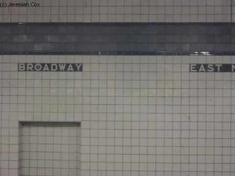
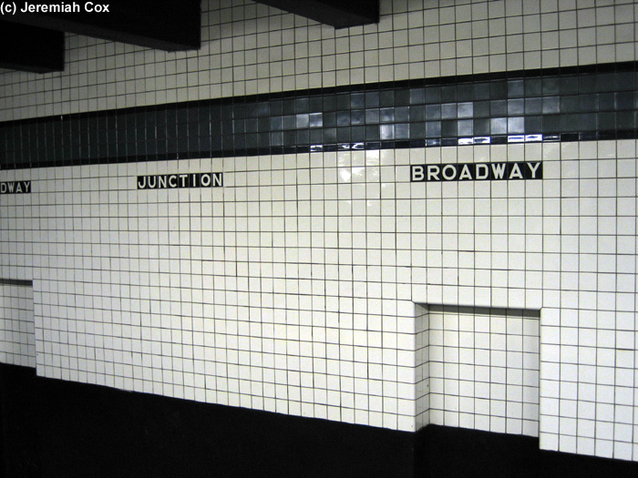
The station's tile band is unique in that it incorporates two types of tile–gloss and matte–in contrasting shades of cobalt blue (gloss border) and blueberry (matte center). When the station was renamed in 2003, [38] the "EAST NY" tiles on the wall were removed [65] and replaced by tiles reading "JUNCTION", in a very closely matching IND font. [66] There is an active control tower just past the head end of the Queens-bound platform. [67]

East of the station, the tunnel widens on both sides to accommodate an additional trackway diverging from the local tracks. These bellmouths, one of which has an emergency exit, were built for a proposed extension along the BMT Jamaica Line, or for a proposed Jamaica Avenue Subway. [68] They were not a provision for the IND Second System, as were similar structures on other IND lines, but rather date from an earlier plan for the IND Fulton Street Line, which would have connected the IND tracks west of the station to two lines to the east of the station: the BMT Jamaica Line tracks, and the BMT Fulton Street Line tracks to Lefferts Boulevard, which were eventually connected to the IND Fulton Street Line anyway, albeit past Grant Avenue. [69]

BMT Fulton Street Line platforms

 Manhattan Junction
 
Former New York City Subway station
Station statistics
Division B (BMT) [1]
Line BMT Fulton Street Line (formerly)
ServicesNone (demolished)
Structure Elevated
Platforms1 island platform
1 side platform (for East New York Loop)
Tracks2
Other information
OpenedJuly 4, 1889;134 years ago (1889-07-04)
ClosedApril 26, 1956;67 years ago (1956-04-26)
Station succession
Next west Rockaway Avenue
Next east Atlantic Avenue
Station service legend
SymbolDescription
NYCS-SSI-alltimes.svg Stops in station at all times
NYCS-SSI-allexceptnights.svg Stops all times except late nights
NYCS-SSI-nightsonly.svg Stops late nights only
NYCS-SSI-nightsweekends.svg Stops late nights and weekends only
NYCS-SSI-weekdaysonly.svg Stops weekdays during the day
NYCS-SSI-weekendsonly.svg Stops weekends during the day
NYCS-SSI-allexceptrush.svg Stops all times except rush hours in the peak direction
NYCS-SSI-allexceptrush.svg Stops all times except weekdays in the peak direction
NYCS-SSI-allexceptrush.svg Stops all times except nights and rush hours in the peak direction
NYCS-SSI-rushonly.svg Stops rush hours only
NYCS-SSI-rushpeak.svg Stops rush hours in the peak direction only
NYCS-SSI-closed.svg Station is closed
(Details about time periods)

Manhattan Junction was the original name for the Fulton Street Elevated platforms. It was located above Fulton and Sackman Streets, and was the second station to be built in the area of Broadway Junction. The station was built by the Kings County Elevated Railway on July 4, 1889. [12] Manhattan Junction station had an island platform and two tracks, with a spur leading to the East New York Yard, as well as a side platform on the north side of the station that turned north along the East New York Loop, and ended on the south side of the BMT Jamaica Line platforms. [14] The line was originally double tracked; a third track was added in the mid-1910s as part of the Dual Contracts expansion of the line between Nostrand Avenue and Hinsdale Street. [70]

In 1938, the Independent Subway System began constructing their own Fulton Street Subway and added an underground subway station named Broadway–East New York station. [7] :49 Stations west of this point were being made obsolete as many were being replaced by the subway stations. The subway station opened in December 1946, [24] [25] and the elevated station above it closed on April 26, 1956, along with all other stations east of Rockaway Avenue. [28] The ironwork for the old Fulton Elevated trackways can still be found over Fulton Street between Van Sinderen Avenue and Williams Place, and can be seen under this portion of the complex from the Canarsie Line platforms. The severed connection between the station and the East New York Yard can also be seen below the Canarsie Line and above the north side of Fulton Street. [7] :50

Ridership

In 2016, the station had 3,085,401 boardings, making it the 166th most used station in the 422-station system. This amounted to an average of 9,189 passengers per weekday. [2] In 2017, The New York Times wrote that 100,000 daily passengers used the station per day, meaning that the vast majority of passengers used the station to make transfers to other routes. [3] By 2019, annual ridership had declined to 2,759,349 boardings, making Broadway Junction the 177th most-used station in the 423-station system. This amounted to an average of 7,813 passengers per weekday. [2] Due to the COVID-19 pandemic in New York City, ridership dropped drastically in 2020, with only 1,292,868 passengers entering the station that year. [2]

Related Research Articles

<span class="mw-page-title-main">Independent Subway System</span> Defunct subway operator in New York City

The Independent Subway System was a rapid transit rail system in New York City that is now part of the New York City Subway. It was first constructed as the Eighth Avenue Line in Manhattan in 1932. It was originally also known as the Independent City-Owned Subway System (ICOSS) or the Independent City-Owned Rapid Transit Railroad (ICORTR).

<span class="mw-page-title-main">Proposed expansion of the New York City Subway</span>

Since the opening of the original New York City Subway line in 1904, and throughout the subway's history, various official and planning agencies have proposed numerous extensions to the subway system. The first major expansion of the subway system was the Dual Contracts, a set of agreements between the City of New York and the IRT and the BRT. The system was expanded into the outer reaches of the Bronx, Brooklyn, and Queens, and it provided for the construction of important lines in Manhattan. This one expansion of the system provided for a majority of today's system.

<span class="mw-page-title-main">J/Z (New York City Subway service)</span> New York City Subway services

The J Nassau Street Local and Z Nassau Street Express are two rapid transit services in the B Division of the New York City Subway. Their route emblems, or "bullets", are colored brown since they use the BMT Nassau Street Line in Lower Manhattan.

<span class="mw-page-title-main">L (New York City Subway service)</span> New York City Subway service

The L 14th Street–Canarsie Local is a rapid transit service in the B Division of the New York City Subway. Its route emblem, or "bullet", is colored medium gray since it serves the BMT Canarsie Line.

The BMT Canarsie Line is a rapid transit line of the B Division of the New York City Subway system, named after its terminus in the Canarsie neighborhood of Brooklyn. It is served by the L train at all times, which is shown in medium gray on the New York City Subway map and on station signs.

The BMT Jamaica Line, also known as the Broadway - Brooklyn Line is an elevated rapid transit line of the B Division of the New York City Subway, in Brooklyn and Queens, New York City, United States. It runs from the Williamsburg Bridge southeast over Broadway to East New York, Brooklyn, and then east over Fulton Street and Jamaica Avenue to Jamaica, Queens. In western Jamaica, the line goes into a tunnel, becoming the lower level of the Archer Avenue lines in central Jamaica. The J and Z trains serve the entire length of the Jamaica Line, and the M serves the line west of Myrtle Avenue.

The IND Fulton Street Line is a rapid transit line of the IND Division of the New York City Subway, running from the Cranberry Street Tunnel under the East River through central Brooklyn to a terminus in Ozone Park, Queens. The IND Rockaway Line branches from it just east of Rockaway Boulevard. The A train runs express during daytime hours and local at night on the underground portion of the line; it runs local on the elevated portion of the line at all times. The C train runs local on the underground portion of the line at all times except late nights.

<span class="mw-page-title-main">Myrtle Avenue station (BMT Jamaica Line)</span> New York City Subway station in Brooklyn

The Myrtle Avenue station is a New York City Subway express station on the BMT Jamaica Line. Located at the intersection of Myrtle Avenue and Broadway in Bushwick, Brooklyn. It is served by the J and M trains at all times, and by the Z during rush hours in peak direction.

<span class="mw-page-title-main">Myrtle–Wyckoff Avenues station</span> New York City Subway station complex in Brooklyn and Queens

The Myrtle–Wyckoff Avenues station is a New York City Subway station complex formed by the intersecting stations of the BMT Canarsie Line and the BMT Myrtle Avenue Line, served by the L and M trains at all times. It is located at Myrtle Avenue and Wyckoff Avenue in the Bushwick neighborhood of Brooklyn and the Ridgewood neighborhood of Queens. The complex is connected by a set of stairs and several elevators and escalators between the elevated and underground levels. The station was renovated completely from 2004 to 2008.

<span class="mw-page-title-main">Atlantic Avenue station (BMT Canarsie Line)</span> New York City Subway station in Brooklyn

The Atlantic Avenue station is a rapid transit station on the BMT Canarsie Line of the New York City Subway. Located at the intersection of Atlantic and Snediker Avenues at East New York, Brooklyn, it is served by the L train at all times.

<span class="mw-page-title-main">Canarsie–Rockaway Parkway station</span> New York City Subway station in Brooklyn

The Canarsie–Rockaway Parkway station is the southern terminal station of the BMT Canarsie Line of the New York City Subway, and is one of the few grade-level stations in the system. Located at the intersection of Rockaway Parkway and Glenwood Road in the Canarsie neighborhood of Brooklyn, it is served by the L train at all times.

<span class="mw-page-title-main">Jefferson Street station</span> New York City Subway station in Brooklyn

The Jefferson Street station is a station on the BMT Canarsie Line of the New York City Subway. Located in Bushwick, Brooklyn at the intersection of Jefferson Street and Wyckoff Avenue, it is served by the L train at all times.

<span class="mw-page-title-main">Marcy Avenue station</span> New York City Subway station in Brooklyn

The Marcy Avenue station is a station on the BMT Jamaica Line of the New York City Subway. Located at the intersection of Marcy Avenue and Broadway in Brooklyn, it is served by the J train at all times, the M train at all times except late nights, and the Z train during rush hours in the peak direction.

Broadway station may refer to:

The New York City Subway's B Division consists of the lines that operate with lettered services, as well as the Franklin Avenue and Rockaway Park Shuttles. These lines and services were operated by the Brooklyn–Manhattan Transit Corporation (BMT) and city-owned Independent Subway System (IND) before the 1940 city takeover of the BMT. B Division rolling stock is wider, longer, and heavier than those of the A Division, measuring 10 or 9.75 ft by 60 or 75 ft.

The Hinsdale Street station was a station on the demolished BMT Fulton Street Line in Brooklyn, New York City, at Pitkin Avenue and Hinsdale Street. It had 3 tracks and 2 side platforms. It opened on November 17, 1918, as a replacement for Eastern Parkway station one block to the west on Snediker Avenue, as part of the Dual Contracts, and had a connecting spur to the BMT Lexington Avenue Line via Manhattan Beach Crossing. It was served by BMT 13 trains until 1940, when they were replaced with BMT 12 trains. It also had a connection to the Bergen Street Line trolleys. It closed on April 26, 1956, along with the rest of the remaining segment of the Fulton Elevated Line west of Hudson Street. The station was not replaced with an underground IND Fulton Street Line station, which runs north along Pennsylvania Avenue towards Broadway Junction; the nearest existing station is Sutter Avenue on the BMT Canarsie Line.

References

  1. 1 2 3 4 5 "Glossary". Second Avenue Subway Supplemental Draft Environmental Impact Statement (SDEIS) (PDF). Vol. 1. Metropolitan Transportation Authority. March 4, 2003. pp. 1–2. Archived from the original (PDF) on February 26, 2021. Retrieved January 1, 2021.
  2. 1 2 3 4 5 6 "Annual Subway Ridership (2017–2022)". Metropolitan Transportation Authority. 2022. Retrieved November 8, 2023.
  3. 1 2 3 Hu, Winnie. "A Tired Brooklyn Transit Hub Is Finally Getting Attention; New York City officials aim to transform Broadway Junction from a pass-through to a destination stop with offices, stores, restaurants and other amenities." Archived November 27, 2017, at the Wayback Machine , The New York Times , November 26, 2017. Accessed November 27, 2017. "Currently, about 100,000 riders pass through Broadway Junction every weekday, making it the third busiest station in Brooklyn, according to the Metropolitan Transportation Authority. Most riders are transferring between the various lines."
  4. Hanc, John (July 2, 2003). "Prospect Park It's Peaceful – Now The biggest battle of the Revolutionary War took place in a bucolic corner of Brooklyn". Long Island Newsday. Archived from the original on January 4, 2020. Retrieved January 1, 2018.
  5. Council, Brooklyn (New York, N. Y. ) Common; Bishop, William G.; McCloskey, Henry (1868). Manual of the Common Council of the City of Brooklyn for ... The Council. p. 468. Archived from the original on July 2, 2022. Retrieved November 9, 2020.{{cite book}}: CS1 maint: multiple names: authors list (link)
  6. "Long Island Railroad Co". Brooklyn Daily Eagle . Brooklyn, NY. March 4, 1843. p. 3.
  7. 1 2 3 4 5 6 7 8 9 10 11 12 13 14 15 16 17 18 "Broadway Junction Transportation Study: NYC Department of City Planning Final Report-November 2008" (PDF). nyc.gov . New York City Department of City Planning. November 2008. Archived (PDF) from the original on June 6, 2010. Retrieved October 27, 2015.
  8. "Building a Terminus". Brooklyn Daily Eagle . Brooklyn, NY. September 18, 1885. p. 1.
  9. "The Brooklyn Elevated". Brooklyn Daily Eagle . Brooklyn, NY. January 3, 1886. p. 1.
  10. "Going Ahead". Brooklyn Daily Eagle . Brooklyn, NY. April 3, 1880. p. 4.
  11. 1 2 "East New York". Brooklyn Daily Eagle . Brooklyn, NY. June 13, 1885. p. 6.
  12. 1 2 "The Fulton Street Elevated". Brooklyn Daily Eagle . Brooklyn, NY. June 28, 1889. p. 6.
  13. "To Join Elevated Roads". Brooklyn Daily Eagle . Brooklyn, NY. September 8, 1899. p. 3.
  14. 1 2 "Loop in Operation". Brooklyn Daily Eagle . Brooklyn, NY. August 9, 1900. p. 3.
  15. "Twenty-Sixth Warders Complain of New L Loop". Brooklyn Daily Eagle . Brooklyn, NY. August 10, 1900. p. 3.
  16. 1 2 Williams, Keith. "Weaving the Broadway Junction tapestry". The Weekly Nabe. Retrieved August 6, 2012.
  17. Whitehorne, Wayne. "BMT Canarsie Line". www.nycsubway.org. Archived from the original on May 11, 2012. Retrieved January 1, 2018.
  18. Cudahy, Brian J. (1995). Under the Sidewalks of New York: The Story of the Greatest Subway System in the World . Fordham Univ Press. pp.  60. ISBN   9780823216185. manhattan junction.
  19. Derrick, Peter (2002). Tunneling to the Future: The Story of the Great Subway Expansion That Saved New York. NYU Press. pp. 221, 227, 280. ISBN   9780814719541. Archived from the original on July 2, 2022. Retrieved November 9, 2020.
  20. Moodys Manual of Railroads and Corporation Securities. Moody Manual Company. 1918. p. 67. Archived from the original on July 2, 2022. Retrieved November 9, 2020.
  21. District, New York (State) Public Service Commission First (January 1, 1921). Annual Report for the Year Ended ... The Commission. Archived from the original on March 13, 2022. Retrieved November 9, 2020.
  22. 1 2 "Last Link of New 14th St-E.D. Subway To Be Opened Today: First Train This Afternoon Will Carry Officials – Citizens to Celebrate". Brooklyn Daily Eagle. July 14, 1928. Archived from the original on October 21, 2020. Retrieved August 25, 2015 via Newspapers.com.
  23. 1 2 "CELEBRATE OPENING OF NEW B. M. T. LINE; Officials and Civic Association Members Fill First Train From Union Square. MET BY BAND AT CANARSIE Crowds Cheer Passing Cars at Stations Along New Route to Jamaica Bay". The New York Times. July 15, 1928. ISSN   0362-4331. Archived from the original on December 10, 2021. Retrieved January 1, 2018.
  24. 1 2 3 4 Raskin, Joseph B. (2013). The Routes Not Taken: A Trip Through New York City's Unbuilt Subway System. New York, New York: Fordham University Press. doi:10.5422/fordham/9780823253692.001.0001. ISBN   978-0-82325-369-2.
  25. 1 2 3 4 Blauvelt, Paul (June 9, 1946). "Shortages Snarl $50,000,000 Tube Links". Brooklyn Daily Eagle . p. 21. Archived from the original on October 26, 2016. Retrieved October 9, 2015 via Newspapers.com.
  26. 1 2 3 4 5 "Big Escalator To Link Three Lines in E.N.Y.: Will connect Fulton St. Subway With 14th St., Broadway Routes". Brooklyn Daily Eagle . February 17, 1947. Archived from the original on December 20, 2016. Retrieved July 15, 2016 via Newspapers.com.
  27. 1 2 Report for the three and one-half years ending June 30, 1949. New York City Board of Transportation. 1949. hdl:2027/mdp.39015023094926.
  28. 1 2 "First Leg of Rockaways Transit Opened at Cost of $10,154,702" (PDF). The New York Times . April 30, 1956. Archived from the original on July 2, 2022. Retrieved June 29, 2015.
  29. Bennett, Charles G. (November 20, 1949). "Transit Platforms on Lines in Queens to Be Lengthened; $3,850,000 Program Outlined for Next Year to Care for Borough's Rapid Growth". The New York Times. ISSN   0362-4331 . Retrieved May 23, 2023.
  30. "37 Platforms On Subways To Be Lengthened: All Stations of B. M. T. and I.R.T. in Queens Included in $5,000,000 Program". New York Herald Tribune. November 20, 1949. p. 32. ISSN   1941-0646. ProQuest   1325174459.
  31. Report. New York City Transit Authority. 1953.
  32. Ingalls, Leonard (August 28, 1953). "2 Subway Lines to Add Cars, Another to Speed Up Service" (PDF). The New York Times. ISSN   0362-4331 . Retrieved January 25, 2016.
  33. "16-Point Plan Can Give Boro Relief Now". Long Island Star–Journal. August 10, 1962. Retrieved April 24, 2018.
  34. NYC Transit Committee Agenda May 1994. New York City Transit. May 16, 1994.
  35. "Artwork: Brooklyn, New Morning (Al Loving)". www.nycsubway.org. Archived from the original on January 8, 2017. Retrieved January 1, 2018.
  36. "Broadway Junction AL LOVING Brooklyn, New Morning, 2001". web.mta.info. Metropolitan Transportation Authority. Archived from the original on January 2, 2018. Retrieved January 1, 2018.
  37. 1 2 "REHABILITATE EAST NEW YORK STATION COMPLEX BROOKLYN". mta.nyc.ny.us. New York City Transit. February 2, 1997. Archived from the original on February 2, 1997. Retrieved September 18, 2016.
  38. 1 2 "New York City Subway Map May 2003" (PDF). mta.info. May 2003. Archived from the original (PDF) on July 10, 2003. Retrieved January 1, 2018.
  39. 1 2
  40. 1 2 "Steps forward: Broadway Junction station to get two new stairways ahead of L-train closure". Brooklyn Paper. March 2, 2018. Archived from the original on March 8, 2018. Retrieved March 8, 2018.
  41. 1 2
  42. 1 2 Stark-Miller, Ethan (May 2, 2023). "Brooklyn subway station to undergo a $500M overhaul, includes new elevators and pedestrian plazas". amNewYork. Archived from the original on May 5, 2023. Retrieved May 2, 2023.
  43. Ginsburg, Aaron (May 2, 2023). "Broadway Junction's overhaul to include $500M in safety, public space, and accessibility upgrades". 6sqft. Archived from the original on May 2, 2023. Retrieved May 2, 2023.
  44. 1 2 3 "Sustainable Communities East New York; Chapter V: Broadway Junction Subarea" (PDF). nyc.gov . New York City Department of City Planning. June 2014. Archived (PDF) from the original on March 2, 2017. Retrieved July 16, 2016.
  45. 1 2 "MTA Neighborhood Maps: Ocean Hill" (PDF). mta.info . Metropolitan Transportation Authority. 2015. Archived (PDF) from the original on June 16, 2016. Retrieved July 19, 2015.
  46. "25 Years Later, NYC Has a Long Way to Go on Accessibility". Tri-State Transportation Campaign. July 27, 2015. Archived from the original on March 8, 2018. Retrieved March 8, 2018.
  47. "Broadway Junction Community Visioning Forum" (PDF). nyc.gov . New York City Department of City Planning. p. 8. Archived (PDF) from the original on November 30, 2018. Retrieved March 8, 2018.
  48. "Straphangers to MTA: We need elevators!". Brooklyn Daily. July 7, 2017. Archived from the original on March 8, 2018. Retrieved March 8, 2018.
  49. "TA Police Shifting Dist. HQ To 116 St". Wave of Long Island . Fultonhistory.com. May 18, 1977. Archived from the original on July 2, 2022. Retrieved July 16, 2016.
  50. 1 2 "Callahan & Kelly Playground: History". New York City Department of Parks and Recreation. Archived from the original on August 7, 2016. Retrieved July 16, 2016.
  51. "Broadway Junction Technical Assistance Panel" (PDF). Urban Land Institute. June 26, 2014. pp. 19–20. Archived from the original (PDF) on December 15, 2016. Retrieved July 16, 2016.
  52. 1 2 3 4 5 Dougherty, Peter (2020). Tracks of the New York City Subway 2020 (16th ed.). Dougherty. OCLC   1056711733.
  53. 1 2 3 "Subway Map" (PDF). Metropolitan Transportation Authority. September 2021. Retrieved September 17, 2021.
  54. Leverett, Chris (March 8, 1998). "View of Canarsie line heading north into tunnel from northbound Canarsie line platform". www.nycsubway.org. Archived from the original on January 2, 2018. Retrieved January 1, 2018.
  55. Chen, Chao-Hwa (December 21, 2001). "Image 133702 North of Broadway Junction". www.nycsubway.org. Archived from the original on January 2, 2018. Retrieved January 1, 2018.
  56. "Eye on the Future – MTA New York City Transit". mta.nyc.ny.us. July 1997. Archived from the original on January 27, 1998. Retrieved December 31, 2017.
  57. Pirmann, David (April 30, 1999). "Old Light Fixtures". www.nycsubway.org. Archived from the original on January 2, 2018. Retrieved January 1, 2018.
  58. Mencher, Robert (September 2003). "Canarsie Line platforms at Broadway Junction Image 27008". www.nycsubway.org. Archived from the original on January 2, 2018. Retrieved January 1, 2018.
  59. "Reopening Closed Subway Entrances" (PDF). pcac.org. New York City Transit Riders Council. November 2001. Archived (PDF) from the original on December 22, 2015. Retrieved December 6, 2015.
  60. 1 2 "Little Move, but Good". Brooklyn Daily Eagle . January 2, 1947. Archived from the original on December 20, 2016. Retrieved July 15, 2016 via Newspapers.com.
  61. "'At Home' Boro Parties Top New Year's Week". Brooklyn Daily Eagle . December 28, 1946. p. 3. Archived from the original on December 20, 2016. Retrieved July 16, 2016 via Newspapers.com.
  62. Bennett, Charles G. (November 20, 1949). "Transit Platforms on Lines in Queens to be Lengthened" (PDF). The New York Times . Archived from the original on July 2, 2022. Retrieved July 16, 2016.
  63. Noonan, Dan (March 6, 1951). "Transit Board to Add 1 Car to Fulton St. IND Trains: 11-Car Units Will East Rush Hour Jam in Boro". Brooklyn Daily Eagle . p. 5. Archived from the original on December 20, 2016. Retrieved July 16, 2016 via Newspapers.com.
  64. Ingalls, Leonard (August 28, 1953). "2 Subway Lines to Add Cars, Another to Speed Up Service" (PDF). New York Times. Archived from the original on July 2, 2022. Retrieved January 25, 2016.
  65. Cox, Jeremiah (March 8, 2003). "The pre-renovation wall tiles at Broadway Jct. They still say Broadway and East NY beneath the stations blue trim". subwaynut.com. Archived from the original on March 9, 2016. Retrieved January 1, 2018.
  66. Cox, Jeremiah (December 22, 2004). "The platform wall at Broadway Junction (A, C) after Renovation, its still in the original IND sceam except says 'Junction' instead of 'East NY'". subwaynut.com. Archived from the original on March 9, 2016. Retrieved January 1, 2018.
  67. "Buttons to Speed Travel in Subway: $2,000,000 System of Signals Soon to Be in Operation on Brooklyn IND Division" (PDF). The New York Times . November 12, 1948. Archived from the original on July 2, 2022. Retrieved December 27, 2016.
  68. RFW of The 168th Street Bound C Train Part 1: Euclid Avenue to Ralph Avenue. August 9, 2010. Archived from the original on December 21, 2021 via YouTube. (The bellmouth can be seen towards the right, at the 5:40 mark in the video, just before the train enters the Broadway Junction station)
  69. "New Fulton St Subway Officially Started as Byrne Turns Earth". April 17, 1929. p. 4. Archived from the original on July 2, 2022. Retrieved December 5, 2016.
  70. "Fulton Street Consents to Go to P.S. Board". Brooklyn Daily Eagle. October 29, 1913. p. 20. Archived from the original on October 2, 2018. Retrieved October 2, 2018 via newspapers.org; Brooklyn Public Library.

The Subway Nut:

Miscellaneous links:

Google Maps Street View: