Broad Street station (BMT Nassau Street Line)

Last updated

 Broad Street
  NYCS-bull-trans-J-Std.svg NYCS-bull-trans-Z-Std.svg
MTA NYC logo.svg New York City Subway station (rapid transit)
Broad Street (J-Z platform)v2.JPG
Southbound/terminating platform
Station statistics
AddressBroad Street & Wall Street
New York, NY 10005
Borough Manhattan
Locale Financial District
Coordinates 40°42′25″N74°00′39″W / 40.70694°N 74.01083°W / 40.70694; -74.01083
Division B (BMT) [1]
Line     BMT Nassau Street Line
Services    J   NYCS-SSI-alltimes.svg (all times)
   Z   NYCS-SSI-rushpeak.svg (rush hours, peak direction)
TransitAiga bus trans.svg New York City Transit: M15, M15 SBS, M55, SIM1, SIM1C, SIM2, SIM3C, SIM5, SIM15, SIM32, SIM33C, SIM34, SIM35, X27, X28
MTA Bus: BM1, BM2, BM3, BM4, QM7, QM8, QM11, QM25
BSicon FERRY.svg Staten Island Ferry at Whitehall Terminal
StructureUnderground
Platforms2 side platforms
Tracks2
Other information
OpenedMay 29, 1931;92 years ago (1931-05-29) [2]
Accessible not ADA-accessible; accessibility planned
Opposite-
direction
transfer
Yes
Traffic
20231,214,353 [3] Increase2.svg 17.6%
Rank250 out of 423 [3]
Services
Preceding station MTA NYC logo.svg New York City Subway Following station
Fulton Street
J   NYCS-SSI-alltimes.svg Z   NYCS-SSI-rushpeak.svg
NYCS-bull-trans-J-Std.svg NYCS-bull-trans-Z-Std.svg Terminus
Location
NYCS map blank.svg
Map pointer.svg
USA New York City location map.svg
Map pointer.svg
USA New York location map.svg
Map pointer.svg
Track layout

Contents

BSicon MFADEg.svg
BSicon uvSTR.svg
BSicon uvSTRfg.svg
BSicon uvUSTr.svg
BSicon dPLTl.svg
BSicon uvSTR.svg
BSicon dPLTr.svg
BSicon dPLTl.svg
BSicon uvSTR.svg
BSicon dPLTr.svg
BSicon dPLTl.svg
BSicon uvSTR.svg
BSicon dPLTr.svg
BSicon uv-SHI2gr.svg
BSicon uvSHI2gl-.svg
BSicon udSTR.svg
BSicon uvUST.svg
BSicon udSTR.svg
BSicon uvSTR.svg
BSicon uvSTR.svg
BSicon numN330.svg
BSicon uvSTR.svg
BSicon uvSTR.svg
BSicon uvSTR.svg
BSicon uvSTR.svg
BSicon MFADEg.svg
BSicon uSTRc1.svg
BSicon MFADEg.svg
BSicon uSTR2+4.svg
BSicon MFADEg.svg
BSicon uSTRc3.svg
BSicon dMFADEf.svg
BSicon utdSTR.svg
BSicon udSTR.svg
BSicon uvENDEe.svg
BSicon udSTR.svg
BSicon MFADEg.svg
BSicon uSTRc1.svg
BSicon MFADEg.svg
BSicon uSTRc1.svg
BSicon uSTR2+4.svg
BSicon MFADEg.svg
BSicon uSTR2+4.svg
BSicon uSTRc3.svg
BSicon uSTRc3.svg
BSicon utdSTR.svg
BSicon udSTR.svg
BSicon MFADEf.svg
BSicon utSTRc1.svg
BSicon uSTRc1.svg
BSicon MFADEf.svg
BSicon utSTR2+4.svg
BSicon uSTRc1.svg
BSicon uSTR2+4.svg
BSicon MFADEf.svg
BSicon utSTRc3.svg
BSicon uSTR2+4.svg
BSicon utSHI1+r.svg
BSicon uSTRc3.svg
BSicon ucSTRc3.svg
BSicon uSHI1r.svg
BSicon utSTRc1.svg
BSicon uSTRc1.svg
BSicon utABZ2+4g.svg
BSicon uABZ2+4g.svg
BSicon utSTRc3.svg
BSicon uSTRc3.svg
BSicon MFADEg.svg
BSicon utSTRc1.svg
BSicon uSTRc1.svg
BSicon MFADEg.svg
BSicon utSTR2+4.svg
BSicon uSTRc1.svg
BSicon uSTR2+4.svg
BSicon MFADEg.svg
BSicon utSTRc3.svg
BSicon uSTR2+4.svg
BSicon uSTRc3.svg
BSicon uSTRc3.svg
BSicon MFADEf.svg
BSicon uSTRc1.svg
BSicon uSTRc1.svg
BSicon MFADEf.svg
BSicon uSTR2+4.svg
BSicon uSTR2+4.svg
BSicon MFADEf.svg
BSicon uSTRc3.svg
BSicon MFADEf.svg
BSicon uSTRc3.svg
Street map

Broad Street station (BMT Nassau Street Line)

Station service legend
SymbolDescription
NYCS-SSI-alltimes.svg Stops all times
NYCS-SSI-rushpeak.svg Stops rush hours in the peak direction only

The Broad Street station is a station on the BMT Nassau Street Line of the New York City Subway at the intersection of Broad and Wall Streets in the Financial District of Manhattan. It serves as the southern terminal for J trains at all times and for Z trains during rush hours in the peak direction.

The station was built as part of the Dual Contracts, signed between the Brooklyn Rapid Transit Company (later reorganized as the Brooklyn–Manhattan Transit Corporation, or BMT) and the city in 1913. The Nassau Street Line was one of the last lines to be completed under the Dual Contracts, and construction did not proceed until James Walker was elected as mayor of New York City in 1926. This station opened on May 29, 1931, as part of the final portion of the Nassau Street Line. Despite being under Broad and Nassau Streets, with Wall Street as the cross-street, this station was named after Broad Street to prevent confusion with other stations. Between 1990 and 2015, Broad Street was only open on weekdays and weekday nights.

History

Planning and construction

On March 19, 1913, the Brooklyn Rapid Transit Company (BRT; after 1923, the Brooklyn–Manhattan Transit Corporation or BMT [4] ) and the city signed Contract 4 of the Dual Contracts, which provided for the construction of certain lines, including the Nassau Street Line. [5] In July 1915, the New York Public Service Commission received the rights to build subway entrances within five buildings near the intersection of Broad and Wall Streets, which would have served the proposed BRT station there. Among the buildings were the New York Stock Exchange Building, the Mills Building, and 23 Wall Street. [6] Most of the BMT's Dual Contracts lines were completed by 1924, except for the Nassau Street Line. [5] BMT chairman Gerhard Dahl was persistent at requesting that the city build the line, saying in 1923 that the BMT was willing to operate the line as soon as the city completed it. [7] At the time, the BMT was planning to construct two stations on the Nassau Street Line, including one at the intersection of Wall and Broad Streets. [8] However, mayor John Hylan refused to act during his final two years in office. [5] BOT chairman John H. Delaney believed that the line was unnecessary because both of its planned stations would be extremely close to existing subway stations. [9] Meanwhile, the BMT claimed that the city's failure to complete the line was overburdening other BMT lines. [10] By January 1925, the BMT was asking its passengers to pressure Hylan into approving the remainder of the Nassau Street Line. [11] Work did not commence until after James Walker succeeded Hylan as mayor at the end of 1925. [5]

The city government agreed to build the Nassau Street Line in May 1927, [12] after the BMT sued the city for $30 million. [12] [13] At the time, the city wanted to take over the BMT's lines but could not do so until all Dual Contracts lines were completed. [13] The BOT received bids for the construction of the line that July, [14] but it rejected every bid the next month because of concerns over the lowest bidder's ability to complete the work. [13] [15] That September, contractors again submitted bids to the BOT; some bidders offered to build the entire line, while others only offered to construct the segments of the line to the north or south of Liberty Street. [14] The BOT awarded construction contracts for the line's construction two months later. The Marcus Contracting Company was hired to build the portion north of Liberty Street, including the Fulton Street station, for $4.7 million, while Moranti and Raymond were hired to build the portion to the south for $5.7 million. [16] [17] The New York City Board of Estimate approved the contracts in January 1928, allowing the builders to construct the line using the cut-and-cover method, despite merchants' requests that the line be constructed using tunneling shields. [18]

The line was constructed 20 feet (6.1 m) below the active IRT Lexington Avenue Line, next to buildings along the narrow Nassau Street, and the project encountered difficulties such as quicksand. [5] [19] When the construction contracts were awarded, work had been projected to be completed in 39 months. [5] Nassau Street is only 34 feet (10 m) wide, and the subway floor was only 20 feet (6.1 m) below building foundations. As a result, 89 buildings had to be underpinned to ensure that they would stay on their foundations. Construction had to be done 20 feet below the active IRT Lexington Avenue Line. An area filled with quicksand with water, which used to belong to a spring, was found between John Street and Broad Street. [5] Additionally, the station underpinned the former Sub-Treasury building (now Federal Hall) at the northeast corner of Wall Street and Nassau Street; the city had to receive permission from the United States Congress to dig under the building, and it constructed a new foundation for that edifice. [20] Construction was done at night so as to not disturb workers in the Financial District. [5] [21]

By early 1929, sixty percent of the work had been finished. [5] [22] The project was 80 percent complete by April 1930. [23] [21] Later that year, a federal judge ruled that the city government did not have to pay the BMT $30 million in damages for failing to construct the Nassau Street Line. [24] The total construction cost was $10.072 million [19] [25] for 0.9 miles (1.4 km) of new tunnels, or $2,068 per foot ($6,780/m), which was three times the normal cost of construction at the time. [5]

Operation

Grecian revival tablet and frieze circa 1996 from original Vickers design Broad Street BMT 008.JPG
Grecian revival tablet and frieze circa 1996 from original Vickers design

The station opened on May 29, 1931, completing what was known as the "Nassau Street Loop". [26] [27] [28] The loop ran from the line's previous terminus at Chambers Street, running through the Fulton Street and Broad Street stations before merging with the Montague Street Tunnel to Brooklyn. [29] The completion of the line relieved congestion on several BMT lines to southern Brooklyn, which previously had to operate to Midtown Manhattan using the Broadway Line. [30] When the line was completed, Culver Line trains began operating on the loop; previously, elevated Culver Line trains from Coney Island ran only as far as Ninth Avenue, where transfers were made to West End subway trains. The new line provided an additional ten percent capacity compared with existing service through DeKalb Avenue. Service on the Jamaica Line was extended to operate to this station. [31] [32]

The station is under Broad and Nassau Streets, with Wall Street as the cross-street, but was named after Broad Street to distinguish it from the two other Wall Street stations nearby, at Broadway and at William Street. [20] [33] When the station opened, it had 14 exits to nearby buildings. [20] [21] Banking firm J.P. Morgan & Co., which occupied a structure at 23 Wall Street (on the southwest corner with Broad and Nassau Streets), paid for the installation of bronze rails and stanchions on the subway entrance just outside its building. Other entrances were built to the basements of the Equitable Building and the Bankers Trust Company Building. In addition, there were street entrances outside the New York Stock Exchange Building; to the intersection of Broad Street and Exchange Place; and to the northwest corners of Nassau and Cedar Streets. [20]

In April 1993, the New York State Legislature agreed to give the MTA $9.6 billion for capital improvements. Some of the funds would be used to renovate nearly one hundred New York City Subway stations, [34] [35] including Broad Street. [36] From September 30, 1990, [37] to June 14, 2015, the Broad and Fulton Street stations were closed during weekends, making them two of the four New York City Subway stations that lacked full-time service (the remaining two being the platforms for the 42nd Street Shuttle). [38]

Proposed elevators

A proposed skyscraper at 45 Broad Street will provisionally include an entrance to the station that contains elevators, making the station compliant with the Americans with Disabilities Act of 1990. [39] The plans call for two elevators, one for each platform, at the northeastern and southwestern corners of Broad Street and Exchange Place. [40] The New York City Council approved the construction of the elevators in July 2018, and granted the developers an additional 71,391 square feet (6,632.4 m2) in zoning rights in exchange for building the elevators. [41]

Residents and tenants of 15 and 30 Broad Street opposed construction of glass-and-metal elevators, saying they posed a risk for terrorist attacks; the buildings' occupants hired a security consultant who determined they were a terrorist risk. [42] However, the Metropolitan Transportation Authority hired its own security consultant who found they would not make the area more prone to terrorist attacks. Regular riders at the Broad Street station also advocated for the elevators because only six of the 30 stations served by the J and Z trains were wheelchair-accessible as of 2020. [42]

Station layout

GroundStreet LevelEntrance/exit
MezzanineFare control, station agent, out-of-system passageway to Wall Street
Platform level Side platform
Northbound NYCS-bull-trans-J-Std.svg toward Jamaica Center–Parsons/Archer (Fulton Street)
NYCS-bull-trans-Z-Std.svg PM rush toward Jamaica Center–Parsons/Archer (Fulton Street)
Southbound NYCS-bull-trans-J-Std.svg NYCS-bull-trans-Z-Std.svg termination track →
(No service: Court Street)
Side platform
A consist of R42 cars in J service at Broad Street NYC Broad Street J train.jpg
A consist of R42 cars in J service at Broad Street

This station has two tracks and two side platforms [43] and is approximately 535 feet (163 m) long. [21] The J train stops here at all times, while the Z train stops here during rush hours in the peak direction. [44] The Broad Street station is the southern terminus of both routes; the next station to the north is Fulton Street. [45] In contrast to the Fulton Street station, which is built on two levels because of the narrowness of Nassau Street, the Broad Street station is wide enough to accommodate both tracks on the same level. [20] [21] South of this station, there are two center stub tracks ending at bumper blocks used for laying-up and relaying trains. [20] [43] Trains terminate on the southbound track and continue to the center stub tracks, where they reverse direction. There is also a single switch north of the station to enable trains on the southbound track to return to the northbound track. [43]

Further south, the two tracks of the BMT Nassau Street Line merge with the BMT Broadway Line via a flying junction as it enters the Montague Street Tunnel into Downtown Brooklyn. [43] After the line merges with the Montague Street Tunnel, the next station to the south is Court Street. [43] No regular service has used this connection since the M train was rerouted in June 2010. [46] [47]

The station originally had red tile bands, similar to those used on the Independent Subway System. [48] [49] This station was renovated in the late 1990s and a mosaic design was added to the platform walls. Beneath a small green and gold trim-line is a larger gold trim-line with a maroon border and white "B" and "BROAD ST" tablets on a blue-green background at regular intervals. [50]

Exits

Entrance next to 23 Wall Street, following the restoration of full-time service to the station Broad Street - Exit at 23 Wall Street.jpg
Entrance next to 23 Wall Street, following the restoration of full-time service to the station

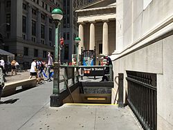
This station has three entrance and exit areas, with eight total stairways. The full-time entrance/exit is at the north end above the platforms. Two staircases from each side go up to a mezzanine containing a turnstile bank and station agent's booth. Outside of fare control, two street stairs go up to the southeastern corner of Wall and Broad Streets (outside 23 Wall Street). [51] Two more street stairs go up to the southwestern corner of the same intersection and lie outside of the New York Stock Exchange Building (NYSE). After the September 11 attacks in 2001, the stair facing away from Wall Street was closed off by the New York City Police Department, which had instituted a security zone around the NYSE. [5] [50] In 2012, the stair facing towards Wall Street was closed when the security zone was reorganized. [52] In 2017, the two exits were proposed to be sealed as part of general improvements in that area, but no action was taken. [53] In 2019, the MTA again proposed permanently closing and removing the stairways to allow the NYSE to improve the streetscape just outside the building. [52]

The other two fare entrances/exits are unstaffed and at platform level. The northbound platform has a part-time bank of both regular and HEET turnstiles and three street stairs, one to the northeastern corner of Exchange Place and Broad Street (outside 15 Broad Street) and two along Broad Street between Exchange Place and Beaver Street (outside the Broad Exchange Building). [51] The southbound platform has turnstiles that were originally HEET access, but were converted to exit-only following the elimination of through service at this station. Two staircases go to Broad Street between Exchange Place and Beaver Street, outside 30 Broad Street. [51] A third on the southwestern corner of Exchange Place and Broad Street was closed and sealed. There is another exit-only staircase at the station leading to the northwestern corner of Broad Street and Exchange Place. It was previously closed by the New York City Police Department as well, but was reopened when security zone was reorganized. [50]

Outside of fare control, the station's main entrance/exit has a long passage that is only open weekdays from 7:00 a.m. to 6:00 p.m. It runs north three blocks to the basement of 28 Liberty Street, where two sets of doors and a wide staircase lead to an unmarked entrance/exit at the east side of Nassau Street at Cedar Street. This entrance also provides access to the Wall Street/William Street station ( 2 and 3 trains) and the Wall Street/Broadway station ( 4 and 5 trains). [51] The passage also has two closed exits; one led to the northwestern corner of Wall Street and Nassau Street and was closed by 1992. [54] The other led to the northwestern corner of Cedar Street and Nassau Street, near 140 Broadway, but was closed by 1999 and has since been repurposed into an emergency exit. [55] Halfway through the passage, a short staircase from the west side leads up to a narrower passageway that runs through the basement of the Equitable Building before two offset High Entrance/Exit Turnstiles provide entrance to the Wall Street/Broadway station. [51] Inside fare control, the passage splits in half with each branch leading to either side platform of Wall Street. [56] Free connections between the BMT Nassau Street Line and IRT Lexington Avenue Line are available at the next three stations north (Fulton Street, Chambers Street, and Canal Street). [57]

Lower Manhattan transit
BSicon MFADEg.svg
BSicon STR red.svg
BSicon MFADEg.svg
BSicon uSTR.svg
BSicon MFADEg.svg
BSicon STR yellow.svg
BSicon MFADEg.svg
BSicon fSTR.svg
BSicon MFADEg.svg
BSicon STR brown.svg
BSicon HST red.svg
BSicon uSTR.svg
BSicon STR yellow.svg
BSicon HUB2.svg
BSicon fACC.svg
BSicon HUBc3.svg
BSicon STR brown.svg
NYCS-bull-trans-1-Std.svg NYCS-bull-trans-2-Std.svg NYCS-bull-trans-3-Std.svg Chambers Street
BSicon ACC red.svg
BSicon uKRWgl.svg
BSicon uKRW+r.svg
BSicon STR yellow.svg
BSicon HUBc1.svg
BSicon fSTR.svg
BSicon HUB4.svg
BSicon ACC brown.svg
BSicon STR red.svg
BSicon HUBaq.svg
BSicon uBHF.svg
BSicon lACC.svg
BSicon HUBlg.svg
BSicon uKBHFe.svg
BSicon HST yellow.svg
BSicon fSTR.svg
BSicon STR brown.svg
City Hall NYCS-bull-trans-R-Std.svg NYCS-bull-trans-W-Std.svg
BSicon ABZgl red.svg
BSicon uSTR.svg
BSicon STRq red.svg
BSicon HUB.svg
BSicon BHFq red.svg
BSicon STR yellow.svg
BSicon STRq red.svg
BSicon fSTR.svg
BSicon STRq red.svg
BSicon STR brown.svg
BSicon STRq red.svg
BSicon STR+r red.svg
BSicon ACC red.svg
BSicon BLaq.svg
BSicon ukSTR2.svg
BSicon BLq.svg
BSicon KRW+l yellow.svg
BSicon lACC~L.svg
BSicon HUBl.svg
BSicon BLq.svg
BSicon KRWr yellow.svg
BSicon BL2+r.svg
BSicon lACC~R.svg
BSicon dHUBeq.svg
BSicon d.svg
BSicon BLc3.svg
BSicon c.svg
BSicon fSTR.svg
BSicon STR brown.svg
BSicon STR red.svg
(Pfeil links.svg  HOB    NWK  ) World Trade Center
BSicon MFADEgq.svg
BSicon STRq.svg
BSicon STR red.svg
BSicon cdSTRq.svg
BSicon KACCeq.svg
BSicon ukSTRc1.svg
BSicon STR yellow.svg
BSicon ukSTRl+4.svg
BSicon BLc1.svg
BSicon uSTRq.svg
BSicon XACC-L.svg
BSicon fSTR.svg
BSicon KBL4.svg
BSicon lACC.svg
BSicon HUBaq.svg
BSicon uSTRq.svg
BSicon ACC brown.svg
BSicon HUBq.svg
BSicon XACC-M.svg
BSicon XACC-R.svg
BSicon ACC red.svg
BSicon HUBeq.svg
BSicon uSTRq.svg
BSicon MFADEfq.svg
BSicon uSTRq.svg
Fulton Street NYCS-bull-trans-2-Std.svg NYCS-bull-trans-3-Std.svg NYCS-bull-trans-4-Std.svg NYCS-bull-trans-5-Std.svg NYCS-bull-trans-A-Std.svg NYCS-bull-trans-C-Std.svg NYCS-bull-trans-J-Std.svg NYCS-bull-trans-Z-Std.svg
BSicon HST red.svg
BSicon HST yellow.svg
BSicon fSTR.svg
BSicon STR brown.svg
BSicon STR red.svg
BSicon STR red.svg
BSicon STR yellow.svg
BSicon fHST.svg
BSicon KBL2.svg
BSicon STR brown.svg
BSicon BL3+l.svg
BSicon HST red.svg
BSicon BLeq.svg
BSicon eABZgl red.svg
BSicon exSTRq red.svg
BSicon STR yellow.svg
BSicon exSTR+r red.svg
BSicon fACC.svg
BSicon BLc1.svg
BSicon KHSTxe brown.svg
BSicon KBL4.svg
BSicon STRl red.svg
BSicon MFADEfq.svg
BSicon STRq red.svg
Broad Street (Pfeil oben.svg NYCS-bull-trans-J-Std.svg NYCS-bull-trans-Z-Std.svg )
BSicon STRl red.svg
BSicon HUBaq.svg
BSicon KACCeq red.svg
BSicon HUBeq.svg
BSicon BHF yellow.svg
BSicon exSTR red.svg
BSicon fexKRW+l.svg
BSicon fSTR.svg
BSicon fexKRWr.svg
BSicon exSTR brown.svg
BSicon FERRY.svg
BSicon STRl yellow.svg
BSicon exSTR red.svg
BSicon STRq yellow.svg
BSicon fkSTR2.svg
BSicon STRq yellow.svg
BSicon exSTRl brown.svg
BSicon STRq yellow.svg
BSicon MFADEfq.svg
BSicon STRq yellow.svg
BSicon exKBHFe red.svg
BSicon fkSTRc1.svg
BSicon fkSTRl+4.svg
BSicon fSTRq.svg
BSicon MFADEfq.svg
BSicon fSTRq.svg

Related Research Articles

<span class="mw-page-title-main">Wall Street station (IRT Lexington Avenue Line)</span> New York City Subway station in Manhattan

The Wall Street station is a station on the IRT Lexington Avenue Line of the New York City Subway. The station is located at the intersection of Broadway and Wall Street in the Financial District of Lower Manhattan. It is served by the 4 train at all times and the 5 train at all times except late nights.

<span class="mw-page-title-main">Times Square–42nd Street station</span> New York City Subway station in Manhattan

The Times Square–42nd Street station is a major New York City Subway station complex located under Times Square, at the intersection of 42nd Street, Seventh Avenue, and Broadway, in Midtown Manhattan. The complex allows free transfers between the IRT 42nd Street Shuttle, the BMT Broadway Line, the IRT Broadway–Seventh Avenue Line and the IRT Flushing Line, as well as to the IND Eighth Avenue Line a block west at 42nd Street–Port Authority Bus Terminal. The complex is served by the 1, 2, 3, 7, N and Q trains at all times, the W train during weekdays; the R and 42nd Street Shuttle (S) trains at all times except late nights; and <7> trains during rush hours in the peak direction. A free passageway from the shuttle platform to the 42nd Street–Bryant Park/Fifth Avenue station, served by the 7, <7>​​, B, ​D, ​F, <F>, and ​M trains, is open during the day from 6 a.m. to 12 a.m.

<span class="mw-page-title-main">Borough Hall/Court Street station</span> New York City Subway station in Brooklyn

The Borough Hall/Court Street station is an underground New York City Subway station complex in Brooklyn shared by the BMT Fourth Avenue Line, the IRT Broadway–Seventh Avenue Line and the IRT Eastern Parkway Line. The complex comprises three stations: Borough Hall on the IRT lines and Court Street on the BMT line. The stations are located under Court, Joralemon, and Montague Streets, next to Brooklyn Borough Hall, in the Downtown Brooklyn and Brooklyn Heights neighborhoods of Brooklyn. It is served by the 2, 4, and R trains at all times; the 3 train all times except late nights; the 5 train on weekdays; the N train during late nights; and limited rush-hour W trains.

The BMT Nassau Street Line is a rapid transit line of the B Division of the New York City Subway system in Manhattan. At its northern end, the line is a westward continuation of the BMT Jamaica Line in Brooklyn after the Jamaica Line crosses the Williamsburg Bridge into Manhattan. The Nassau Street Line continues south to a junction with the BMT Broadway Line just before the Montague Street Tunnel, after which the line reenters Brooklyn. Although the tracks merge into the Broadway Line south of Broad Street, there has been no regular service south of the Broad Street station since June 25, 2010. While the line is officially recognized as the Nassau Street Line, it only serves one station on Nassau Street: Fulton Street.

<span class="mw-page-title-main">Wall Street station (IRT Broadway–Seventh Avenue Line)</span> New York City Subway station in Manhattan

The Wall Street station is a station on the IRT Broadway–Seventh Avenue Line of the New York City Subway, located at the intersection of Wall Street and William Street in the Financial District of Manhattan. It is served by the 2 train at all times and the 3 train at all times except late nights.

<span class="mw-page-title-main">34th Street–Herald Square station</span> New York City Subway station in Manhattan

The 34th Street–Herald Square station is an underground station complex on the BMT Broadway Line and the IND Sixth Avenue Line of the New York City Subway. It is located at Herald Square in Midtown Manhattan where 34th Street, Broadway and Sixth Avenue intersect, and is served by the D, F, N, and Q trains at all times; the R train at all times except late nights; the B, M, and W trains on weekdays; and the <F> train during rush hours in the peak direction.

<span class="mw-page-title-main">23rd Street station (BMT Broadway Line)</span> New York City Subway station in Manhattan

The 23rd Street station is a local station on the BMT Broadway Line of the New York City Subway. Located at the intersection of 23rd Street, Broadway, and Fifth Avenue in the Flatiron District of Manhattan, it is served by the R train at all times except late nights, the W train on weekdays, the N train during late nights and weekends, and the Q train during late nights.

<span class="mw-page-title-main">Bay Ridge–95th Street station</span> New York City Subway station in Brooklyn

The Bay Ridge–95th Street station is the southern terminal station on the BMT Fourth Avenue Line of the New York City Subway. Despite the name, the station is located in the neighborhood of Fort Hamilton at the intersection of 95th Street and Fourth Avenue in southwestern Brooklyn. It is served by the R train at all times. Geographically, this station is the westernmost New York City Subway station.

<span class="mw-page-title-main">Rector Street station (BMT Broadway Line)</span> New York City Subway station in Manhattan

The Rector Street station is a local station on the BMT Broadway Line of the New York City Subway. Located at the corner of Rector Street and Trinity Place in Financial District, Lower Manhattan, the station is served by the R train at all times except late nights, when the N train takes over service. The W train also serves this station on weekdays.

<span class="mw-page-title-main">49th Street station (BMT Broadway Line)</span> New York City Subway station in Manhattan

The 49th Street station is a local station on the BMT Broadway Line of the New York City Subway. Located at West 49th Street and Seventh Avenue in Midtown Manhattan, it is served by the N train at all times, the R train at all times except late nights, the W train on weekdays, and the Q train during late nights.

<span class="mw-page-title-main">Fifth Avenue–59th Street station</span> New York City Subway station in Manhattan

The Fifth Avenue–59th Street station is a station on the BMT Broadway Line of the New York City Subway. Located under Grand Army Plaza near the intersection of 5th Avenue and 60th Street in Manhattan, it is served by the N train at all times, the W train on weekdays during the day, and the R train at all times except late nights.

<span class="mw-page-title-main">Bowery station</span> New York City Subway station in Manhattan

The Bowery station is a station on the BMT Nassau Street Line of the New York City Subway. Located at the intersection of Bowery and Delancey Street in the Lower East Side and Little Italy neighborhoods, it is served by the J train at all times and the Z train during rush hours in the peak direction.

<span class="mw-page-title-main">Lexington Avenue/59th Street station</span> New York City Subway station in Manhattan

The Lexington Avenue/59th Street station is a New York City Subway station complex shared by the IRT Lexington Avenue Line and the BMT Broadway Line. It is located at Lexington Avenue between 59th and 60th Streets, on the border of Midtown and the Upper East Side of Manhattan. The station complex is the fourteenth-busiest in the system, with over 21 million passengers in 2016.

<span class="mw-page-title-main">Delancey Street/Essex Street station</span> New York City Subway station in Manhattan

The Delancey Street/Essex Street station is a station complex shared by the BMT Nassau Street Line and the IND Sixth Avenue Lines of the New York City Subway, located at the intersection of Essex and Delancey Streets on the Lower East Side of Manhattan, just west of the Williamsburg Bridge. It is served by the:

<span class="mw-page-title-main">Canal Street station (New York City Subway)</span> New York City Subway station in Manhattan

The Canal Street station is a New York City Subway station complex. It is located in the neighborhoods of Chinatown and SoHo in Manhattan and is shared by the BMT Broadway Line, the IRT Lexington Avenue Line, and the BMT Nassau Street Line. It is served by the 6, J, N, and Q trains at all times; the R train at all times except late nights; the W train during weekdays; the <6> train during weekdays in the peak direction; the Z train during rush hours in the peak direction; and the 4 train during late nights.

<span class="mw-page-title-main">14th Street/Eighth Avenue station</span> New York City Subway station in Manhattan

The 14th Street/Eighth Avenue station is an underground New York City Subway station complex shared by the IND Eighth Avenue Line and the BMT Canarsie Line. Located at Eighth Avenue and 14th Street in Manhattan, the station is served by the A, E and L trains at all times and the C train at all times except late nights.

<span class="mw-page-title-main">Fulton Street station (New York City Subway)</span> New York City Subway station in Manhattan

The Fulton Street station is a major New York City Subway station complex in Lower Manhattan. It consists of four linked stations on the IND Eighth Avenue Line, the IRT Lexington Avenue Line, the BMT Nassau Street Line and the IRT Broadway–Seventh Avenue Line. The complex is served by the 2, 4, A, and J trains at all times. The 3, 5, and C trains stop here at all times except late nights, and the Z stops during rush hours in the peak direction.

<span class="mw-page-title-main">Brooklyn Bridge–City Hall/Chambers Street station</span> New York City Subway station in Manhattan

The Brooklyn Bridge–City Hall/Chambers Street station is a New York City Subway station complex in Lower Manhattan. The complex is served by trains of the IRT Lexington Avenue Line and the BMT Nassau Street Line. The station is served by the 4, 6, and J trains at all times; the 5 train at all times except late nights; the <6> train during weekdays in the peak direction; and the Z train during rush hours in the peak direction.

<span class="mw-page-title-main">Jay Street–MetroTech station</span> New York City Subway station in Brooklyn

The Jay Street–MetroTech station is a New York City Subway station complex on the IND Fulton Street, IND Culver, and BMT Fourth Avenue lines. The complex is located in the vicinity of MetroTech Center in Downtown Brooklyn. It is served by the A, F, and R trains at all times; the C train at all times except late nights; the N train during late nights only; and a few rush-hour W and <F> trains in the peak direction.

<span class="mw-page-title-main">Chambers Street–World Trade Center/Park Place/Cortlandt Street station</span> New York City Subway station in Manhattan

The Chambers Street–World Trade Center/Park Place/Cortlandt Street station is a New York City Subway station complex on the IND Eighth Avenue Line, IRT Broadway–Seventh Avenue Line, and BMT Broadway Line. Located on Church Street between Chambers and Cortlandt Streets in Lower Manhattan, it is served by the 2, A and E trains at all times; W train on weekdays; 3, C and R trains at all times except late nights; and N train during late nights.

References

  1. "Glossary". Second Avenue Subway Supplemental Draft Environmental Impact Statement (SDEIS) (PDF). Vol. 1. Metropolitan Transportation Authority. March 4, 2003. pp. 1–2. Archived from the original (PDF) on February 26, 2021. Retrieved January 1, 2021.
  2. "Mayor Drives Train in New Subway Link". The New York Times. May 30, 1931. p. 11. Archived from the original on December 17, 2021. Retrieved April 19, 2020.
  3. 1 2 "Annual Subway Ridership (2018–2023)". Metropolitan Transportation Authority. 2023. Retrieved April 20, 2024.
  4. State of New York Transit Commission Third Annual Report for the Calendar Year 1923. New York State Transit Commission. 1924. p. 501.
  5. 1 2 3 4 5 6 7 8 9 10 11 Linder, Bernard (February 2016). "Contract 4 Subway Controversy". The Bulletin. Vol. 59, no. 2. Electric Railroaders' Association. pp. 1, 6. Archived from the original on August 16, 2016. Retrieved July 28, 2016.
  6. "Have Obtained Valuable Rights: Public Service Gets Free Many Station Entrances on New Routes". New-York Tribune. July 11, 1915. p. C2. ISSN   1941-0646. ProQuest   575403970.
  7. "Agree to Extension of 14th St. Subway; B.M.T. Relinquishes Demand for Elevated Structure Specified in Contract". The New York Times. December 19, 1923. ISSN   0362-4331 . Retrieved May 7, 2023.
  8. "Nassau St. Subway Plan Nearly Ready; Southern End Completed, but Northern Section Involves a More Difficult Problem". The New York Times. March 3, 1923. ISSN   0362-4331 . Retrieved May 7, 2023.
  9. Young, James C. (June 12, 1927). "Nassau Loop Builders Face a Difficult Task; The Half-Mile of Subway in the Heart of New York's Financial District Raises Construction Problems Never Before Encountered". The New York Times. ISSN   0362-4331 . Retrieved May 7, 2023.
  10. "B.M.T. Plans Work to Cost $2,000,000; Directors Approve Program of Improvements to Be Made This Year". The New York Times. May 20, 1925. ISSN   0362-4331 . Retrieved May 7, 2023.
  11. "B.M.T. Asks Public to Make Hylan Act; Offers $15,000,000; Starts Campaign to Force Construction of the Nassau Street Subway". The New York Times. April 6, 1925. ISSN   0362-4331 . Retrieved May 7, 2023.
  12. 1 2 "City Will Build Nassau St. Tube; Forced to Yield; Link for the B.M.T., Less Than a Mile in Length, Will Cost $13,000,000". The New York Times. May 28, 1927. ISSN   0362-4331 . Retrieved May 7, 2023.
  13. 1 2 3 Moscow, Warren (August 21, 1927). "Nassau Street Subway Again Proves Nuisance As Board Rejects Bids". The Brooklyn Citizen. pp. 1, 4 . Retrieved May 7, 2023.
  14. 1 2 "$9,986,997 Low Bid for Nassau Subway; Board Tabulates Figures of 17 Contractors in Second Competition for the Work". The New York Times. September 25, 1927. ISSN   0362-4331 . Retrieved May 7, 2023.
  15. "All Bids Rejected on Nassau Subway; Transportation Board Orders New Figures -- Delays Start of Work Three Months". The New York Times. August 21, 1927. ISSN   0362-4331 . Retrieved May 7, 2023.
  16. "Awards Contracts for Nassau St. Links; Board Lets Out Work on Two Subway Sections for $10,458,034". The New York Times. November 24, 1927. ISSN   0362-4331 . Retrieved May 7, 2023.
  17. "Board Awards Nassau Street Tube Contracts". The Standard Union. November 23, 1927. p. 3. Retrieved May 7, 2023.
  18. "Approves Open Cut for Nassau St. Link; Estimate Board Overrules the Pleas for Tunnel Method of Subway Construction". The New York Times. January 27, 1928. ISSN   0362-4331 . Retrieved May 7, 2023.
  19. 1 2 "Nassau St. Subway To Open On May 30; Its Construction an Engineering Feat Because Many Buildings Had to Be Underpinned. Cost $10,072,000 To Build It Will Link B.M.T.'s Centre Street Loop With Tunnel Under East River. 14th St. Extension Ready Connection With Eighth Avenue Line Will Go Into Operation on the Same Day". The New York Times. May 10, 1931. ISSN   0362-4331. Archived from the original on July 26, 2018. Retrieved July 28, 2016.
  20. 1 2 3 4 5 6 Harrington, John Walker (May 17, 1931). "Nassau St. Loop In Subway Opens Memorial Day: Link for 3 Divisions, Costing 11 Millions a Mile, to Speed Service 40 P. C. Task Debated 18 Years 4-Track System in Broad St. Part of Switching Plan Scenes and Charts in Forging of City's New Underground Railway Link". New York Herald Tribune. p. A12. ISSN   1941-0646. ProQuest   1114183895.
  21. 1 2 3 4 5 "Bids Asked for B.-M.T. Subway in Manhattan". The Brooklyn Citizen. April 20, 1930. p. 3. Retrieved May 10, 2023 via Newspapers.com.
  22. "Engineers Study Nassau St. Loop; 200 Spend 3 Hours in Subway of B.M.T. System Watching All Phases of Work". The New York Times. January 20, 1929. ISSN   0362-4331 . Retrieved May 7, 2023.
  23. "New B.M.T. Link is 80% Complete; Nassau-Broad St. Tracks to Be Finished by Autumn, Transit Board Says". The New York Times. April 20, 1930. ISSN   0362-4331 . Retrieved May 7, 2023.
  24. "B.M.T. Loses to City in $30,000,000 Suit; Court Rules in 8-Year-Old Action New York Is Not Liable for Building Delay". The New York Times. August 2, 1930. ISSN   0362-4331 . Retrieved May 14, 2023.
  25. "Mayor Inspects New Nassau St. Subway Today: City Officials To Be Guests of B.M.T. in Tour of Links That Open Tomorrow". New York Herald Tribune. May 29, 1931. p. 21. ISSN   1941-0646. ProQuest   1114186438.
  26. Cunningham, Joseph; DeHart, Leonard O. (January 1, 1993). A History of the New York City Subway System. J. Schmidt, R. Giglio, and K. Lang. Archived from the original on May 2, 2022. Retrieved December 30, 2020.
  27. "Mayor Drives Train In New Subway Link; The Mayor Becomes A Motorman". The New York Times. May 30, 1931. ISSN   0362-4331. Archived from the original on December 17, 2021. Retrieved July 28, 2016.
  28. "Walker Operates First Train in Nassau St. Loop: Tests Out Whistle Before Sudden Stop for Which Instructor Takes Blame New B. M. T. System Link Other Officials at Opening of $10,000,000 Subway Nassau Street Subway Is Formally Opened". New York Herald Tribune. May 30, 1931. p. 3. ISSN   1941-0646. ProQuest   1114103146.
  29. Derrick, Peter (April 1, 2002). Tunneling to the Future: The Story of the Great Subway Expansion That Saved New York. NYU Press. ISBN   9780814719541. Archived from the original on May 22, 2020. Retrieved December 30, 2020.
  30. "Nassau-Broad Subway Route Opens May 30: 14th St. Link of B. M. T. Line From 6th to 8th Aves. Also To Be Finished Then Both Cost $13,630,313 City Labored Three Years on Engineering Projects". New York Herald Tribune. May 10, 1931. p. 2. ISSN   1941-0646. ProQuest   1114181918.
  31. "Nassau St. Service Outlined By B.M.T.; Loop to Be Used for Direct Connection From Brooklyn and Jamaica to Manhattan" . The New York Times. May 21, 1931. ISSN   0362-4331. Archived from the original on June 14, 2018. Retrieved July 28, 2016.
  32. "B.M.T. Provides Through Service On Culver Line: Additional Trains on Nassau St. Loop and 14th St. Extension Run May 30". New York Herald Tribune. May 21, 1931. p. 43. ISSN   1941-0646. ProQuest   1114100391.
  33. "Nassau St. Subway To Open On May 30; Its Construction an Engineering Feat Because Many Buildings Had to Be Underpinned. Cost $10,072,000 To Build It Will Link B.M.T.'s Centre Street Loop With Tunnel Under East River. 14th St. Extension Ready Connection With Eighth Avenue Line Will Go Into Operation on the Same Day" . The New York Times. May 10, 1931. ISSN   0362-4331. Archived from the original on July 26, 2018. Retrieved July 28, 2016.
  34. Benenson, Joel (April 1, 1993). "Albany deal to save the $1.25 fare". New York Daily News. p. 1059. Archived from the original on April 28, 2023. Retrieved April 28, 2023.
  35. Faison, Seth (April 3, 1993). "$9.6 Billion Package for M.T.A. Is Crucial to its Rebuilding Plans". The New York Times. ISSN   0362-4331. Archived from the original on April 28, 2023. Retrieved April 28, 2023.
  36. "Stop the Fussing". Newsday. May 28, 1993. p. 56. Archived from the original on May 3, 2023. Retrieved April 28, 2023.
  37. See:
  38. See:
  39. Warerkar, Tanay (July 28, 2016). "Supertall at 45 Broad Street will come with new subway elevators". Curbed NY. Archived from the original on January 10, 2021. Retrieved July 28, 2016.
  40. Bindelglass, Evan (July 28, 2016). "45 Broad Street Supertall Coming with New Subway Elevators, Financial District". New York YIMBY. Archived from the original on January 10, 2021. Retrieved July 28, 2016.
  41. Brenzel, Kathryn (July 5, 2018). "City Council approves 70K sf bonus for Madison Equities' FiDi supertall". The Real Deal. Archived from the original on August 16, 2018. Retrieved August 15, 2018.
  42. 1 2 Nir, Sarah Maslin (January 22, 2018). "In New Proposed Subway Elevators, Some See a Terrorism Risk". The New York Times. ISSN   0362-4331. Archived from the original on January 23, 2018. Retrieved January 23, 2018.
  43. 1 2 3 4 5 Dougherty, Peter (2020). Tracks of the New York City Subway 2020 (16th ed.). Dougherty. OCLC   1056711733.
  44. "J/ZSubway Timetable, Effective July 2, 2023". Metropolitan Transportation Authority . Retrieved August 26, 2023.
  45. "Subway Map" (PDF). Metropolitan Transportation Authority. September 2021. Retrieved September 17, 2021.
  46. Grynbaum, Michael M. (March 19, 2010). "Under a New Subway Plan, the V Stands for Vanished". The New York Times . Archived from the original on September 4, 2020. Retrieved March 20, 2010.
  47. Prendergast, Thomas (March 19, 2010). "Modifications to NYCT Transit Service Revisions" (PDF). mta.info. Metropolitan Transportation Authority. Archived (PDF) from the original on June 6, 2014. Retrieved July 28, 2016.
  48. Carlson, Jen (February 18, 2016). "Map: These Color Tiles In The Subway System Used To Mean Something". Gothamist. Retrieved May 10, 2023.
  49. Gleason, Will (February 18, 2016). "The hidden meaning behind the New York subway's colored tiles". Time Out New York. Retrieved May 10, 2023.
  50. 1 2 3 Jeremiah Cox. "Broad Street (J,Z) - The SubwayNut". subwaynut.com. Archived from the original on March 21, 2014. Retrieved March 20, 2014.
  51. 1 2 3 4 5 "MTA Neighborhood Maps: Lower Manhattan" (PDF). Metropolitan Transportation Authority. 2015. Retrieved October 1, 2018.
  52. 1 2 "Transit & Bus Committee Meeting" (PDF). Metropolitan Transportation Authority. July 22, 2019. pp. 206–210. Archived (PDF) from the original on July 19, 2019. Retrieved January 19, 2019.
  53. "Transit & Bus Committee Meeting" (PDF). Metropolitan Transportation Authority. February 21, 2017. pp. 117–120. Archived from the original (PDF) on February 22, 2017. Retrieved March 4, 2017.
  54. April 1992 Transit Authority Committee Agenda. New York City Transit Authority. April 16, 1992. pp. E.144. Archived from the original on October 31, 2020. Retrieved May 2, 2020.
  55. Postal, Matthew A. (June 25, 2013). "140 Broadway" (PDF). New York City Landmarks Preservation Commission. pp. 5, 10. Archived (PDF) from the original on September 6, 2013.
  56. Jeremiah Cox. "Wall Street (4,5) - The SubwayNut". subwaynut.com. Archived from the original on July 6, 2020. Retrieved March 20, 2014.
  57. "Subway Map" (PDF). Metropolitan Transportation Authority. September 2021. Retrieved September 17, 2021.