
The Pine Grove Covered Bridge is a covered bridge that spans the East Branch of Octoraro Creek on the border between Lancaster County and Chester County in Pennsylvania, United States. It is the longest covered bridge in Lancaster County. The bridge was built in 1884 by Elias McMellen.

The Sloan–Parker House, also known as the Stone House, Parker Family Residence, or Richard Sloan House, is a late-18th-century stone residence near Junction, Hampshire County, in the U.S. state of West Virginia. It was built on land vacated by the Shawnee after the Native American nation had been violently forced to move west to Kansas following their defeat at the Battle of Point Pleasant in 1774. The building was added to the National Register of Historic Places on June 5, 1975, becoming Hampshire County's first property to be listed on the register. The Sloan–Parker House has been in the Parker family since 1854. The house and its adjacent farm are located along the Northwestern Turnpike in the rural Mill Creek valley.

Buffalo Grove Lime Kiln is one of two old lime kilns in Illinois listed on the National Register of Historic Places. The other is the Griggsville Landing Lime Kiln in Pike County. Buffalo Grove Lime Kiln is located near the Ogle County city of Polo. When in use, the kiln would have produced raw quicklime. The lime kiln was added to the National Register in 2002.

Honey Run Covered Bridge was a wooden covered bridge crossing Butte Creek, in Butte County, northern California. It was located on Honey Run Road at Centerville Road, about halfway in between Chico and Paradise, until it was destroyed in the Camp Fire on November 8, 2018.

The Lyndon Bridge is a metal Parker Pratt through truss bridge in the village of Lyndon, Whiteside County, Illinois, United States. The Lyndon Bridge was designed by engineer R.S. Riser and completed in 1894 for around $20,000. Whiteside County maintained the bridge from its construction until it was closed to all traffic in 1980. In 1995, as the county was about to demolish the bridge, a group of citizens worked together and saved it from demolition. The bridge was listed on the U.S. National Register of Historic Places in 2003.

Kellogg's Grove is an area in western Stephenson County, Illinois, United States near the present-day unincorporated town of Kent. The grove is considered historically significant because it was the site of two minor skirmishes during the Black Hawk War in 1832. Today, most of the grove is privately owned but 1.5 acres (6,100 m2) are allocated as a park owned by Stephenson County. While most of the battle occurred on what is today private property the park contains a monument dedicated to the battle and cemetery with the graves of several militia members killed during the skirmish at Kellogg's Grove. The cemetery also holds the graves of those killed in other area battles. The Kellogg's Grove battle site was added to the U.S. National Register of Historic Places in 1978.

The Red Covered Bridge is a wooden, covered bridge that runs over Big Bureau Creek north of Princeton in Dover Township, Bureau County, Illinois. It was originally built in 1863, at a cost of $3,148.57. The 149-foot (45 m) span is one of five remaining covered bridges in Illinois, and it is still open to traffic, though now covered with CCTV cameras. It was once part of the Peoria-Galena Trail.
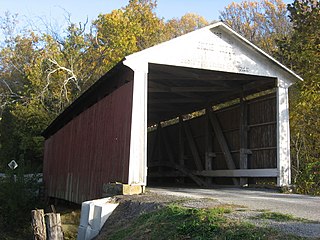
The Billie Creek Covered Bridge is a Burr Arch structure that was built by Joseph J. Daniels in 1895. J.L. Van Fossen supplied the sandstone that makes up the abutments cut from A.E. Fuel's nearby quarry.

Sugar Creek, a tributary of the Sangamon River, is a large creek in central Illinois, United States. It rises in Talkington Township in southwestern Sangamon County, flows briefly through northeastern Macoupin County, and then runs northeastward through south-central Sangamon County before discharging into Lake Springfield. The creek drains Auburn and Virden, Illinois and has a total length of 52.8 miles (85.0 km).

The Black Squirrel Creek Bridge carries U.S. 24 over Black Squirrel Creek in El Paso County, Colorado. Prior to 2012, it was locally known as the "green bridge" or "old green bridge"—a historic single-span, Parker through truss bridge that was completed in 1935 and listed on the National Register of Historic Places in 2002. Because it no longer met highway safety standards, the bridge was dismantled and replaced by a newer span in 2012.

The Forksville Covered Bridge is a Burr arch truss covered bridge over Loyalsock Creek in the borough of Forksville, Sullivan County, in the U.S. state of Pennsylvania. It was built in 1850 and is 152 feet 11 inches (46.61 m) in length. The bridge was placed on the National Register of Historic Places in 1980. The Forksville bridge is named for the borough it is in, which in turn is named for its location at the confluence or "forks" of the Little Loyalsock and Loyalsock Creeks.

The Antelope Creek Bridge is a wooden covered bridge, 58 feet (18 m) long, spanning Little Butte Creek in Eagle Point in the U.S. state of Oregon. Constructed in 1922 by brothers Wes and Lyle Hartman, it originally spanned Antelope Creek, north of Medford. Antelope Creek is a tributary of Little Butte Creek, which it enters about 2 miles (3 km) downstream of Eagle Point. According to Oregon's Covered Bridges, at its original location the bridge carried "the old Medford – Crater Lake Road" over Antelope Creek.

The EFP Bridge spans Owl Creek in Hot Springs County, Wyoming. The bridge was erected in 1919–20 by the Monarch Engineering Company of Denver and spans 124 feet (38 m) with a total length of 126 feet (38 m). The rigid 7-panel Parker (camelback) through-truss was nominated for inclusion on the National Register of Historic Places as one of forty bridges throughout Wyoming that collectively illustrate steel truss construction, a technique of bridge design that has become obsolete since the mid-twentieth century. The bridge is supported on sandstone abutments and has a timber deck, 15 feet (4.6 m) in width.

The Saville Covered Bridge is a historic wooden covered bridge located at Saville Township in Perry County, Pennsylvania. It is a 60-foot-long (18 m) Burr Truss bridge, constructed about 1903. It crosses Big Buffalo Creek.

The Fleisher Covered Bridge is a historic wooden covered bridge located at Oliver Township near Newport in Perry County, Pennsylvania. It is a 113-foot-long (34 m) Burr truss bridge, constructed in 1887. Steel I-beams were erected in 1960. It crosses Big Buffalo Creek.
The Kochenderfer Covered Bridge is a historic wooden covered bridge located at Saville Township in Perry County, Pennsylvania. It is a 72-foot-long (22 m), modified king post, queen post truss bridge, constructed in 1919. It crosses Big Buffalo Creek. Its WGCB reference is 38-50-09.

The War Eagle Bridge is a historic bridge in War Eagle, Arkansas, United States, that is listed on the National Register of Historic Places.

The EDL Peloux Bridge near Buffalo, Wyoming, is a Pratt pony truss bridge that was built in 1912 by the Canton Bridge Company. The bridge carries Johnson County Road CN16-40 across Clear Creek. The single-span bridge is 81.5 feet (24.8 m) long and has a wooden roadway supported by steel pins and piles. The bridge was placed on the National Register of Historic Places in 1985 as part of a Multiple Property Submission devoted to historic bridges in Wyoming The bridge was relocated to Buffalo City Park in 1986.

The Chicago & North Western Railway Stone Arch Bridge, also known as the Kinnikinnick Creek Railway Bridge, is a historic Chicago and North Western Railway bridge that crosses South Kinnikinnick Creek east of Roscoe, Illinois. The bridge was built in 1882 to replace a wooden bridge; the line it was on opened in 1853 as part of the Galena and Chicago Union Railroad and originally connected Belvidere, Illinois and Beloit, Wisconsin. C&NW Chief Engineer Van Mienen designed the double arch dolomitic limestone bridge, which is 53 feet (16 m) long, 60 feet (18 m) wide, and 58 feet (18 m) high. The railroad allowed the sand quarrying industry in Roscoe and South Beloit to ship its products to construction sites in Chicago; the bridge is one of the few surviving remnants of the railroad in Roscoe. The bridge is the only stone-faced rubble fill bridge with more than one arch in Winnebago County; the nearest bridge of the type is a five-arch bridge in Tiffany, Wisconsin.

The Grist Mill Bridge, Dam and Mill Site consists of three structures located along Upton Road between Island Road and the Maple River, one-half mile west of Elsie, Michigan in Duplain Township. The three structures are:


