
Red Delicious is a type of apple with a red exterior and sweet taste that was first recognized in Madison County, Iowa, in 1872. Today, the name Red Delicious comprises more than 50 cultivars. It was the most produced cultivar in the United States from 1968 to 2018, when it was surpassed by Gala.

Horne Creek Farm is a historical farm near Pinnacle, Surry County, North Carolina. The farm is a North Carolina State Historic Site that belongs to the North Carolina Department of Natural and Cultural Resources, and it is operated to depict farm life in the northwest Piedmont area c. 1900. The historic site includes the late 19th century Hauser Farmhouse, which has been furnished to reflect the 1900-1910 era, along with other supporting structures. The farm raised animal breeds that were common in the early 20th century. The site also includes the Southern Heritage Apple Orchard, which preserves about 800 trees of about 400 heritage apple varieties. A visitor center includes exhibits, a gift shop and offices.
Manzanar was a town in Inyo County, California, founded by water engineer and land developer George Chaffey. Most notably, Manzanar is known for its role in the internment of Japanese Americans during World War II.

Chief Plenty Coups State Park is a state park located approximately 0.5 miles (0.8 km) west of Pryor, Montana, on the Crow Indian Reservation. Chief Plenty Coups' (Alek-Chea-Ahoosh) Home, located in the state park, is a National Historic Landmark with several contributing resources. The homestead was listed on the U.S. National Register of Historic Places in 1970 and became a National Historic Landmark in 1999. The 195-acre (79 ha) property belonged to Chief Plenty Coups, the last traditional tribal Chief of the Apsáalooke people. He and his wife, Strikes the Iron, left their home and property to all people in 1928. The only museum of Apsáalooke culture in the United States is located here along with a memorial to Plenty Coups and his achievements.

Tulpehocken station is a SEPTA Regional Rail station in Philadelphia, Pennsylvania. Located at 333 West Tulpehocken Street in the Germantown neighborhood, it serves the Chestnut Hill West Line. The Pennsylvania Railroad built the station in 1878. The station is in zone 2 on the Chestnut Hill West Line, and is 8.5 track miles from Suburban Station. In 2004, this station saw 176 boardings on an average weekday.

The Merchants' National Bank (1914) building is a historic commercial building located in Grinnell, Iowa. It is one of a series of small banks designed by Louis Sullivan in the Midwest between 1909 and 1919. All of the banks are built of brick and for this structure he employed various shades of brick, ranging in color from blue-black to golden brown, giving it an overall reddish brown appearance. It was declared a National Historic Landmark in 1976 for its architecture. In 1991, it was listed as a contributing property in the Grinnell Historic Commercial District.

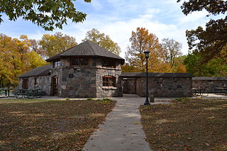
Backbone State Park is Iowa's oldest state park, dedicated in 1919. Located in the valley of the Maquoketa River, it is approximately three miles (5 km) south of Strawberry Point in Delaware County. It is named for a narrow and steep ridge of bedrock carved by a loop of the Maquoketa River originally known as the Devil's Backbone. The initial 1,200 acres (490 ha) were donated by E.M. Carr of Lamont, Iowa. Backbone Lake Dam, a relatively low dam built by the Civilian Conservation Corps (CCC) in the 1930s, created Backbone Lake. The CCC constructed a majority of trails and buildings which make up the park.

Montgomery Place, now Bard College: The Montgomery Place Campus, near Barrytown, New York, United States, is an early 19th-century estate that has been designated a National Historic Landmark. It is also a contributing property to the Hudson River Historic District, itself a National Historic Landmark. It is a Federal-style house, with expansion designed by architect Alexander Jackson Davis. It reflects the tastes of a younger, post-Revolutionary generation of wealthy landowners in the Livingston family who were beginning to be influenced by French trends in home design, moving beyond the strictly English models exemplified by Clermont Manor a short distance up the Hudson River. It is the only Hudson Valley estate house from this era that survives intact, and Davis's only surviving neoclassical country house.

Black Hawk State Park is a state park in Sac County, Iowa, United States, in the town of Lake View. The park includes land, campgrounds, trails, game preserves, historic structures, and the waters of Black Hawk Lake. Also it is home to the Lake View Water Carnival. This event is held the third full weekend in July every year, and includes many family-friendly activities including a Water Parade. Three sections of the park were listed on the National Register of Historic Places in 1991.

The Faeth Farmstead and Orchard District is a nationally recognized historic district located near Fort Madison, Iowa, United States. At the time of its nomination it contained 27 resources, which included 15 contributing buildings, three contributing sites, three contributing structures, and six non-contributing buildings. The contributing buildings include the farm house, the main barn (1882), a stable, a privy, engine house, smokehouse, chicken house, and hog house all from the early 1900s, a shop/crib, a second barn (1925), an apple packing shed, an apple cold storage shed or cooler with loading dock, a truck shed, a garage (1950s) and a machine shed. The contributing structures include a pond that was used for spraying apples, a spray tank/house (1946), and an old section of road. The contributing sites are the three historic orchards. The East Orchard was established before 1874 and it still has remnant older trees. The Old North Orchard was established around the turn of the 20th century, but the trees were primarily planted in the 1970s and the 1980s. The North Orchard was established in 1940-1941 and includes some remnant older trees and replacement trees from the 1970s to the 1990s. The non-contributing buildings are more recently built, or moved here in recent years.

Cumberland Homesteads is a community located in Cumberland County, Tennessee, United States. Established by the New Deal-era Division of Subsistence Homesteads in 1934, the community was envisioned by federal planners as a model of cooperative living for the region's distressed farmers, coal miners, and factory workers. While the cooperative experiment failed and the federal government withdrew from the project in the 1940s, the Homesteads community nevertheless survived. In 1988, several hundred of the community's original houses and other buildings, which are characterized by the native "crab orchard" sandstone used in their construction, were added to the National Register of Historic Places as a historic district.

The John W. Keeney and Erena Alexander Rogers Farm, commonly known simply as the Keeney Farm, is a historic district located at 5300 Monroe Street (M-50) in Franklin Township in north-central Lenawee County, Michigan. It was designated as a Michigan Historic Site and added to the National Register of Historic Places on September 24, 2001. The apple orchard has been continuously operating since 1875, and is one of the oldest such orchards in Lenawee County.

The Cass County Courthouse in Atlantic, Iowa, United States, was built in 1934 as the first courthouse in the state built with funding from the Public Works Administration (PWA). It was listed on the National Register of Historic Places in 2003 as a part of the PWA-Era County Courthouses of Iowa Multiple Properties Submission. The courthouse is the third structure to house court functions and county administration.

The Yosemite Village Historic District encompasses the primary built-up section of the Yosemite Valley as it was developed by the National Park Service for Yosemite National Park. The district includes visitor services areas, park personnel residences and administrative facilities. It is located to the north of the Merced River. The district includes the National Historic Landmark Rangers' Club.

The Scott Farm Historic District encompasses a historic farm property at 707 Kipling Road in Dummerston, Vermont. Developed between about 1850 and 1915, Scott Farm is a well-preserved farm and orchard complex of that period. It was listed on the National Register of Historic Places in 2001.
Beeds Lake State Park is located northwest of Hampton, Iowa, United States. It was listed has a historic district on the National Register of Historic Places as Beeds Lake State Park, Civilian Conservation Corps Area in 1990. At the time of its nomination it contained 21 resources, which included one contributing building, 15 contributing structures, and five non-contributing structures. The 319-acre (129 ha) park surrounds a 99-acre (40 ha) reservoir. It features hiking trails, boating, fishing, swimming, camping, picnic areas and shelters, lodges and concessions.

Pilot Knob State Park is located southeast of Forest City, Iowa, United States. Founded in 1923, it is one of the oldest state parks in Iowa. Between 1990 and 1995 one area was named nationally recognized historic district and five structures were individually listed on the National Register of Historic Places.

Lacey-Keosauqua State Park is located southwest of Keosauqua, Iowa, United States. The park is located along the Des Moines River in Van Buren County. First dedicated in 1921, it is the largest state park in size in Iowa. In 1990, three areas were named nationally recognized historic districts and listed on the National Register of Historic Places.
The Jones Creek Watershed Historic District is a nationally recognized historic district located southwest of Moorhead, Iowa, United States. It was listed on the National Register of Historic Places in 1991. At the time of its nomination it contained 19 resources, which included eight contributing structures, nine non-contributing buildings, and two non-contributing structures. The historic district is made up of eight gully control dams erected by the Civilian Conservation Corps (CCC) Camp DPE-79, working for the Soil Conservation Service (SCS). They were built between 1937 and 1941. The project was completed by crews from the conscientious objector camp in Denison in late 1941 and 1942.

West Eleventh Street Historic District is a nationally recognized historic district located in Dubuque, Iowa, United States. It was listed on the National Register of Historic Places in 2004. At the time of its nomination it consisted of 288 resources, which included 191 contributing buildings, 32 contributing structures, 61 non-contributing buildings, two contributing sites, and one non-contributing structure. This district is a residential area on top of the bluff above the Jackson Park Historic District, which is in the river valley below. Its name comes from its historical association with the former West Eleventh Street Elevator, a funicular that was similar to the Fenelon Place Elevator to the south. For the most part the historic buildings here are single-family residences with their attendant out-buildings, although the number of out-buildings located here is relatively low. There is one apartment building and 46 duplexes. Some of the single-family houses were converted into multi-family residences, and then some of those were converted back. The various Victorian styles are found along the bluff fronts on the eastern and southern edge of the district, and vernacular structures on the northern and western sections. The Charles T. Hancock House (1890) was individually listed on the National Register. Given the steep bluffs in the district the historic structures are retaining walls and steps that replace the sidewalks.


