Camp Clipper

Last updated
Camp Clipper and Camp Essex
CampClipper 1943.jpg
Camp Clipper in June 1943, 108th ECB street
Locationnear Fenner, California
Coordinates 34°46′13″N115°13′17″W / 34.77018261°N 115.22138865°W / 34.77018261; -115.22138865
Area21,537.78 acres
Built1942
ArchitectUS Army
Reference no.985.5
USA California location map.svg
Red pog.svg
Location of Camp Clipper and Camp Essex in California
Desert Training Center 1943 Desert-training-center-1943.jpeg
Desert Training Center 1943
Camp Essex Service in 1943 Camp Essex DTV service in 1943.GIF
Camp Essex Service in 1943
Map of Desert training center with Camp Granite Desert training center - map.png
Map of Desert training center with Camp Granite
Desert Training Center map US Army 1943 US Army DesertTrainingCentermap.jpg
Desert Training Center map US Army 1943
US Army live fire exercises remains at Desert Training Center USarmylivefireexercises remains.jpg
US Army live fire exercises remains at Desert Training Center
Camp Clipper Army barracks rock boundary in 2010, Mojave Desert, California Camp Clipper barracks rock boundary.jpg
Camp Clipper Army barracks rock boundary in 2010, Mojave Desert, California

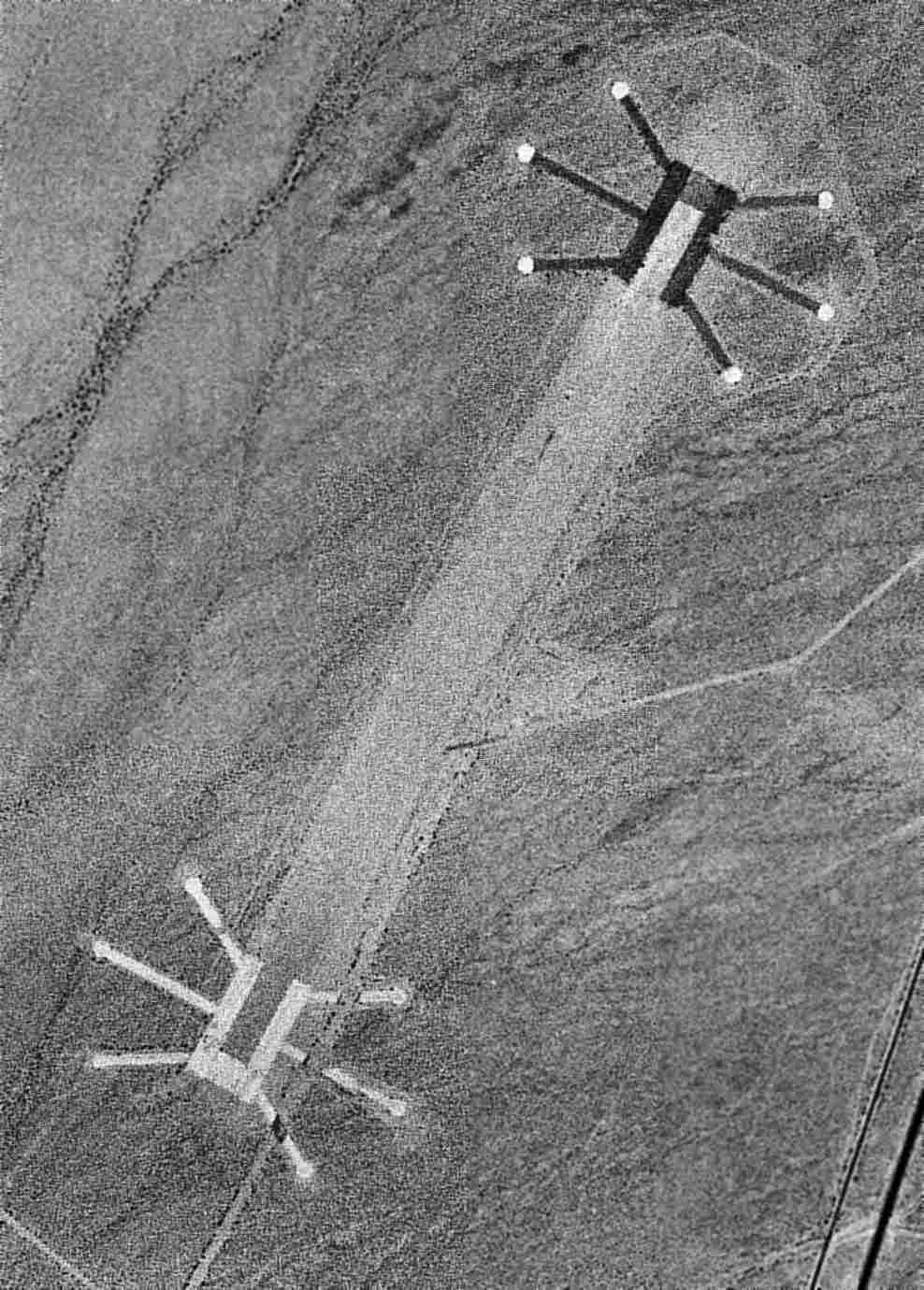
Camp Clipper and Camp Essex were subcamps of the US Army's Desert Training Center in San Bernardino County, California, located near Historic Route 66 and the Santa Fe Railway. The main headquarters for the Desert Training Center was Camp Young. This is where General George S. Patton's 3rd Armored Division was stationed. Camp Clipper was designated a California Historic Landmark (No.985.5). The site of Camp Clipper is now located near the Fenner Rest Area in Fenner, California, on Interstate 40 and Route 66, 32 miles (51 km) west of Needles in San Bernardino County, California, near the Clipper Mountains. Currently at the south end of the Mojave National Preserve. Camp Clipper was just to the east of Camp Essex. Clipper was a temporary camp for incoming and outgoing troops. Camp Essex was named after a small town near the camp, Essex. Near Camp Clipper was the 4,500 foot Camp Essex Army Airfield. [1] [2]

Contents

Built in 1942, Camp Essex and Camp Clipper were built to prepare troops to do battle in North Africa to fight the Nazis during World War II. At Camp Clipper were trained the 93rd Infantry Division. The trained troops went on to fight in the North African campaign. There was a temporary camp built for the training of the 33rd Infantry Division. When completed the camp had 36 shower buildings, an outdoor theater, 191 latrines, 149 wooden tent frames, and a 50,000-gallon water tank. Also built was a 500,000 gallon concrete reservoir and two 740-foot-deep wells. Camp had 14 training ranges. The camp was used shortly in 1944 for Italian prisoners of war. The camp closed on 16 March 1944 and is now overseen by the Bureau of Land Management. The army used live-fire exercises and warning signs are still on the site. [3] [4] [5]

Operating Camp Essex:

Operating Camp Clipper:

[6] [7]

Camp Essex Army Airfield

There was an air strip near Camp Clipper to support training activities. The runway was two 4,500 feet long runs made of steel landing mats with 6 parking pads at each end of the runway. The runway ran north-south, parallel to the old U.S. Route 66 and Camp Clipper. The runway was for the use of small planes, like the L-4 Piper Aircraft so the vast training grounds could be watched from the air. The runway was long enough for large planes to use in training exercises: Douglas C-50 cargo plane, Douglas A-20 Havoc, Curtiss P-40 Warhawk, Lockheed P-38 Lightning and Consolidated B-24 Liberator. In early 1950 the airfield was used as a private airfield, being not maintained it was abandoned in the late 1950s. [8]

Marker

Marker at the Eastbound Rest Stop in California reads: [9]

See also

Related Research Articles

<span class="mw-page-title-main">General George S. Patton Memorial Museum</span> Biographical museum in Chiriaco Summit, California /

The General George S. Patton Memorial Museum, in Chiriaco Summit, California, is a museum erected in tribute to General George S. Patton on the site of the entrance of Camp Young, part of the Desert Training Center of World War II.

<span class="mw-page-title-main">Fort Barfoot</span> US Army post near Blackstone, VA

Fort Barfoot, formerly Fort Pickett, is a Virginia Army National Guard installation, located near the town of Blackstone, Virginia. Home of the Army National Guard Maneuver Training Center, Fort Barfoot was originally named for the United States Army officer and Confederate General George Pickett. It was one of the U.S. Army installations named for Confederate soldiers that has been renamed by The Naming Commission. Their recommendation was for the post to be renamed Fort Barfoot, in honor of Medal of Honor recipient Colonel Van T. Barfoot. On 5 January 2023, William A. LaPlante, US Under Secretary of Defense for Acquisition and Sustainment, directed the full implementation of the recommendations of the Naming Commission, DoD-wide. The redesignation ceremony occurred on 24 March 2023.

<span class="mw-page-title-main">Camp Roberts, California</span> California National Guard post

Camp Roberts is a California National Guard post in central California, located on both sides of the Salinas River in Monterey and San Luis Obispo counties, now run by the California Army National Guard. It was opened in 1941 and is named after Corporal Harold W. Roberts, a World War I Medal of Honor recipient. Nearby communities include San Miguel, Heritage Ranch, Oak Shores, and Bradley, all unincorporated. The nearest incorporated city is Paso Robles. Camp Roberts is roughly 25 miles southeast of Fort Hunter Liggett.

During World War II, the United States Army Air Forces (USAAF) established numerous airfields in California for training pilots and aircrews of USAAF fighters and bombers.

<span class="mw-page-title-main">Desert Training Center</span> US Army training centers during World War II

The Desert Training Center (DTC), also known as California–Arizona Maneuver Area (CAMA), was a World War II training facility established in the Mojave Desert and Sonoran Desert, largely in Southern California and Western Arizona in 1942.

<span class="mw-page-title-main">Camp Ibis</span> California Historic Landmark

Camp Ibis was one of twelve divisional tent camps of the US Army Desert Training Center (DTC) which was established in early 1942 during World War II, originally to advance desert tank warfare and to train troops for desert combat. The DTC was located in the Mojave Desert and Sonoran Desert, largely in Southern California and Western Arizona. In October 1943, the DTC was redesignated as the California-Arizona Maneuver Area (C-AMA). The headquarters for the Desert Training Center was Camp Young where General Patton's 3rd Armored Division was stationed. Camp Ibis was designated a California Historic Landmark. The site of the Camp Ibis 8 miles (13 km) East of Needles, California off Highway 95, north of Interstate 40 in San Bernardino County, California. The camp was originally named after the Ibis railroad siding in Piute Valley. The camp was located at the west side of the Dead Mountains Wilderness.

<span class="mw-page-title-main">Camp Granite</span> California Historic Landmark

The Camp Granite was a sub camp of the US Army Desert Training Center in Riverside County, California. The main headquarters for the Desert Training Center was Camp Young were General Patton's 3rd Armored Division was stationed. Camp Granite was designated a California Historic Landmark (No.985.2). The site of the Camp Granite is 45 miles East of Indio, California off Interstate 10 and California State Route 62 near the Granite Mountains.

<span class="mw-page-title-main">Camp Coxcomb</span> California Historic Landmark

The Camp Coxcomb was a sub camp of the US Army Desert Training Center in Riverside County, California. The main headquarters for the Desert Training Center was Camp Young where General Patton's 3rd Armored Division was stationed. Camp Coxcomb was designated a California Historic Landmark (No.985). The site of the Camp Granite is 45 miles East of Indio, California off Interstate 10 and California State Route 177 near the Coxcomb Mountains. The train stop at Freda railroad siding delivered Troops and equipment. The camp closed in early in 1944 after about two years of operations.

<span class="mw-page-title-main">Camp Iron Mountain</span> California Historic Landmark

The Camp Iron Mountain was a sub camp of the US Army Desert Training Center in Riverside County, California. The main headquarters for the Desert Training Center was Camp Young; this is where General Patton's 3rd Armored Division was stationed. Camp Iron Mountain was designated a California Historic Landmark (No.985.6). Camp Iron Mountain is near the site of Camp Granite, both are 45 miles (72 km) miles East of Indio, California off Interstate 10 and California State Route 62 near the Granite Mountains in San Bernardino County, California. In 1980 Camp Iron Mountain received the listing as an Area of Critical Environmental Concern from the Bureau of Land Management. The listing was given as Camp Iron Mountain is the best preserved of the Desert Training Center Camps. The Bureau of Land Management put up fences to protect the camp from Off-road vehicle traffic. Still at the camp today are a 200 x 175 foot contour training map, some rock mosaics, two church altars, rock lined roads and walkways. The camp is named after the near by Iron Mountains.

<span class="mw-page-title-main">Camp Bouse</span> US Army training center during World War II

Camp Bouse was a secret camp of the US Army, Desert Training Center in Mohave County, Arizona. Camp Bouse is located 25 miles (40 km) from Bouse, Arizona, just north of Arizona State Route 72 and about 50 miles (80 km) north of Interstate 10.

<span class="mw-page-title-main">Camp Hyder</span> US Army sub camp during World War II

Camp Hyder was a US Army installation in Arizona, functioning as a subcamp of the Desert Training Center in Riverside County, California. The main headquarters for the Desert Training Center was Camp Young, this is where General Patton's 3rd Armored Division was stationed. Camp Hyder is 2 miles (3.2 km) miles south of Hyder, Arizona. The camp was just north of the Gila River. Camp Hyder is 60 miles (97 km) miles east of Yuma, Arizona, near Camp Horn. Camp Hyder was built at the site of an old 1890s military base. Trained at Camp Hyder, in 1943, for six months was the 77th Infantry Division from April 1943 to September 1943. Then the 104th Infantry Division moved in for training. Unlike the other camps, no large tank activity was done. The camp was built by The 369th Engineer Regiment. Camp Hyder had its own rail station at which most troops arrived. The train station at Sentinel, Arizona south of the camp was also used. Over 13,000 troops were trained at Camp Horn and Camp Hyder.

<span class="mw-page-title-main">Camp Laguna</span> US WWII army training camp

The Camp Laguna was a sub camp of the US Army, Desert Training Center in Riverside County, California. The main headquarters for the Desert Training Center was Camp Young, this is where General Patton's 3rd Armored Division was stationed. Camp Laguna is 16 miles (26 km) miles northeast of Yuma, Arizona, off of U.S. Route 95. Trained at Camp Laguna were the 3rd Armored Divisions the 9th Armored Divisions, the 79th Infantry Divisions, 80th Infantry Divisions and 8th Infantry Division. The camp is named after the nearby town of Laguna, Yuma County, Arizona on the Colorado River. Camp Laguna was first World War II training camp built in the Sonoran Desert of Arizona, it trained thousands of troop for war. Most of the land that was Camp Laguna is now part of the vast Yuma Proving Ground.

<span class="mw-page-title-main">Camp Desert Center</span> California Historic Landmark

The Camp Desert Center was a sub camp of the US Army, Desert Training Center in Riverside County, California. The main headquarters for the Desert Training Center was Camp Young, where General Patton's 3rd Armored Division was stationed. Camp Desert Center was at Desert Center, California, in Riverside County, California in the Colorado Desert.

<span class="mw-page-title-main">Camp Horn, Arizona</span> California Historic Landmark

The Camp Horn was a sub camp of the US Army, Desert Training Center in Riverside County, California. The main headquarters for the Desert Training Center was Camp Young, this is where General Patton's 3rd Armored Division was stationed. Camp Horn was near Camp Hyder about 6 miles (9.7 km) miles west of Hyder, Arizona. Camp Horn was just north of the Gila River. Camp Horn was 54 miles (87 km) miles east of Yuma, Arizona. Most troop arrived at Camp Horn from the train station at Camp Hyder or the train station at Sentinel, Arizona south of the camp. Over 13,000 troops were trained at Camp Horn and Camp Hyder. The 81st Infantry Division trained at Camp Horn was from June 1943 to November 1943.

<span class="mw-page-title-main">Camp Pilot Knob</span> Historical US Army sub camp in California

The Camp Pilot Knob was a sub camp of the US Army, Desert Training Center in Imperial County, California. The main headquarters for the Desert Training Center was Camp Young, this is where General Patton's 3rd Armored Division was stationed. Camp Pilot Knob was designated a California Historic Landmark (No.985). Camp Pilot Knob is near Felicity, California, in Imperial County, California. Camp Pilot Knob is 2 miles north of the US-Mexico border, just north of the now Interstate 8. The camp is five miles northwest of Yuma, Arizona and 2 miles west of the Colorado river. The camp was built just north of the Felicity train station, which was used to bring the troops and supplies to the camp. The camp is named after a hill south of the camp.

<span class="mw-page-title-main">Camp Goffs</span> Former U.S. Army Camp in Mojave Desert, California

The Camp Goffs was a sub camp of the US Army Desert Training Center in Riverside County, California. The main headquarters for the Desert Training Center was Camp Young, this is where General Patton's 3rd Armored Division was stationed. Camp Goffs was designated a California Historic Landmark (No.985). The site of the Camp Goffs just north at the former Santa Fe Railroad station at Goffs, California. Goffs, California is on U.S. Route 66 5 miles north of the current Interstate 40, 25 miles (40 km) west of Needles in San Bernardino County, California. Currently at the south east end of the Mojave National Preserve. Camp Goffs was 20 miles southeast of Camp Essex and Camp Clipper.

<span class="mw-page-title-main">California during World War II</span> Overview of the role of the U.S. state of California during World War II

California during World War II was a major contributor to the World War II effort. California's long Pacific Ocean coastline provided the support needed for the Pacific War. California also supported the war in Europe. After the Japanese attack on Pearl Harbor on December 7, 1941, most of California's manufacturing was shifted to the war effort. California became a major ship builder and aircraft manufacturer. Existing military installations were enlarged and many new ones were built. California trained many of the troops before their oversea deployment. Over 800,000 Californians served in the United States Armed Forces. California agriculture, ranches and farms were used to feed the troops around the world. California's long coastline also put the state in fear, as an attack on California seemed likely. California was used for the temporary and permanent internment camps for Japanese Americans. The population grew significantly, largely due to servicemen who were stationed at the new military bases/training facilities and the mass influx of workers from around the U.S. in the growing defense industries. With all the new economy activity, California was lifted out of the Great Depression. Over 500,000 people moved to California from other states to work in the growing economy. California expanded its oil and mineral production to keep up with the war demand.

<span class="mw-page-title-main">Victorville Army Airfield auxiliary fields</span> US WWII airfield

Victorville Army Airfield auxiliary fields were four airfields used during World War II to support the Victorville Army Airfield pilot training near Victorville, California, and Adelanto, California. After the war the Victorville Army Airfield was renamed George Air Force Base on January 13, 1948. The airfields were built in 1941 by the United States Army Air Corps just before the war. Victorville Army Airfield covered 2,200-acre in the Mojave Desert. The US Army held a groundbreaking ceremony on 12 July 1941. The base, called Victorville Army Flying School, was ready to use before the attack on Pearl Harbor on December 7, 1941. The Army built four runways in a triangle configuration, with one runway down the middle of the triangle. Seven hangars were built to support operation. On April 23, 1943, the base was renamed Victorville Army Airfield.

Needles Station Hospital was US army Hospital built to support the training at the camps of the vast World War II Desert Training Center. Needles Station Hospital was located in the City of Needles, California in San Bernardino County, California. The main headquarters for the Desert Training Center was Camp Young were General Patton's 3rd Armored Division was stationed. Needles Station Hospital was on 875 acres of land and was open from 1942 to 1943. The hospital had two 250 bed hospital units. The hospital and camp was built using temporary buildings. Due to a shortage of manpower, Prisoner of War at the Hospital Camp volunteered to work at the hospital. The land was transferred back to the Department of the Interior on December 16, 1944. The site today is a mix of open land and housing. The Federal Property ID number is J09CA0507.

<span class="mw-page-title-main">Condor Field</span> Airbase in Twentynine Palms, California

Condor Field was an airbase located in Twentynine Palms, California used for training both in World War II and the Korean War. From 1939 to 1942, and from 1945 to 1949, it was operated as a civil airport. The now-abandoned airfield is on the Marine Corps Air Ground Combat Center Twentynine Palms. In about 1939, a 3,000-foot runway was built at the southeast edge of dry lake Mesquite Lake as a civil field and named Twenty Nine Palms Airfield.

References